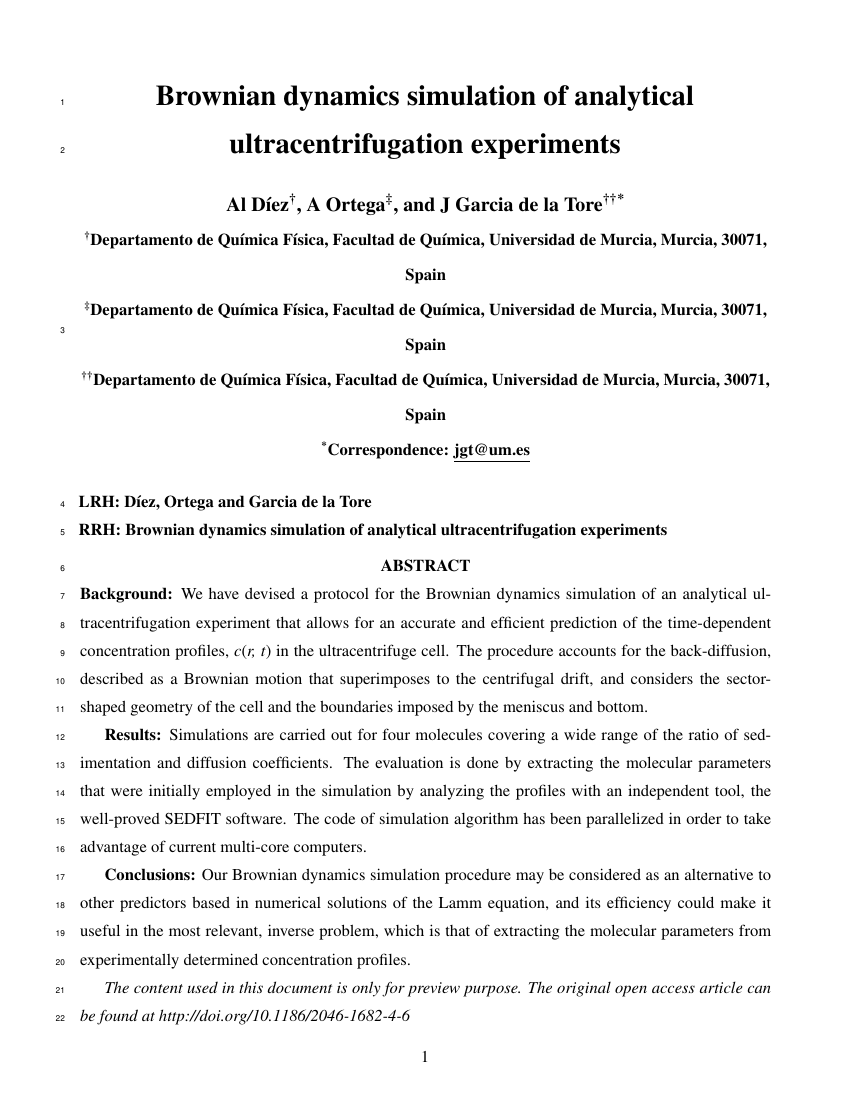
Example of Journal of Coastal Research format
Recent searches

Example of Journal of Coastal Research format Example of Journal of Coastal Research format Example of Journal of Coastal Research format Example of Journal of Coastal Research format Example of Journal of Coastal Research format Example of Journal of Coastal Research format Example of Journal of Coastal Research format Example of Journal of Coastal Research format Example of Journal of Coastal Research format Example of Journal of Coastal Research format Example of Journal of Coastal Research format Example of Journal of Coastal Research format Example of Journal of Coastal Research format Example of Journal of Coastal Research format Example of Journal of Coastal Research format Example of Journal of Coastal Research format Example of Journal of Coastal Research format Example of Journal of Coastal Research format
Sample paper formatted on SciSpace - SciSpace
This content is only for preview purposes.
Look Inside
Example of Journal of Coastal Research format Example of Journal of Coastal Research format Example of Journal of Coastal Research format Example of Journal of Coastal Research format Example of Journal of Coastal Research format Example of Journal of Coastal Research format Example of Journal of Coastal Research format Example of Journal of Coastal Research format Example of Journal of Coastal Research format Example of Journal of Coastal Research format Example of Journal of Coastal Research format Example of Journal of Coastal Research format Example of Journal of Coastal Research format Example of Journal of Coastal Research format Example of Journal of Coastal Research format Example of Journal of Coastal Research format Example of Journal of Coastal Research format Example of Journal of Coastal Research format
Sample paper formatted on SciSpace - SciSpace
This content is only for preview purposes.
open access Open Access

Journal of Coastal Research — Template for authors

Categories Rank Trend in last 3 yrs
Earth-Surface Processes #107 of 145 down down by 43 ranks
Ecology #302 of 400 down down by 119 ranks
Water Science and Technology #171 of 225 down down by 59 ranks
journal-quality-icon Journal quality:
Medium
calendar-icon Last 4 years overview: 3539 Published Papers | 2852 Citations
indexed-in-icon Indexed in: Scopus
last-updated-icon Last updated: 17/07/2020
Related journals
Insights
General info
Top papers
Popular templates
Get started guide
Why choose from SciSpace
FAQ

Related Journals

open access Open Access

Springer

Quality:  
High
CiteRatio: 4.0
SJR: 0.881
SNIP: 0.986
open access Open Access

Springer

Quality:  
High
CiteRatio: 4.5
SJR: 0.641
SNIP: 1.11
open access Open Access
recommended Recommended

Elsevier

Quality:  
High
CiteRatio: 7.6
SJR: 1.493
SNIP: 2.047
open access Open Access
recommended Recommended

Wiley

Quality:  
High
CiteRatio: 5.4
SJR: 0.982
SNIP: 1.057

Journal Performance & Insights

Impact Factor

CiteRatio

Determines the importance of a journal by taking a measure of frequency with which the average article in a journal has been cited in a particular year.

A measure of average citations received per peer-reviewed paper published in the journal.

0.793

25% from 2018

Impact factor for Journal of Coastal Research from 2016 - 2019
Year Value
2019 0.793
2018 1.053
2017 0.804
2016 0.915
graph view Graph view
table view Table view

0.8

38% from 2019

CiteRatio for Journal of Coastal Research from 2016 - 2020
Year Value
2020 0.8
2019 1.3
2018 1.5
2017 1.7
2016 2.1
graph view Graph view
table view Table view

insights Insights

  • Impact factor of this journal has decreased by 25% in last year.
  • This journal’s impact factor is in the top 10 percentile category.

insights Insights

  • CiteRatio of this journal has decreased by 38% in last years.
  • This journal’s CiteRatio is in the top 10 percentile category.

SCImago Journal Rank (SJR)

Source Normalized Impact per Paper (SNIP)

Measures weighted citations received by the journal. Citation weighting depends on the categories and prestige of the citing journal.

Measures actual citations received relative to citations expected for the journal's category.

0.247

31% from 2019

SJR for Journal of Coastal Research from 2016 - 2020
Year Value
2020 0.247
2019 0.359
2018 0.424
2017 0.383
2016 0.584
graph view Graph view
table view Table view

0.463

10% from 2019

SNIP for Journal of Coastal Research from 2016 - 2020
Year Value
2020 0.463
2019 0.516
2018 0.831
2017 0.567
2016 0.841
graph view Graph view
table view Table view

insights Insights

  • SJR of this journal has decreased by 31% in last years.
  • This journal’s SJR is in the top 10 percentile category.

insights Insights

  • SNIP of this journal has decreased by 10% in last years.
  • This journal’s SNIP is in the top 10 percentile category.
Journal of Coastal Research

Guideline source: View

All company, product and service names used in this website are for identification purposes only. All product names, trademarks and registered trademarks are property of their respective owners.

Use of these names, trademarks and brands does not imply endorsement or affiliation. Disclaimer Notice

Coastal Education & Research Foundation

Journal of Coastal Research

The Journal of Coastal Research (JCR) covers all fields of coastal research [e.g., geology, biology, geomorphology, physical geography, climate, littoral oceanography, hydrography, coastal hydraulics, environmental (resource) management (law), engineering, and remote sensing] ...... Read More

Earth-Surface Processes

Water Science and Technology

Ecology

Earth and Planetary Sciences

i
Last updated on
17 Jul 2020
i
ISSN
0749-0208
i
Impact Factor
Medium - 0.821
i
Frequency
Bimonthly
i
Open Access
Yes
i
Sherpa RoMEO Archiving Policy
White faq
i
Plagiarism Check
Available via Turnitin
i
Endnote Style
Download Available
i
Citation Type
Author Year
(Blonder, Tinkham and Klapwijk, 1982)
i
Bibliography Example
Blonder, G. E.; Tinkham, M. and Klapwijk, T. M. 1982. Transition from metallic to tunneling regimes in superconducting microconstrictions: Excess current, 16 charge imbalance, and supercurrent conversion. Phys. Rev. B, 25(7), 4515–4532. 17 URL: 10.1103/PhysRevB.25.4515

Top papers written in this journal

open accessOpen access Journal Article
A global analysis of human settlement in coastal zones

Abstract:

Recent improvements in mapping of global population distribution makes it possible to estimate the number and distribution of people near coasts with greater accuracy than previously possible, and hence consider the potential exposure of these populations to coastal hazards. In this paper, we combine the updated Gridded Popul... Recent improvements in mapping of global population distribution makes it possible to estimate the number and distribution of people near coasts with greater accuracy than previously possible, and hence consider the potential exposure of these populations to coastal hazards. In this paper, we combine the updated Gridded Population of the World (GPW2) population distribution estimate for 1990 and lighted settlement imagery with a global digital elevation model (DEM) and a high resolution vector coastline. This produces bivariate distributions of population, lighted settlements and land area as functions of elevation and coastal proximity. The near-coastal population within 100 km of a shoreline and 100 m of sea level was estimated as 1.2 X 10(9) people with average densities nearly 3 times higher than the global average density. Within the near coastal-zone, the average population density diminishes more rapidly with elevation than with distance, while the opposite is true of lighted settlements. Lighted settlements are concentrated within 5 km of coastlines worldwide, whereas average population densities are higher at elevations below 20 m throughout the 100 km width of the near-coastal zone. Presently most of the near-coastal population live in relatively densely-populated rural areas and small to medium cities, rather than in large cities. A range of improvements are required to define a better baseline and scenarios for policy analysis. Improving the resolution of the underlying population data is a priority. read more read less

Topics:

Population (61%)61% related to the paper, Coastal hazards (52%)52% related to the paper, Population density (51%)51% related to the paper
1,404 Citations
open accessOpen access Journal Article DOI: 10.2112/03-0071.1
Shoreline Definition and Detection: A Review
Elizabeth H. Boak1, Ian L. Turner1

Abstract:

BOAK, E.H. and TURNER, I.L., 2005. Shoreline Definition and Detection: A Review. Journal of Coastal Research, 21(4), 688‐703. West Palm Beach (Florida), ISSN 0749-0208. Analysis of shoreline variability and shoreline erosion-accretion trends is fundamental to a broad range of investigations undertaken by coastal scientists, c... BOAK, E.H. and TURNER, I.L., 2005. Shoreline Definition and Detection: A Review. Journal of Coastal Research, 21(4), 688‐703. West Palm Beach (Florida), ISSN 0749-0208. Analysis of shoreline variability and shoreline erosion-accretion trends is fundamental to a broad range of investigations undertaken by coastal scientists, coastal engineers, and coastal managers. Though strictly defined as the intersection of water and land surfaces, for practical purposes, the dynamic nature of this boundary and its dependence on the temporal and spatial scale at which it is being considered results in the use of a range of shoreline indicators. These proxies are generally one of two types: either a feature that is visibly discernible in coastal imagery (e.g., highwater line [HWL]) or the intersection of a tidal datum with the coastal profile (e.g., mean high water [MHW]). Recently, a third category of shoreline indicator has begun to be reported in the literature, based on the application of imageprocessing techniques to extract proxy shoreline features from digital coastal images that are not necessarily visible to the human eye. Potential data sources for shoreline investigation include historical photographs, coastal maps and charts, aerial photography, beach surveys, in situ geographic positioning system shorelines, and a range of digital elevation or image data derived from remote sensing platforms. The identification of a ‘‘shoreline’’ involves two stages: the first requires the selection and definition of a shoreline indicator feature, and the second is the detection of the chosen shoreline feature within the available data source. To date, the most common shoreline detection technique has been subjective visual interpretation. Recent photogrammetry, topographic data collection, and digital image-processing techniques now make it possible for the coastal investigator to use objective shoreline detection methods. The remaining challenge is to improve the quantitative and process-based understanding of these shoreline indicator features and their spatial relationship relative to the physical land‐water boundary. read more read less

Topics:

Shore (51%)51% related to the paper
View PDF
1,033 Citations
open accessOpen access Journal Article
Storm Impact Scale for Barrier Islands

Abstract:

A new scale is proposed that categorizes impacts to natural barrier islands resulting from tropical and extra-tropical storms The proposed scale is fundamentally different than existing storm-related scales in that the coupling between forcing processes and the geometry of the coast is explicitly included Four regimes, repres... A new scale is proposed that categorizes impacts to natural barrier islands resulting from tropical and extra-tropical storms The proposed scale is fundamentally different than existing storm-related scales in that the coupling between forcing processes and the geometry of the coast is explicitly included Four regimes, representing different levels of impact, are defined Within each regime, patterns and relative magnitudes of net erosion and accretion are argued to be unique The borders between regimes represent thresholds defining where processes and magnitudes of impacts change dramatically Impact level 1 is the 'swash' regime describing a storm where runup is confined to the foreshore The foreshore typically erodes during the storm and recovers following the storm; hence, there is no net change Impact level 2 is the 'collision' regime describing a storm where the wave runup exceeds the threshold of the base of the foredune ridge Swash impacts the dune forcing net erosion Impact level 3 is the 'overwash' regime describing a storm where wave runup overtops the berm or, if present, the foredune ridge The associated net landward sand transport contributes to net migration of the barrier landward Impact level 4 is the 'inundation' regime describing a storm where the storm surge is sufficient to completely and continuously submerge the barrier island Sand undergoes net landward transport over the barrier island; limited evidence suggests the quantities and distance of transport are much greater than what occurs during the 'overwash' regime read more read less

Topics:

Overwash (63%)63% related to the paper, Storm (55%)55% related to the paper, Swash (55%)55% related to the paper, Storm surge (54%)54% related to the paper, Barrier island (53%)53% related to the paper
View PDF
817 Citations
open accessOpen access Journal Article
Equilibrium Beach Profiles: Characteristics and Applications

Abstract:

An understanding of equilibrium beach profiles can be useful in a number of types of coastal engineering projects. Empirical correlations between a scale parameter and the sediment size or fall velocity allow computation of equilibrium beach profiles. The most often used form is h(y) = Ay 2/3 in which h is the water depth at ... An understanding of equilibrium beach profiles can be useful in a number of types of coastal engineering projects. Empirical correlations between a scale parameter and the sediment size or fall velocity allow computation of equilibrium beach profiles. The most often used form is h(y) = Ay 2/3 in which h is the water depth at a distance y from the shoreline and A is the sediment-dependent scale parameter. Expressions for shoreline position change are presented for arbitrary water levels and wave heights. Application of equilibrium beach profile concepts to profile changes seaward of a seawall include effects of sea level change and arbitrary wave heights. For fixed wave heights and increasing water level, the additional depth adjacent to the seawall first increases, then decreases to zero for a wave height just breaking at the seawall. Shoreline recession and implications due to increased sea level and wave heights are examined. It is shown, for the equilibrium profile form examined, that the effect of wave set-up on recession is small compared to expected storm tides during storms. Profile evolution from a uniform slope is shown to result in five different profile types, depending on initial slope, sediment characteristics, berm height and depth of active sediment redistribution. The reduction in required sand volumes through perching of a nourished beach by an offshore sill is examined for arbitrary sediment and sill combinations. When beaches are nourished with a sediment of arbitrary but uniform size, it is found that three types of profiles can result: (1) submerged profiles in which the placed sediment is of smaller diameter than the native and all of the sediment equilibrates underwater with no widening of the dry beach, (2) non-intersecting profiles in which the sea- ward portion of the placed material lies above the original profile at that location, and (3) intersecting profiles with the placed sand coarser than the native and resulting in the placed profile intersecting with the original profile. Equations and graphs are presented portraying the additional dry beach width for differing volumes of sand of varying sizes relative to the native. The offshore volumetric redistribution of material due to sea level rise as a function of water depth is of interest in interpreting the cause of shoreline recession. If only offshore transport occurs and the surveys extend over the active profile, the net volumetric change is zero. It is shown that the maximum volume change due to cross-shore sediment redistribution is only a fraction of the product of the active vertical profile dimension and shoreline recession. The paper presents several other applications of equilibrium beach profiles to problems of coastal engineering interest. read more read less

Topics:

Beach ridge (59%)59% related to the paper, Seawall (58%)58% related to the paper, Coastal erosion (52%)52% related to the paper, Shore (50%)50% related to the paper
View PDF
669 Citations
open accessOpen access Journal Article
The Effect of Tide Range on Beach Morphodynamics and Morphology: A Conceptual Beach Model

Abstract:

Natural beaches may be grouped into several beach types on the basis of breaker height (H b ), wave period (T), high tide sediment fall velocity (w s ) and tide range (TR). These four variables are quantified by two dimensionless parameters: the dimensionless fall velocity (Ω= H b /w s T) used by WRIGHT and SHORT (1984) to cl... Natural beaches may be grouped into several beach types on the basis of breaker height (H b ), wave period (T), high tide sediment fall velocity (w s ) and tide range (TR). These four variables are quantified by two dimensionless parameters: the dimensionless fall velocity (Ω= H b /w s T) used by WRIGHT and SHORT (1984) to classify micro-tidal beaches, and the relative tide range (RTR = TR/H b ) introduced in this paper. The value of the dimensionless fall velocity indicates whether reflective, intermediate or dissipative surf zone conditions will prevail. The relative tide range reflects the relative importance of swash, surf zone and shoaling wave processes. A conceptual model is presented in which beach morphology (beach type) may be predicted using the dimensionless fall velocity and the relative tide range, whereby the mean spring tide range (MSR) is used to calculate the relative tide range. The model consists of the existing micro-tidal beach types, which as RTR Increases, shift from reflective to low tide terrace with and finally without rips; from intermediate to low tide bar and rips and finally ultra-dissipative; and from barred dissipative to non-barred dissipative and finally ultra-dissipative. Using this model, all wave-dominated beaches in all tidal ranges can be classified. read more read less

Topics:

Swash (59%)59% related to the paper, Surf zone (57%)57% related to the paper, Beach morphodynamics (57%)57% related to the paper
View PDF
667 Citations
Author Pic

SciSpace is a very innovative solution to the formatting problem and existing providers, such as Mendeley or Word did not really evolve in recent years.

- Andreas Frutiger, Researcher, ETH Zurich, Institute for Biomedical Engineering

Get MS-Word and LaTeX output to any Journal within seconds
1
Choose a template
Select a template from a library of 40,000+ templates
2
Import a MS-Word file or start fresh
It takes only few seconds to import
3
View and edit your final output
SciSpace will automatically format your output to meet journal guidelines
4
Submit directly or Download
Submit to journal directly or Download in PDF, MS Word or LaTeX

(Before submission check for plagiarism via Turnitin)

clock Less than 3 minutes

What to expect from SciSpace?

Speed and accuracy over MS Word

''

With SciSpace, you do not need a word template for Journal of Coastal Research.

It automatically formats your research paper to Coastal Education & Research Foundation formatting guidelines and citation style.

You can download a submission ready research paper in pdf, LaTeX and docx formats.

Time comparison

Time taken to format a paper and Compliance with guidelines

Plagiarism Reports via Turnitin

SciSpace has partnered with Turnitin, the leading provider of Plagiarism Check software.

Using this service, researchers can compare submissions against more than 170 million scholarly articles, a database of 70+ billion current and archived web pages. How Turnitin Integration works?

Turnitin Stats
Publisher Logos

Freedom from formatting guidelines

One editor, 100K journal formats – world's largest collection of journal templates

With such a huge verified library, what you need is already there.

publisher-logos

Easy support from all your favorite tools

Automatically format and order your citations and bibliography in a click.

SciSpace allows imports from all reference managers like Mendeley, Zotero, Endnote, Google Scholar etc.

Frequently asked questions

1. Can I write Journal of Coastal Research in LaTeX?

Absolutely not! Our tool has been designed to help you focus on writing. You can write your entire paper as per the Journal of Coastal Research guidelines and auto format it.

2. Do you follow the Journal of Coastal Research guidelines?

Yes, the template is compliant with the Journal of Coastal Research guidelines. Our experts at SciSpace ensure that. If there are any changes to the journal's guidelines, we'll change our algorithm accordingly.

3. Can I cite my article in multiple styles in Journal of Coastal Research?

Of course! We support all the top citation styles, such as APA style, MLA style, Vancouver style, Harvard style, and Chicago style. For example, when you write your paper and hit autoformat, our system will automatically update your article as per the Journal of Coastal Research citation style.

4. Can I use the Journal of Coastal Research templates for free?

Sign up for our free trial, and you'll be able to use all our features for seven days. You'll see how helpful they are and how inexpensive they are compared to other options, Especially for Journal of Coastal Research.

5. Can I use a manuscript in Journal of Coastal Research that I have written in MS Word?

Yes. You can choose the right template, copy-paste the contents from the word document, and click on auto-format. Once you're done, you'll have a publish-ready paper Journal of Coastal Research that you can download at the end.

6. How long does it usually take you to format my papers in Journal of Coastal Research?

It only takes a matter of seconds to edit your manuscript. Besides that, our intuitive editor saves you from writing and formatting it in Journal of Coastal Research.

7. Where can I find the template for the Journal of Coastal Research?

It is possible to find the Word template for any journal on Google. However, why use a template when you can write your entire manuscript on SciSpace , auto format it as per Journal of Coastal Research's guidelines and download the same in Word, PDF and LaTeX formats? Give us a try!.

8. Can I reformat my paper to fit the Journal of Coastal Research's guidelines?

Of course! You can do this using our intuitive editor. It's very easy. If you need help, our support team is always ready to assist you.

9. Journal of Coastal Research an online tool or is there a desktop version?

SciSpace's Journal of Coastal Research is currently available as an online tool. We're developing a desktop version, too. You can request (or upvote) any features that you think would be helpful for you and other researchers in the "feature request" section of your account once you've signed up with us.

10. I cannot find my template in your gallery. Can you create it for me like Journal of Coastal Research?

Sure. You can request any template and we'll have it setup within a few days. You can find the request box in Journal Gallery on the right side bar under the heading, "Couldn't find the format you were looking for like Journal of Coastal Research?”

11. What is the output that I would get after using Journal of Coastal Research?

After writing your paper autoformatting in Journal of Coastal Research, you can download it in multiple formats, viz., PDF, Docx, and LaTeX.

12. Is Journal of Coastal Research's impact factor high enough that I should try publishing my article there?

To be honest, the answer is no. The impact factor is one of the many elements that determine the quality of a journal. Few of these factors include review board, rejection rates, frequency of inclusion in indexes, and Eigenfactor. You need to assess all these factors before you make your final call.

13. What is Sherpa RoMEO Archiving Policy for Journal of Coastal Research?

SHERPA/RoMEO Database

We extracted this data from Sherpa Romeo to help researchers understand the access level of this journal in accordance with the Sherpa Romeo Archiving Policy for Journal of Coastal Research. The table below indicates the level of access a journal has as per Sherpa Romeo's archiving policy.

RoMEO Colour Archiving policy
Green Can archive pre-print and post-print or publisher's version/PDF
Blue Can archive post-print (ie final draft post-refereeing) or publisher's version/PDF
Yellow Can archive pre-print (ie pre-refereeing)
White Archiving not formally supported
FYI:
  1. Pre-prints as being the version of the paper before peer review and
  2. Post-prints as being the version of the paper after peer-review, with revisions having been made.

14. What are the most common citation types In Journal of Coastal Research?

The 5 most common citation types in order of usage for Journal of Coastal Research are:.

S. No. Citation Style Type
1. Author Year
2. Numbered
3. Numbered (Superscripted)
4. Author Year (Cited Pages)
5. Footnote

15. How do I submit my article to the Journal of Coastal Research?

It is possible to find the Word template for any journal on Google. However, why use a template when you can write your entire manuscript on SciSpace , auto format it as per Journal of Coastal Research's guidelines and download the same in Word, PDF and LaTeX formats? Give us a try!.

16. Can I download Journal of Coastal Research in Endnote format?

Yes, SciSpace provides this functionality. After signing up, you would need to import your existing references from Word or Bib file to SciSpace. Then SciSpace would allow you to download your references in Journal of Coastal Research Endnote style according to Elsevier guidelines.

Fast and reliable,
built for complaince.

Instant formatting to 100% publisher guidelines on - SciSpace.

Available only on desktops 🖥

No word template required

Typset automatically formats your research paper to Journal of Coastal Research formatting guidelines and citation style.
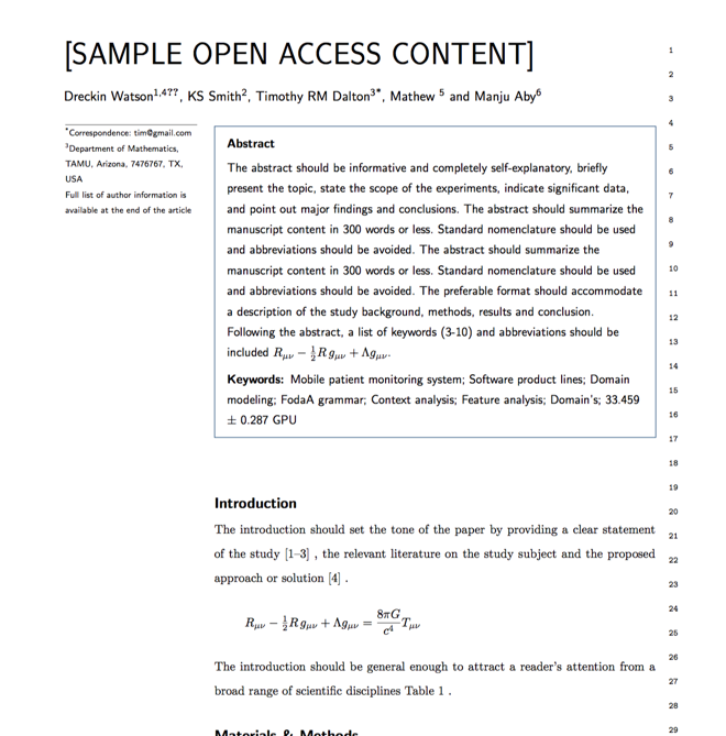

Verifed journal formats

One editor, 100K journal formats.
With the largest collection of verified journal formats, what you need is already there.

Trusted by academicians

I spent hours with MS word for reformatting. It was frustrating - plain and simple. With SciSpace, I can draft my manuscripts and once it is finished I can just submit. In case, I have to submit to another journal it is really just a button click instead of an afternoon of reformatting.

Andreas Frutiger
Researcher & Ex MS Word user
Use this template