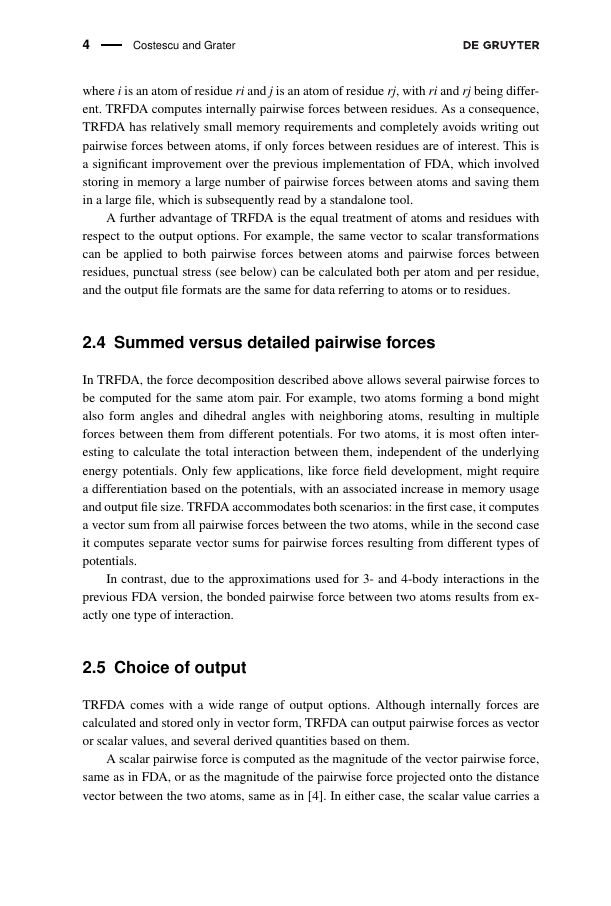
Example of Journal of Applied Geodesy format
Recent searches

Example of Journal of Applied Geodesy format Example of Journal of Applied Geodesy format Example of Journal of Applied Geodesy format Example of Journal of Applied Geodesy format Example of Journal of Applied Geodesy format Example of Journal of Applied Geodesy format Example of Journal of Applied Geodesy format Example of Journal of Applied Geodesy format Example of Journal of Applied Geodesy format Example of Journal of Applied Geodesy format Example of Journal of Applied Geodesy format Example of Journal of Applied Geodesy format
Sample paper formatted on SciSpace - SciSpace
This content is only for preview purposes. The original open access content can be found here.
Look Inside
Example of Journal of Applied Geodesy format Example of Journal of Applied Geodesy format Example of Journal of Applied Geodesy format Example of Journal of Applied Geodesy format Example of Journal of Applied Geodesy format Example of Journal of Applied Geodesy format Example of Journal of Applied Geodesy format Example of Journal of Applied Geodesy format Example of Journal of Applied Geodesy format Example of Journal of Applied Geodesy format Example of Journal of Applied Geodesy format Example of Journal of Applied Geodesy format
Sample paper formatted on SciSpace - SciSpace
This content is only for preview purposes. The original open access content can be found here.
open access Open Access

Journal of Applied Geodesy — Template for authors

Publisher: De Gruyter
Categories Rank Trend in last 3 yrs
Engineering (miscellaneous) #31 of 77 down down by 10 ranks
Earth and Planetary Sciences (miscellaneous) #55 of 106 down down by 8 ranks
Modeling and Simulation #151 of 290 down down by 38 ranks
journal-quality-icon Journal quality:
Good
calendar-icon Last 4 years overview: 105 Published Papers | 246 Citations
indexed-in-icon Indexed in: Scopus
last-updated-icon Last updated: 18/07/2020
Related journals
Insights
General info
Top papers
Popular templates
Get started guide
Why choose from SciSpace
FAQ

Related Journals

open access Open Access
recommended Recommended

Springer

Quality:  
High
CiteRatio: 8.6
SJR: 0.53
SNIP: 2.363
open access Open Access

Springer

Quality:  
Good
CiteRatio: 2.6
SJR: 1.01
SNIP: 0.941
open access Open Access
recommended Recommended

Taylor and Francis

Quality:  
High
CiteRatio: 8.9
SJR: 1.347
SNIP: 3.098
open access Open Access
recommended Recommended

Taylor and Francis

Quality:  
High
CiteRatio: 5.9
SJR: 0.972
SNIP: 1.349

Journal Performance & Insights

CiteRatio

SCImago Journal Rank (SJR)

Source Normalized Impact per Paper (SNIP)

A measure of average citations received per peer-reviewed paper published in the journal.

Measures weighted citations received by the journal. Citation weighting depends on the categories and prestige of the citing journal.

Measures actual citations received relative to citations expected for the journal's category.

2.3

8% from 2019

CiteRatio for Journal of Applied Geodesy from 2016 - 2020
Year Value
2020 2.3
2019 2.5
2018 2.4
2017 2.1
2016 1.8
graph view Graph view
table view Table view

0.325

17% from 2019

SJR for Journal of Applied Geodesy from 2016 - 2020
Year Value
2020 0.325
2019 0.393
2018 0.532
2017 0.445
2016 0.379
graph view Graph view
table view Table view

0.88

2% from 2019

SNIP for Journal of Applied Geodesy from 2016 - 2020
Year Value
2020 0.88
2019 0.859
2018 1.081
2017 1.411
2016 0.78
graph view Graph view
table view Table view

insights Insights

  • CiteRatio of this journal has decreased by 8% in last years.
  • This journal’s CiteRatio is in the top 10 percentile category.

insights Insights

  • SJR of this journal has decreased by 17% in last years.
  • This journal’s SJR is in the top 10 percentile category.

insights Insights

  • SNIP of this journal has increased by 2% in last years.
  • This journal’s SNIP is in the top 10 percentile category.

Journal of Applied Geodesy

Guideline source: View

All company, product and service names used in this website are for identification purposes only. All product names, trademarks and registered trademarks are property of their respective owners.

Use of these names, trademarks and brands does not imply endorsement or affiliation. Disclaimer Notice

De Gruyter

Journal of Applied Geodesy

The Journal of Applied Geodesy (JAG) is a forum for peer-reviewed research articles in the area of application of geodesy to engineering and other natural sciences. It publishes innovative contributions on sensor developments, multi-sensor systems and sensor data fusion focusi...... Read More

Geosciences

i
Last updated on
17 Jul 2020
i
ISSN
1862-9024
i
Impact Factor
Medium - 0.908
i
Acceptance Rate
Not provided
i
Frequency
Not provided
i
Open Access
Yes
i
Sherpa RoMEO Archiving Policy
Yellow faq
i
Plagiarism Check
Available via Turnitin
i
Endnote Style
Download Available
i
Bibliography Name
unsrt
i
Citation Type
Numbered
[25]
i
Bibliography Example
C. W. J. Beenakker. Specular andreev reflection in graphene. Phys. Rev. Lett., 97(6):067007, 2006.

Top papers written in this journal

Journal Article DOI: 10.1515/JAG.2007.017
Rigorous 3D error analysis of kinematic scanning LIDAR systems

Abstract:

Abstract To date, LIDAR sensors have been primarily airborne, and utilized as a fast and efficient means of collecting topographic information. As a result, in research studies and in most commercial work the accuracy of the LIDAR information is primarily obtained by examining the vertical component of LIDAR error only. Howev... Abstract To date, LIDAR sensors have been primarily airborne, and utilized as a fast and efficient means of collecting topographic information. As a result, in research studies and in most commercial work the accuracy of the LIDAR information is primarily obtained by examining the vertical component of LIDAR error only. However, more and more end users are using LIDAR intensity to produce planimetric feature maps, and there are also emerging ground based kinematic laser scanning systems which are mounted on a van or truck platform. For both of these uses, the traditional vertical only error analysis of the LIDAR system is inadequate when defining the overall expected accuracy of the end-product received from the system. Therefore, in order to quantify the overall 3D expected accuracy of LIDAR systems (both land and air based) a rigorous 1st order error analysis of the LIDAR georeferencing equations are undertaken. Typical error parameters are then placed into the error analysis to generate expected horizontal and vertical system accuracies for different LIDAR system configurations. Finally, the results obtained from the theoretical error analysis are independently verified using real world LIDAR data. read more read less

Topics:

Lidar (56%)56% related to the paper, Kinematics (52%)52% related to the paper
175 Citations
Journal Article DOI: 10.1515/JAG.2010.005
Monitoring of displacements with ground-based microwave interferometry: IBIS-S and IBIS-L

Abstract:

Abstract One fundamental component of early warning systems for natural hazards is displacement monitoring. Spaceborne SAR Interferometry has proven to be a powerful remote sensing tool for this task. Lately new ground-based SAR instruments are available. Their application field is wide and they combine high resolution and ac... Abstract One fundamental component of early warning systems for natural hazards is displacement monitoring. Spaceborne SAR Interferometry has proven to be a powerful remote sensing tool for this task. Lately new ground-based SAR instruments are available. Their application field is wide and they combine high resolution and accuracy with the classical benefits of remote sensing techniques. Here, the principles of the microwave interferometer IBIS are presented, as well as its advantages and disadvantages compared to common monitoring techniques. IBIS can be operated in two modes: IBIS-S is a microwave interferometer capable of high frequency displacement monitoring of buildings and structures (up to 200 Hz); IBIS-L is a ground-based SAR for long-term displacement monitoring of buildings and natural phenomena as landslides, glaciers, etc. Exemplary three applications are presented: the use of IBIS-S for dynamic monitoring of a chimney; the use of IBIS-L for displacement monitoring in an active quarry and the long-term operation of IBIS-L as part of a “Volcano Fast Response System” (VFRS) on an active volcano. read more read less

Topics:

Ibis (65%)65% related to the paper
88 Citations
Journal Article DOI: 10.1515/JAG.2010.002
Boresight alignment method for mobile laser scanning systems

Abstract:

Abstract Mobile laser scanning (MLS) is the latest approach towards fast and cost-efficient acquisition of 3-dimensional spatial data. Accurately evaluating the boresight alignment in MLS systems is an obvious necessity. However, recent systems available on the market may lack of suitable and efficient practical workflows on ... Abstract Mobile laser scanning (MLS) is the latest approach towards fast and cost-efficient acquisition of 3-dimensional spatial data. Accurately evaluating the boresight alignment in MLS systems is an obvious necessity. However, recent systems available on the market may lack of suitable and efficient practical workflows on how to perform this calibration. This paper discusses an innovative method for accurately determining the boresight alignment of MLS systems by employing 3D laser scanners. Scanning objects using a 3D laser scanner operating in a 2D line-scan mode from various different runs and scan directions provides valuable scan data for determining the angular alignment between inertial measurement unit and laser scanner. Field data is presented demonstrating the final accuracy of the calibration and the high quality of the point cloud acquired during an MLS campaign. read more read less

Topics:

Laser scanning (70%)70% related to the paper
View PDF
68 Citations
Journal Article DOI: 10.1515/JAG.2009.015
The new gravimetric quasigeoid model KTH08 over Sweden
Jonas Ågren, Lars E. Sjöberg, Ramin Kiamehr

Abstract:

The least squares modification of Stokes formula has been developed in a series of papers published in Journal of Geodesy between 1984 and 2008. It consists of a least squares (stochastic) Stokes k ... The least squares modification of Stokes formula has been developed in a series of papers published in Journal of Geodesy between 1984 and 2008. It consists of a least squares (stochastic) Stokes k ... read more read less

Topics:

Least squares (62%)62% related to the paper, Geoid (52%)52% related to the paper
65 Citations
Journal Article DOI: 10.1515/JAG.2007.018
Non-parametric segmentation of ALS point clouds using mean shift

Abstract:

Abstract Segmentation is a key task in the processing of 3D point clouds as obtained from airborne laser scanners (ALS). However, most of the segmentation techniques currently employed require prior gridding of the data and thus do not respect the inherently three-dimensional geometry of more intricate structures such as powe... Abstract Segmentation is a key task in the processing of 3D point clouds as obtained from airborne laser scanners (ALS). However, most of the segmentation techniques currently employed require prior gridding of the data and thus do not respect the inherently three-dimensional geometry of more intricate structures such as power lines. By contrast, the mean shift procedure, a filtering and clustering approach which has recently found much interest in the image processing community, works directly on the original 3D point cloud; also, mean shift is a non-parametric technique (i.e., it does not depend on any geometric model assumptions) and can thus also be applied to vegetation structures. In this paper, we will give a self-contained derivation of the mean shift procedure, and discuss how it can be used to obtain a classification or segmentation of an unstructured 3D point cloud. Two application examples shall further illustrate its usefulness to ALS data processing. read more read less

Topics:

Segmentation (50%)50% related to the paper
62 Citations
Author Pic

SciSpace is a very innovative solution to the formatting problem and existing providers, such as Mendeley or Word did not really evolve in recent years.

- Andreas Frutiger, Researcher, ETH Zurich, Institute for Biomedical Engineering

Get MS-Word and LaTeX output to any Journal within seconds
1
Choose a template
Select a template from a library of 40,000+ templates
2
Import a MS-Word file or start fresh
It takes only few seconds to import
3
View and edit your final output
SciSpace will automatically format your output to meet journal guidelines
4
Submit directly or Download
Submit to journal directly or Download in PDF, MS Word or LaTeX

(Before submission check for plagiarism via Turnitin)

clock Less than 3 minutes

What to expect from SciSpace?

Speed and accuracy over MS Word

''

With SciSpace, you do not need a word template for Journal of Applied Geodesy.

It automatically formats your research paper to De Gruyter formatting guidelines and citation style.

You can download a submission ready research paper in pdf, LaTeX and docx formats.

Time comparison

Time taken to format a paper and Compliance with guidelines

Plagiarism Reports via Turnitin

SciSpace has partnered with Turnitin, the leading provider of Plagiarism Check software.

Using this service, researchers can compare submissions against more than 170 million scholarly articles, a database of 70+ billion current and archived web pages. How Turnitin Integration works?


Turnitin Stats
Publisher Logos

Freedom from formatting guidelines

One editor, 100K journal formats – world's largest collection of journal templates

With such a huge verified library, what you need is already there.

publisher-logos

Easy support from all your favorite tools

Journal of Applied Geodesy format uses unsrt citation style.

Automatically format and order your citations and bibliography in a click.

SciSpace allows imports from all reference managers like Mendeley, Zotero, Endnote, Google Scholar etc.

Frequently asked questions

1. Can I write Journal of Applied Geodesy in LaTeX?

Absolutely not! Our tool has been designed to help you focus on writing. You can write your entire paper as per the Journal of Applied Geodesy guidelines and auto format it.

2. Do you follow the Journal of Applied Geodesy guidelines?

Yes, the template is compliant with the Journal of Applied Geodesy guidelines. Our experts at SciSpace ensure that. If there are any changes to the journal's guidelines, we'll change our algorithm accordingly.

3. Can I cite my article in multiple styles in Journal of Applied Geodesy?

Of course! We support all the top citation styles, such as APA style, MLA style, Vancouver style, Harvard style, and Chicago style. For example, when you write your paper and hit autoformat, our system will automatically update your article as per the Journal of Applied Geodesy citation style.

4. Can I use the Journal of Applied Geodesy templates for free?

Sign up for our free trial, and you'll be able to use all our features for seven days. You'll see how helpful they are and how inexpensive they are compared to other options, Especially for Journal of Applied Geodesy.

5. Can I use a manuscript in Journal of Applied Geodesy that I have written in MS Word?

Yes. You can choose the right template, copy-paste the contents from the word document, and click on auto-format. Once you're done, you'll have a publish-ready paper Journal of Applied Geodesy that you can download at the end.

6. How long does it usually take you to format my papers in Journal of Applied Geodesy?

It only takes a matter of seconds to edit your manuscript. Besides that, our intuitive editor saves you from writing and formatting it in Journal of Applied Geodesy.

7. Where can I find the template for the Journal of Applied Geodesy?

It is possible to find the Word template for any journal on Google. However, why use a template when you can write your entire manuscript on SciSpace , auto format it as per Journal of Applied Geodesy's guidelines and download the same in Word, PDF and LaTeX formats? Give us a try!.

8. Can I reformat my paper to fit the Journal of Applied Geodesy's guidelines?

Of course! You can do this using our intuitive editor. It's very easy. If you need help, our support team is always ready to assist you.

9. Journal of Applied Geodesy an online tool or is there a desktop version?

SciSpace's Journal of Applied Geodesy is currently available as an online tool. We're developing a desktop version, too. You can request (or upvote) any features that you think would be helpful for you and other researchers in the "feature request" section of your account once you've signed up with us.

10. I cannot find my template in your gallery. Can you create it for me like Journal of Applied Geodesy?

Sure. You can request any template and we'll have it setup within a few days. You can find the request box in Journal Gallery on the right side bar under the heading, "Couldn't find the format you were looking for like Journal of Applied Geodesy?”

11. What is the output that I would get after using Journal of Applied Geodesy?

After writing your paper autoformatting in Journal of Applied Geodesy, you can download it in multiple formats, viz., PDF, Docx, and LaTeX.

12. Is Journal of Applied Geodesy's impact factor high enough that I should try publishing my article there?

To be honest, the answer is no. The impact factor is one of the many elements that determine the quality of a journal. Few of these factors include review board, rejection rates, frequency of inclusion in indexes, and Eigenfactor. You need to assess all these factors before you make your final call.

13. What is Sherpa RoMEO Archiving Policy for Journal of Applied Geodesy?

SHERPA/RoMEO Database

We extracted this data from Sherpa Romeo to help researchers understand the access level of this journal in accordance with the Sherpa Romeo Archiving Policy for Journal of Applied Geodesy. The table below indicates the level of access a journal has as per Sherpa Romeo's archiving policy.

RoMEO Colour Archiving policy
Green Can archive pre-print and post-print or publisher's version/PDF
Blue Can archive post-print (ie final draft post-refereeing) or publisher's version/PDF
Yellow Can archive pre-print (ie pre-refereeing)
White Archiving not formally supported
FYI:
  1. Pre-prints as being the version of the paper before peer review and
  2. Post-prints as being the version of the paper after peer-review, with revisions having been made.

14. What are the most common citation types In Journal of Applied Geodesy?

The 5 most common citation types in order of usage for Journal of Applied Geodesy are:.

S. No. Citation Style Type
1. Author Year
2. Numbered
3. Numbered (Superscripted)
4. Author Year (Cited Pages)
5. Footnote

15. How do I submit my article to the Journal of Applied Geodesy?

It is possible to find the Word template for any journal on Google. However, why use a template when you can write your entire manuscript on SciSpace , auto format it as per Journal of Applied Geodesy's guidelines and download the same in Word, PDF and LaTeX formats? Give us a try!.

16. Can I download Journal of Applied Geodesy in Endnote format?

Yes, SciSpace provides this functionality. After signing up, you would need to import your existing references from Word or Bib file to SciSpace. Then SciSpace would allow you to download your references in Journal of Applied Geodesy Endnote style according to Elsevier guidelines.

Fast and reliable,
built for complaince.

Instant formatting to 100% publisher guidelines on - SciSpace.
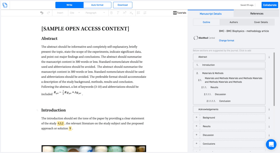
Available only on desktops 🖥

No word template required

Typset automatically formats your research paper to Journal of Applied Geodesy formatting guidelines and citation style.
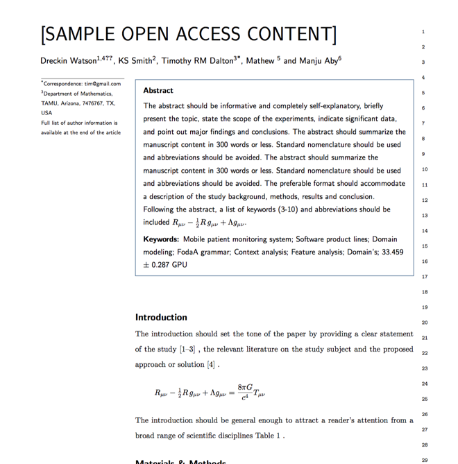

Verifed journal formats

One editor, 100K journal formats.
With the largest collection of verified journal formats, what you need is already there.

Trusted by academicians

I spent hours with MS word for reformatting. It was frustrating - plain and simple. With SciSpace, I can draft my manuscripts and once it is finished I can just submit. In case, I have to submit to another journal it is really just a button click instead of an afternoon of reformatting.

Andreas Frutiger
Researcher & Ex MS Word user
Use this template