Example of Frontiers in Earth Science format
Recent searches

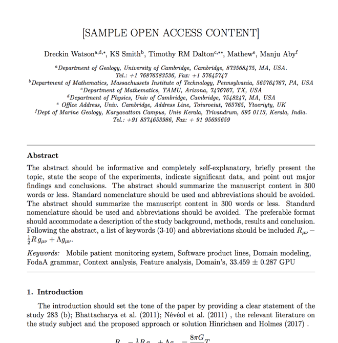
Example of Frontiers in Earth Science format Example of Frontiers in Earth Science format Example of Frontiers in Earth Science format Example of Frontiers in Earth Science format Example of Frontiers in Earth Science format Example of Frontiers in Earth Science format Example of Frontiers in Earth Science format Example of Frontiers in Earth Science format Example of Frontiers in Earth Science format Example of Frontiers in Earth Science format Example of Frontiers in Earth Science format Example of Frontiers in Earth Science format Example of Frontiers in Earth Science format Example of Frontiers in Earth Science format Example of Frontiers in Earth Science format Example of Frontiers in Earth Science format Example of Frontiers in Earth Science format Example of Frontiers in Earth Science format
Sample paper formatted on SciSpace - SciSpace
This content is only for preview purposes. The original open access content can be found here.
Look Inside
Example of Frontiers in Earth Science format Example of Frontiers in Earth Science format Example of Frontiers in Earth Science format Example of Frontiers in Earth Science format Example of Frontiers in Earth Science format Example of Frontiers in Earth Science format Example of Frontiers in Earth Science format Example of Frontiers in Earth Science format Example of Frontiers in Earth Science format Example of Frontiers in Earth Science format Example of Frontiers in Earth Science format Example of Frontiers in Earth Science format Example of Frontiers in Earth Science format Example of Frontiers in Earth Science format Example of Frontiers in Earth Science format Example of Frontiers in Earth Science format Example of Frontiers in Earth Science format Example of Frontiers in Earth Science format
Sample paper formatted on SciSpace - SciSpace
This content is only for preview purposes. The original open access content can be found here.
open access Open Access

Frontiers in Earth Science — Template for authors

Publisher: Frontiers Media
Categories Rank Trend in last 3 yrs
Earth and Planetary Sciences (all) #48 of 186 down down by 16 ranks
journal-quality-icon Journal quality:
Good
calendar-icon Last 4 years overview: 1217 Published Papers | 4045 Citations
indexed-in-icon Indexed in: Scopus
last-updated-icon Last updated: 14/07/2020
Related journals
Insights
General info
Top papers
Popular templates
Get started guide
Why choose from SciSpace
FAQ

Related Journals

open access Open Access

Taylor and Francis

Quality:  
High
CiteRatio: 4.1
SJR: 0.694
SNIP: 0.72
open access Open Access
recommended Recommended

Taylor and Francis

Quality:  
High
CiteRatio: 6.6
SJR: 0.813
SNIP: 1.434
open access Open Access
recommended Recommended

Springer

Quality:  
High
CiteRatio: 7.2
SJR: 1.148
SNIP: 1.68
open access Open Access
recommended Recommended

IEEE

Quality:  
High
CiteRatio: 15.5
SJR: 3.038
SNIP: 7.166

Journal Performance & Insights

CiteRatio

SCImago Journal Rank (SJR)

Source Normalized Impact per Paper (SNIP)

A measure of average citations received per peer-reviewed paper published in the journal.

Measures weighted citations received by the journal. Citation weighting depends on the categories and prestige of the citing journal.

Measures actual citations received relative to citations expected for the journal's category.

3.3

CiteRatio for Frontiers in Earth Science from 2016 - 2020
Year Value
2020 3.3
2019 3.3
2018 3.6
2017 3.5
2016 2.1
graph view Graph view
table view Table view

1.104

5% from 2019

SJR for Frontiers in Earth Science from 2016 - 2020
Year Value
2020 1.104
2019 1.159
2018 1.148
2017 1.248
2016 1.021
graph view Graph view
table view Table view

1.072

9% from 2019

SNIP for Frontiers in Earth Science from 2016 - 2020
Year Value
2020 1.072
2019 0.985
2018 0.954
2017 0.976
2016 0.825
graph view Graph view
table view Table view

insights Insights

  • This journal’s CiteRatio is in the top 10 percentile category.

insights Insights

  • SJR of this journal has decreased by 5% in last years.
  • This journal’s SJR is in the top 10 percentile category.

insights Insights

  • SNIP of this journal has increased by 9% in last years.
  • This journal’s SNIP is in the top 10 percentile category.

Frontiers in Earth Science

Guideline source: View

Potential, possible, or probable predatory scholarly open-access publishers.

All company, product and service names used in this website are for identification purposes only. All product names, trademarks and registered trademarks are property of their respective owners.

Use of these names, trademarks and brands does not imply endorsement or affiliation. Disclaimer Notice

Frontiers Media

Frontiers in Earth Science

Approved by publishing and review experts on SciSpace, this template is built as per for Frontiers in Earth Science formatting guidelines as mentioned in Frontiers Media author instructions. The current version was created on 14 Jul 2020 and has been used by 985 authors to write and format their manuscripts to this journal.

Earth and Planetary Sciences

i
Last updated on
14 Jul 2020
i
ISSN
2296-6463
i
Open Access
No
i
Sherpa RoMEO Archiving Policy
Green faq
i
Plagiarism Check
Available via Turnitin
i
Endnote Style
Download Available
i
Bibliography Name
frontiersinSCNS_ENG_HUMS
i
Citation Type
Numbered
[25]
i
Bibliography Example
Blonder GE, Tinkham M, Klapwijk TM. Transition from metallic to tunneling regimes in superconducting microconstrictions: Excess current, charge imbalance, and supercurrent conversion. Phys. Rev. B 25 (1982) 4515–4532.

Top papers written in this journal

open accessOpen access Journal Article DOI: 10.3389/FEART.2014.00026
Citizen science in hydrology and water resources: opportunities for knowledge generation, ecosystem service management, and sustainable development

Abstract:

The participation of the general public in the research design, data collection and interpretation process together with scientists is often referred to as citizen science. While citizen science itself has existed since the start of scientific practice, developments in sensing technology, data processing and visualisation, an... The participation of the general public in the research design, data collection and interpretation process together with scientists is often referred to as citizen science. While citizen science itself has existed since the start of scientific practice, developments in sensing technology, data processing and visualisation, and communication of ideas and results, are creating a wide range of new opportunities for public participation in scientific research. This paper reviews the state of citizen science in a hydrological context and explores the potential of citizen science to complement more traditional ways of scientific data collection and knowledge generation for hydrological sciences and water resources management. Although hydrological data collection often involves advanced technology, the advent of robust, cheap and low-maintenance sensing equipment provides unprecedented opportunities for data collection in a citizen science context. These data have a significant potential to create new hydrological knowledge, especially in relation to the characterisation of process heterogeneity, remote regions, and human impacts on the water cycle. However, the nature and quality of data collected in citizen science experiments is potentially very different from those of traditional monitoring networks. This poses challenges in terms of their processing, interpretation, and use, especially with regard to assimilation of traditional knowledge, the quantification of uncertainties, and their role in decision support. It also requires care in designing citizen science projects such that the generated data complement optimally other available knowledge. Lastly, we reflect on the challenges and opportunities in the integration of hydrologically-oriented citizen science in water resources management, the role of scientific knowledge in the decision-making process, and the potential contestation to established community institutions posed by co-generation of new knowledge. read more read less

Topics:

Citizen science (58%)58% related to the paper, Sociology of scientific knowledge (53%)53% related to the paper, Public participation (53%)53% related to the paper, Participatory action research (51%)51% related to the paper, Traditional knowledge (51%)51% related to the paper
View PDF
382 Citations
open accessOpen access Journal Article DOI: 10.3389/FEART.2015.00054
A new model for global glacier change and sea-level rise
Matthias Huss1, Matthias Huss2, Regine Hock3, Regine Hock4

Abstract:

The anticipated retreat of glaciers around the globe will pose far-reaching challenges to the management of fresh water resources and significantly contribute to sea-level rise within the coming decades. Here, we present a new model for calculating the 21st century mass changes of all glaciers on Earth outside the ice sheets.... The anticipated retreat of glaciers around the globe will pose far-reaching challenges to the management of fresh water resources and significantly contribute to sea-level rise within the coming decades. Here, we present a new model for calculating the 21st century mass changes of all glaciers on Earth outside the ice sheets. The Global Glacier Evolution Model (GloGEM) includes mass loss due to frontal ablation at marine-terminating glacier fronts and accounts for glacier advance/retreat and surface Elevation changes. Simulations are driven with monthly near-surface air temperature and precipitation from 14 Global Circulation Models forced by the RCP2.6, RCP4.5 and RCP8.5 emission scenarios. Depending on the scenario, the model yields a global glacier volume loss of 25-48% between 2010 and 2100. For calculating glacier contribution to sea-level rise, we account for ice located below sea-level presently displacing ocean water. This effect reduces glacier contribution by 11-14%, so that our model predicts a sea-level equivalent (multi-model mean +-1 standard deviation) of 79+-24 mm (RCP2.6), 108+-28 mm (RCP4.5) and 157+-31 mm (RCP8.5). Mass losses by frontal ablation account for 10% of total ablation globally, and up to 30% regionally. Regional equilibrium line altitudes are projected to rise by 100-800 m until 2100, but the effect on ice wastage depends on initial glacier hypsometries. read more read less

Topics:

Glacier mass balance (77%)77% related to the paper, Glacier ice accumulation (72%)72% related to the paper, Accumulation zone (70%)70% related to the paper, Glacier morphology (68%)68% related to the paper, Ice stream (64%)64% related to the paper
View PDF
323 Citations
open accessOpen access Journal Article DOI: 10.3389/FEART.2017.00017
Exploring Google Earth Engine platform for big data processing: classification of multi-temporal satellite imagery for crop mapping
Andrii Shelestov1, Mykola Lavreniuk1, Nataliia Kussul1, Alexei Novikov1, Sergii Skakun2, Sergii Skakun3

Abstract:

Many applied problems arising in agricultural monitoring and food security require reliable crop maps at national or global scale. Large scale crop mapping requires processing and management of large amount of heterogeneous satellite imagery acquired by various sensors that consequently leads to a “Big Data” problem. The main... Many applied problems arising in agricultural monitoring and food security require reliable crop maps at national or global scale. Large scale crop mapping requires processing and management of large amount of heterogeneous satellite imagery acquired by various sensors that consequently leads to a “Big Data” problem. The main objective of this study is to explore efficiency of using the Google Earth Engine (GEE) platform when classifying multi-temporal satellite imagery with potential to apply the platform for a larger scale (e.g. country level) and multiple sensors (e.g. Landsat-8 and Sentinel-2). In particular, multiple state-of-the-art classifiers available in the GEE platform are compared to produce a high resolution (30 m) crop classification map for a large territory (~28,100 km2 and 1.0 M ha of cropland). Though this study does not involve large volumes of data, it does address efficiency of the GEE platform to effectively execute complex workflows of satellite data processing required with large scale applications such as crop mapping. The study discusses strengths and weaknesses of classifiers, assesses accuracies that can be achieved with different classifiers for the Ukrainian landscape, and compares them to the benchmark classifier using a neural network approach that was developed in our previous studies. The study is carried out for the Joint Experiment of Crop Assessment and Monitoring (JECAM) test site in Ukraine covering the Kyiv region (North of Ukraine) in 2013. We found that Google Earth Engine (GEE) provides very good performance in terms of enabling access to the remote sensing products through the cloud platform and providing pre-processing; however, in terms of classification accuracy, the neural network based approach outperformed support vector machine (SVM), decision tree and random forest classifiers available in GEE. read more read less

Topics:

Big data (52%)52% related to the paper, Satellite imagery (52%)52% related to the paper
View PDF
280 Citations
open accessOpen access Journal Article DOI: 10.3389/FEART.2019.00363
A systematic, regional assessment of High-Mountain Asia glacier mass balance

Abstract:

High-mountain Asia (HMA) constitutes the largest glacierized region outside of the Earth's polar regions. Although available observations are limited, long-term records indicate sustained HMA glacier mass loss since ~1850, with accelerated loss in recent decades. Recent satellite data capture the spatial variability of this m... High-mountain Asia (HMA) constitutes the largest glacierized region outside of the Earth's polar regions. Although available observations are limited, long-term records indicate sustained HMA glacier mass loss since ~1850, with accelerated loss in recent decades. Recent satellite data capture the spatial variability of this mass loss, but spatial resolution is coarse and some estimates for regional and HMA-wide mass loss disagree. To address these issues, we generated 5797 high-resolution digital elevation models (DEMs) from available sub-meter commercial stereo imagery (DigitalGlobe WorldView-1/2/3 and GeoEye-1) acquired over HMA glaciers from 2007–2018 (primarily 2013–2017). We also reprocessed 28278 ASTER DEMs over HMA from 2000–2018. We combined these observations to generate robust elevation change trend maps and geodetic mass balance estimates for 99% of HMA glaciers between 2000 and 2018. We estimate total HMA glacier mass change of -19.0±2.5 Gt yr-1 (-0.19±0.03 m w.e. yr-1). We document the spatial pattern of HMA glacier mass change with unprecedented detail, and present aggregated estimates for HMA glacierized sub-regions and hydrologic basins. Our results offer improved estimates for the HMA contribution to global sea level rise in recent decades with total cumulative sea-level rise contribution of ~0.7 mm from exorheic basins between 2000 and 2018. We estimate that the range of excess glacier meltwater runoff due to negative glacier mass balance in each basin constitutes ~12-53% of the total basin-specific glacier meltwater runoff. These results can be used for calibration and validation of glacier mass balance models, satellite gravimetry observations, and hydrologic models needed for present and future water resource management. read more read less

Topics:

Glacier mass balance (70%)70% related to the paper, Glacier (55%)55% related to the paper, Meltwater (50%)50% related to the paper
257 Citations
open accessOpen access Journal Article DOI: 10.3389/FEART.2018.00228
Changes in Climate and Land Use Over the Amazon Region: Current and Future Variability and Trends

Abstract:

This paper shows recent progress in our understanding of climate variability and trends in the Amazon region, and how these interact with land use change. The review includes an overview of up-to-date information on climate and hydrological variability, and on warming trends in Amazonia, which reached 0.6-0.7 °C over the last... This paper shows recent progress in our understanding of climate variability and trends in the Amazon region, and how these interact with land use change. The review includes an overview of up-to-date information on climate and hydrological variability, and on warming trends in Amazonia, which reached 0.6-0.7 °C over the last 40 years, with 2016 as the warmest year since at least 1950 (0.9 °C +0.3°C). We focus on local and remote drivers of climate variability and change. We review the impacts of these drivers on the length of dry season, the role of the forest in climate and carbon cycles, the resilience of the forest, the risk of fires and biomass burning, and the potential “die back” of the Amazon forests if surpassing a “tipping point”. The role of the Amazon in moisture recycling and transport is also investigated, and a review of model development for climate change projections in the region is included. In sum, future sustainability of the Amazonian forests and its many services requires management strategies that consider the likelihood of multi-year droughts superimposed on a continued warming trend. Science has assembled enough knowledge to underline the global and regional importance of an intact Amazon region that can support policymaking and to keep this sensitive ecosystem functioning. This major challenge requires substantial resources and strategic cross-national planning, and a unique blend of expertise and capacities established in Amazon countries and from international collaboration. This also highlights the role of deforestation control in in support of policy for mitigation options as established in the Paris Agreement of 2015. read more read less

Topics:

Amazon rainforest (58%)58% related to the paper, Deforestation (57%)57% related to the paper, Land use, land-use change and forestry (57%)57% related to the paper, Climate change (57%)57% related to the paper, Tipping point (climatology) (55%)55% related to the paper
242 Citations
Author Pic

SciSpace is a very innovative solution to the formatting problem and existing providers, such as Mendeley or Word did not really evolve in recent years.

- Andreas Frutiger, Researcher, ETH Zurich, Institute for Biomedical Engineering

Get MS-Word and LaTeX output to any Journal within seconds
1
Choose a template
Select a template from a library of 40,000+ templates
2
Import a MS-Word file or start fresh
It takes only few seconds to import
3
View and edit your final output
SciSpace will automatically format your output to meet journal guidelines
4
Submit directly or Download
Submit to journal directly or Download in PDF, MS Word or LaTeX

(Before submission check for plagiarism via Turnitin)

clock Less than 3 minutes

What to expect from SciSpace?

Speed and accuracy over MS Word

''

With SciSpace, you do not need a word template for Frontiers in Earth Science.

It automatically formats your research paper to Frontiers Media formatting guidelines and citation style.

You can download a submission ready research paper in pdf, LaTeX and docx formats.

Time comparison

Time taken to format a paper and Compliance with guidelines

Plagiarism Reports via Turnitin

SciSpace has partnered with Turnitin, the leading provider of Plagiarism Check software.

Using this service, researchers can compare submissions against more than 170 million scholarly articles, a database of 70+ billion current and archived web pages. How Turnitin Integration works?

Turnitin Stats
Publisher Logos

Freedom from formatting guidelines

One editor, 100K journal formats – world's largest collection of journal templates

With such a huge verified library, what you need is already there.

publisher-logos

Easy support from all your favorite tools

Frontiers in Earth Science format uses frontiersinSCNS_ENG_HUMS citation style.

Automatically format and order your citations and bibliography in a click.

SciSpace allows imports from all reference managers like Mendeley, Zotero, Endnote, Google Scholar etc.

Frequently asked questions

1. Can I write Frontiers in Earth Science in LaTeX?

Absolutely not! Our tool has been designed to help you focus on writing. You can write your entire paper as per the Frontiers in Earth Science guidelines and auto format it.

2. Do you follow the Frontiers in Earth Science guidelines?

Yes, the template is compliant with the Frontiers in Earth Science guidelines. Our experts at SciSpace ensure that. If there are any changes to the journal's guidelines, we'll change our algorithm accordingly.

3. Can I cite my article in multiple styles in Frontiers in Earth Science?

Of course! We support all the top citation styles, such as APA style, MLA style, Vancouver style, Harvard style, and Chicago style. For example, when you write your paper and hit autoformat, our system will automatically update your article as per the Frontiers in Earth Science citation style.

4. Can I use the Frontiers in Earth Science templates for free?

Sign up for our free trial, and you'll be able to use all our features for seven days. You'll see how helpful they are and how inexpensive they are compared to other options, Especially for Frontiers in Earth Science.

5. Can I use a manuscript in Frontiers in Earth Science that I have written in MS Word?

Yes. You can choose the right template, copy-paste the contents from the word document, and click on auto-format. Once you're done, you'll have a publish-ready paper Frontiers in Earth Science that you can download at the end.

6. How long does it usually take you to format my papers in Frontiers in Earth Science?

It only takes a matter of seconds to edit your manuscript. Besides that, our intuitive editor saves you from writing and formatting it in Frontiers in Earth Science.

7. Where can I find the template for the Frontiers in Earth Science?

It is possible to find the Word template for any journal on Google. However, why use a template when you can write your entire manuscript on SciSpace , auto format it as per Frontiers in Earth Science's guidelines and download the same in Word, PDF and LaTeX formats? Give us a try!.

8. Can I reformat my paper to fit the Frontiers in Earth Science's guidelines?

Of course! You can do this using our intuitive editor. It's very easy. If you need help, our support team is always ready to assist you.

9. Frontiers in Earth Science an online tool or is there a desktop version?

SciSpace's Frontiers in Earth Science is currently available as an online tool. We're developing a desktop version, too. You can request (or upvote) any features that you think would be helpful for you and other researchers in the "feature request" section of your account once you've signed up with us.

10. I cannot find my template in your gallery. Can you create it for me like Frontiers in Earth Science?

Sure. You can request any template and we'll have it setup within a few days. You can find the request box in Journal Gallery on the right side bar under the heading, "Couldn't find the format you were looking for like Frontiers in Earth Science?”

11. What is the output that I would get after using Frontiers in Earth Science?

After writing your paper autoformatting in Frontiers in Earth Science, you can download it in multiple formats, viz., PDF, Docx, and LaTeX.

12. Is Frontiers in Earth Science's impact factor high enough that I should try publishing my article there?

To be honest, the answer is no. The impact factor is one of the many elements that determine the quality of a journal. Few of these factors include review board, rejection rates, frequency of inclusion in indexes, and Eigenfactor. You need to assess all these factors before you make your final call.

13. What is Sherpa RoMEO Archiving Policy for Frontiers in Earth Science?

SHERPA/RoMEO Database

We extracted this data from Sherpa Romeo to help researchers understand the access level of this journal in accordance with the Sherpa Romeo Archiving Policy for Frontiers in Earth Science. The table below indicates the level of access a journal has as per Sherpa Romeo's archiving policy.

RoMEO Colour Archiving policy
Green Can archive pre-print and post-print or publisher's version/PDF
Blue Can archive post-print (ie final draft post-refereeing) or publisher's version/PDF
Yellow Can archive pre-print (ie pre-refereeing)
White Archiving not formally supported
FYI:
  1. Pre-prints as being the version of the paper before peer review and
  2. Post-prints as being the version of the paper after peer-review, with revisions having been made.

14. What are the most common citation types In Frontiers in Earth Science?

The 5 most common citation types in order of usage for Frontiers in Earth Science are:.

S. No. Citation Style Type
1. Author Year
2. Numbered
3. Numbered (Superscripted)
4. Author Year (Cited Pages)
5. Footnote

15. How do I submit my article to the Frontiers in Earth Science?

It is possible to find the Word template for any journal on Google. However, why use a template when you can write your entire manuscript on SciSpace , auto format it as per Frontiers in Earth Science's guidelines and download the same in Word, PDF and LaTeX formats? Give us a try!.

16. Can I download Frontiers in Earth Science in Endnote format?

Yes, SciSpace provides this functionality. After signing up, you would need to import your existing references from Word or Bib file to SciSpace. Then SciSpace would allow you to download your references in Frontiers in Earth Science Endnote style according to Elsevier guidelines.

Fast and reliable,
built for complaince.

Instant formatting to 100% publisher guidelines on - SciSpace.
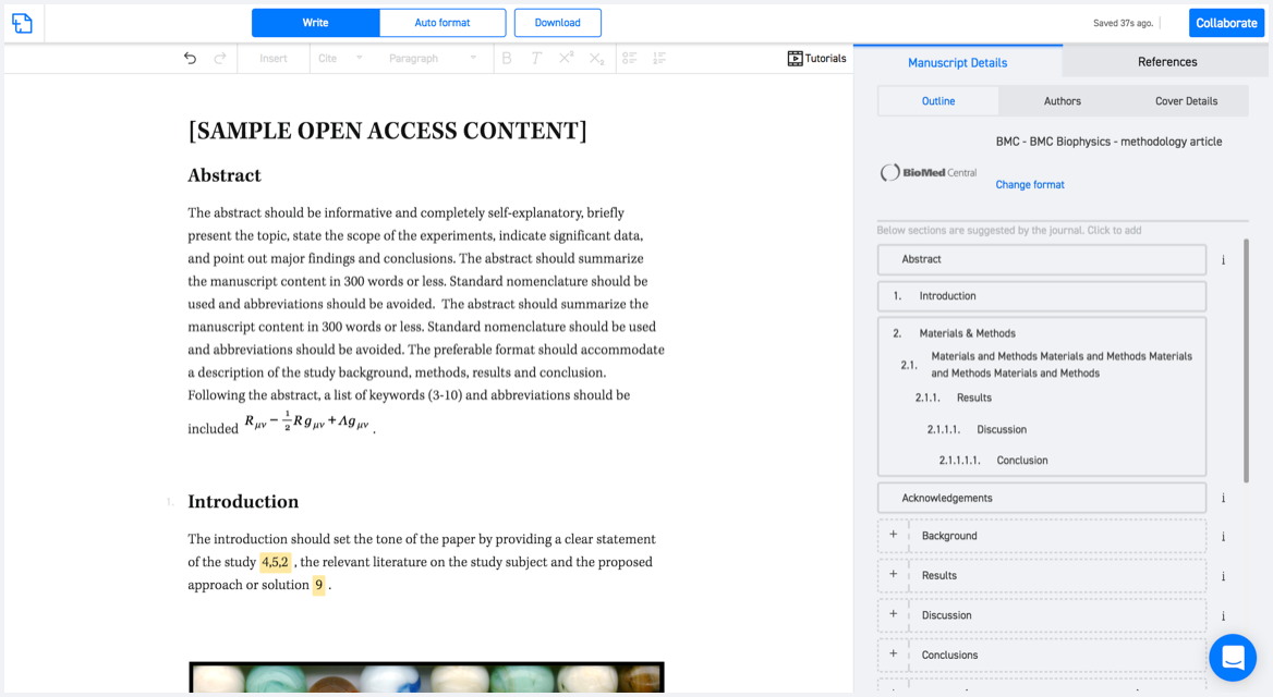
Available only on desktops 🖥

No word template required

Typset automatically formats your research paper to Frontiers in Earth Science formatting guidelines and citation style.
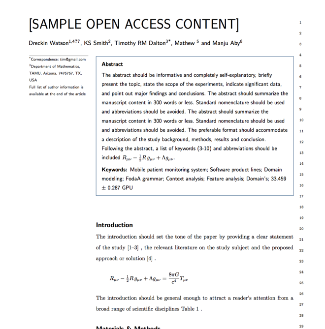
Verifed journal formats

One editor, 100K journal formats.
With the largest collection of verified journal formats, what you need is already there.

Trusted by academicians

I spent hours with MS word for reformatting. It was frustrating - plain and simple. With SciSpace, I can draft my manuscripts and once it is finished I can just submit. In case, I have to submit to another journal it is really just a button click instead of an afternoon of reformatting.

Andreas Frutiger
Researcher & Ex MS Word user
Use this template