Example of IEEE Geoscience and Remote Sensing Magazine format
Recent searches

Example of IEEE Geoscience and Remote Sensing Magazine format Example of IEEE Geoscience and Remote Sensing Magazine format Example of IEEE Geoscience and Remote Sensing Magazine format Example of IEEE Geoscience and Remote Sensing Magazine format Example of IEEE Geoscience and Remote Sensing Magazine format Example of IEEE Geoscience and Remote Sensing Magazine format Example of IEEE Geoscience and Remote Sensing Magazine format
Sample paper formatted on SciSpace - SciSpace
This content is only for preview purposes. The original open access content can be found here.
Look Inside
Example of IEEE Geoscience and Remote Sensing Magazine format Example of IEEE Geoscience and Remote Sensing Magazine format Example of IEEE Geoscience and Remote Sensing Magazine format Example of IEEE Geoscience and Remote Sensing Magazine format Example of IEEE Geoscience and Remote Sensing Magazine format Example of IEEE Geoscience and Remote Sensing Magazine format Example of IEEE Geoscience and Remote Sensing Magazine format
Sample paper formatted on SciSpace - SciSpace
This content is only for preview purposes. The original open access content can be found here.
open access Open Access
recommended Recommended

IEEE Geoscience and Remote Sensing Magazine — Template for authors

Publisher: IEEE
Categories Rank Trend in last 3 yrs
Instrumentation #2 of 128 up up by 5 ranks
Earth and Planetary Sciences (all) #3 of 186 up up by 10 ranks
Computer Science (all) #4 of 226 up up by 12 ranks
Electrical and Electronic Engineering #20 of 693 up up by 63 ranks
journal-quality-icon Journal quality:
High
calendar-icon Last 4 years overview: 127 Published Papers | 1964 Citations
indexed-in-icon Indexed in: Scopus
last-updated-icon Last updated: 05/06/2020
Related journals
Insights
General info
Top papers
Popular templates
Get started guide
Why choose from SciSpace
FAQ

Related Journals

open access Open Access

Hindawi

Quality:  
High
CiteRatio: 4.1
SJR: 0.399
SNIP: 1.108
open access Open Access

Hindawi

Quality:  
High
CiteRatio: 3.9
SJR: 0.318
SNIP: 0.926
open access Open Access
recommended Recommended

IEEE

Quality:  
High
CiteRatio: 6.0
SJR: 0.681
SNIP: 1.481
open access Open Access
recommended Recommended

IEEE

Quality:  
High
CiteRatio: 6.1
SJR: 0.82
SNIP: 1.928

Journal Performance & Insights

CiteRatio

SCImago Journal Rank (SJR)

Source Normalized Impact per Paper (SNIP)

A measure of average citations received per peer-reviewed paper published in the journal.

Measures weighted citations received by the journal. Citation weighting depends on the categories and prestige of the citing journal.

Measures actual citations received relative to citations expected for the journal's category.

15.5

4% from 2019

CiteRatio for IEEE Geoscience and Remote Sensing Magazine from 2016 - 2020
Year Value
2020 15.5
2019 14.9
2018 10.7
2017 5.7
2016 6.6
graph view Graph view
table view Table view

3.038

17% from 2019

SJR for IEEE Geoscience and Remote Sensing Magazine from 2016 - 2020
Year Value
2020 3.038
2019 3.642
2018 2.631
2017 1.742
2016 1.902
graph view Graph view
table view Table view

7.166

7% from 2019

SNIP for IEEE Geoscience and Remote Sensing Magazine from 2016 - 2020
Year Value
2020 7.166
2019 6.68
2018 7.091
2017 5.179
2016 7.875
graph view Graph view
table view Table view

insights Insights

  • CiteRatio of this journal has increased by 4% in last years.
  • This journal’s CiteRatio is in the top 10 percentile category.

insights Insights

  • SJR of this journal has decreased by 17% in last years.
  • This journal’s SJR is in the top 10 percentile category.

insights Insights

  • SNIP of this journal has increased by 7% in last years.
  • This journal’s SNIP is in the top 10 percentile category.
IEEE Geoscience and Remote Sensing Magazine

Guideline source: View

All company, product and service names used in this website are for identification purposes only. All product names, trademarks and registered trademarks are property of their respective owners.

Use of these names, trademarks and brands does not imply endorsement or affiliation. Disclaimer Notice

IEEE

IEEE Geoscience and Remote Sensing Magazine

Approved by publishing and review experts on SciSpace, this template is built as per for IEEE Geoscience and Remote Sensing Magazine formatting guidelines as mentioned in IEEE author instructions. The current version was created on 05 Jun 2020 and has been used by 858 authors to write and format their manuscripts to this journal.

Earth and Planetary Sciences

i
Last updated on
05 Jun 2020
i
ISSN
2168-6831
i
Open Access
No
i
Plagiarism Check
Available via Turnitin
i
Endnote Style
Download Available
i
Bibliography Name
IEEEtran
i
Citation Type
Numbered
[25]
i
Bibliography Example
C. W. J. Beenakker, “Specular andreev reflection in graphene,” Phys. Rev. Lett., vol. 97, no. 6, p.

Top papers written in this journal

open accessOpen access Journal Article DOI: 10.1109/MGRS.2017.2762307
Deep Learning in Remote Sensing: A Comprehensive Review and List of Resources
Xiao Xiang Zhu1, Devis Tuia2, Lichao Mou1, Gui-Song Xia3, Liangpei Zhang3, Feng Xu4, Friedrich Fraundorfer5

Abstract:

Central to the looming paradigm shift toward data-intensive science, machine-learning techniques are becoming increasingly important. In particular, deep learning has proven to be both a major breakthrough and an extremely powerful tool in many fields. Shall we embrace deep learning as the key to everything? Or should we resi... Central to the looming paradigm shift toward data-intensive science, machine-learning techniques are becoming increasingly important. In particular, deep learning has proven to be both a major breakthrough and an extremely powerful tool in many fields. Shall we embrace deep learning as the key to everything? Or should we resist a black-box solution? These are controversial issues within the remote-sensing community. In this article, we analyze the challenges of using deep learning for remote-sensing data analysis, review recent advances, and provide resources we hope will make deep learning in remote sensing seem ridiculously simple. More importantly, we encourage remote-sensing scientists to bring their expertise into deep learning and use it as an implicit general model to tackle unprecedented, large-scale, influential challenges, such as climate change and urbanization. read more read less
View PDF
2,095 Citations
Journal Article DOI: 10.1109/MGRS.2016.2540798
Deep Learning for Remote Sensing Data: A Technical Tutorial on the State of the Art
Liangpei Zhang1, Lefei Zhang1, Bo Du1

Abstract:

Deep-learning (DL) algorithms, which learn the representative and discriminative features in a hierarchical manner from the data, have recently become a hotspot in the machine-learning area and have been introduced into the geoscience and remote sensing (RS) community for RS big data analysis. Considering the low-level featur... Deep-learning (DL) algorithms, which learn the representative and discriminative features in a hierarchical manner from the data, have recently become a hotspot in the machine-learning area and have been introduced into the geoscience and remote sensing (RS) community for RS big data analysis. Considering the low-level features (e.g., spectral and texture) as the bottom level, the output feature representation from the top level of the network can be directly fed into a subsequent classifier for pixel-based classification. As a matter of fact, by carefully addressing the practical demands in RS applications and designing the input?output levels of the whole network, we have found that DL is actually everywhere in RS data analysis: from the traditional topics of image preprocessing, pixel-based classification, and target recognition, to the recent challenging tasks of high-level semantic feature extraction and RS scene understanding. read more read less

Topics:

Feature extraction (56%)56% related to the paper, Semantic feature (51%)51% related to the paper, Deep learning (51%)51% related to the paper
1,625 Citations
open accessOpen access Journal Article DOI: 10.1109/MGRS.2013.2248301
A tutorial on synthetic aperture radar

Abstract:

Synthetic Aperture Radar (SAR) has been widely used for Earth remote sensing for more than 30 years. It provides high-resolution, day-and-night and weather-independent images for a multitude of applications ranging from geoscience and climate change research, environmental and Earth system monitoring, 2-D and 3-D mapping, cha... Synthetic Aperture Radar (SAR) has been widely used for Earth remote sensing for more than 30 years. It provides high-resolution, day-and-night and weather-independent images for a multitude of applications ranging from geoscience and climate change research, environmental and Earth system monitoring, 2-D and 3-D mapping, change detection, 4-D mapping (space and time), security-related applications up to planetary exploration. With the advances in radar technology and geo/bio-physical parameter inversion modeling in the 90s, using data from several airborne and spaceborne systems, a paradigm shift occurred from the development driven by the technology push to the user demand pull. Today, more than 15 spaceborne SAR systems are being operated for innumerous applications. This paper provides first a tutorial about the SAR principles and theory, followed by an overview of established techniques like polarimetry, interferometry and differential interferometry as well as of emerging techniques (e.g., polarimetric SAR interferometry, tomography and holographic tomography). Several application examples including the associated parameter inversion modeling are provided for each case. The paper also describes innovative technologies and concepts like digital beamforming, Multiple-Input Multiple-Output (MIMO) and bi- and multi-static configurations which are suitable means to fulfill the increasing user requirements. The paper concludes with a vision for SAR remote sensing. read more read less

Topics:

Synthetic aperture radar (62%)62% related to the paper, Space-based radar (60%)60% related to the paper, Inverse synthetic aperture radar (58%)58% related to the paper, Radar imaging (58%)58% related to the paper, Side looking airborne radar (58%)58% related to the paper
View PDF
1,614 Citations
open accessOpen access Journal Article DOI: 10.1109/MGRS.2013.2244672
Hyperspectral Remote Sensing Data Analysis and Future Challenges

Abstract:

Hyperspectral remote sensing technology has advanced significantly in the past two decades. Current sensors onboard airborne and spaceborne platforms cover large areas of the Earth surface with unprecedented spectral, spatial, and temporal resolutions. These characteristics enable a myriad of applications requiring fine ident... Hyperspectral remote sensing technology has advanced significantly in the past two decades. Current sensors onboard airborne and spaceborne platforms cover large areas of the Earth surface with unprecedented spectral, spatial, and temporal resolutions. These characteristics enable a myriad of applications requiring fine identification of materials or estimation of physical parameters. Very often, these applications rely on sophisticated and complex data analysis methods. The sources of difficulties are, namely, the high dimensionality and size of the hyperspectral data, the spectral mixing (linear and nonlinear), and the degradation mechanisms associated to the measurement process such as noise and atmospheric effects. This paper presents a tutorial/overview cross section of some relevant hyperspectral data analysis methods and algorithms, organized in six main topics: data fusion, unmixing, classification, target detection, physical parameter retrieval, and fast computing. In all topics, we describe the state-of-the-art, provide illustrative examples, and point to future challenges and research directions. read more read less

Topics:

Hyperspectral imaging (57%)57% related to the paper, Full spectral imaging (57%)57% related to the paper, Data analysis (52%)52% related to the paper
View PDF
1,604 Citations
open accessOpen access Journal Article DOI: 10.1109/MGRS.2015.2440094
Hyperspectral Pansharpening: A Review

Abstract:

Pansharpening aims at fusing a panchromatic image with a multispectral one, to generate an image with the high spatial resolution of the former and the high spectral resolution of the latter. In the last decade, many algorithms have been presented in the literatures for pansharpening using multispectral data. With the increas... Pansharpening aims at fusing a panchromatic image with a multispectral one, to generate an image with the high spatial resolution of the former and the high spectral resolution of the latter. In the last decade, many algorithms have been presented in the literatures for pansharpening using multispectral data. With the increasing availability of hyperspectral systems, these methods are now being adapted to hyperspectral images. In this work, we compare new pansharpening techniques designed for hyperspectral data with some of the state-of-the-art methods for multispectral pansharpening, which have been adapted for hyperspectral data. Eleven methods from different classes (component substitution, multiresolution analysis, hybrid, Bayesian and matrix factorization) are analyzed. These methods are applied to three datasets and their effectiveness and robustness are evaluated with widely used performance indicators. In addition, all the pansharpening techniques considered in this paper have been implemented in a MATLAB toolbox that is made available to the community. read more read less

Topics:

Hyperspectral imaging (55%)55% related to the paper, Multispectral image (54%)54% related to the paper
View PDF
620 Citations
Author Pic

SciSpace is a very innovative solution to the formatting problem and existing providers, such as Mendeley or Word did not really evolve in recent years.

- Andreas Frutiger, Researcher, ETH Zurich, Institute for Biomedical Engineering

Get MS-Word and LaTeX output to any Journal within seconds
1
Choose a template
Select a template from a library of 40,000+ templates
2
Import a MS-Word file or start fresh
It takes only few seconds to import
3
View and edit your final output
SciSpace will automatically format your output to meet journal guidelines
4
Submit directly or Download
Submit to journal directly or Download in PDF, MS Word or LaTeX

(Before submission check for plagiarism via Turnitin)

clock Less than 3 minutes

What to expect from SciSpace?

Speed and accuracy over MS Word

''

With SciSpace, you do not need a word template for IEEE Geoscience and Remote Sensing Magazine.

It automatically formats your research paper to IEEE formatting guidelines and citation style.

You can download a submission ready research paper in pdf, LaTeX and docx formats.

Time comparison

Time taken to format a paper and Compliance with guidelines

Plagiarism Reports via Turnitin

SciSpace has partnered with Turnitin, the leading provider of Plagiarism Check software.

Using this service, researchers can compare submissions against more than 170 million scholarly articles, a database of 70+ billion current and archived web pages. How Turnitin Integration works?


Turnitin Stats
Publisher Logos

Freedom from formatting guidelines

One editor, 100K journal formats – world's largest collection of journal templates

With such a huge verified library, what you need is already there.

publisher-logos

Easy support from all your favorite tools

IEEE Geoscience and Remote Sensing Magazine format uses IEEEtran citation style.

Automatically format and order your citations and bibliography in a click.

SciSpace allows imports from all reference managers like Mendeley, Zotero, Endnote, Google Scholar etc.

Frequently asked questions

1. Can I write IEEE Geoscience and Remote Sensing Magazine in LaTeX?

Absolutely not! Our tool has been designed to help you focus on writing. You can write your entire paper as per the IEEE Geoscience and Remote Sensing Magazine guidelines and auto format it.

2. Do you follow the IEEE Geoscience and Remote Sensing Magazine guidelines?

Yes, the template is compliant with the IEEE Geoscience and Remote Sensing Magazine guidelines. Our experts at SciSpace ensure that. If there are any changes to the journal's guidelines, we'll change our algorithm accordingly.

3. Can I cite my article in multiple styles in IEEE Geoscience and Remote Sensing Magazine?

Of course! We support all the top citation styles, such as APA style, MLA style, Vancouver style, Harvard style, and Chicago style. For example, when you write your paper and hit autoformat, our system will automatically update your article as per the IEEE Geoscience and Remote Sensing Magazine citation style.

4. Can I use the IEEE Geoscience and Remote Sensing Magazine templates for free?

Sign up for our free trial, and you'll be able to use all our features for seven days. You'll see how helpful they are and how inexpensive they are compared to other options, Especially for IEEE Geoscience and Remote Sensing Magazine.

5. Can I use a manuscript in IEEE Geoscience and Remote Sensing Magazine that I have written in MS Word?

Yes. You can choose the right template, copy-paste the contents from the word document, and click on auto-format. Once you're done, you'll have a publish-ready paper IEEE Geoscience and Remote Sensing Magazine that you can download at the end.

6. How long does it usually take you to format my papers in IEEE Geoscience and Remote Sensing Magazine?

It only takes a matter of seconds to edit your manuscript. Besides that, our intuitive editor saves you from writing and formatting it in IEEE Geoscience and Remote Sensing Magazine.

7. Where can I find the template for the IEEE Geoscience and Remote Sensing Magazine?

It is possible to find the Word template for any journal on Google. However, why use a template when you can write your entire manuscript on SciSpace , auto format it as per IEEE Geoscience and Remote Sensing Magazine's guidelines and download the same in Word, PDF and LaTeX formats? Give us a try!.

8. Can I reformat my paper to fit the IEEE Geoscience and Remote Sensing Magazine's guidelines?

Of course! You can do this using our intuitive editor. It's very easy. If you need help, our support team is always ready to assist you.

9. IEEE Geoscience and Remote Sensing Magazine an online tool or is there a desktop version?

SciSpace's IEEE Geoscience and Remote Sensing Magazine is currently available as an online tool. We're developing a desktop version, too. You can request (or upvote) any features that you think would be helpful for you and other researchers in the "feature request" section of your account once you've signed up with us.

10. I cannot find my template in your gallery. Can you create it for me like IEEE Geoscience and Remote Sensing Magazine?

Sure. You can request any template and we'll have it setup within a few days. You can find the request box in Journal Gallery on the right side bar under the heading, "Couldn't find the format you were looking for like IEEE Geoscience and Remote Sensing Magazine?”

11. What is the output that I would get after using IEEE Geoscience and Remote Sensing Magazine?

After writing your paper autoformatting in IEEE Geoscience and Remote Sensing Magazine, you can download it in multiple formats, viz., PDF, Docx, and LaTeX.

12. Is IEEE Geoscience and Remote Sensing Magazine's impact factor high enough that I should try publishing my article there?

To be honest, the answer is no. The impact factor is one of the many elements that determine the quality of a journal. Few of these factors include review board, rejection rates, frequency of inclusion in indexes, and Eigenfactor. You need to assess all these factors before you make your final call.

13. What is Sherpa RoMEO Archiving Policy for IEEE Geoscience and Remote Sensing Magazine?

SHERPA/RoMEO Database

We extracted this data from Sherpa Romeo to help researchers understand the access level of this journal in accordance with the Sherpa Romeo Archiving Policy for IEEE Geoscience and Remote Sensing Magazine. The table below indicates the level of access a journal has as per Sherpa Romeo's archiving policy.

RoMEO Colour Archiving policy
Green Can archive pre-print and post-print or publisher's version/PDF
Blue Can archive post-print (ie final draft post-refereeing) or publisher's version/PDF
Yellow Can archive pre-print (ie pre-refereeing)
White Archiving not formally supported
FYI:
  1. Pre-prints as being the version of the paper before peer review and
  2. Post-prints as being the version of the paper after peer-review, with revisions having been made.

14. What are the most common citation types In IEEE Geoscience and Remote Sensing Magazine?

The 5 most common citation types in order of usage for IEEE Geoscience and Remote Sensing Magazine are:.

S. No. Citation Style Type
1. Author Year
2. Numbered
3. Numbered (Superscripted)
4. Author Year (Cited Pages)
5. Footnote

15. How do I submit my article to the IEEE Geoscience and Remote Sensing Magazine?

It is possible to find the Word template for any journal on Google. However, why use a template when you can write your entire manuscript on SciSpace , auto format it as per IEEE Geoscience and Remote Sensing Magazine's guidelines and download the same in Word, PDF and LaTeX formats? Give us a try!.

16. Can I download IEEE Geoscience and Remote Sensing Magazine in Endnote format?

Yes, SciSpace provides this functionality. After signing up, you would need to import your existing references from Word or Bib file to SciSpace. Then SciSpace would allow you to download your references in IEEE Geoscience and Remote Sensing Magazine Endnote style according to Elsevier guidelines.

Fast and reliable,
built for complaince.

Instant formatting to 100% publisher guidelines on - SciSpace.
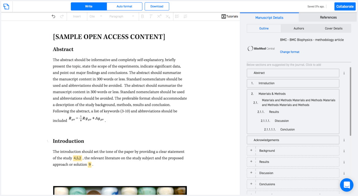
Available only on desktops 🖥

No word template required

Typset automatically formats your research paper to IEEE Geoscience and Remote Sensing Magazine formatting guidelines and citation style.
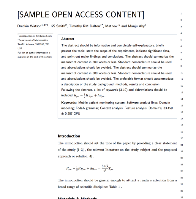

Verifed journal formats

One editor, 100K journal formats.
With the largest collection of verified journal formats, what you need is already there.

Trusted by academicians

I spent hours with MS word for reformatting. It was frustrating - plain and simple. With SciSpace, I can draft my manuscripts and once it is finished I can just submit. In case, I have to submit to another journal it is really just a button click instead of an afternoon of reformatting.

Andreas Frutiger
Researcher & Ex MS Word user
Use this template