Example of IEEE Journal of Selected Topics in Applied Earth Observations and Remote Sensing format
Recent searches

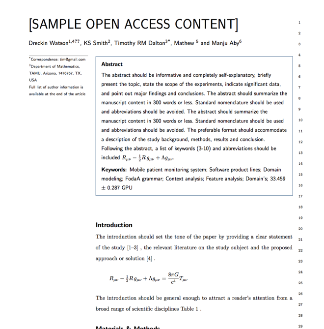
Example of IEEE Journal of Selected Topics in Applied Earth Observations and Remote Sensing format Example of IEEE Journal of Selected Topics in Applied Earth Observations and Remote Sensing format Example of IEEE Journal of Selected Topics in Applied Earth Observations and Remote Sensing format Example of IEEE Journal of Selected Topics in Applied Earth Observations and Remote Sensing format Example of IEEE Journal of Selected Topics in Applied Earth Observations and Remote Sensing format Example of IEEE Journal of Selected Topics in Applied Earth Observations and Remote Sensing format Example of IEEE Journal of Selected Topics in Applied Earth Observations and Remote Sensing format
Sample paper formatted on SciSpace - SciSpace
This content is only for preview purposes. The original open access content can be found here.
Look Inside
Example of IEEE Journal of Selected Topics in Applied Earth Observations and Remote Sensing format Example of IEEE Journal of Selected Topics in Applied Earth Observations and Remote Sensing format Example of IEEE Journal of Selected Topics in Applied Earth Observations and Remote Sensing format Example of IEEE Journal of Selected Topics in Applied Earth Observations and Remote Sensing format Example of IEEE Journal of Selected Topics in Applied Earth Observations and Remote Sensing format Example of IEEE Journal of Selected Topics in Applied Earth Observations and Remote Sensing format Example of IEEE Journal of Selected Topics in Applied Earth Observations and Remote Sensing format
Sample paper formatted on SciSpace - SciSpace
This content is only for preview purposes. The original open access content can be found here.
open access Open Access

IEEE Journal of Selected Topics in Applied Earth Observations and Remote Sensing — Template for authors

Publisher: IEEE
Categories Rank Trend in last 3 yrs
Computers in Earth Sciences #7 of 52 down down by 2 ranks
Atmospheric Science #18 of 124 down down by 2 ranks
journal-quality-icon Journal quality:
High
calendar-icon Last 4 years overview: 1836 Published Papers | 13185 Citations
indexed-in-icon Indexed in: Scopus
last-updated-icon Last updated: 12/06/2020
Related journals
Insights
General info
Top papers
Popular templates
Get started guide
Why choose from SciSpace
FAQ

Related Journals

open access Open Access

Elsevier

Quality:  
Good
CiteRatio: 2.8
SJR: 0.518
SNIP: 0.73
open access Open Access
recommended Recommended

American Meteorological Society

Quality:  
High
CiteRatio: 13.5
SJR: 3.367
SNIP: 2.93
open access Open Access

American Meteorological Society

Quality:  
High
CiteRatio: 4.1
SJR: 0.774
SNIP: 1.154
open access Open Access
recommended Recommended

American Meteorological Society

Quality:  
High
CiteRatio: 9.8
SJR: 3.315
SNIP: 1.909

Journal Performance & Insights

Impact Factor

CiteRatio

Determines the importance of a journal by taking a measure of frequency with which the average article in a journal has been cited in a particular year.

A measure of average citations received per peer-reviewed paper published in the journal.

3.827

13% from 2018

Impact factor for IEEE Journal of Selected Topics in Applied Earth Observations and Remote Sensing from 2016 - 2019
Year Value
2019 3.827
2018 3.392
2017 2.777
2016 2.913
graph view Graph view
table view Table view

7.2

1% from 2019

CiteRatio for IEEE Journal of Selected Topics in Applied Earth Observations and Remote Sensing from 2016 - 2020
Year Value
2020 7.2
2019 7.3
2018 6.7
2017 6.2
2016 5.1
graph view Graph view
table view Table view

insights Insights

  • Impact factor of this journal has increased by 13% in last year.
  • This journal’s impact factor is in the top 10 percentile category.

insights Insights

  • CiteRatio of this journal has decreased by 1% in last years.
  • This journal’s CiteRatio is in the top 10 percentile category.

SCImago Journal Rank (SJR)

Source Normalized Impact per Paper (SNIP)

Measures weighted citations received by the journal. Citation weighting depends on the categories and prestige of the citing journal.

Measures actual citations received relative to citations expected for the journal's category.

1.246

16% from 2019

SJR for IEEE Journal of Selected Topics in Applied Earth Observations and Remote Sensing from 2016 - 2020
Year Value
2020 1.246
2019 1.48
2018 1.508
2017 1.547
2016 1.595
graph view Graph view
table view Table view

1.579

7% from 2019

SNIP for IEEE Journal of Selected Topics in Applied Earth Observations and Remote Sensing from 2016 - 2020
Year Value
2020 1.579
2019 1.699
2018 1.882
2017 1.648
2016 1.937
graph view Graph view
table view Table view

insights Insights

  • SJR of this journal has decreased by 16% in last years.
  • This journal’s SJR is in the top 10 percentile category.

insights Insights

  • SNIP of this journal has decreased by 7% in last years.
  • This journal’s SNIP is in the top 10 percentile category.

IEEE Journal of Selected Topics in Applied Earth Observations and Remote Sensing

Guideline source: View

All company, product and service names used in this website are for identification purposes only. All product names, trademarks and registered trademarks are property of their respective owners.

Use of these names, trademarks and brands does not imply endorsement or affiliation. Disclaimer Notice

IEEE

IEEE Journal of Selected Topics in Applied Earth Observations and Remote Sensing

The “IEEE Journal of Selected Topics in Applied Earth Observations and Remote Sensing” (JSTARS) is a new quarterly publication sponsored by the IEEE Geoscience and Remote Sensing Society (GRSS) and co-sponsored by the IEEE Committee on Earth Observations (ICEO). The new Journa...... Read More

Computers in Earth Sciences

Atmospheric Science

Earth and Planetary Sciences

i
Last updated on
12 Jun 2020
i
ISSN
1939-1404
i
Impact Factor
High - 2.015
i
Open Access
No
i
Sherpa RoMEO Archiving Policy
Green faq
i
Plagiarism Check
Available via Turnitin
i
Endnote Style
Download Available
i
Bibliography Name
IEEEtran
i
Citation Type
Numbered
[25]
i
Bibliography Example
C. W. J. Beenakker, “Specular andreev reflection in graphene,” Phys. Rev. Lett., vol. 97, no. 6, p.

Top papers written in this journal

open accessOpen access Journal Article DOI: 10.1109/JSTARS.2012.2194696
Hyperspectral Unmixing Overview: Geometrical, Statistical, and Sparse Regression-Based Approaches

Abstract:

Imaging spectrometers measure electromagnetic energy scattered in their instantaneous field view in hundreds or thousands of spectral channels with higher spectral resolution than multispectral cameras. Imaging spectrometers are therefore often referred to as hyperspectral cameras (HSCs). Higher spectral resolution enables ma... Imaging spectrometers measure electromagnetic energy scattered in their instantaneous field view in hundreds or thousands of spectral channels with higher spectral resolution than multispectral cameras. Imaging spectrometers are therefore often referred to as hyperspectral cameras (HSCs). Higher spectral resolution enables material identification via spectroscopic analysis, which facilitates countless applications that require identifying materials in scenarios unsuitable for classical spectroscopic analysis. Due to low spatial resolution of HSCs, microscopic material mixing, and multiple scattering, spectra measured by HSCs are mixtures of spectra of materials in a scene. Thus, accurate estimation requires unmixing. Pixels are assumed to be mixtures of a few materials, called endmembers. Unmixing involves estimating all or some of: the number of endmembers, their spectral signatures, and their abundances at each pixel. Unmixing is a challenging, ill-posed inverse problem because of model inaccuracies, observation noise, environmental conditions, endmember variability, and data set size. Researchers have devised and investigated many models searching for robust, stable, tractable, and accurate unmixing algorithms. This paper presents an overview of unmixing methods from the time of Keshava and Mustard's unmixing tutorial to the present. Mixing models are first discussed. Signal-subspace, geometrical, statistical, sparsity-based, and spatial-contextual unmixing algorithms are described. Mathematical problems and potential solutions are described. Algorithm characteristics are illustrated experimentally. read more read less

Topics:

Hyperspectral imaging (57%)57% related to the paper, Endmember (53%)53% related to the paper, Multispectral image (52%)52% related to the paper
View PDF
2,373 Citations
Journal Article DOI: 10.1109/JSTARS.2014.2329330
Deep Learning-Based Classification of Hyperspectral Data
Yushi Chen1, Zhouhan Lin1, Xing Zhao1, Gang Wang2, Yanfeng Gu1

Abstract:

Classification is one of the most popular topics in hyperspectral remote sensing. In the last two decades, a huge number of methods were proposed to deal with the hyperspectral data classification problem. However, most of them do not hierarchically extract deep features. In this paper, the concept of deep learning is introdu... Classification is one of the most popular topics in hyperspectral remote sensing. In the last two decades, a huge number of methods were proposed to deal with the hyperspectral data classification problem. However, most of them do not hierarchically extract deep features. In this paper, the concept of deep learning is introduced into hyperspectral data classification for the first time. First, we verify the eligibility of stacked autoencoders by following classical spectral information-based classification. Second, a new way of classifying with spatial-dominated information is proposed. We then propose a novel deep learning framework to merge the two features, from which we can get the highest classification accuracy. The framework is a hybrid of principle component analysis (PCA), deep learning architecture, and logistic regression. Specifically, as a deep learning architecture, stacked autoencoders are aimed to get useful high-level features. Experimental results with widely-used hyperspectral data indicate that classifiers built in this deep learning-based framework provide competitive performance. In addition, the proposed joint spectral-spatial deep neural network opens a new window for future research, showcasing the deep learning-based methods' huge potential for accurate hyperspectral data classification. read more read less

Topics:

Deep belief network (66%)66% related to the paper, Deep learning (56%)56% related to the paper, Hyperspectral imaging (54%)54% related to the paper, Artificial neural network (53%)53% related to the paper, Support vector machine (53%)53% related to the paper
2,071 Citations
Journal Article DOI: 10.1109/JSTARS.2015.2388577
Spectral–Spatial Classification of Hyperspectral Data Based on Deep Belief Network
Yushi Chen1, Xing Zhao1, Xiuping Jia2

Abstract:

Hyperspectral data classification is a hot topic in remote sensing community. In recent years, significant effort has been focused on this issue. However, most of the methods extract the features of original data in a shallow manner. In this paper, we introduce a deep learning approach into hyperspectral image classification.... Hyperspectral data classification is a hot topic in remote sensing community. In recent years, significant effort has been focused on this issue. However, most of the methods extract the features of original data in a shallow manner. In this paper, we introduce a deep learning approach into hyperspectral image classification. A new feature extraction (FE) and image classification framework are proposed for hyperspectral data analysis based on deep belief network (DBN). First, we verify the eligibility of restricted Boltzmann machine (RBM) and DBN by the following spectral information-based classification. Then, we propose a novel deep architecture, which combines the spectral–spatial FE and classification together to get high classification accuracy. The framework is a hybrid of principal component analysis (PCA), hierarchical learning-based FE, and logistic regression (LR). Experimental results with hyperspectral data indicate that the classifier provide competitive solution with the state-of-the-art methods. In addition, this paper reveals that deep learning system has huge potential for hyperspectral data classification. read more read less

Topics:

Deep belief network (62%)62% related to the paper, Contextual image classification (58%)58% related to the paper, Hyperspectral imaging (58%)58% related to the paper, Restricted Boltzmann machine (55%)55% related to the paper, Feature extraction (54%)54% related to the paper
1,028 Citations
Journal Article DOI: 10.1109/JSTARS.2009.2020300
Irradiance Forecasting for the Power Prediction of Grid-Connected Photovoltaic Systems
Elke Lorenz1, Johannes Hurka1, Detlev Heinemann1, Hans Georg Beyer

Abstract:

The contribution of power production by photovoltaic (PV) systems to the electricity supply is constantly increasing. An efficient use of the fluctuating solar power production will highly benefit from forecast information on the expected power production. This forecast information is necessary for the management of the elect... The contribution of power production by photovoltaic (PV) systems to the electricity supply is constantly increasing. An efficient use of the fluctuating solar power production will highly benefit from forecast information on the expected power production. This forecast information is necessary for the management of the electricity grids and for solar energy trading. This paper presents an approach to predict regional PV power output based on forecasts up to three days ahead provided by the European Centre for Medium-Range Weather Forecasts (ECMWF). Focus of the paper is the description and evaluation of the approach of irradiance forecasting, which is the basis for PV power prediction. One day-ahead irradiance forecasts for single stations in Germany show a rRMSE of 36%. For regional forecasts, forecast accuracy is increasing in dependency on the size of the region. For the complete area of Germany, the rRMSE amounts to 13%. Besides the forecast accuracy, also the specification of the forecast uncertainty is an important issue for an effective application. We present and evaluate an approach to derive weather specific prediction intervals for irradiance forecasts. The accuracy of PV power prediction is investigated in a case study. read more read less

Topics:

Solar power (58%)58% related to the paper, Photovoltaic system (56%)56% related to the paper, Weather forecasting (54%)54% related to the paper, Mains electricity (51%)51% related to the paper
637 Citations
open accessOpen access Journal Article DOI: 10.1109/JSTARS.2020.3005403
Remote Sensing Image Scene Classification Meets Deep Learning: Challenges, Methods, Benchmarks, and Opportunities
Gong Cheng1, Xingxing Xie1, Junwei Han1, Lei Guo1, Gui-Song Xia2

Abstract:

Remote sensing image scene classification, which aims at labeling remote sensing images with a set of semantic categories based on their contents, has broad applications in a range of fields. Propelled by the powerful feature learning capabilities of deep neural networks, remote sensing image scene classification driven by de... Remote sensing image scene classification, which aims at labeling remote sensing images with a set of semantic categories based on their contents, has broad applications in a range of fields. Propelled by the powerful feature learning capabilities of deep neural networks, remote sensing image scene classification driven by deep learning has drawn remarkable attention and achieved significant breakthroughs. However, to the best of our knowledge, a comprehensive review of recent achievements regarding deep learning for scene classification of remote sensing images is still lacking. Considering the rapid evolution of this field, this article provides a systematic survey of deep learning methods for remote sensing image scene classification by covering more than 160 papers. To be specific, we discuss the main challenges of remote sensing image scene classification and survey: first, autoencoder-based remote sensing image scene classification methods; second, convolutional neural network-based remote sensing image scene classification methods; and third, generative adversarial network-based remote sensing image scene classification methods. In addition, we introduce the benchmarks used for remote sensing image scene classification and summarize the performance of more than two dozen of representative algorithms on three commonly used benchmark datasets. Finally, we discuss the promising opportunities for further research. read more read less

Topics:

Feature learning (53%)53% related to the paper, Deep learning (52%)52% related to the paper, Autoencoder (51%)51% related to the paper, Remote sensing (archaeology) (50%)50% related to the paper
View PDF
450 Citations
Author Pic

SciSpace is a very innovative solution to the formatting problem and existing providers, such as Mendeley or Word did not really evolve in recent years.

- Andreas Frutiger, Researcher, ETH Zurich, Institute for Biomedical Engineering

Get MS-Word and LaTeX output to any Journal within seconds
1
Choose a template
Select a template from a library of 40,000+ templates
2
Import a MS-Word file or start fresh
It takes only few seconds to import
3
View and edit your final output
SciSpace will automatically format your output to meet journal guidelines
4
Submit directly or Download
Submit to journal directly or Download in PDF, MS Word or LaTeX

(Before submission check for plagiarism via Turnitin)

clock Less than 3 minutes

What to expect from SciSpace?

Speed and accuracy over MS Word

''

With SciSpace, you do not need a word template for IEEE Journal of Selected Topics in Applied Earth Observations and Remote Sensing.

It automatically formats your research paper to IEEE formatting guidelines and citation style.

You can download a submission ready research paper in pdf, LaTeX and docx formats.

Time comparison

Time taken to format a paper and Compliance with guidelines

Plagiarism Reports via Turnitin

SciSpace has partnered with Turnitin, the leading provider of Plagiarism Check software.

Using this service, researchers can compare submissions against more than 170 million scholarly articles, a database of 70+ billion current and archived web pages. How Turnitin Integration works?


Turnitin Stats
Publisher Logos

Freedom from formatting guidelines

One editor, 100K journal formats – world's largest collection of journal templates

With such a huge verified library, what you need is already there.

publisher-logos

Easy support from all your favorite tools

IEEE Journal of Selected Topics in Applied Earth Observations and Remote Sensing format uses IEEEtran citation style.

Automatically format and order your citations and bibliography in a click.

SciSpace allows imports from all reference managers like Mendeley, Zotero, Endnote, Google Scholar etc.

Frequently asked questions

1. Can I write IEEE Journal of Selected Topics in Applied Earth Observations and Remote Sensing in LaTeX?

Absolutely not! Our tool has been designed to help you focus on writing. You can write your entire paper as per the IEEE Journal of Selected Topics in Applied Earth Observations and Remote Sensing guidelines and auto format it.

2. Do you follow the IEEE Journal of Selected Topics in Applied Earth Observations and Remote Sensing guidelines?

Yes, the template is compliant with the IEEE Journal of Selected Topics in Applied Earth Observations and Remote Sensing guidelines. Our experts at SciSpace ensure that. If there are any changes to the journal's guidelines, we'll change our algorithm accordingly.

3. Can I cite my article in multiple styles in IEEE Journal of Selected Topics in Applied Earth Observations and Remote Sensing?

Of course! We support all the top citation styles, such as APA style, MLA style, Vancouver style, Harvard style, and Chicago style. For example, when you write your paper and hit autoformat, our system will automatically update your article as per the IEEE Journal of Selected Topics in Applied Earth Observations and Remote Sensing citation style.

4. Can I use the IEEE Journal of Selected Topics in Applied Earth Observations and Remote Sensing templates for free?

Sign up for our free trial, and you'll be able to use all our features for seven days. You'll see how helpful they are and how inexpensive they are compared to other options, Especially for IEEE Journal of Selected Topics in Applied Earth Observations and Remote Sensing.

5. Can I use a manuscript in IEEE Journal of Selected Topics in Applied Earth Observations and Remote Sensing that I have written in MS Word?

Yes. You can choose the right template, copy-paste the contents from the word document, and click on auto-format. Once you're done, you'll have a publish-ready paper IEEE Journal of Selected Topics in Applied Earth Observations and Remote Sensing that you can download at the end.

6. How long does it usually take you to format my papers in IEEE Journal of Selected Topics in Applied Earth Observations and Remote Sensing?

It only takes a matter of seconds to edit your manuscript. Besides that, our intuitive editor saves you from writing and formatting it in IEEE Journal of Selected Topics in Applied Earth Observations and Remote Sensing.

7. Where can I find the template for the IEEE Journal of Selected Topics in Applied Earth Observations and Remote Sensing?

It is possible to find the Word template for any journal on Google. However, why use a template when you can write your entire manuscript on SciSpace , auto format it as per IEEE Journal of Selected Topics in Applied Earth Observations and Remote Sensing's guidelines and download the same in Word, PDF and LaTeX formats? Give us a try!.

8. Can I reformat my paper to fit the IEEE Journal of Selected Topics in Applied Earth Observations and Remote Sensing's guidelines?

Of course! You can do this using our intuitive editor. It's very easy. If you need help, our support team is always ready to assist you.

9. IEEE Journal of Selected Topics in Applied Earth Observations and Remote Sensing an online tool or is there a desktop version?

SciSpace's IEEE Journal of Selected Topics in Applied Earth Observations and Remote Sensing is currently available as an online tool. We're developing a desktop version, too. You can request (or upvote) any features that you think would be helpful for you and other researchers in the "feature request" section of your account once you've signed up with us.

10. I cannot find my template in your gallery. Can you create it for me like IEEE Journal of Selected Topics in Applied Earth Observations and Remote Sensing?

Sure. You can request any template and we'll have it setup within a few days. You can find the request box in Journal Gallery on the right side bar under the heading, "Couldn't find the format you were looking for like IEEE Journal of Selected Topics in Applied Earth Observations and Remote Sensing?”

11. What is the output that I would get after using IEEE Journal of Selected Topics in Applied Earth Observations and Remote Sensing?

After writing your paper autoformatting in IEEE Journal of Selected Topics in Applied Earth Observations and Remote Sensing, you can download it in multiple formats, viz., PDF, Docx, and LaTeX.

12. Is IEEE Journal of Selected Topics in Applied Earth Observations and Remote Sensing's impact factor high enough that I should try publishing my article there?

To be honest, the answer is no. The impact factor is one of the many elements that determine the quality of a journal. Few of these factors include review board, rejection rates, frequency of inclusion in indexes, and Eigenfactor. You need to assess all these factors before you make your final call.

13. What is Sherpa RoMEO Archiving Policy for IEEE Journal of Selected Topics in Applied Earth Observations and Remote Sensing?

SHERPA/RoMEO Database

We extracted this data from Sherpa Romeo to help researchers understand the access level of this journal in accordance with the Sherpa Romeo Archiving Policy for IEEE Journal of Selected Topics in Applied Earth Observations and Remote Sensing. The table below indicates the level of access a journal has as per Sherpa Romeo's archiving policy.

RoMEO Colour Archiving policy
Green Can archive pre-print and post-print or publisher's version/PDF
Blue Can archive post-print (ie final draft post-refereeing) or publisher's version/PDF
Yellow Can archive pre-print (ie pre-refereeing)
White Archiving not formally supported
FYI:
  1. Pre-prints as being the version of the paper before peer review and
  2. Post-prints as being the version of the paper after peer-review, with revisions having been made.

14. What are the most common citation types In IEEE Journal of Selected Topics in Applied Earth Observations and Remote Sensing?

The 5 most common citation types in order of usage for IEEE Journal of Selected Topics in Applied Earth Observations and Remote Sensing are:.

S. No. Citation Style Type
1. Author Year
2. Numbered
3. Numbered (Superscripted)
4. Author Year (Cited Pages)
5. Footnote

15. How do I submit my article to the IEEE Journal of Selected Topics in Applied Earth Observations and Remote Sensing?

It is possible to find the Word template for any journal on Google. However, why use a template when you can write your entire manuscript on SciSpace , auto format it as per IEEE Journal of Selected Topics in Applied Earth Observations and Remote Sensing's guidelines and download the same in Word, PDF and LaTeX formats? Give us a try!.

16. Can I download IEEE Journal of Selected Topics in Applied Earth Observations and Remote Sensing in Endnote format?

Yes, SciSpace provides this functionality. After signing up, you would need to import your existing references from Word or Bib file to SciSpace. Then SciSpace would allow you to download your references in IEEE Journal of Selected Topics in Applied Earth Observations and Remote Sensing Endnote style according to Elsevier guidelines.

Fast and reliable,
built for complaince.

Instant formatting to 100% publisher guidelines on - SciSpace.

Available only on desktops 🖥

No word template required

Typset automatically formats your research paper to IEEE Journal of Selected Topics in Applied Earth Observations and Remote Sensing formatting guidelines and citation style.

Verifed journal formats

One editor, 100K journal formats.
With the largest collection of verified journal formats, what you need is already there.

Trusted by academicians

I spent hours with MS word for reformatting. It was frustrating - plain and simple. With SciSpace, I can draft my manuscripts and once it is finished I can just submit. In case, I have to submit to another journal it is really just a button click instead of an afternoon of reformatting.

Andreas Frutiger
Researcher & Ex MS Word user
Use this template