Example of IEEE Transactions on Geoscience and Remote Sensing format
Recent searches

Example of IEEE Transactions on Geoscience and Remote Sensing format Example of IEEE Transactions on Geoscience and Remote Sensing format Example of IEEE Transactions on Geoscience and Remote Sensing format Example of IEEE Transactions on Geoscience and Remote Sensing format Example of IEEE Transactions on Geoscience and Remote Sensing format Example of IEEE Transactions on Geoscience and Remote Sensing format Example of IEEE Transactions on Geoscience and Remote Sensing format Example of IEEE Transactions on Geoscience and Remote Sensing format Example of IEEE Transactions on Geoscience and Remote Sensing format Example of IEEE Transactions on Geoscience and Remote Sensing format Example of IEEE Transactions on Geoscience and Remote Sensing format
Sample paper formatted on SciSpace - SciSpace
This content is only for preview purposes. The original open access content can be found here.
Look Inside
Example of IEEE Transactions on Geoscience and Remote Sensing format Example of IEEE Transactions on Geoscience and Remote Sensing format Example of IEEE Transactions on Geoscience and Remote Sensing format Example of IEEE Transactions on Geoscience and Remote Sensing format Example of IEEE Transactions on Geoscience and Remote Sensing format Example of IEEE Transactions on Geoscience and Remote Sensing format Example of IEEE Transactions on Geoscience and Remote Sensing format Example of IEEE Transactions on Geoscience and Remote Sensing format Example of IEEE Transactions on Geoscience and Remote Sensing format Example of IEEE Transactions on Geoscience and Remote Sensing format Example of IEEE Transactions on Geoscience and Remote Sensing format
Sample paper formatted on SciSpace - SciSpace
This content is only for preview purposes. The original open access content can be found here.
open access Open Access
recommended Recommended

IEEE Transactions on Geoscience and Remote Sensing — Template for authors

Publisher: IEEE
Categories Rank Trend in last 3 yrs
Earth and Planetary Sciences (all) #5 of 186 down down by 2 ranks
Electrical and Electronic Engineering #47 of 693 down down by 22 ranks
journal-quality-icon Journal quality:
High
calendar-icon Last 4 years overview: 2569 Published Papers | 28519 Citations
indexed-in-icon Indexed in: Scopus
last-updated-icon Last updated: 03/07/2020
Related journals
Insights
General info
Top papers
Popular templates
Get started guide
Why choose from SciSpace
FAQ

Related Journals

open access Open Access
recommended Recommended

IEEE

Quality:  
High
CiteRatio: 15.5
SJR: 3.038
SNIP: 7.166
open access Open Access

Wiley

Quality:  
Good
CiteRatio: 3.1
SJR: 0.371
SNIP: 0.901
open access Open Access

IEEE

Quality:  
High
CiteRatio: 6.4
SJR: 0.786
SNIP: 2.027
open access Open Access

Taylor and Francis

Quality:  
High
CiteRatio: 4.1
SJR: 0.694
SNIP: 0.72

Journal Performance & Insights

Impact Factor

CiteRatio

Determines the importance of a journal by taking a measure of frequency with which the average article in a journal has been cited in a particular year.

A measure of average citations received per peer-reviewed paper published in the journal.

5.855

4% from 2018

Impact factor for IEEE Transactions on Geoscience and Remote Sensing from 2016 - 2019
Year Value
2019 5.855
2018 5.63
2017 4.662
2016 4.942
graph view Graph view
table view Table view

11.1

4% from 2019

CiteRatio for IEEE Transactions on Geoscience and Remote Sensing from 2016 - 2020
Year Value
2020 11.1
2019 10.7
2018 10.8
2017 10.3
2016 8.9
graph view Graph view
table view Table view

insights Insights

  • Impact factor of this journal has increased by 4% in last year.
  • This journal’s impact factor is in the top 10 percentile category.

insights Insights

  • CiteRatio of this journal has increased by 4% in last years.
  • This journal’s CiteRatio is in the top 10 percentile category.

SCImago Journal Rank (SJR)

Source Normalized Impact per Paper (SNIP)

Measures weighted citations received by the journal. Citation weighting depends on the categories and prestige of the citing journal.

Measures actual citations received relative to citations expected for the journal's category.

2.141

18% from 2019

SJR for IEEE Transactions on Geoscience and Remote Sensing from 2016 - 2020
Year Value
2020 2.141
2019 2.616
2018 2.763
2017 2.649
2016 2.616
graph view Graph view
table view Table view

2.504

14% from 2019

SNIP for IEEE Transactions on Geoscience and Remote Sensing from 2016 - 2020
Year Value
2020 2.504
2019 2.909
2018 3.132
2017 2.873
2016 3.264
graph view Graph view
table view Table view

insights Insights

  • SJR of this journal has decreased by 18% in last years.
  • This journal’s SJR is in the top 10 percentile category.

insights Insights

  • SNIP of this journal has decreased by 14% in last years.
  • This journal’s SNIP is in the top 10 percentile category.

IEEE Transactions on Geoscience and Remote Sensing

Guideline source: View

All company, product and service names used in this website are for identification purposes only. All product names, trademarks and registered trademarks are property of their respective owners.

Use of these names, trademarks and brands does not imply endorsement or affiliation. Disclaimer Notice

IEEE

IEEE Transactions on Geoscience and Remote Sensing

This publication focuses on the theory, concepts, and techniques of science and engineering as applied to sensing the earth, oceans, atmosphere, and space; and the processing, interpretation, and dissemination of this information. This journal publishes technical papers disclo...... Read More

Earth and Planetary Sciences

i
Last updated on
03 Jul 2020
i
ISSN
0196-2892
i
Impact Factor
Very High - 3.313
i
Open Access
No
i
Sherpa RoMEO Archiving Policy
Green faq
i
Plagiarism Check
Available via Turnitin
i
Endnote Style
Download Available
i
Bibliography Name
IEEEtran
i
Citation Type
Numbered
[25]
i
Bibliography Example
C. W. J. Beenakker, “Specular andreev reflection in graphene,” Phys. Rev. Lett., vol. 97, no. 6, p.

Top papers written in this journal

Journal Article DOI: 10.1109/36.898661
Permanent scatterers in SAR interferometry
Alessandro Ferretti1, Claudio Prati1, Fabio Rocca1

Abstract:

Temporal and geometrical decorrelation often prevents SAR interferometry from being an operational tool for surface deformation monitoring and topographic profile reconstruction. Moreover, atmospheric disturbances can strongly compromise the accuracy of the results. The authors present a complete procedure for the identificat... Temporal and geometrical decorrelation often prevents SAR interferometry from being an operational tool for surface deformation monitoring and topographic profile reconstruction. Moreover, atmospheric disturbances can strongly compromise the accuracy of the results. The authors present a complete procedure for the identification and exploitation of stable natural reflectors or permanent scatterers (PSs) starting from long temporal series of interferometric SAR images. When, as it often happens, the dimension of the PS is smaller than the resolution cell, the coherence is good even for interferograms with baselines larger than the decorrelation one, and all the available images of the ESA ERS data set can be successfully exploited. On these pixels, submeter DEM accuracy and millimetric terrain motion detection can be achieved, since atmospheric phase screen (APS) contributions can be estimated and removed. Examples are then shown of small motion measurements, DEM refinement, and APS estimation and removal in the case of a sliding area in Ancona, Italy. ERS data have been used. read more read less

Topics:

Synthetic aperture radar (54%)54% related to the paper, Decorrelation (52%)52% related to the paper, Interferometric synthetic aperture radar (51%)51% related to the paper, Motion estimation (51%)51% related to the paper, Interferometry (50%)50% related to the paper
3,963 Citations
open accessOpen access Journal Article DOI: 10.1109/TGRS.2004.831865
Classification of hyperspectral remote sensing images with support vector machines
Farid Melgani1, Lorenzo Bruzzone1

Abstract:

This paper addresses the problem of the classification of hyperspectral remote sensing images by support vector machines (SVMs) First, we propose a theoretical discussion and experimental analysis aimed at understanding and assessing the potentialities of SVM classifiers in hyperdimensional feature spaces Then, we assess the ... This paper addresses the problem of the classification of hyperspectral remote sensing images by support vector machines (SVMs) First, we propose a theoretical discussion and experimental analysis aimed at understanding and assessing the potentialities of SVM classifiers in hyperdimensional feature spaces Then, we assess the effectiveness of SVMs with respect to conventional feature-reduction-based approaches and their performances in hypersubspaces of various dimensionalities To sustain such an analysis, the performances of SVMs are compared with those of two other nonparametric classifiers (ie, radial basis function neural networks and the K-nearest neighbor classifier) Finally, we study the potentially critical issue of applying binary SVMs to multiclass problems in hyperspectral data In particular, four different multiclass strategies are analyzed and compared: the one-against-all, the one-against-one, and two hierarchical tree-based strategies Different performance indicators have been used to support our experimental studies in a detailed and accurate way, ie, the classification accuracy, the computational time, the stability to parameter setting, and the complexity of the multiclass architecture The results obtained on a real Airborne Visible/Infrared Imaging Spectroradiometer hyperspectral dataset allow to conclude that, whatever the multiclass strategy adopted, SVMs are a valid and effective alternative to conventional pattern recognition approaches (feature-reduction procedures combined with a classification method) for the classification of hyperspectral remote sensing data read more read less

Topics:

Multiclass classification (66%)66% related to the paper, Support vector machine (56%)56% related to the paper, Contextual image classification (55%)55% related to the paper, Hyperspectral imaging (54%)54% related to the paper, Feature (machine learning) (52%)52% related to the paper
View PDF
3,607 Citations
Journal Article DOI: 10.1109/TGRS.2002.803792
A new algorithm for surface deformation monitoring based on small baseline differential SAR interferograms
Paolo Berardino1, Gianfranco Fornaro1, Riccardo Lanari1, Eugenio Sansosti1

Abstract:

We present a new differential synthetic aperture radar (SAR) interferometry algorithm for monitoring the temporal evolution of surface deformations. The presented technique is based on an appropriate combination of differential interferograms produced by data pairs characterized by a small orbital separation (baseline) in ord... We present a new differential synthetic aperture radar (SAR) interferometry algorithm for monitoring the temporal evolution of surface deformations. The presented technique is based on an appropriate combination of differential interferograms produced by data pairs characterized by a small orbital separation (baseline) in order to limit the spatial decorrelation phenomena. The application of the singular value decomposition method allows us to easily "link" independent SAR acquisition datasets, separated by large baselines, thus increasing the observation temporal sampling rate. The availability of both spatial and temporal information in the processed data is used to identify and filter out atmospheric phase artifacts. We present results obtained on the data acquired from 1992 to 2000 by the European Remote Sensing satellites and relative to the Campi Flegrei caldera and to the city of Naples, Italy, that demonstrate the capability of the proposed approach to follow the dynamics of the detected deformations. read more read less

Topics:

Synthetic aperture radar (58%)58% related to the paper, Interferometric synthetic aperture radar (54%)54% related to the paper
View PDF
3,522 Citations
Journal Article DOI: 10.1109/36.581987
Second Simulation of the Satellite Signal in the Solar Spectrum, 6S: an overview
Eric Vermote1, Didier Tanré1, Jean-Luc Deuzé1, Maurice Herman, J.-J. Morcette

Abstract:

Remote sensing from satellite or airborne platforms of land or sea surfaces in the visible and near infrared is strongly affected by the presence of the atmosphere along the path from Sun to target (surface) to sensor. This paper presents 6S (Second Simulation of the Satellite Signal in the Solar Spectrum), a computer code wh... Remote sensing from satellite or airborne platforms of land or sea surfaces in the visible and near infrared is strongly affected by the presence of the atmosphere along the path from Sun to target (surface) to sensor. This paper presents 6S (Second Simulation of the Satellite Signal in the Solar Spectrum), a computer code which can accurately simulate the above problems. The 6S code is an improved version of 5S (Simulation of the Satellite Signal in the Solar Spectrum), developed by the Laboratoire d'Optique Atmospherique ten years ago. The new version now permits calculations of near-nadir (down-looking) aircraft observations, accounting for target elevation, non lambertian surface conditions, and new absorbing species (CH/sub 4/, N/sub 2/O, CO). The computational accuracy for Rayleigh and aerosol scattering effects has been improved by the use of state-of-the-art approximations and implementation of the successive order of scattering (SOS) algorithm. The step size (resolution) used for spectral integration has been improved to 2.5 nm. The goal of this paper is not to provide a complete description of the methods used as that information is detailed in the 6S manual, but rather to illustrate the impact of the improvements between 5S and 6S by examining some typical remote sensing situations. Nevertheless, the 6S code has still limitations. It cannot handle spherical atmosphere and as a result, it cannot be used for limb observations. In addition, the decoupling the authors are using for absorption and scattering effects does not allow to use the code in presence of strong absorption bands. read more read less

Topics:

Atmospheric correction (53%)53% related to the paper, Atmospheric optics (52%)52% related to the paper, Source code (52%)52% related to the paper, Rayleigh scattering (51%)51% related to the paper, Radiative transfer (51%)51% related to the paper
2,955 Citations
Journal Article DOI: 10.1109/36.3001
A transformation for ordering multispectral data in terms of image quality with implications for noise removal
Andy Green1, Mark Berman1, Paul Switzer2, Maurice Craig1

Abstract:

A transformation known as the maximum noise fraction (MNF) transformation, which always produces new components ordered by image quality, is presented. It can be shown that this transformation is equivalent to principal components transformations when the noise variance is the same in all bands and that it reduces to a multip... A transformation known as the maximum noise fraction (MNF) transformation, which always produces new components ordered by image quality, is presented. It can be shown that this transformation is equivalent to principal components transformations when the noise variance is the same in all bands and that it reduces to a multiple linear regression when noise is in one band only. Noise can be effectively removed from multispectral data by transforming to the MNF space, smoothing or rejecting the most noisy components, and then retransforming to the original space. In this way, more intense smoothing can be applied to the MNF components with high noise and low signal content than could be applied to each band of the original data. The MNF transformation requires knowledge of both the signal and noise covariance matrices. Except when the noise is in one band only, the noise covariance matrix needs to be estimated. One procedure for doing this is discussed and examples of cleaned images are presented. > read more read less

Topics:

Value noise (65%)65% related to the paper, Gaussian noise (65%)65% related to the paper, Salt-and-pepper noise (64%)64% related to the paper, Gradient noise (64%)64% related to the paper, Noise (63%)63% related to the paper
View PDF
2,576 Citations
Author Pic

SciSpace is a very innovative solution to the formatting problem and existing providers, such as Mendeley or Word did not really evolve in recent years.

- Andreas Frutiger, Researcher, ETH Zurich, Institute for Biomedical Engineering

Get MS-Word and LaTeX output to any Journal within seconds
1
Choose a template
Select a template from a library of 40,000+ templates
2
Import a MS-Word file or start fresh
It takes only few seconds to import
3
View and edit your final output
SciSpace will automatically format your output to meet journal guidelines
4
Submit directly or Download
Submit to journal directly or Download in PDF, MS Word or LaTeX

(Before submission check for plagiarism via Turnitin)

clock Less than 3 minutes

What to expect from SciSpace?

Speed and accuracy over MS Word

''

With SciSpace, you do not need a word template for IEEE Transactions on Geoscience and Remote Sensing.

It automatically formats your research paper to IEEE formatting guidelines and citation style.

You can download a submission ready research paper in pdf, LaTeX and docx formats.

Time comparison

Time taken to format a paper and Compliance with guidelines

Plagiarism Reports via Turnitin

SciSpace has partnered with Turnitin, the leading provider of Plagiarism Check software.

Using this service, researchers can compare submissions against more than 170 million scholarly articles, a database of 70+ billion current and archived web pages. How Turnitin Integration works?


Turnitin Stats
Publisher Logos

Freedom from formatting guidelines

One editor, 100K journal formats – world's largest collection of journal templates

With such a huge verified library, what you need is already there.

publisher-logos

Easy support from all your favorite tools

IEEE Transactions on Geoscience and Remote Sensing format uses IEEEtran citation style.

Automatically format and order your citations and bibliography in a click.

SciSpace allows imports from all reference managers like Mendeley, Zotero, Endnote, Google Scholar etc.

Frequently asked questions

1. Can I write IEEE Transactions on Geoscience and Remote Sensing in LaTeX?

Absolutely not! Our tool has been designed to help you focus on writing. You can write your entire paper as per the IEEE Transactions on Geoscience and Remote Sensing guidelines and auto format it.

2. Do you follow the IEEE Transactions on Geoscience and Remote Sensing guidelines?

Yes, the template is compliant with the IEEE Transactions on Geoscience and Remote Sensing guidelines. Our experts at SciSpace ensure that. If there are any changes to the journal's guidelines, we'll change our algorithm accordingly.

3. Can I cite my article in multiple styles in IEEE Transactions on Geoscience and Remote Sensing?

Of course! We support all the top citation styles, such as APA style, MLA style, Vancouver style, Harvard style, and Chicago style. For example, when you write your paper and hit autoformat, our system will automatically update your article as per the IEEE Transactions on Geoscience and Remote Sensing citation style.

4. Can I use the IEEE Transactions on Geoscience and Remote Sensing templates for free?

Sign up for our free trial, and you'll be able to use all our features for seven days. You'll see how helpful they are and how inexpensive they are compared to other options, Especially for IEEE Transactions on Geoscience and Remote Sensing.

5. Can I use a manuscript in IEEE Transactions on Geoscience and Remote Sensing that I have written in MS Word?

Yes. You can choose the right template, copy-paste the contents from the word document, and click on auto-format. Once you're done, you'll have a publish-ready paper IEEE Transactions on Geoscience and Remote Sensing that you can download at the end.

6. How long does it usually take you to format my papers in IEEE Transactions on Geoscience and Remote Sensing?

It only takes a matter of seconds to edit your manuscript. Besides that, our intuitive editor saves you from writing and formatting it in IEEE Transactions on Geoscience and Remote Sensing.

7. Where can I find the template for the IEEE Transactions on Geoscience and Remote Sensing?

It is possible to find the Word template for any journal on Google. However, why use a template when you can write your entire manuscript on SciSpace , auto format it as per IEEE Transactions on Geoscience and Remote Sensing's guidelines and download the same in Word, PDF and LaTeX formats? Give us a try!.

8. Can I reformat my paper to fit the IEEE Transactions on Geoscience and Remote Sensing's guidelines?

Of course! You can do this using our intuitive editor. It's very easy. If you need help, our support team is always ready to assist you.

9. IEEE Transactions on Geoscience and Remote Sensing an online tool or is there a desktop version?

SciSpace's IEEE Transactions on Geoscience and Remote Sensing is currently available as an online tool. We're developing a desktop version, too. You can request (or upvote) any features that you think would be helpful for you and other researchers in the "feature request" section of your account once you've signed up with us.

10. I cannot find my template in your gallery. Can you create it for me like IEEE Transactions on Geoscience and Remote Sensing?

Sure. You can request any template and we'll have it setup within a few days. You can find the request box in Journal Gallery on the right side bar under the heading, "Couldn't find the format you were looking for like IEEE Transactions on Geoscience and Remote Sensing?”

11. What is the output that I would get after using IEEE Transactions on Geoscience and Remote Sensing?

After writing your paper autoformatting in IEEE Transactions on Geoscience and Remote Sensing, you can download it in multiple formats, viz., PDF, Docx, and LaTeX.

12. Is IEEE Transactions on Geoscience and Remote Sensing's impact factor high enough that I should try publishing my article there?

To be honest, the answer is no. The impact factor is one of the many elements that determine the quality of a journal. Few of these factors include review board, rejection rates, frequency of inclusion in indexes, and Eigenfactor. You need to assess all these factors before you make your final call.

13. What is Sherpa RoMEO Archiving Policy for IEEE Transactions on Geoscience and Remote Sensing?

SHERPA/RoMEO Database

We extracted this data from Sherpa Romeo to help researchers understand the access level of this journal in accordance with the Sherpa Romeo Archiving Policy for IEEE Transactions on Geoscience and Remote Sensing. The table below indicates the level of access a journal has as per Sherpa Romeo's archiving policy.

RoMEO Colour Archiving policy
Green Can archive pre-print and post-print or publisher's version/PDF
Blue Can archive post-print (ie final draft post-refereeing) or publisher's version/PDF
Yellow Can archive pre-print (ie pre-refereeing)
White Archiving not formally supported
FYI:
  1. Pre-prints as being the version of the paper before peer review and
  2. Post-prints as being the version of the paper after peer-review, with revisions having been made.

14. What are the most common citation types In IEEE Transactions on Geoscience and Remote Sensing?

The 5 most common citation types in order of usage for IEEE Transactions on Geoscience and Remote Sensing are:.

S. No. Citation Style Type
1. Author Year
2. Numbered
3. Numbered (Superscripted)
4. Author Year (Cited Pages)
5. Footnote

15. How do I submit my article to the IEEE Transactions on Geoscience and Remote Sensing?

It is possible to find the Word template for any journal on Google. However, why use a template when you can write your entire manuscript on SciSpace , auto format it as per IEEE Transactions on Geoscience and Remote Sensing's guidelines and download the same in Word, PDF and LaTeX formats? Give us a try!.

16. Can I download IEEE Transactions on Geoscience and Remote Sensing in Endnote format?

Yes, SciSpace provides this functionality. After signing up, you would need to import your existing references from Word or Bib file to SciSpace. Then SciSpace would allow you to download your references in IEEE Transactions on Geoscience and Remote Sensing Endnote style according to Elsevier guidelines.

Fast and reliable,
built for complaince.

Instant formatting to 100% publisher guidelines on - SciSpace.
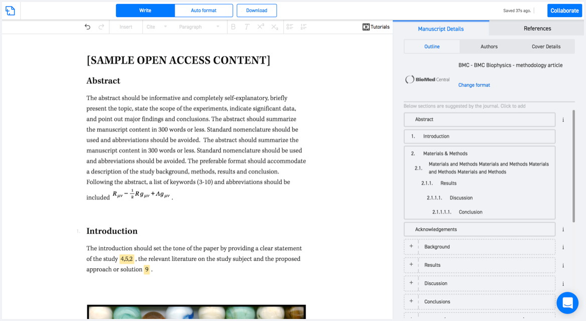
Available only on desktops 🖥

No word template required

Typset automatically formats your research paper to IEEE Transactions on Geoscience and Remote Sensing formatting guidelines and citation style.
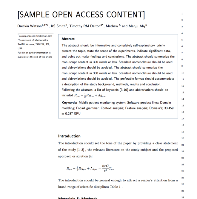

Verifed journal formats

One editor, 100K journal formats.
With the largest collection of verified journal formats, what you need is already there.

Trusted by academicians

I spent hours with MS word for reformatting. It was frustrating - plain and simple. With SciSpace, I can draft my manuscripts and once it is finished I can just submit. In case, I have to submit to another journal it is really just a button click instead of an afternoon of reformatting.

Andreas Frutiger
Researcher & Ex MS Word user
Use this template