
Example of ISPRS International Journal of Geo-Information format
Recent searches

Example of ISPRS International Journal of Geo-Information format Example of ISPRS International Journal of Geo-Information format Example of ISPRS International Journal of Geo-Information format Example of ISPRS International Journal of Geo-Information format Example of ISPRS International Journal of Geo-Information format Example of ISPRS International Journal of Geo-Information format Example of ISPRS International Journal of Geo-Information format Example of ISPRS International Journal of Geo-Information format Example of ISPRS International Journal of Geo-Information format Example of ISPRS International Journal of Geo-Information format
Sample paper formatted on SciSpace - SciSpace
This content is only for preview purposes. The original open access content can be found here.
Look Inside
Example of ISPRS International Journal of Geo-Information format Example of ISPRS International Journal of Geo-Information format Example of ISPRS International Journal of Geo-Information format Example of ISPRS International Journal of Geo-Information format Example of ISPRS International Journal of Geo-Information format Example of ISPRS International Journal of Geo-Information format Example of ISPRS International Journal of Geo-Information format Example of ISPRS International Journal of Geo-Information format Example of ISPRS International Journal of Geo-Information format Example of ISPRS International Journal of Geo-Information format
Sample paper formatted on SciSpace - SciSpace
This content is only for preview purposes. The original open access content can be found here.
open access Open Access

ISPRS International Journal of Geo-Information — Template for authors

Categories Rank Trend in last 3 yrs
Geography, Planning and Development #76 of 704 up up by 114 ranks
Computers in Earth Sciences #13 of 52 up up by 5 ranks
Earth and Planetary Sciences (miscellaneous) #27 of 106 up up by 21 ranks
journal-quality-icon Journal quality:
High
calendar-icon Last 4 years overview: 2017 Published Papers | 9316 Citations
indexed-in-icon Indexed in: Scopus
last-updated-icon Last updated: 13/06/2020
Related journals
Insights
General info
Top papers
Popular templates
Get started guide
Why choose from SciSpace
FAQ

Related Journals

open access Open Access

Taylor and Francis

Quality:  
Good
CiteRatio: 3.0
SJR: 0.468
SNIP: 0.945
open access Open Access
recommended Recommended

Taylor and Francis

Quality:  
High
CiteRatio: 4.1
SJR: 0.888
SNIP: 1.46
open access Open Access
recommended Recommended

Wiley

Quality:  
High
CiteRatio: 6.4
SJR: 1.294
SNIP: 1.449
open access Open Access

Springer

Quality:  
Good
CiteRatio: 2.2
SJR: 0.371
SNIP: 0.713

Journal Performance & Insights

CiteRatio

SCImago Journal Rank (SJR)

Source Normalized Impact per Paper (SNIP)

A measure of average citations received per peer-reviewed paper published in the journal.

Measures weighted citations received by the journal. Citation weighting depends on the categories and prestige of the citing journal.

Measures actual citations received relative to citations expected for the journal's category.

4.6

21% from 2019

CiteRatio for ISPRS International Journal of Geo-Information from 2016 - 2020
Year Value
2020 4.6
2019 3.8
2018 3.0
2017 2.1
2016 1.8
graph view Graph view
table view Table view

0.684

4% from 2019

SJR for ISPRS International Journal of Geo-Information from 2016 - 2020
Year Value
2020 0.684
2019 0.655
2018 0.59
2017 0.493
2016 0.475
graph view Graph view
table view Table view

1.333

13% from 2019

SNIP for ISPRS International Journal of Geo-Information from 2016 - 2020
Year Value
2020 1.333
2019 1.181
2018 1.311
2017 1.106
2016 0.864
graph view Graph view
table view Table view

insights Insights

  • CiteRatio of this journal has increased by 21% in last years.
  • This journal’s CiteRatio is in the top 10 percentile category.

insights Insights

  • SJR of this journal has increased by 4% in last years.
  • This journal’s SJR is in the top 10 percentile category.

insights Insights

  • SNIP of this journal has increased by 13% in last years.
  • This journal’s SNIP is in the top 10 percentile category.
ISPRS International Journal of Geo-Information

Guideline source: View

All company, product and service names used in this website are for identification purposes only. All product names, trademarks and registered trademarks are property of their respective owners.

Use of these names, trademarks and brands does not imply endorsement or affiliation. Disclaimer Notice

Multidisciplinary Digital Publishing Institute

ISPRS International Journal of Geo-Information

ISPRS International Journal of Geo-Information (ISSN 2220-9964) provides an advanced forum for the science and technology of geographic information. ISPRS International Journal of Geo-Information publishes regular research papers, reviews and communications. Our aim is to enco...... Read More

Geography, Planning and Development

Earth and Planetary Sciences (miscellaneous)

Computers in Earth Sciences

Social Sciences

i
Last updated on
13 Jun 2020
i
ISSN
2220-9964
i
Impact Factor
High - 1.502
i
Acceptance Rate
Not provided
i
Frequency
Not provided
i
Open Access
Yes
i
Sherpa RoMEO Archiving Policy
Green faq
i
Plagiarism Check
Available via Turnitin
i
Endnote Style
Download Available
i
Bibliography Name
MDPI Custom Citation
i
Citation Type
Numbered
[25]
i
Bibliography Example
Blonder, G.E.; Tinkham, M.; Klapwijk, T.M. Transition from metallic to tunneling regimes in superconducting microconstrictions: Excess current, charge imbalance, and supercurrent conversion. Phys. Rev. B 1982, 25, 4515–4532.

Top papers written in this journal

open accessOpen access Journal Article DOI: 10.3390/IJGI4042842
Applications of 3D City Models: State of the Art Review

Abstract:

In the last decades, 3D city models appear to have been predominantly used for visualisation; however, today they are being increasingly employed in a number of domains and for a large range of tasks beyond visualisation. In this paper, we seek to understand and document the state of the art regarding the utilisation of 3D ci... In the last decades, 3D city models appear to have been predominantly used for visualisation; however, today they are being increasingly employed in a number of domains and for a large range of tasks beyond visualisation. In this paper, we seek to understand and document the state of the art regarding the utilisation of 3D city models across multiple domains based on a comprehensive literature study including hundreds of research papers, technical reports and online resources. A challenge in a study such as ours is that the ways in which 3D city models are used cannot be readily listed due to fuzziness, terminological ambiguity, unclear added-value of 3D geoinformation in some instances, and absence of technical information. To address this challenge, we delineate a hierarchical terminology (spatial operations, use cases, applications), and develop a theoretical reasoning to segment and categorise the diverse uses of 3D city models. Following this framework, we provide a list of identified use cases of 3D city models (with a description of each), and their applications. Our study demonstrates that 3D city models are employed in at least 29 use cases that are a part of more than 100 applications. The classified inventory could be useful for scientists as well as stakeholders in the geospatial industry, such as companies and national mapping agencies, as it may serve as a reference document to better position their operations, design product portfolios, and to better understand the market. read more read less

Topics:

3D city models (62%)62% related to the paper, CityGML (54%)54% related to the paper, Terminology (51%)51% related to the paper, Geospatial analysis (51%)51% related to the paper
View PDF
547 Citations
open accessOpen access Journal Article DOI: 10.3390/IJGI4010199
Mapping local climate zones for a worldwide database of the form and function of cities

Abstract:

Progress in urban climate science is severely restricted by the lack of useful information that describes aspects of the form and function of cities at a detailed spatial resolution. To overcome this shortcoming we are initiating an international effort to develop the World Urban Database and Access Portal Tools (WUDAPT) to g... Progress in urban climate science is severely restricted by the lack of useful information that describes aspects of the form and function of cities at a detailed spatial resolution. To overcome this shortcoming we are initiating an international effort to develop the World Urban Database and Access Portal Tools (WUDAPT) to gather and disseminate this information in a consistent manner for urban areas worldwide. The first step in developing WUDAPT is a description of cities based on the Local Climate Zone (LCZ) scheme, which classifies natural and urban landscapes into categories based on climate-relevant surface properties. This methodology provides a culturally-neutral framework for collecting information about the internal physical structure of cities. Moreover, studies have shown that remote sensing data can be used for supervised LCZ mapping. Mapping of LCZs is complicated because similar LCZs in different regions have dissimilar spectral properties due to differences in vegetation, building materials and other variations in cultural and physical environmental factors. The WUDAPT protocol developed here provides an easy to understand workflow; uses freely available data and software; and can be applied by someone without specialist knowledge in spatial analysis or urban climate science. The paper also provides an example use of the WUDAPT project results. read more read less

Topics:

Urban climate (56%)56% related to the paper
View PDF
439 Citations
open accessOpen access Journal Article DOI: 10.3390/IJGI1010032
EASE-Grid 2.0: Incremental but Significant Improvements for Earth-Gridded Data Sets

Abstract:

Defined in the early 1990s for use with gridded satellite passive microwave data, the Equal-Area Scalable Earth Grid (EASE-Grid) was quickly adopted and used for distribution of a variety of satellite and in situ data sets. Conceptually easy to understand, EASE-Grid suffers from limitations that make it impossible to format i... Defined in the early 1990s for use with gridded satellite passive microwave data, the Equal-Area Scalable Earth Grid (EASE-Grid) was quickly adopted and used for distribution of a variety of satellite and in situ data sets. Conceptually easy to understand, EASE-Grid suffers from limitations that make it impossible to format in the widely popular GeoTIFF convention without reprojection. Importing EASE-Grid data into standard mapping software packages is nontrivial and error-prone. This article defines a standard for an improved EASE-Grid 2.0 definition, addressing how the changes rectify issues with the original grid definition. Data distributed using the EASE-Grid 2.0 standard will be easier for users to import into standard software packages and will minimize common reprojection errors that users had encountered with the original EASE-Grid definition. read more read less

Topics:

GeoTIFF (54%)54% related to the paper, Grid (51%)51% related to the paper, Software (50%)50% related to the paper
View PDF
349 Citations
open accessOpen access Journal Article DOI: 10.3390/IJGI8060269
mgwr: A Python Implementation of Multiscale Geographically Weighted Regression for Investigating Process Spatial Heterogeneity and Scale
Taylor M. Oshan1, Ziqi Li2, Wei Kang3, Levi John Wolf4, A. Stewart Fotheringham

Abstract:

Geographically weighted regression (GWR) is a spatial statistical technique that recognizes that traditional ‘global’ regression models may be limited when spatial processes vary with spatial context. GWR captures process spatial heterogeneity by allowing effects to vary over space. To do this, GWR calibrates an ensemble of l... Geographically weighted regression (GWR) is a spatial statistical technique that recognizes that traditional ‘global’ regression models may be limited when spatial processes vary with spatial context. GWR captures process spatial heterogeneity by allowing effects to vary over space. To do this, GWR calibrates an ensemble of local linear models at any number of locations using ‘borrowed’ nearby data. This provides a surface of location-specific parameter estimates for each relationship in the model that is allowed to vary spatially, as well as a single bandwidth parameter that provides intuition about the geographic scale of the processes. A recent extension to this framework allows each relationship to vary according to a distinct spatial scale parameter, and is therefore known as multiscale (M)GWR. This paper introduces mgwr, a Python-based implementation of MGWR that explicitly focuses on the multiscale analysis of spatial heterogeneity. It provides novel functionality for inference and exploratory analysis of local spatial processes, new diagnostics unique to multi-scale local models, and drastic improvements to efficiency in estimation routines. We provide two case studies using mgwr, in addition to reviewing core concepts of local models. We present this in a literate programming style, providing an overview of the primary software functionality and demonstrations of suggested usage alongside the discussion of primary concepts and demonstration of the improvements made in mgwr. read more read less

Topics:

Spatial analysis (55%)55% related to the paper, Spatial contextual awareness (51%)51% related to the paper
308 Citations
open accessOpen access Journal Article DOI: 10.3390/IJGI5050055
Crowdsourcing, citizen science or volunteered geographic information? The current state of crowdsourced geographic information

Abstract:

Citizens are increasingly becoming an important source of geographic information, sometimes entering domains that had until recently been the exclusive realm of authoritative agencies. This activity has a very diverse character as it can, amongst other things, be active or passive, involve spatial or aspatial data and the dat... Citizens are increasingly becoming an important source of geographic information, sometimes entering domains that had until recently been the exclusive realm of authoritative agencies. This activity has a very diverse character as it can, amongst other things, be active or passive, involve spatial or aspatial data and the data provided can be variable in terms of key attributes such as format, description and quality. Unsurprisingly, therefore, there are a variety of terms used to describe data arising from citizens. In this article, the expressions used to describe citizen sensing of geographic information are reviewed and their use over time explored, prior to categorizing them and highlighting key issues in the current state of the subject. The latter involved a review of ~100 Internet sites with particular focus on their thematic topic, the nature of the data and issues such as incentives for contributors. This review suggests that most sites involve active rather than passive contribution, with citizens typically motivated by the desire to aid a worthy cause, often receiving little training. As such, this article provides a snapshot of the role of citizens in crowdsourcing geographic information and a guide to the current status of this rapidly emerging and evolving subject. read more read less

Topics:

Volunteered geographic information (58%)58% related to the paper, Crowdsourcing (55%)55% related to the paper
View PDF
304 Citations
Author Pic

SciSpace is a very innovative solution to the formatting problem and existing providers, such as Mendeley or Word did not really evolve in recent years.

- Andreas Frutiger, Researcher, ETH Zurich, Institute for Biomedical Engineering

Get MS-Word and LaTeX output to any Journal within seconds
1
Choose a template
Select a template from a library of 40,000+ templates
2
Import a MS-Word file or start fresh
It takes only few seconds to import
3
View and edit your final output
SciSpace will automatically format your output to meet journal guidelines
4
Submit directly or Download
Submit to journal directly or Download in PDF, MS Word or LaTeX

(Before submission check for plagiarism via Turnitin)

clock Less than 3 minutes

What to expect from SciSpace?

Speed and accuracy over MS Word

''

With SciSpace, you do not need a word template for ISPRS International Journal of Geo-Information.

It automatically formats your research paper to Multidisciplinary Digital Publishing Institute formatting guidelines and citation style.

You can download a submission ready research paper in pdf, LaTeX and docx formats.

Time comparison

Time taken to format a paper and Compliance with guidelines

Plagiarism Reports via Turnitin

SciSpace has partnered with Turnitin, the leading provider of Plagiarism Check software.

Using this service, researchers can compare submissions against more than 170 million scholarly articles, a database of 70+ billion current and archived web pages. How Turnitin Integration works?


Turnitin Stats
Publisher Logos

Freedom from formatting guidelines

One editor, 100K journal formats – world's largest collection of journal templates

With such a huge verified library, what you need is already there.

publisher-logos

Easy support from all your favorite tools

ISPRS International Journal of Geo-Information format uses MDPI Custom Citation citation style.

Automatically format and order your citations and bibliography in a click.

SciSpace allows imports from all reference managers like Mendeley, Zotero, Endnote, Google Scholar etc.

Frequently asked questions

1. Can I write ISPRS International Journal of Geo-Information in LaTeX?

Absolutely not! Our tool has been designed to help you focus on writing. You can write your entire paper as per the ISPRS International Journal of Geo-Information guidelines and auto format it.

2. Do you follow the ISPRS International Journal of Geo-Information guidelines?

Yes, the template is compliant with the ISPRS International Journal of Geo-Information guidelines. Our experts at SciSpace ensure that. If there are any changes to the journal's guidelines, we'll change our algorithm accordingly.

3. Can I cite my article in multiple styles in ISPRS International Journal of Geo-Information?

Of course! We support all the top citation styles, such as APA style, MLA style, Vancouver style, Harvard style, and Chicago style. For example, when you write your paper and hit autoformat, our system will automatically update your article as per the ISPRS International Journal of Geo-Information citation style.

4. Can I use the ISPRS International Journal of Geo-Information templates for free?

Sign up for our free trial, and you'll be able to use all our features for seven days. You'll see how helpful they are and how inexpensive they are compared to other options, Especially for ISPRS International Journal of Geo-Information.

5. Can I use a manuscript in ISPRS International Journal of Geo-Information that I have written in MS Word?

Yes. You can choose the right template, copy-paste the contents from the word document, and click on auto-format. Once you're done, you'll have a publish-ready paper ISPRS International Journal of Geo-Information that you can download at the end.

6. How long does it usually take you to format my papers in ISPRS International Journal of Geo-Information?

It only takes a matter of seconds to edit your manuscript. Besides that, our intuitive editor saves you from writing and formatting it in ISPRS International Journal of Geo-Information.

7. Where can I find the template for the ISPRS International Journal of Geo-Information?

It is possible to find the Word template for any journal on Google. However, why use a template when you can write your entire manuscript on SciSpace , auto format it as per ISPRS International Journal of Geo-Information's guidelines and download the same in Word, PDF and LaTeX formats? Give us a try!.

8. Can I reformat my paper to fit the ISPRS International Journal of Geo-Information's guidelines?

Of course! You can do this using our intuitive editor. It's very easy. If you need help, our support team is always ready to assist you.

9. ISPRS International Journal of Geo-Information an online tool or is there a desktop version?

SciSpace's ISPRS International Journal of Geo-Information is currently available as an online tool. We're developing a desktop version, too. You can request (or upvote) any features that you think would be helpful for you and other researchers in the "feature request" section of your account once you've signed up with us.

10. I cannot find my template in your gallery. Can you create it for me like ISPRS International Journal of Geo-Information?

Sure. You can request any template and we'll have it setup within a few days. You can find the request box in Journal Gallery on the right side bar under the heading, "Couldn't find the format you were looking for like ISPRS International Journal of Geo-Information?”

11. What is the output that I would get after using ISPRS International Journal of Geo-Information?

After writing your paper autoformatting in ISPRS International Journal of Geo-Information, you can download it in multiple formats, viz., PDF, Docx, and LaTeX.

12. Is ISPRS International Journal of Geo-Information's impact factor high enough that I should try publishing my article there?

To be honest, the answer is no. The impact factor is one of the many elements that determine the quality of a journal. Few of these factors include review board, rejection rates, frequency of inclusion in indexes, and Eigenfactor. You need to assess all these factors before you make your final call.

13. What is Sherpa RoMEO Archiving Policy for ISPRS International Journal of Geo-Information?

SHERPA/RoMEO Database

We extracted this data from Sherpa Romeo to help researchers understand the access level of this journal in accordance with the Sherpa Romeo Archiving Policy for ISPRS International Journal of Geo-Information. The table below indicates the level of access a journal has as per Sherpa Romeo's archiving policy.

RoMEO Colour Archiving policy
Green Can archive pre-print and post-print or publisher's version/PDF
Blue Can archive post-print (ie final draft post-refereeing) or publisher's version/PDF
Yellow Can archive pre-print (ie pre-refereeing)
White Archiving not formally supported
FYI:
  1. Pre-prints as being the version of the paper before peer review and
  2. Post-prints as being the version of the paper after peer-review, with revisions having been made.

14. What are the most common citation types In ISPRS International Journal of Geo-Information?

The 5 most common citation types in order of usage for ISPRS International Journal of Geo-Information are:.

S. No. Citation Style Type
1. Author Year
2. Numbered
3. Numbered (Superscripted)
4. Author Year (Cited Pages)
5. Footnote

15. How do I submit my article to the ISPRS International Journal of Geo-Information?

It is possible to find the Word template for any journal on Google. However, why use a template when you can write your entire manuscript on SciSpace , auto format it as per ISPRS International Journal of Geo-Information's guidelines and download the same in Word, PDF and LaTeX formats? Give us a try!.

16. Can I download ISPRS International Journal of Geo-Information in Endnote format?

Yes, SciSpace provides this functionality. After signing up, you would need to import your existing references from Word or Bib file to SciSpace. Then SciSpace would allow you to download your references in ISPRS International Journal of Geo-Information Endnote style according to Elsevier guidelines.

Fast and reliable,
built for complaince.

Instant formatting to 100% publisher guidelines on - SciSpace.
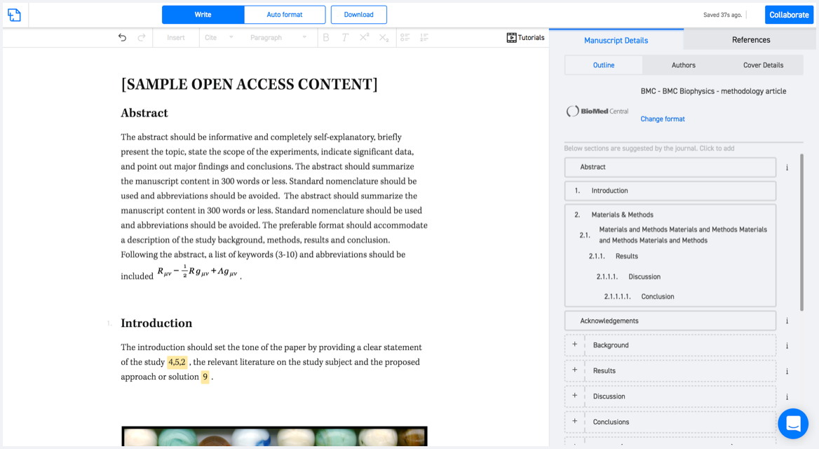
Available only on desktops 🖥

No word template required

Typset automatically formats your research paper to ISPRS International Journal of Geo-Information formatting guidelines and citation style.
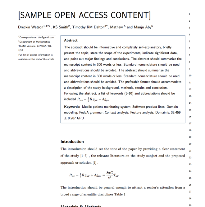

Verifed journal formats

One editor, 100K journal formats.
With the largest collection of verified journal formats, what you need is already there.

Trusted by academicians

I spent hours with MS word for reformatting. It was frustrating - plain and simple. With SciSpace, I can draft my manuscripts and once it is finished I can just submit. In case, I have to submit to another journal it is really just a button click instead of an afternoon of reformatting.

Andreas Frutiger
Researcher & Ex MS Word user
Use this template