Example of Arabian Journal of Geosciences format
Recent searches

Example of Arabian Journal of Geosciences format Example of Arabian Journal of Geosciences format Example of Arabian Journal of Geosciences format Example of Arabian Journal of Geosciences format Example of Arabian Journal of Geosciences format Example of Arabian Journal of Geosciences format Example of Arabian Journal of Geosciences format Example of Arabian Journal of Geosciences format Example of Arabian Journal of Geosciences format Example of Arabian Journal of Geosciences format Example of Arabian Journal of Geosciences format Example of Arabian Journal of Geosciences format Example of Arabian Journal of Geosciences format Example of Arabian Journal of Geosciences format Example of Arabian Journal of Geosciences format Example of Arabian Journal of Geosciences format Example of Arabian Journal of Geosciences format Example of Arabian Journal of Geosciences format
Sample paper formatted on SciSpace - SciSpace
This content is only for preview purposes. The original open access content can be found here.
Look Inside
Example of Arabian Journal of Geosciences format Example of Arabian Journal of Geosciences format Example of Arabian Journal of Geosciences format Example of Arabian Journal of Geosciences format Example of Arabian Journal of Geosciences format Example of Arabian Journal of Geosciences format Example of Arabian Journal of Geosciences format Example of Arabian Journal of Geosciences format Example of Arabian Journal of Geosciences format Example of Arabian Journal of Geosciences format Example of Arabian Journal of Geosciences format Example of Arabian Journal of Geosciences format Example of Arabian Journal of Geosciences format Example of Arabian Journal of Geosciences format Example of Arabian Journal of Geosciences format Example of Arabian Journal of Geosciences format Example of Arabian Journal of Geosciences format Example of Arabian Journal of Geosciences format
Sample paper formatted on SciSpace - SciSpace
This content is only for preview purposes. The original open access content can be found here.
open access Open Access

Arabian Journal of Geosciences — Template for authors

Publisher: Springer
Categories Rank Trend in last 3 yrs
Earth and Planetary Sciences (all) #84 of 186 down down by 18 ranks
Environmental Science (all) #105 of 220 down down by 19 ranks
journal-quality-icon Journal quality:
Good
calendar-icon Last 4 years overview: 3405 Published Papers | 7155 Citations
indexed-in-icon Indexed in: Scopus
last-updated-icon Last updated: 16/07/2020
Related journals
Insights
General info
Top papers
Popular templates
Get started guide
Why choose from SciSpace
FAQ

Related Journals

open access Open Access

Cambridge University Press

Quality:  
High
CiteRatio: 3.9
SJR: 0.574
SNIP: 0.957
open access Open Access

Springer

Quality:  
High
CiteRatio: 2.8
SJR: 0.371
SNIP: 0.625
open access Open Access

Taylor and Francis

Quality:  
High
CiteRatio: 6.2
SJR: 0.899
SNIP: 1.595
open access Open Access

Springer

Quality:  
Good
CiteRatio: 3.2
SJR: 0.468
SNIP: 1.089

Journal Performance & Insights

Impact Factor

CiteRatio

Determines the importance of a journal by taking a measure of frequency with which the average article in a journal has been cited in a particular year.

A measure of average citations received per peer-reviewed paper published in the journal.

1.327

16% from 2018

Impact factor for Arabian Journal of Geosciences from 2016 - 2019
Year Value
2019 1.327
2018 1.141
2017 0.86
2016 0.955
graph view Graph view
table view Table view

2.1

5% from 2019

CiteRatio for Arabian Journal of Geosciences from 2016 - 2020
Year Value
2020 2.1
2019 2.0
2018 2.0
2017 2.0
2016 2.1
graph view Graph view
table view Table view

insights Insights

  • Impact factor of this journal has increased by 16% in last year.
  • This journal’s impact factor is in the top 10 percentile category.

insights Insights

  • CiteRatio of this journal has increased by 5% in last years.
  • This journal’s CiteRatio is in the top 10 percentile category.

SCImago Journal Rank (SJR)

Source Normalized Impact per Paper (SNIP)

Measures weighted citations received by the journal. Citation weighting depends on the categories and prestige of the citing journal.

Measures actual citations received relative to citations expected for the journal's category.

0.415

3% from 2019

SJR for Arabian Journal of Geosciences from 2016 - 2020
Year Value
2020 0.415
2019 0.404
2018 0.408
2017 0.319
2016 0.378
graph view Graph view
table view Table view

0.842

12% from 2019

SNIP for Arabian Journal of Geosciences from 2016 - 2020
Year Value
2020 0.842
2019 0.752
2018 0.8
2017 0.616
2016 0.793
graph view Graph view
table view Table view

insights Insights

  • SJR of this journal has increased by 3% in last years.
  • This journal’s SJR is in the top 10 percentile category.

insights Insights

  • SNIP of this journal has increased by 12% in last years.
  • This journal’s SNIP is in the top 10 percentile category.

Arabian Journal of Geosciences

Guideline source: View

All company, product and service names used in this website are for identification purposes only. All product names, trademarks and registered trademarks are property of their respective owners.

Use of these names, trademarks and brands does not imply endorsement or affiliation. Disclaimer Notice

Springer

Arabian Journal of Geosciences

The Arabian Journal of Geosciences is the official journal of the Saudi Society for Geosciences and publishes peer-reviewed original and review articles on the entire range of earth science themes, focused on, but not limited to those that have regional significance to the Mid...... Read More

Earth and Planetary Sciences

i
Last updated on
16 Jul 2020
i
ISSN
1866-7511
i
Impact Factor
High - 1.34
i
Open Access
No
i
Sherpa RoMEO Archiving Policy
Green faq
i
Plagiarism Check
Available via Turnitin
i
Endnote Style
Download Available
i
Bibliography Name
SPBASIC
i
Citation Type
Author Year
(Blonder et al, 1982)
i
Bibliography Example
Beenakker CWJ (2006) Specular andreev reflection in graphene. Phys Rev Lett 97(6):067,007, URL 10.1103/PhysRevLett.97.067007

Top papers written in this journal

Journal Article DOI: 10.1007/S12517-014-1668-4
Groundwater potential mapping at Kurdistan region of Iran using analytic hierarchy process and GIS

Abstract:

Multi-criteria decision analysis (MCDA) as an advantageous tool has been applied by various researchers to improve their management ability. Management of groundwater resource, especially under data-scarce and arid areas, encountered a lot of problems and issues which drives the planers to use of MCDA. In this research, a sta... Multi-criteria decision analysis (MCDA) as an advantageous tool has been applied by various researchers to improve their management ability. Management of groundwater resource, especially under data-scarce and arid areas, encountered a lot of problems and issues which drives the planers to use of MCDA. In this research, a standard methodology has been applied to delineate groundwater resource potential zonation based on integrated analytical hierarchy process (AHP), geographic information system (GIS), and remote sensing (RS) techniques in Kurdistan plain, Iran. At first, the effective thematic layers on the groundwater potential such as rainfall, lithology, drainage density, lineament density, and slope percent were derived from the spatial geodatabase. Then, the assigned weights of thematic layers based on expert knowledge were normalized by eigenvector technique of AHP. To prepare the groundwater potential index, the weighted linear combination (WLC) method was applied in GIS. Finally, the receiver operating characteristic (ROC) curve was drawn for groundwater potential map, and the area under curve (AUC) was computed. Results indicated that the rainfall and slope percent factors have taken the highest and lowest weights, respectively. Validation of results showed that the AHP method (AUC = 73.66 %) performed fairly good predication accuracy. Such findings revealed that in the regions suffering from data scarcity through the MCDM methodology, the planners would be able to having accurate knowledge on groundwater resources based on geospatial data analysis. Therefore, the developing scenario for future planning of groundwater exploration can be achieved in an efficient manner. read more read less

Topics:

Geographic information system (52%)52% related to the paper, Geospatial analysis (51%)51% related to the paper
389 Citations
open accessOpen access Journal Article DOI: 10.1007/S12517-012-0807-Z
Application of frequency ratio, statistical index, and weights-of-evidence models and their comparison in landslide susceptibility mapping in Central Nepal Himalaya

Abstract:

The Mugling–Narayanghat road section falls within the Lesser Himalaya and Siwalik zones of Central Nepal Himalaya and is highly deformed by the presence of numerous faults and folds. Over the years, this road section and its surrounding area have experienced repeated landslide activities. For that reason, landslide susceptibi... The Mugling–Narayanghat road section falls within the Lesser Himalaya and Siwalik zones of Central Nepal Himalaya and is highly deformed by the presence of numerous faults and folds. Over the years, this road section and its surrounding area have experienced repeated landslide activities. For that reason, landslide susceptibility zonation is essential for roadside slope disaster management and for planning further development activities. The main goal of this study was to investigate the application of the frequency ratio (FR), statistical index (SI), and weights-of-evidence (WoE) approaches for landslide susceptibility mapping of this road section and its surrounding area. For this purpose, the input layers of the landslide conditioning factors were prepared in the first stage. A landslide inventory map was prepared using earlier reports, aerial photographs interpretation, and multiple field surveys. A total of 438 landslide locations were detected. Out these, 295 (67 %) landslides were randomly selected as training data for the modeling using FR, SI, and WoE models and the remaining 143 (33 %) were used for the validation purposes. The landslide conditioning factors considered for the study area are slope gradient, slope aspect, plan curvature, altitude, stream power index, topographic wetness index, lithology, land use, distance from faults, distance from rivers, and distance from highway. The results were validated using area under the curve (AUC) analysis. From the analysis, it is seen that the FR model with a success rate of 76.8 % and predictive accuracy of 75.4 % performs better than WoE (success rate, 75.6 %; predictive accuracy, 74.9 %) and SI (success rate, 75.5 %; predictive accuracy, 74.6 %) models. Overall, all the models showed almost similar results. The resultant susceptibility maps can be useful for general land use planning. read more read less

Topics:

Landslide (62%)62% related to the paper, Topographic Wetness Index (54%)54% related to the paper
View PDF
365 Citations
open accessOpen access Journal Article DOI: 10.1007/S12517-012-0610-X
Landslide susceptibility mapping at Vaz Watershed (Iran) using an artificial neural network model: a comparison between multilayer perceptron (MLP) and radial basic function (RBF) algorithms
Mohammad Zare1, Hamid Reza Pourghasemi2, Mahdi Vafakhah2, Biswajeet Pradhan3

Abstract:

Landslide susceptibility and hazard assessments are the most important steps in landslide risk mapping. The main objective of this study was to investigate and compare the results of two artificial neural network (ANN) algorithms, i.e., multilayer perceptron (MLP) and radial basic function (RBF) for spatial prediction of land... Landslide susceptibility and hazard assessments are the most important steps in landslide risk mapping. The main objective of this study was to investigate and compare the results of two artificial neural network (ANN) algorithms, i.e., multilayer perceptron (MLP) and radial basic function (RBF) for spatial prediction of landslide susceptibility in Vaz Watershed, Iran. At first, landslide locations were identified by aerial photographs and field surveys, and a total of 136 landside locations were constructed from various sources. Then the landslide inventory map was randomly split into a training dataset 70 % (95 landslide locations) for training the ANN model and the remaining 30 % (41 landslides locations) was used for validation purpose. Nine landslide conditioning factors such as slope, slope aspect, altitude, land use, lithology, distance from rivers, distance from roads, distance from faults, and rainfall were constructed in geographical information system. In this study, both MLP and RBF algorithms were used in artificial neural network model. The results showed that MLP with Broyden–Fletcher–Goldfarb–Shanno learning algorithm is more efficient than RBF in landslide susceptibility mapping for the study area. Finally the landslide susceptibility maps were validated using the validation data (i.e., 30 % landslide location data that was not used during the model construction) using area under the curve (AUC) method. The success rate curve showed that the area under the curve for RBF and MLP was 0.9085 (90.85 %) and 0.9193 (91.93 %) accuracy, respectively. Similarly, the validation result showed that the area under the curve for MLP and RBF models were 0.881 (88.1 %) and 0.8724 (87.24 %), respectively. The results of this study showed that landslide susceptibility mapping in the Vaz Watershed of Iran using the ANN approach is viable and can be used for land use planning. read more read less

Topics:

Landslide (59%)59% related to the paper, Multilayer perceptron (55%)55% related to the paper
View PDF
309 Citations
Journal Article DOI: 10.1007/S12517-013-1174-0
Blasting-induced flyrock and ground vibration prediction through an expert artificial neural network based on particle swarm optimization

Abstract:

Blasting is a major component of the construction and mining industries in terms of rock fragmentation and concrete demolition. Blast designers are constantly concerned about flyrock and ground vibration induced by blasting as adverse and unintended effects of explosive usage on the surrounding areas. In recent years, several... Blasting is a major component of the construction and mining industries in terms of rock fragmentation and concrete demolition. Blast designers are constantly concerned about flyrock and ground vibration induced by blasting as adverse and unintended effects of explosive usage on the surrounding areas. In recent years, several researches have been done to predict flyrock and ground vibration by means of conventional backpropagation (BP) artificial neural network (ANN). However, the convergence rate of the BP-ANN is relatively slow and solutions can be trapped at local minima. Since particle swarm optimization (PSO) is a robust global search algorithm, it can be used to improve ANNs' performance. In this study, a novel approach of incorporating PSO algorithm with ANN has been proposed to eliminate the limitation of the BP-ANN. This approach was applied to simulate the flyrock distance and peak particle velocity (PPV) induced by blasting. PSO parameters and optimal network architecture were determined using sensitivity analysis and trial and error method, respectively. Finally, a model was selected, and the proposed model was trained and tested using 44 datasets obtained from three granite quarry sites in Malaysia. Each dataset involved ten inputs, including the most influential parameters on flyrock distance and PPV, and two outputs. The results indicate that the proposed method is able to predict flyrock distance and PPV induced by blasting with a high degree of accuracy. Sensitivity analysis was also conducted to determine the influence of each parameter on flyrock distance and PPV. The results show that the powder factor and charge per delay are the most effective parameters on flyrock distance, whereas sub-drilling and charge per delay are the most effective parameters on PPV. read more read less

Topics:

Particle swarm optimization (50%)50% related to the paper
285 Citations
open accessOpen access Journal Article DOI: 10.1007/S12517-012-0532-7
Application of weights-of-evidence and certainty factor models and their comparison in landslide susceptibility mapping at Haraz watershed, Iran
Hamid Reza Pourghasemi1, Biswajeet Pradhan2, Candan Gokceoglu3, Majid Mohammadi1, Hamid Reza Moradi1

Abstract:

The main goal of this study was to investigate the application of the weights-of-evidence and certainty factor approaches for producing landslide susceptibility maps of a landslide-prone area (Haraz) in Iran For this purpose, the input layers of the landslide conditioning factors were prepared in the first stage The landslide... The main goal of this study was to investigate the application of the weights-of-evidence and certainty factor approaches for producing landslide susceptibility maps of a landslide-prone area (Haraz) in Iran For this purpose, the input layers of the landslide conditioning factors were prepared in the first stage The landslide conditioning factors considered for the study area were slope gradient, slope aspect, altitude, lithology, land use, distance from streams, distance from roads, distance from faults, topographic wetness index, stream power index, stream transport index and plan curvature For validation of the produced landslide susceptibility maps, the results of the analyses were compared with the field-verified landslide locations Additionally, the receiver operating characteristic curves for all the landslide susceptibility models were constructed and the areas under the curves were calculated The landslide locations were used to validate results of the landslide susceptibility maps The verification results showed that the weights-of-evidence model (7987%) performed better than certainty factor (7202%) model with a standard error of 00663 and 00756, respectively According to the results of the area under curve evaluation, the map produced by weights-of-evidence exhibits satisfactory properties read more read less

Topics:

Landslide (65%)65% related to the paper, Topographic Wetness Index (54%)54% related to the paper
View PDF
264 Citations
Author Pic

SciSpace is a very innovative solution to the formatting problem and existing providers, such as Mendeley or Word did not really evolve in recent years.

- Andreas Frutiger, Researcher, ETH Zurich, Institute for Biomedical Engineering

Get MS-Word and LaTeX output to any Journal within seconds
1
Choose a template
Select a template from a library of 40,000+ templates
2
Import a MS-Word file or start fresh
It takes only few seconds to import
3
View and edit your final output
SciSpace will automatically format your output to meet journal guidelines
4
Submit directly or Download
Submit to journal directly or Download in PDF, MS Word or LaTeX

(Before submission check for plagiarism via Turnitin)

clock Less than 3 minutes

What to expect from SciSpace?

Speed and accuracy over MS Word

''

With SciSpace, you do not need a word template for Arabian Journal of Geosciences.

It automatically formats your research paper to Springer formatting guidelines and citation style.

You can download a submission ready research paper in pdf, LaTeX and docx formats.

Time comparison

Time taken to format a paper and Compliance with guidelines

Plagiarism Reports via Turnitin

SciSpace has partnered with Turnitin, the leading provider of Plagiarism Check software.

Using this service, researchers can compare submissions against more than 170 million scholarly articles, a database of 70+ billion current and archived web pages. How Turnitin Integration works?


Turnitin Stats
Publisher Logos

Freedom from formatting guidelines

One editor, 100K journal formats – world's largest collection of journal templates

With such a huge verified library, what you need is already there.

publisher-logos

Easy support from all your favorite tools

Arabian Journal of Geosciences format uses SPBASIC citation style.

Automatically format and order your citations and bibliography in a click.

SciSpace allows imports from all reference managers like Mendeley, Zotero, Endnote, Google Scholar etc.

Frequently asked questions

1. Can I write Arabian Journal of Geosciences in LaTeX?

Absolutely not! Our tool has been designed to help you focus on writing. You can write your entire paper as per the Arabian Journal of Geosciences guidelines and auto format it.

2. Do you follow the Arabian Journal of Geosciences guidelines?

Yes, the template is compliant with the Arabian Journal of Geosciences guidelines. Our experts at SciSpace ensure that. If there are any changes to the journal's guidelines, we'll change our algorithm accordingly.

3. Can I cite my article in multiple styles in Arabian Journal of Geosciences?

Of course! We support all the top citation styles, such as APA style, MLA style, Vancouver style, Harvard style, and Chicago style. For example, when you write your paper and hit autoformat, our system will automatically update your article as per the Arabian Journal of Geosciences citation style.

4. Can I use the Arabian Journal of Geosciences templates for free?

Sign up for our free trial, and you'll be able to use all our features for seven days. You'll see how helpful they are and how inexpensive they are compared to other options, Especially for Arabian Journal of Geosciences.

5. Can I use a manuscript in Arabian Journal of Geosciences that I have written in MS Word?

Yes. You can choose the right template, copy-paste the contents from the word document, and click on auto-format. Once you're done, you'll have a publish-ready paper Arabian Journal of Geosciences that you can download at the end.

6. How long does it usually take you to format my papers in Arabian Journal of Geosciences?

It only takes a matter of seconds to edit your manuscript. Besides that, our intuitive editor saves you from writing and formatting it in Arabian Journal of Geosciences.

7. Where can I find the template for the Arabian Journal of Geosciences?

It is possible to find the Word template for any journal on Google. However, why use a template when you can write your entire manuscript on SciSpace , auto format it as per Arabian Journal of Geosciences's guidelines and download the same in Word, PDF and LaTeX formats? Give us a try!.

8. Can I reformat my paper to fit the Arabian Journal of Geosciences's guidelines?

Of course! You can do this using our intuitive editor. It's very easy. If you need help, our support team is always ready to assist you.

9. Arabian Journal of Geosciences an online tool or is there a desktop version?

SciSpace's Arabian Journal of Geosciences is currently available as an online tool. We're developing a desktop version, too. You can request (or upvote) any features that you think would be helpful for you and other researchers in the "feature request" section of your account once you've signed up with us.

10. I cannot find my template in your gallery. Can you create it for me like Arabian Journal of Geosciences?

Sure. You can request any template and we'll have it setup within a few days. You can find the request box in Journal Gallery on the right side bar under the heading, "Couldn't find the format you were looking for like Arabian Journal of Geosciences?”

11. What is the output that I would get after using Arabian Journal of Geosciences?

After writing your paper autoformatting in Arabian Journal of Geosciences, you can download it in multiple formats, viz., PDF, Docx, and LaTeX.

12. Is Arabian Journal of Geosciences's impact factor high enough that I should try publishing my article there?

To be honest, the answer is no. The impact factor is one of the many elements that determine the quality of a journal. Few of these factors include review board, rejection rates, frequency of inclusion in indexes, and Eigenfactor. You need to assess all these factors before you make your final call.

13. What is Sherpa RoMEO Archiving Policy for Arabian Journal of Geosciences?

SHERPA/RoMEO Database

We extracted this data from Sherpa Romeo to help researchers understand the access level of this journal in accordance with the Sherpa Romeo Archiving Policy for Arabian Journal of Geosciences. The table below indicates the level of access a journal has as per Sherpa Romeo's archiving policy.

RoMEO Colour Archiving policy
Green Can archive pre-print and post-print or publisher's version/PDF
Blue Can archive post-print (ie final draft post-refereeing) or publisher's version/PDF
Yellow Can archive pre-print (ie pre-refereeing)
White Archiving not formally supported
FYI:
  1. Pre-prints as being the version of the paper before peer review and
  2. Post-prints as being the version of the paper after peer-review, with revisions having been made.

14. What are the most common citation types In Arabian Journal of Geosciences?

The 5 most common citation types in order of usage for Arabian Journal of Geosciences are:.

S. No. Citation Style Type
1. Author Year
2. Numbered
3. Numbered (Superscripted)
4. Author Year (Cited Pages)
5. Footnote

15. How do I submit my article to the Arabian Journal of Geosciences?

It is possible to find the Word template for any journal on Google. However, why use a template when you can write your entire manuscript on SciSpace , auto format it as per Arabian Journal of Geosciences's guidelines and download the same in Word, PDF and LaTeX formats? Give us a try!.

16. Can I download Arabian Journal of Geosciences in Endnote format?

Yes, SciSpace provides this functionality. After signing up, you would need to import your existing references from Word or Bib file to SciSpace. Then SciSpace would allow you to download your references in Arabian Journal of Geosciences Endnote style according to Elsevier guidelines.

Fast and reliable,
built for complaince.

Instant formatting to 100% publisher guidelines on - SciSpace.
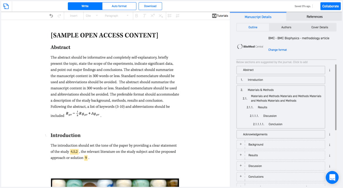
Available only on desktops 🖥

No word template required

Typset automatically formats your research paper to Arabian Journal of Geosciences formatting guidelines and citation style.
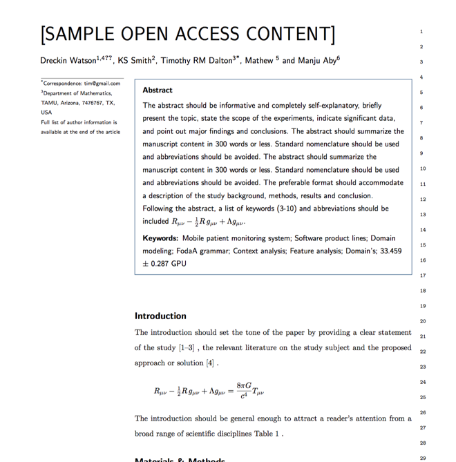
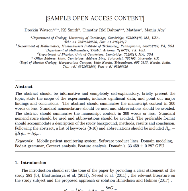
Verifed journal formats

One editor, 100K journal formats.
With the largest collection of verified journal formats, what you need is already there.

Trusted by academicians

I spent hours with MS word for reformatting. It was frustrating - plain and simple. With SciSpace, I can draft my manuscripts and once it is finished I can just submit. In case, I have to submit to another journal it is really just a button click instead of an afternoon of reformatting.

Andreas Frutiger
Researcher & Ex MS Word user
Use this template