Example of Geoenvironmental Disasters format
Recent searches

Example of Geoenvironmental Disasters format Example of Geoenvironmental Disasters format Example of Geoenvironmental Disasters format Example of Geoenvironmental Disasters format Example of Geoenvironmental Disasters format Example of Geoenvironmental Disasters format Example of Geoenvironmental Disasters format Example of Geoenvironmental Disasters format Example of Geoenvironmental Disasters format Example of Geoenvironmental Disasters format Example of Geoenvironmental Disasters format Example of Geoenvironmental Disasters format Example of Geoenvironmental Disasters format Example of Geoenvironmental Disasters format Example of Geoenvironmental Disasters format Example of Geoenvironmental Disasters format Example of Geoenvironmental Disasters format Example of Geoenvironmental Disasters format
Sample paper formatted on SciSpace - SciSpace
This content is only for preview purposes. The original open access content can be found here.
Look Inside
Example of Geoenvironmental Disasters format Example of Geoenvironmental Disasters format Example of Geoenvironmental Disasters format Example of Geoenvironmental Disasters format Example of Geoenvironmental Disasters format Example of Geoenvironmental Disasters format Example of Geoenvironmental Disasters format Example of Geoenvironmental Disasters format Example of Geoenvironmental Disasters format Example of Geoenvironmental Disasters format Example of Geoenvironmental Disasters format Example of Geoenvironmental Disasters format Example of Geoenvironmental Disasters format Example of Geoenvironmental Disasters format Example of Geoenvironmental Disasters format Example of Geoenvironmental Disasters format Example of Geoenvironmental Disasters format Example of Geoenvironmental Disasters format
Sample paper formatted on SciSpace - SciSpace
This content is only for preview purposes. The original open access content can be found here.
open access Open Access

Geoenvironmental Disasters — Template for authors

Publisher: Springer
Categories Rank Trend in last 3 yrs
Geography, Planning and Development #113 of 704 down down by None rank
Environmental Science (miscellaneous) #20 of 104 down down by None rank
Safety, Risk, Reliability and Quality #43 of 165 down down by None rank
Geotechnical Engineering and Engineering Geology #54 of 195 down down by None rank
Management, Monitoring, Policy and Law #109 of 355 down down by None rank
journal-quality-icon Journal quality:
High
calendar-icon Last 4 years overview: 97 Published Papers | 377 Citations
indexed-in-icon Indexed in: Scopus
last-updated-icon Last updated: 14/07/2020
Related journals
Insights
General info
Top papers
Popular templates
Get started guide
Why choose from SciSpace
FAQ

Related Journals

open access Open Access

Inderscience Publishers

Quality:  
Medium
CiteRatio: 0.9
SJR: 0.179
SNIP: 0.317
open access Open Access
recommended Recommended

Taylor and Francis

Quality:  
High
CiteRatio: 5.5
SJR: 0.683
SNIP: 1.45
open access Open Access

Taylor and Francis

Quality:  
High
CiteRatio: 3.2
SJR: 0.798
SNIP: 1.518

Journal Performance & Insights

CiteRatio

SCImago Journal Rank (SJR)

Source Normalized Impact per Paper (SNIP)

A measure of average citations received per peer-reviewed paper published in the journal.

Measures weighted citations received by the journal. Citation weighting depends on the categories and prestige of the citing journal.

Measures actual citations received relative to citations expected for the journal's category.

3.9

5% from 2019

CiteRatio for Geoenvironmental Disasters from 2016 - 2020
Year Value
2020 3.9
2019 3.7
graph view Graph view
table view Table view

0.725

24% from 2019

SJR for Geoenvironmental Disasters from 2019 - 2020
Year Value
2020 0.725
2019 0.584
graph view Graph view
table view Table view

1.494

60% from 2019

SNIP for Geoenvironmental Disasters from 2019 - 2020
Year Value
2020 1.494
2019 0.933
graph view Graph view
table view Table view

insights Insights

  • CiteRatio of this journal has increased by 5% in last years.
  • This journal’s CiteRatio is in the top 10 percentile category.

insights Insights

  • SJR of this journal has increased by 24% in last years.
  • This journal’s SJR is in the top 10 percentile category.

insights Insights

  • SNIP of this journal has increased by 60% in last years.
  • This journal’s SNIP is in the top 10 percentile category.

Geoenvironmental Disasters

Guideline source: View

All company, product and service names used in this website are for identification purposes only. All product names, trademarks and registered trademarks are property of their respective owners.

Use of these names, trademarks and brands does not imply endorsement or affiliation. Disclaimer Notice

Springer

Geoenvironmental Disasters

Approved by publishing and review experts on SciSpace, this template is built as per for Geoenvironmental Disasters formatting guidelines as mentioned in Springer author instructions. The current version was created on and has been used by 234 authors to write and format their manuscripts to this journal.

Hydro-meteorological events

i
Last updated on
13 Jul 2020
i
ISSN
1606-8610
i
Open Access
Yes
i
Sherpa RoMEO Archiving Policy
White faq
i
Plagiarism Check
Available via Turnitin
i
Endnote Style
Download Available
i
Citation Type
Author Year
(Blonder et al, 1982)
i
Bibliography Example
Beenakker CWJ (2006) Specular andreev reflection in graphene. Phys Rev Lett 97(6):067,007, URL 10.1103/PhysRevLett.97.067007

Top papers written in this journal

open accessOpen access Journal Article DOI: 10.1186/S40677-017-0073-1
Spaceborne, UAV and ground-based remote sensing techniques for landslide mapping, monitoring and early warning

Abstract:

The current availability of advanced remote sensing technologies in the field of landslide analysis allows for rapid and easily updatable data acquisitions, improving the traditional capabilities of detection, mapping and monitoring, as well as optimizing fieldwork and investigating hazardous or inaccessible areas, while gran... The current availability of advanced remote sensing technologies in the field of landslide analysis allows for rapid and easily updatable data acquisitions, improving the traditional capabilities of detection, mapping and monitoring, as well as optimizing fieldwork and investigating hazardous or inaccessible areas, while granting at the same time the safety of the operators. Among Earth Observation (EO) techniques in the last decades optical Very High Resolution (VHR) and Synthetic Aperture Radar (SAR) imagery represent very effective tools for these implementations, since very high spatial resolution can be obtained by means of optical systems, and by the new generations of sensors designed for interferometric applications. Although these spaceborne platforms have revisiting times of few days they still cannot match the spatial detail or time resolution achievable by means of Unmanned Aerial Vehicles (UAV) Digital Photogrammetry (DP), and ground-based devices, such as Ground-Based Interferometric SAR (GB-InSAR), Terrestrial Laser Scanning (TLS) and InfraRed Thermography (IRT), which in the recent years have undergone a significant increase of usage, thanks to their technological development and data quality improvement, fast measurement and processing times, portability and cost-effectiveness. In this paper the potential of the abovementioned techniques and the effectiveness of their synergic use is explored in the field of landslide analysis by analyzing various case studies, characterized by different slope instability processes, spatial scales and risk management phases. Spaceborne optical Very High Resolution (VHR) and SAR data were applied at a basin scale for analysing shallow rapid-moving and slow-moving landslides in the emergency management and post- disaster phases, demonstrating their effectiveness for post-disaster damage assessment, landslide detection and rapid mapping, the definition of states of activity and updating of landslide inventory maps. The potential of UAV-DP for very high resolution periodical checks of instability phenomena was explored at a slope-scale in a selected test site; two shallow landslides were detected and characterized, in terms of areal extension, volume and temporal evolution. The combined use of GB-InSAR, TLS and IRT ground based methods, was applied for the surveying, monitoring and characterization of rock slides, unstable cliffs and translational slides. These applications were evaluated in the framework of successful rapid risk scenario evaluation, long term monitoring and emergency management activities. All of the results were validated by means of field surveying activities. The attempt of this work is to give a contribution to the current state of the art of advanced spaceborne and ground based techniques applied to landslide studies, with the aim of improving and extending their investigative capacity in the framework of a growing demand for effective Civil Protection procedures in pre- and post-disaster initiatives. Advantages and limitations of the proposed methods, as well as further fields of applications are evaluated for landslide-prone areas. read more read less

Topics:

Landslide (53%)53% related to the paper, Synthetic aperture radar (52%)52% related to the paper, Earth observation (50%)50% related to the paper
View PDF
219 Citations
open accessOpen access Journal Article DOI: 10.1186/S40677-016-0044-Y
Flood risk assessment and mapping in Abidjan district using multi-criteria analysis (AHP) model and geoinformation techniques, (cote d’ivoire)

Abstract:

Flood is one of the most destructive natural disasters of climate change effects in West Africa. Flood risk occurrence is a combination of natural and anthropogenic factors, which calls for a better understanding of its spatial extent. The aim of this paper is to identify, and map areas of flood risk in Abidjan district. This... Flood is one of the most destructive natural disasters of climate change effects in West Africa. Flood risk occurrence is a combination of natural and anthropogenic factors, which calls for a better understanding of its spatial extent. The aim of this paper is to identify, and map areas of flood risk in Abidjan district. This work is based on the integration of multi-criteria data including slope, drainage density, type of soil, Isohyet, population density, land use and sewer system density within ArcGIS interface. The resulting AHP flood risk map shows that areas under high and very high flood risk covers 34 % of the study area. The Analytic Hierarchy Process (AHP) method used as a multi-criteria analysis allowed the integration of several elements under two criteria, hazards and vulnerability, for flood risk assessment and mapping. Results revealed that, Abidjan district is heavily exposed to the risk of flooding. Eight out of thirteen (8/13) municipalities within the district are at a high risk of flooding which calls for decision makers to effectively develop strategies for future flood occurrences within the Abidjan district (South of Cote d’Ivoire). read more read less

Topics:

Flood risk assessment (69%)69% related to the paper, Flood myth (58%)58% related to the paper, Natural hazard (50%)50% related to the paper
View PDF
141 Citations
open accessOpen access Journal Article DOI: 10.1186/S40677-016-0053-X
Performance of frequency ratio and logistic regression model in creating GIS based landslides susceptibility map at Lompobattang Mountain, Indonesia
Abdul Rachman Rasyid1, Abdul Rachman Rasyid2, Netra Prakash Bhandary1, Ryuichi Yatabe1

Abstract:

The purposes of this study is to create a landslide susceptibility map (LSM) for Lompobattang Mountain area in Indonesia. The foot of the Lompobattang Mountain area suffered flash flood and landslides in 2006, which led to significant adverse impact on the nearby settlements. There were 158 identified landslides covering a to... The purposes of this study is to create a landslide susceptibility map (LSM) for Lompobattang Mountain area in Indonesia. The foot of the Lompobattang Mountain area suffered flash flood and landslides in 2006, which led to significant adverse impact on the nearby settlements. There were 158 identified landslides covering a total area of 3.44 km2. Landslide inventory data were collected using google earth image interpretations. The landslide inventories were prepared out of the past landslide events, and future landslide occurrence was predicted by correlating landslide causal factors. In this study landslide inventories were divided into landslide data for training and landslide data for validation. The LSM was prepared by Frequency Ratio (FR) and Logistic Regression (LR) statistical methods. Lithology, distance from the road, distance from the river, distance from the fault, land use, curvature, aspect, and slope degree were used as conditioning parameters. Area under the curve (AUC) of the Receiver Operating Characteristic (ROC) was used to check the performance of the models. In the analysis, the FR model results in 85.8 % accuracy in the AUC success rate while the LR model was found to have 86.9 % accuracy. However, the accuracy of both these models in AUC predictive rate is the same at around 85.1 %. The LR model is 6.34 % higher than the FR model in comparison to its accuracy for ratio of landslide validation. The landslide susceptibility map consist of the predicted landslide area, hence it can be used to reduce the potential hazard associated with the landslides in this study area. read more read less

Topics:

Landslide (67%)67% related to the paper
View PDF
138 Citations
open accessOpen access Journal Article DOI: 10.1186/S40677-016-0060-Y
UAV- based Photogrammetry and Geocomputing for Hazards and Disaster Risk Monitoring – A Review
Christopher Gomez1, Christopher Gomez2, Heather Purdie2

Abstract:

The unraveling of the human-induced climate-change crisis has put to the forth the ability of human-beings to impact the planet as a whole, but the discourse of politics has also emphasized the ability of the human race to adapt and counterweigh the environmental change, in turn increasing the public expectation that one shou... The unraveling of the human-induced climate-change crisis has put to the forth the ability of human-beings to impact the planet as a whole, but the discourse of politics has also emphasized the ability of the human race to adapt and counterweigh the environmental change, in turn increasing the public expectation that one should be able to control nature and its affects. Such cozy and reassured society consequently puts an increasing amount of pressure on hazards assessors, emergency and disaster managers “to get it right”, and not only to save the majority, but to save all. To reach such level of competency, emergency relief teams and disaster managers have to work always faster with an increasing need of high quality, high-resolution geospatial data. This need is being partly resolved with the usage of UAV (Unmanned Autonomous Vehicles), both on the ground and airborne. In this contribution, we present a review of this field of research that has increased exponentially in the last few years. The rapid democratization of the tool has lead to a significant price reduction and consequently a broad scientific usage that have resulted in thousands of scientific contributions over the last decade. The main usages of UAVs are the mapping of land features and their evolution over time, the mapping of hazards and disasters as they happen, the observation of human activity during an emergency or a disaster, the replacement of telecommunication structures impacted by a natural hazards and the transport of material to isolated groups. Those usages are mostly based on the use of single UAVs or UAVs as single agents eventually collaborating. The future is most certainly in the ability to accomplish complex tasks by leveraging the multiple platforms possibilities. As an example, we presented an experiment showing how multiple UAV platforms taking imagery together at the same time could provide true 4D (3D in time) of geo-processes such as river-bed evolution, or rockfalls, etc. read more read less
View PDF
132 Citations
open accessOpen access Journal Article DOI: 10.1186/S40677-020-00152-0
Landslide susceptibility evaluation and hazard zonation techniques – a review
Leulalem Shano1, Tarun Kumar Raghuvanshi1, Matebie Meten

Abstract:

Landslides are the most destructive geological hazard in the hilly regions. For systematic landslide mitigation and management, landslide evaluation and hazard zonation is required. Over the past few decades several techniques have been developed that can be used for landslide evaluation and zonation. These techniques can bro... Landslides are the most destructive geological hazard in the hilly regions. For systematic landslide mitigation and management, landslide evaluation and hazard zonation is required. Over the past few decades several techniques have been developed that can be used for landslide evaluation and zonation. These techniques can broadly be classified into qualitative and quantitative approaches. Qualitative approaches include geomorphological analysis and heuristic techniques whereas quantitative approaches include statistical, artificial intelligence and deterministic techniques. In quantitative techniques prediction for landslide susceptibility is based on the actual realistic data and interpretations. Further, the quantitative techniques also overcome the subjectivity of qualitative approaches. Each of these techniques may consider different causative factors and utilizes various means for factor evaluation and analysis. When compared, each of these techniques has its own advantage and disadvantage over other techniques. The selection of appropriate technique for landslide hazard evaluation and zonation is very crucial. The factors that need to be considered to adopt an appropriate approach are; investigation purpose, the extent of the area to be covered, the type of mapping units, the scale of map to be produced, type of data to be used, type of landslides, availability of resources, capability and skill set of an evaluator and the accessibility to the study area. The main aim of this article is to present a comprehensive review on various techniques and approaches available for landslide susceptibility and hazard zonation mapping. Further, attempt is also made to assess the effectiveness of these techniques in landslide hazard zonation studies. read more read less

Topics:

Landslide mitigation (61%)61% related to the paper, Landslide (57%)57% related to the paper
View PDF
103 Citations
Author Pic

SciSpace is a very innovative solution to the formatting problem and existing providers, such as Mendeley or Word did not really evolve in recent years.

- Andreas Frutiger, Researcher, ETH Zurich, Institute for Biomedical Engineering

Get MS-Word and LaTeX output to any Journal within seconds
1
Choose a template
Select a template from a library of 40,000+ templates
2
Import a MS-Word file or start fresh
It takes only few seconds to import
3
View and edit your final output
SciSpace will automatically format your output to meet journal guidelines
4
Submit directly or Download
Submit to journal directly or Download in PDF, MS Word or LaTeX

(Before submission check for plagiarism via Turnitin)

clock Less than 3 minutes

What to expect from SciSpace?

Speed and accuracy over MS Word

''

With SciSpace, you do not need a word template for Geoenvironmental Disasters.

It automatically formats your research paper to Springer formatting guidelines and citation style.

You can download a submission ready research paper in pdf, LaTeX and docx formats.

Time comparison

Time taken to format a paper and Compliance with guidelines

Plagiarism Reports via Turnitin

SciSpace has partnered with Turnitin, the leading provider of Plagiarism Check software.

Using this service, researchers can compare submissions against more than 170 million scholarly articles, a database of 70+ billion current and archived web pages. How Turnitin Integration works?

Turnitin Stats
Publisher Logos

Freedom from formatting guidelines

One editor, 100K journal formats – world's largest collection of journal templates

With such a huge verified library, what you need is already there.

publisher-logos

Easy support from all your favorite tools

Automatically format and order your citations and bibliography in a click.

SciSpace allows imports from all reference managers like Mendeley, Zotero, Endnote, Google Scholar etc.

Frequently asked questions

1. Can I write Geoenvironmental Disasters in LaTeX?

Absolutely not! Our tool has been designed to help you focus on writing. You can write your entire paper as per the Geoenvironmental Disasters guidelines and auto format it.

2. Do you follow the Geoenvironmental Disasters guidelines?

Yes, the template is compliant with the Geoenvironmental Disasters guidelines. Our experts at SciSpace ensure that. If there are any changes to the journal's guidelines, we'll change our algorithm accordingly.

3. Can I cite my article in multiple styles in Geoenvironmental Disasters?

Of course! We support all the top citation styles, such as APA style, MLA style, Vancouver style, Harvard style, and Chicago style. For example, when you write your paper and hit autoformat, our system will automatically update your article as per the Geoenvironmental Disasters citation style.

4. Can I use the Geoenvironmental Disasters templates for free?

Sign up for our free trial, and you'll be able to use all our features for seven days. You'll see how helpful they are and how inexpensive they are compared to other options, Especially for Geoenvironmental Disasters.

5. Can I use a manuscript in Geoenvironmental Disasters that I have written in MS Word?

Yes. You can choose the right template, copy-paste the contents from the word document, and click on auto-format. Once you're done, you'll have a publish-ready paper Geoenvironmental Disasters that you can download at the end.

6. How long does it usually take you to format my papers in Geoenvironmental Disasters?

It only takes a matter of seconds to edit your manuscript. Besides that, our intuitive editor saves you from writing and formatting it in Geoenvironmental Disasters.

7. Where can I find the template for the Geoenvironmental Disasters?

It is possible to find the Word template for any journal on Google. However, why use a template when you can write your entire manuscript on SciSpace , auto format it as per Geoenvironmental Disasters's guidelines and download the same in Word, PDF and LaTeX formats? Give us a try!.

8. Can I reformat my paper to fit the Geoenvironmental Disasters's guidelines?

Of course! You can do this using our intuitive editor. It's very easy. If you need help, our support team is always ready to assist you.

9. Geoenvironmental Disasters an online tool or is there a desktop version?

SciSpace's Geoenvironmental Disasters is currently available as an online tool. We're developing a desktop version, too. You can request (or upvote) any features that you think would be helpful for you and other researchers in the "feature request" section of your account once you've signed up with us.

10. I cannot find my template in your gallery. Can you create it for me like Geoenvironmental Disasters?

Sure. You can request any template and we'll have it setup within a few days. You can find the request box in Journal Gallery on the right side bar under the heading, "Couldn't find the format you were looking for like Geoenvironmental Disasters?”

11. What is the output that I would get after using Geoenvironmental Disasters?

After writing your paper autoformatting in Geoenvironmental Disasters, you can download it in multiple formats, viz., PDF, Docx, and LaTeX.

12. Is Geoenvironmental Disasters's impact factor high enough that I should try publishing my article there?

To be honest, the answer is no. The impact factor is one of the many elements that determine the quality of a journal. Few of these factors include review board, rejection rates, frequency of inclusion in indexes, and Eigenfactor. You need to assess all these factors before you make your final call.

13. What is Sherpa RoMEO Archiving Policy for Geoenvironmental Disasters?

SHERPA/RoMEO Database

We extracted this data from Sherpa Romeo to help researchers understand the access level of this journal in accordance with the Sherpa Romeo Archiving Policy for Geoenvironmental Disasters. The table below indicates the level of access a journal has as per Sherpa Romeo's archiving policy.

RoMEO Colour Archiving policy
Green Can archive pre-print and post-print or publisher's version/PDF
Blue Can archive post-print (ie final draft post-refereeing) or publisher's version/PDF
Yellow Can archive pre-print (ie pre-refereeing)
White Archiving not formally supported
FYI:
  1. Pre-prints as being the version of the paper before peer review and
  2. Post-prints as being the version of the paper after peer-review, with revisions having been made.

14. What are the most common citation types In Geoenvironmental Disasters?

The 5 most common citation types in order of usage for Geoenvironmental Disasters are:.

S. No. Citation Style Type
1. Author Year
2. Numbered
3. Numbered (Superscripted)
4. Author Year (Cited Pages)
5. Footnote

15. How do I submit my article to the Geoenvironmental Disasters?

It is possible to find the Word template for any journal on Google. However, why use a template when you can write your entire manuscript on SciSpace , auto format it as per Geoenvironmental Disasters's guidelines and download the same in Word, PDF and LaTeX formats? Give us a try!.

16. Can I download Geoenvironmental Disasters in Endnote format?

Yes, SciSpace provides this functionality. After signing up, you would need to import your existing references from Word or Bib file to SciSpace. Then SciSpace would allow you to download your references in Geoenvironmental Disasters Endnote style according to Elsevier guidelines.

Fast and reliable,
built for complaince.

Instant formatting to 100% publisher guidelines on - SciSpace.
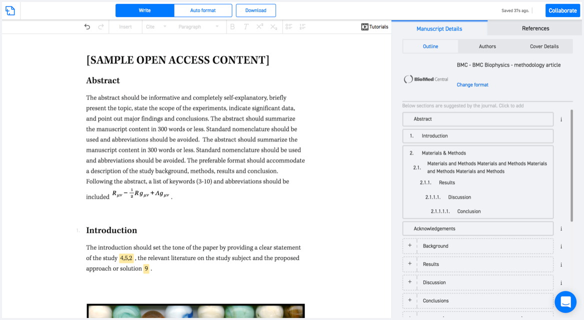
Available only on desktops 🖥

No word template required

Typset automatically formats your research paper to Geoenvironmental Disasters formatting guidelines and citation style.
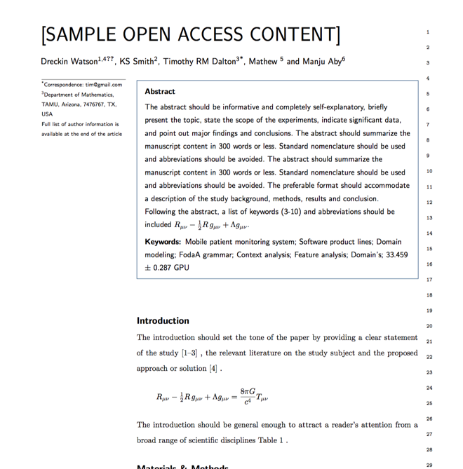
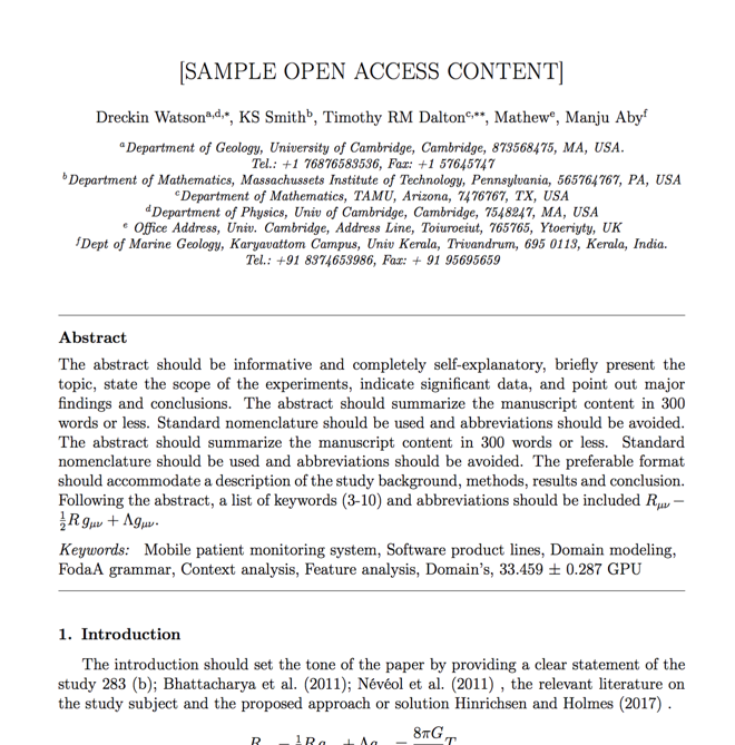
Verifed journal formats

One editor, 100K journal formats.
With the largest collection of verified journal formats, what you need is already there.

Trusted by academicians

I spent hours with MS word for reformatting. It was frustrating - plain and simple. With SciSpace, I can draft my manuscripts and once it is finished I can just submit. In case, I have to submit to another journal it is really just a button click instead of an afternoon of reformatting.

Andreas Frutiger
Researcher & Ex MS Word user
Use this template