Example of Geosciences Journal format
Recent searches

Example of Geosciences Journal format Example of Geosciences Journal format Example of Geosciences Journal format Example of Geosciences Journal format Example of Geosciences Journal format Example of Geosciences Journal format Example of Geosciences Journal format Example of Geosciences Journal format Example of Geosciences Journal format Example of Geosciences Journal format Example of Geosciences Journal format Example of Geosciences Journal format Example of Geosciences Journal format Example of Geosciences Journal format Example of Geosciences Journal format Example of Geosciences Journal format Example of Geosciences Journal format Example of Geosciences Journal format
Sample paper formatted on SciSpace - SciSpace
This content is only for preview purposes. The original open access content can be found here.
Look Inside
Example of Geosciences Journal format Example of Geosciences Journal format Example of Geosciences Journal format Example of Geosciences Journal format Example of Geosciences Journal format Example of Geosciences Journal format Example of Geosciences Journal format Example of Geosciences Journal format Example of Geosciences Journal format Example of Geosciences Journal format Example of Geosciences Journal format Example of Geosciences Journal format Example of Geosciences Journal format Example of Geosciences Journal format Example of Geosciences Journal format Example of Geosciences Journal format Example of Geosciences Journal format Example of Geosciences Journal format
Sample paper formatted on SciSpace - SciSpace
This content is only for preview purposes. The original open access content can be found here.
open access Open Access

Geosciences Journal — Template for authors

Publisher: Springer
Categories Rank Trend in last 3 yrs
Earth and Planetary Sciences (all) #51 of 186 up up by 24 ranks
Environmental Science (all) #68 of 220 up up by 22 ranks
journal-quality-icon Journal quality:
Good
calendar-icon Last 4 years overview: 270 Published Papers | 870 Citations
indexed-in-icon Indexed in: Scopus
last-updated-icon Last updated: 28/06/2020
Related journals
Insights
General info
Top papers
Popular templates
Get started guide
Why choose from SciSpace
FAQ

Related Journals

open access Open Access

Cambridge University Press

Quality:  
High
CiteRatio: 3.9
SJR: 0.574
SNIP: 0.957
open access Open Access

Springer

Quality:  
High
CiteRatio: 2.8
SJR: 0.371
SNIP: 0.625
open access Open Access

Taylor and Francis

Quality:  
High
CiteRatio: 6.2
SJR: 0.899
SNIP: 1.595
open access Open Access

Springer

Quality:  
Good
CiteRatio: 2.1
SJR: 0.415
SNIP: 0.842

Journal Performance & Insights

Impact Factor

CiteRatio

Determines the importance of a journal by taking a measure of frequency with which the average article in a journal has been cited in a particular year.

A measure of average citations received per peer-reviewed paper published in the journal.

1.651

11% from 2018

Impact factor for Geosciences Journal from 2016 - 2019
Year Value
2019 1.651
2018 1.49
2017 1.193
2016 1.095
graph view Graph view
table view Table view

3.2

10% from 2019

CiteRatio for Geosciences Journal from 2016 - 2020
Year Value
2020 3.2
2019 2.9
2018 2.3
2017 1.9
2016 1.6
graph view Graph view
table view Table view

insights Insights

  • Impact factor of this journal has increased by 11% in last year.
  • This journal’s impact factor is in the top 10 percentile category.

insights Insights

  • CiteRatio of this journal has increased by 10% in last years.
  • This journal’s CiteRatio is in the top 10 percentile category.

SCImago Journal Rank (SJR)

Source Normalized Impact per Paper (SNIP)

Measures weighted citations received by the journal. Citation weighting depends on the categories and prestige of the citing journal.

Measures actual citations received relative to citations expected for the journal's category.

0.468

3% from 2019

SJR for Geosciences Journal from 2016 - 2020
Year Value
2020 0.468
2019 0.454
2018 0.419
2017 0.381
2016 0.327
graph view Graph view
table view Table view

1.089

8% from 2019

SNIP for Geosciences Journal from 2016 - 2020
Year Value
2020 1.089
2019 1.006
2018 0.828
2017 0.622
2016 0.702
graph view Graph view
table view Table view

insights Insights

  • SJR of this journal has increased by 3% in last years.
  • This journal’s SJR is in the top 10 percentile category.

insights Insights

  • SNIP of this journal has increased by 8% in last years.
  • This journal’s SNIP is in the top 10 percentile category.

Geosciences Journal

Guideline source: View

All company, product and service names used in this website are for identification purposes only. All product names, trademarks and registered trademarks are property of their respective owners.

Use of these names, trademarks and brands does not imply endorsement or affiliation. Disclaimer Notice

Springer

Geosciences Journal

Geosciences Journal opens a new era for the publication of geoscientific research articles in English, covering geology, geophysics, geochemistry, paleontology, structural geology, mineralogy, petrology, stratigraphy, sedimentology, environmental geology, economic geology, pet...... Read More

Earth and Planetary Sciences

i
Last updated on
27 Jun 2020
i
ISSN
1226-4806
i
Impact Factor
Medium - 0.553
i
Open Access
No
i
Sherpa RoMEO Archiving Policy
Green faq
i
Plagiarism Check
Available via Turnitin
i
Endnote Style
Download Available
i
Bibliography Name
SPBASIC
i
Citation Type
Author Year
(Blonder et al, 1982)
i
Bibliography Example
Beenakker CWJ (2006) Specular andreev reflection in graphene. Phys Rev Lett 97(6):067,007, URL 10.1103/PhysRevLett.97.067007

Top papers written in this journal

Journal Article DOI: 10.1007/BF02910304
Evolution of the Paleo-Asian Ocean (Altai-Sayan Region, Central Asia) and collision of possible Gondwana-derived terranes with the southern marginal part of the Siberian continent
01 Sep 2001 - Geosciences Journal

Abstract:

The paper reviews and integrates new results on the evolution of the Paleo-Asian Ocean and its related geodynamics and geology of Altai-Sayan Region (ASR) in Central Asia. A revised terrane classification based on Vendian-Cambrian geodynamic units and evolution of terranes is described. Reactivated suture zones along the terr... The paper reviews and integrates new results on the evolution of the Paleo-Asian Ocean and its related geodynamics and geology of Altai-Sayan Region (ASR) in Central Asia. A revised terrane classification based on Vendian-Cambrian geodynamic units and evolution of terranes is described. Reactivated suture zones along the terrane boundaries are proposed. The obtained data suggest the important role of strike-slip deformations in the formation of mosaic-block structure of Central Asia. Those complicated and multi-stage deformations resulted from the Late Devonian-Early Carboniferous collision of Gondwana-derived terranes. The deformations reached their peak in the Late Carboniferous-Permian due to the collision of the Kazakhstan and Siberian continents. A system of sinistral strike-slip faults formed ASR along the margin of the Siberian continent as a result of the Late Carboniferous-Permian collision. The intrusion of granites occurred in East Kazakhstan and northwestern Gorny Altai in the Late Carboniferous and Permian. This resulted in the formation of the Northern Eurasia continent. Geodynamic evolution of the Paleo-Asian ocean and paleotectonics of ASR allow to recognize in the region the following five geodynamic stages: Vendian-Early Cambrian, Early Ordovician, Early-Middle Devonian, Late-Devonian-Early Carboniferous and Late Carboniferous-Early Permian times. read more read less

Topics:

Paleo-Tethys Ocean (59%)59% related to the paper, Permian (55%)55% related to the paper, Gondwana (55%)55% related to the paper, Carboniferous (55%)55% related to the paper, Terrane (55%)55% related to the paper
View PDF
273 Citations
Journal Article DOI: 10.1007/S12303-017-0034-4
Landslide prediction, monitoring and early warning: a concise review of state-of-the-art
Byung-Gon Chae, Hyuck-Jin Park1, Filippo Catani2, Alessandro Simoni3, Matteo Berti3
27 Dec 2017 - Geosciences Journal

Abstract:

Landslide is one of the repeated geological hazards during rainy season, which causes fatalities, damage to property and economic losses in Korea. Landslides are responsible for at least 17% of all fatalities from natural hazards worldwide, and nearly 25% of annual casualties caused by natural hazards in Korea. Due to global ... Landslide is one of the repeated geological hazards during rainy season, which causes fatalities, damage to property and economic losses in Korea. Landslides are responsible for at least 17% of all fatalities from natural hazards worldwide, and nearly 25% of annual casualties caused by natural hazards in Korea. Due to global climate change, the frequency of landslide occurrence has been increased and subsequently, the losses and damages associated with landslides also have been increased. Therefore, accurate prediction of landslide occurrence, and monitoring and early warning for ground movements are very important tasks to reduce the damages and losses caused by landslides. Various studies on landslide prediction and reduction in landslide damage have been performed and consequently, much of the recent progress has been in these areas. In particular, the application of information and geospatial technologies such as remote sensing and geographic information systems (GIS) has greatly contributed to landslide hazard assessment studies over recent years. In this paper, the recent advances and the state-of-the-art in the essential components of the landslide hazard assessment, such as landslide susceptibility analysis, runout modeling, landslide monitoring and early warning, were reviewed. Especially, this paper focused on the evaluation of the landslide susceptibility using probabilistic approach and physically based method, runout evaluation using volume based model and dynamic model, in situ ground based monitoring techniques, remote sensing techniques for landslide monitoring, and landslide early warning using rainfall and physical thresholds. read more read less

Topics:

Landslide (68%)68% related to the paper, Natural hazard (53%)53% related to the paper, Geologic hazards (51%)51% related to the paper, Warning system (50%)50% related to the paper
213 Citations
Journal Article DOI: 10.1007/S12303-014-0032-8
Landslide susceptibility mapping at Al-Hasher area, Jizan (Saudi Arabia) using GIS-based frequency ratio and index of entropy models
Ahmed M. Youssef1, Mohamed Al-Kathery, Biswajeet Pradhan2
01 Mar 2015 - Geosciences Journal

Abstract:

Mountain areas in the southern western corner of the Kingdom of Saudi Arabia frequently suffer from various types of landslides due to rain storms and anthropogenic activities. To resolve the problem related to landslides, landslide susceptibility map is important as a quick and safe mitigation measure and to help making stra... Mountain areas in the southern western corner of the Kingdom of Saudi Arabia frequently suffer from various types of landslides due to rain storms and anthropogenic activities. To resolve the problem related to landslides, landslide susceptibility map is important as a quick and safe mitigation measure and to help making strategic planning by identifying the most vulnerable areas. This paper summarizes findings of landslide susceptibility analysis at Al-Hasher area, Jizan, KSA, using two statistical models: frequency ratio and index of entropy models with the aid of GIS tools and remote sensing data. The landslide locations (inventory map) were identified in the study area using historical records, interpretation of high-resolution satellite images that include Geo-Eye in 2.5 m and Quickbird in 0.6m resolution, topographic maps of 1:10,000 scale, and multiple field investigations. A total of 207 landslides (80% out of 257 detected landslides) were randomly selected for model training, and the remaining 50 landslides (19%) were used for the model validation. Ten landslide conditioning factors including slope angle, slope-aspect, altitude, curvature, lithology, distance to lineaments, normalized difference vegetation index (NDVI), distance to roads, precipitation, and distance to streams, were extracted from spatial database. Using these conditioning factors and landslide locations, landslide susceptibility and weights of each factor were analyzed by using frequency ratio and index of entropy models. Our findings showed that the existing landslides of high and very high susceptibility classes cover nearly 80.4% and 79.1% of the susceptibility maps produced by frequency ratio and index of entropy models respectively. For verification, receiver operating characteristic (ROC) curves were drawn and the areas under the curve (AUC) were calculated for success and prediction rates. For success rate the results revealed that for the index of entropy model (AUC = 77.9%) is slightly lower than frequency ratio model (AUC = 78.8%). For the prediction rate, it was found that the index of entropy model (AUC = 74.9%) is slightly lower than the frequency ratio model (AUC = 76.7%). The landslide susceptibility maps produced from this study could help decision makers, planners, engineers, and urban areas developers to make suitable decisions. read more read less

Topics:

Landslide classification (65%)65% related to the paper, Landslide (59%)59% related to the paper, Normalized Difference Vegetation Index (50%)50% related to the paper
195 Citations
Journal Article DOI: 10.1007/BF02910572
Changing perspectives on Cambrian chronostratigraphy and progress toward subdivision of the Cambrian system
Loren E. Babeock1, Shanchi Peng2, Gerd Geyef, John H. Shergold
01 Jun 2005 - Geosciences Journal

Abstract:

Important steps have been made toward global subdivision of the Cambrian System. The consensus of opinion is that the system should be subdivided into four series representing subequal spans of time. The lower two series will correspond approximately to the traditional Lower Cambrian, the third series will correspond approxim... Important steps have been made toward global subdivision of the Cambrian System. The consensus of opinion is that the system should be subdivided into four series representing subequal spans of time. The lower two series will correspond approximately to the traditional Lower Cambrian, the third series will correspond approximately to the traditional Middle Cambrian, and the fourth series corresponds approximately to the traditional Upper Cambrian. The fourth series, called the Furongian Series, has been ratified by the International Union of Geological Sciences (IUGS). Selection of horizons representing evolutionary events that can be correlated on a global scale, and which can be used as stage or series boundaries, is much more difficult for the lower two series intervals of the Cambrian than it is for the upper two series intervals of the Cambrian. The most practical concept for subdividing the system into stages involves the establishment of two stages each for the first and second series, and establishment of three stages each for the third and fourth series. The lowermost stage of the Furongian, called the Paibian Stage, has been ratified by the IUGS, and the International Subcommission on Cambrian Stratigraphy (ISCS) is nearing decisions on the levels that will used to mark the bases of the upper two stages of the Furongian. Concerning stage boundaries within the proposed third series of the Cambrian, the ISCS is close to decisions on two levels that will be used to mark boundaries. read more read less

Topics:

Cambrian Series 3 (76%)76% related to the paper, Series (stratigraphy) (54%)54% related to the paper, Stage (stratigraphy) (52%)52% related to the paper
163 Citations
Journal Article DOI: 10.1007/S12303-015-0026-1
A comparative study of landslide susceptibility maps using logistic regression, frequency ratio, decision tree, weights of evidence and artificial neural network
Liang-Jie Wang1, Min Guo2, Kazuhide Sawada2, Jie Lin1, Jinchi Zhang1
01 Feb 2016 - Geosciences Journal

Abstract:

For the purpose of comparing susceptibility mapping methods in Mizunami City, Japan, the landslide inventory was partitioned into three groups as various training and test datasets to identify the most appropriate method for creating a landslide susceptibility map. A total of fifteen landslide susceptibility maps were produce... For the purpose of comparing susceptibility mapping methods in Mizunami City, Japan, the landslide inventory was partitioned into three groups as various training and test datasets to identify the most appropriate method for creating a landslide susceptibility map. A total of fifteen landslide susceptibility maps were produced using frequency ratio, logistic regression, decision tree, weights of evidence and artificial neural network models, and the results were assessed using existing test landside points and areas under the relative operative characteristic curve (AUC). The validation results indicated that the logistic regression model could provide the highest AUC value (0.865), and a relatively high percentage of landslide points fell in the high and very high landslide susceptibility classes in this study. Furthermore, the paper also suggested that the model performances would be increased if appropriate landslide points were used for the calculation. read more read less

Topics:

Landslide (56%)56% related to the paper, Logistic regression (50%)50% related to the paper
153 Citations
Author Pic

SciSpace is a very innovative solution to the formatting problem and existing providers, such as Mendeley or Word did not really evolve in recent years.

- Andreas Frutiger, Researcher, ETH Zurich, Institute for Biomedical Engineering

Get MS-Word and LaTeX output to any Journal within seconds
1
Choose a template
Select a template from a library of 40,000+ templates
2
Import a MS-Word file or start fresh
It takes only few seconds to import
3
View and edit your final output
SciSpace will automatically format your output to meet journal guidelines
4
Submit directly or Download
Submit to journal directly or Download in PDF, MS Word or LaTeX

(Before submission check for plagiarism via Turnitin)

clock Less than 3 minutes

What to expect from SciSpace?

Speed and accuracy over MS Word

''

With SciSpace, you do not need a word template for Geosciences Journal.

It automatically formats your research paper to Springer formatting guidelines and citation style.

You can download a submission ready research paper in pdf, LaTeX and docx formats.

Time comparison

Time taken to format a paper and Compliance with guidelines

Plagiarism Reports via Turnitin

SciSpace has partnered with Turnitin, the leading provider of Plagiarism Check software.

Using this service, researchers can compare submissions against more than 170 million scholarly articles, a database of 70+ billion current and archived web pages. How Turnitin Integration works?


Turnitin Stats
Publisher Logos

Freedom from formatting guidelines

One editor, 100K journal formats – world's largest collection of journal templates

With such a huge verified library, what you need is already there.

publisher-logos

Easy support from all your favorite tools

Geosciences Journal format uses SPBASIC citation style.

Automatically format and order your citations and bibliography in a click.

SciSpace allows imports from all reference managers like Mendeley, Zotero, Endnote, Google Scholar etc.

Frequently asked questions

1. Can I write Geosciences Journal in LaTeX?

Absolutely not! Our tool has been designed to help you focus on writing. You can write your entire paper as per the Geosciences Journal guidelines and auto format it.

2. Do you follow the Geosciences Journal guidelines?

Yes, the template is compliant with the Geosciences Journal guidelines. Our experts at SciSpace ensure that. If there are any changes to the journal's guidelines, we'll change our algorithm accordingly.

3. Can I cite my article in multiple styles in Geosciences Journal?

Of course! We support all the top citation styles, such as APA style, MLA style, Vancouver style, Harvard style, and Chicago style. For example, when you write your paper and hit autoformat, our system will automatically update your article as per the Geosciences Journal citation style.

4. Can I use the Geosciences Journal templates for free?

Sign up for our free trial, and you'll be able to use all our features for seven days. You'll see how helpful they are and how inexpensive they are compared to other options, Especially for Geosciences Journal.

5. Can I use a manuscript in Geosciences Journal that I have written in MS Word?

Yes. You can choose the right template, copy-paste the contents from the word document, and click on auto-format. Once you're done, you'll have a publish-ready paper Geosciences Journal that you can download at the end.

6. How long does it usually take you to format my papers in Geosciences Journal?

It only takes a matter of seconds to edit your manuscript. Besides that, our intuitive editor saves you from writing and formatting it in Geosciences Journal.

7. Where can I find the template for the Geosciences Journal?

It is possible to find the Word template for any journal on Google. However, why use a template when you can write your entire manuscript on SciSpace , auto format it as per Geosciences Journal's guidelines and download the same in Word, PDF and LaTeX formats? Give us a try!.

8. Can I reformat my paper to fit the Geosciences Journal's guidelines?

Of course! You can do this using our intuitive editor. It's very easy. If you need help, our support team is always ready to assist you.

9. Geosciences Journal an online tool or is there a desktop version?

SciSpace's Geosciences Journal is currently available as an online tool. We're developing a desktop version, too. You can request (or upvote) any features that you think would be helpful for you and other researchers in the "feature request" section of your account once you've signed up with us.

10. I cannot find my template in your gallery. Can you create it for me like Geosciences Journal?

Sure. You can request any template and we'll have it setup within a few days. You can find the request box in Journal Gallery on the right side bar under the heading, "Couldn't find the format you were looking for like Geosciences Journal?”

11. What is the output that I would get after using Geosciences Journal?

After writing your paper autoformatting in Geosciences Journal, you can download it in multiple formats, viz., PDF, Docx, and LaTeX.

12. Is Geosciences Journal's impact factor high enough that I should try publishing my article there?

To be honest, the answer is no. The impact factor is one of the many elements that determine the quality of a journal. Few of these factors include review board, rejection rates, frequency of inclusion in indexes, and Eigenfactor. You need to assess all these factors before you make your final call.

13. What is Sherpa RoMEO Archiving Policy for Geosciences Journal?

SHERPA/RoMEO Database

We extracted this data from Sherpa Romeo to help researchers understand the access level of this journal in accordance with the Sherpa Romeo Archiving Policy for Geosciences Journal. The table below indicates the level of access a journal has as per Sherpa Romeo's archiving policy.

RoMEO Colour Archiving policy
Green Can archive pre-print and post-print or publisher's version/PDF
Blue Can archive post-print (ie final draft post-refereeing) or publisher's version/PDF
Yellow Can archive pre-print (ie pre-refereeing)
White Archiving not formally supported
FYI:
  1. Pre-prints as being the version of the paper before peer review and
  2. Post-prints as being the version of the paper after peer-review, with revisions having been made.

14. What are the most common citation types In Geosciences Journal?

The 5 most common citation types in order of usage for Geosciences Journal are:.

S. No. Citation Style Type
1. Author Year
2. Numbered
3. Numbered (Superscripted)
4. Author Year (Cited Pages)
5. Footnote

15. How do I submit my article to the Geosciences Journal?

It is possible to find the Word template for any journal on Google. However, why use a template when you can write your entire manuscript on SciSpace , auto format it as per Geosciences Journal's guidelines and download the same in Word, PDF and LaTeX formats? Give us a try!.

16. Can I download Geosciences Journal in Endnote format?

Yes, SciSpace provides this functionality. After signing up, you would need to import your existing references from Word or Bib file to SciSpace. Then SciSpace would allow you to download your references in Geosciences Journal Endnote style according to Elsevier guidelines.

Fast and reliable,
built for complaince.

Instant formatting to 100% publisher guidelines on - SciSpace.
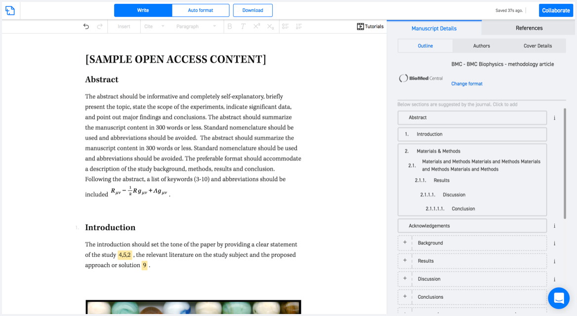
Available only on desktops 🖥

No word template required

Typset automatically formats your research paper to Geosciences Journal formatting guidelines and citation style.
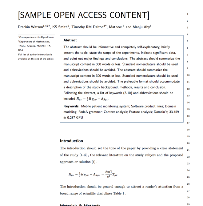

Verifed journal formats

One editor, 100K journal formats.
With the largest collection of verified journal formats, what you need is already there.

Trusted by academicians

I spent hours with MS word for reformatting. It was frustrating - plain and simple. With SciSpace, I can draft my manuscripts and once it is finished I can just submit. In case, I have to submit to another journal it is really just a button click instead of an afternoon of reformatting.

Andreas Frutiger
Researcher & Ex MS Word user
Use this template