Example of International Journal of Earth Sciences format
Recent searches

Example of International Journal of Earth Sciences format Example of International Journal of Earth Sciences format Example of International Journal of Earth Sciences format Example of International Journal of Earth Sciences format Example of International Journal of Earth Sciences format Example of International Journal of Earth Sciences format Example of International Journal of Earth Sciences format Example of International Journal of Earth Sciences format Example of International Journal of Earth Sciences format Example of International Journal of Earth Sciences format Example of International Journal of Earth Sciences format Example of International Journal of Earth Sciences format Example of International Journal of Earth Sciences format Example of International Journal of Earth Sciences format Example of International Journal of Earth Sciences format Example of International Journal of Earth Sciences format Example of International Journal of Earth Sciences format Example of International Journal of Earth Sciences format
Sample paper formatted on SciSpace - SciSpace
This content is only for preview purposes. The original open access content can be found here.
Look Inside
Example of International Journal of Earth Sciences format Example of International Journal of Earth Sciences format Example of International Journal of Earth Sciences format Example of International Journal of Earth Sciences format Example of International Journal of Earth Sciences format Example of International Journal of Earth Sciences format Example of International Journal of Earth Sciences format Example of International Journal of Earth Sciences format Example of International Journal of Earth Sciences format Example of International Journal of Earth Sciences format Example of International Journal of Earth Sciences format Example of International Journal of Earth Sciences format Example of International Journal of Earth Sciences format Example of International Journal of Earth Sciences format Example of International Journal of Earth Sciences format Example of International Journal of Earth Sciences format Example of International Journal of Earth Sciences format Example of International Journal of Earth Sciences format
Sample paper formatted on SciSpace - SciSpace
This content is only for preview purposes. The original open access content can be found here.
open access Open Access

International Journal of Earth Sciences — Template for authors

Publisher: Springer
Categories Rank Trend in last 3 yrs
Earth and Planetary Sciences (all) #27 of 186 down down by 5 ranks
journal-quality-icon Journal quality:
High
calendar-icon Last 4 years overview: 578 Published Papers | 2706 Citations
indexed-in-icon Indexed in: Scopus
last-updated-icon Last updated: 20/06/2020
Related journals
Insights
General info
Top papers
Popular templates
Get started guide
Why choose from SciSpace
FAQ

Related Journals

open access Open Access

Taylor and Francis

Quality:  
High
CiteRatio: 4.1
SJR: 0.694
SNIP: 0.72
open access Open Access
recommended Recommended

Taylor and Francis

Quality:  
High
CiteRatio: 6.6
SJR: 0.813
SNIP: 1.434
open access Open Access
recommended Recommended

Springer

Quality:  
High
CiteRatio: 7.2
SJR: 1.148
SNIP: 1.68
open access Open Access
recommended Recommended

IEEE

Quality:  
High
CiteRatio: 15.5
SJR: 3.038
SNIP: 7.166

Journal Performance & Insights

Impact Factor

CiteRatio

Determines the importance of a journal by taking a measure of frequency with which the average article in a journal has been cited in a particular year.

A measure of average citations received per peer-reviewed paper published in the journal.

2.278

1% from 2018

Impact factor for International Journal of Earth Sciences from 2016 - 2019
Year Value
2019 2.278
2018 2.295
2017 2.276
2016 2.283
graph view Graph view
table view Table view

4.7

15% from 2019

CiteRatio for International Journal of Earth Sciences from 2016 - 2020
Year Value
2020 4.7
2019 4.1
2018 3.9
2017 4.2
2016 4.1
graph view Graph view
table view Table view

insights Insights

  • Impact factor of this journal has decreased by 1% in last year.
  • This journal’s impact factor is in the top 10 percentile category.

insights Insights

  • CiteRatio of this journal has increased by 15% in last years.
  • This journal’s CiteRatio is in the top 10 percentile category.

SCImago Journal Rank (SJR)

Source Normalized Impact per Paper (SNIP)

Measures weighted citations received by the journal. Citation weighting depends on the categories and prestige of the citing journal.

Measures actual citations received relative to citations expected for the journal's category.

1.065

2% from 2019

SJR for International Journal of Earth Sciences from 2016 - 2020
Year Value
2020 1.065
2019 1.048
2018 1.164
2017 1.125
2016 1.166
graph view Graph view
table view Table view

1.104

10% from 2019

SNIP for International Journal of Earth Sciences from 2016 - 2020
Year Value
2020 1.104
2019 1.006
2018 1.125
2017 1.108
2016 1.066
graph view Graph view
table view Table view

insights Insights

  • SJR of this journal has increased by 2% in last years.
  • This journal’s SJR is in the top 10 percentile category.

insights Insights

  • SNIP of this journal has increased by 10% in last years.
  • This journal’s SNIP is in the top 10 percentile category.

International Journal of Earth Sciences

Guideline source: View

All company, product and service names used in this website are for identification purposes only. All product names, trademarks and registered trademarks are property of their respective owners.

Use of these names, trademarks and brands does not imply endorsement or affiliation. Disclaimer Notice

Springer

International Journal of Earth Sciences

The International Journal of Earth Sciences publishes process-oriented original and review papers on the history of the earth, including - Dynamics of the lithosphere- Tectonics and volcanology- Sedimentology- Evolution of life- Marine and continental ecosystems- Global dynami...... Read More

Earth and Planetary Sciences

i
Last updated on
19 Jun 2020
i
ISSN
1437-3254
i
Impact Factor
Medium - 0.951
i
Open Access
No
i
Sherpa RoMEO Archiving Policy
Green faq
i
Plagiarism Check
Available via Turnitin
i
Endnote Style
Download Available
i
Bibliography Name
SPBASIC
i
Citation Type
Author Year
(Blonder et al, 1982)
i
Bibliography Example
Blonder GE, Tinkham M, Klapwijk TM (1982) Transition from metallic to tunneling regimes in superconducting microconstrictions: Excess current, charge imbalance, and supercurrent conversion. Phys Rev B 25(7):4515–4532, URL 10.1103/PhysRevB.25.4515

Top papers written in this journal

Journal Article DOI: 10.1007/S00531-005-0481-4
Convergence history across Zagros (Iran): constraints from collisional and earlier deformation
Philippe Agard1, Jafar Omrani1, Laurent Jolivet1, Frédéric Mouthereau1

Abstract:

The Zagros orogen provides a unique opportunity within the Alpine system to evaluate the interplay between a young Tertiary collision and earlier subduction/obduction processes. Within the Crush zone and the Sanandaj–Sirjan (internal) zone separating the Zagros Fold belt from Central Iran, we document several major tectonic e... The Zagros orogen provides a unique opportunity within the Alpine system to evaluate the interplay between a young Tertiary collision and earlier subduction/obduction processes. Within the Crush zone and the Sanandaj–Sirjan (internal) zone separating the Zagros Fold belt from Central Iran, we document several major tectonic events taking place at the end of the Cretaceous, of the Eocene and from the Mio–Pliocene onwards (ca. <20–15 Ma). Contrary to recent interpretations, our data (cross-sections and description of the overall deformation style) strongly suggest that the Main Zagros Thrust (MZT) is deeply rooted, possibly to Moho depths, and that the suture zone effectively runs along the MZT. Field observations show that the final resorption of the oceanic domain took place slightly after 35 Ma and that collision must have started before ca. 23–25 Ma in northern Zagros. The shortening rate across the Crush zone since the Mid-Miocene (20–15 Ma) is estimated at a minimum 3–4 mm/year. Shear movements in the Crush zone during the Eocene–Oligocene period and extensional/strike-slip movements in the internal zones during the late Cretaceous point to an oblique setting early in the convergence history. A geotectonic scenario for convergence from the time of obduction to the present is finally proposed. read more read less

Topics:

Zagros fold and thrust belt (62%)62% related to the paper, Obduction (52%)52% related to the paper, Subduction (51%)51% related to the paper, Suture (geology) (51%)51% related to the paper
885 Citations
Journal Article DOI: 10.1007/S00531-008-0407-Z
End-Permian to mid-Triassic termination of the accretionary processes of the southern Altaids: implications for the geodynamic evolution, Phanerozoic continental growth, and metallogeny of Central Asia
Wenjiao Xiao1, Brian F. Windley2, Baochun Huang1, Chunming Han1, Chao Yuan1, Hanlin Chen3, Min Sun4, Shu Sun1, JL Li

Abstract:

The Altaids is one of the largest accretionary orogenic collages in the world with the highest rate of Phanerozoic continental growth and significant metallogenic importance. It is widely accepted that subduction-related orogenesis of the Altaids started in the late Precambrian and gradually migrated southward (present coordi... The Altaids is one of the largest accretionary orogenic collages in the world with the highest rate of Phanerozoic continental growth and significant metallogenic importance. It is widely accepted that subduction-related orogenesis of the Altaids started in the late Precambrian and gradually migrated southward (present coordinates). However, it is uncertain when and how the building of the Altaids was finally completed. Based on structural geology, geochemical, geochronological, and paleomagnetic data, this paper presents late Paleozoic to early Mesozoic accretionary tectonics of two key areas, North Xinjiang in the west and Inner Mongolia in the east, together with neighboring Mongolia. The late Paleozoic tectonics of North Xinjiang and adjacent areas were characterized by continuous southward accretion along the wide southern active margin of Siberia and its final amalgamation with the passive margin of Tarim, which may have lasted to the end-Permian to early/mid-Triassic. In contrast, in Inner Mongolia and adjacent areas two wide accretionary wedges developed along the southern active margin of Siberia and the northern active margin of the North China craton, which may have lasted to the mid-Triassic. The final products of the long-lived accretionary processes in the southern Altaids include late Paleozoic to Permian arcs, late Paleozoic to mid-Triassic accretionary wedges composed of radiolarian cherts, pillow lavas, and ophiolitic fragments, and high-pressure/ultrahigh-pressure metamorphic rocks. Permian Alaskan-type zoned mafic-ultramafic complexes intruded along some major faults of the Tien Shan. We define a new Tarim suture zone immediately north of the Tarim craton that is probably now buried below the Tien Shan as a result of northward subduction of the Tarim block in the Cenozoic. The docking of the Tarim and North China cratons against the southern active margin of Siberia in the end-Permian to mid-Triassic resulted in the final closure of the Paleoasian Ocean and terminated the accretionary orogenesis of the southern Altaids in this part of Central Asia. This complex geodynamic evolution led to formation of giant metal deposits in Central Asia and to substantial continental growth. read more read less

Topics:

Craton (53%)53% related to the paper, Passive margin (53%)53% related to the paper, Paleozoic (51%)51% related to the paper, Permian (51%)51% related to the paper
View PDF
788 Citations
Journal Article DOI: 10.1007/S00531-008-0366-4
Cenozoic geodynamic evolution of the Aegean
Laurent Jolivet1, Jean-Pierre Brun2

Abstract:

The Aegean region is a concentrate of the main geodynamic processes that shaped the Mediterranean region: oceanic and continental subduction, mountain building, high-pressure and low-temperature metamorphism, backarc extension, post-orogenic collapse, metamorphic core complexes, gneiss domes are the ingredients of a complex e... The Aegean region is a concentrate of the main geodynamic processes that shaped the Mediterranean region: oceanic and continental subduction, mountain building, high-pressure and low-temperature metamorphism, backarc extension, post-orogenic collapse, metamorphic core complexes, gneiss domes are the ingredients of a complex evolution that started at the end of the Cretaceous with the closure of the Tethyan ocean along the Vardar suture zone. Using available plate kinematic, geophysical, petrological and structural data, we present a synthetic tectonic map of the whole region encompassing the Balkans, Western Turkey, the Aegean Sea, the Hellenic Arc, the Mediterranean Ridge and continental Greece and we build a lithospheric-scale N-S cross-section from Crete to the Rhodope massif. We then describe the tectonic evolution of this cross-section with a series of reconstructions from ~70 Ma to the Present. We follow on the hypothesis that a single subduction has been active throughout most of the Mesozoic and the entire Cenozoic, and we show that the geological record is compatible with this hypothesis. The reconstructions show that continental subduction (Apulian and Pelagonian continental blocks) did not induce slab break-off in this case. Using this evolution, we discuss the mechanisms leading to the exhumation of metamorphic rocks and the subsequent formation of extensional metamorphic domes in the backarc region during slab retreat. The tectonic histories of the two regions showing large-scale extension, the Rhodope and the Cyclades are then compared. The respective contributions to slab retreat, post-orogenic extension and lower crust partial melting of changes in kinematic boundary conditions and in nature of subducting material, from continental to oceanic, are discussed. read more read less

Topics:

Hellenic arc (61%)61% related to the paper, Metamorphic core complex (60%)60% related to the paper, Subduction (59%)59% related to the paper, Suture (geology) (56%)56% related to the paper, Mountain formation (56%)56% related to the paper
View PDF
579 Citations
Journal Article DOI: 10.1007/BF01840108
Explosive volcanic eruptions — a new classification scheme
George P. L. Walker1

Abstract:

A classification scheme is proposed based on measurements made on the resulting pyroclastic fall deposits, the significant parameters being the area of dispersal and degree of fragmentation of the material. An empirical measure of the first is the area enclosed by the 0.01 Tmax isopach (where Tmax is the maximum thickness of ... A classification scheme is proposed based on measurements made on the resulting pyroclastic fall deposits, the significant parameters being the area of dispersal and degree of fragmentation of the material. An empirical measure of the first is the area enclosed by the 0.01 Tmax isopach (where Tmax is the maximum thickness of the deposit), called D, which ranges from less than 10 km2 for deposits of strongly cone-building type to more than 1000 km2 for deposits of strongly sheet-forming type. An empirical measure of the second is the percentage of material finer than 1 mm in the deposit, or more simply at the point where the 0.1 Tmax isopach crosses the dispersal axis. The latter value, called F, varies from less than 20 for deposits in which fragmentation was mainly achieved by the tearing apart of magma, to more than 80 where it was largely due to thermal shock resulting from the quenching of lava by water. read more read less

Topics:

Pyroclastic fall (55%)55% related to the paper, Isopach map (54%)54% related to the paper, Eruption column (52%)52% related to the paper, Lava (51%)51% related to the paper, Magma (51%)51% related to the paper
534 Citations
Journal Article DOI: 10.1007/BF01848693
The brittle-plastic transition and the depth of seismic faulting
Christopher H. Scholz1

Abstract:

A simple rheological model of shearing of the lithosphere that has gained wide acceptance is a two layer model with an upper brittle zone in which deformation takes place by frictional sliding on discrete fault surfaces and a lower plastic zone in which deformation takes place by bulk plastic flow. The two are separated by an... A simple rheological model of shearing of the lithosphere that has gained wide acceptance is a two layer model with an upper brittle zone in which deformation takes place by frictional sliding on discrete fault surfaces and a lower plastic zone in which deformation takes place by bulk plastic flow. The two are separated by an abrupt brittle-plastic transition, which is assumed to be indicated by the lower limit of seismicity. Experimental studies, however, as well as the deformation structures of mylonites, indicate that a broad transitional field of semi-brittle behavior lies between these extremes. This is a field of mixed mode deformation with a strength that can be expected to be considerably higher than that predicted from the extrapolation of high temperature flow laws. For quartzofeldspathic rocks the semi-brittle field lies between T1, the onset of quartz plasticity at about 300 °C and T2, feldspar plasticity at about 450 °C. A model is presented in which the transition T1 does not correspond to a transition to bulk flow but to a change from unstable, velocity-weakening friction to stable, velocity-strengthening friction. T1 thus marks the depth limit of earthquake nucleation, but large earthquakes can propagate to a greater depth, T3, (T3<T2) which corresponds to the lower limit of dynamic frictional behavior in the semi-brittle field and approximately to the peak in strength. The zone between T1 and T3 is one of alternating behavior, with flow occurring m the interseismic period and with co-seismic dynamic slip occurring during large earthquakes. This zone is characterized by mylonites interlaced by pseudotachylytes and other signs of dynamic faulting. The transition T1 is also marked by a change in the generation mechanism of fault rocks, from abrasive wear above which produces cataclastites, to adhesive wear below, which is proposed as an important generation mechanism of mylonites in the upper part of the semi-brittle field. read more read less

Topics:

Slip (materials science) (55%)55% related to the paper, Plasticity (53%)53% related to the paper, Shearing (physics) (52%)52% related to the paper, Brittleness (51%)51% related to the paper, Fault (geology) (51%)51% related to the paper
497 Citations
Author Pic

SciSpace is a very innovative solution to the formatting problem and existing providers, such as Mendeley or Word did not really evolve in recent years.

- Andreas Frutiger, Researcher, ETH Zurich, Institute for Biomedical Engineering

Get MS-Word and LaTeX output to any Journal within seconds
1
Choose a template
Select a template from a library of 40,000+ templates
2
Import a MS-Word file or start fresh
It takes only few seconds to import
3
View and edit your final output
SciSpace will automatically format your output to meet journal guidelines
4
Submit directly or Download
Submit to journal directly or Download in PDF, MS Word or LaTeX

(Before submission check for plagiarism via Turnitin)

clock Less than 3 minutes

What to expect from SciSpace?

Speed and accuracy over MS Word

''

With SciSpace, you do not need a word template for International Journal of Earth Sciences.

It automatically formats your research paper to Springer formatting guidelines and citation style.

You can download a submission ready research paper in pdf, LaTeX and docx formats.

Time comparison

Time taken to format a paper and Compliance with guidelines

Plagiarism Reports via Turnitin

SciSpace has partnered with Turnitin, the leading provider of Plagiarism Check software.

Using this service, researchers can compare submissions against more than 170 million scholarly articles, a database of 70+ billion current and archived web pages. How Turnitin Integration works?


Turnitin Stats
Publisher Logos

Freedom from formatting guidelines

One editor, 100K journal formats – world's largest collection of journal templates

With such a huge verified library, what you need is already there.

publisher-logos

Easy support from all your favorite tools

International Journal of Earth Sciences format uses SPBASIC citation style.

Automatically format and order your citations and bibliography in a click.

SciSpace allows imports from all reference managers like Mendeley, Zotero, Endnote, Google Scholar etc.

Frequently asked questions

1. Can I write International Journal of Earth Sciences in LaTeX?

Absolutely not! Our tool has been designed to help you focus on writing. You can write your entire paper as per the International Journal of Earth Sciences guidelines and auto format it.

2. Do you follow the International Journal of Earth Sciences guidelines?

Yes, the template is compliant with the International Journal of Earth Sciences guidelines. Our experts at SciSpace ensure that. If there are any changes to the journal's guidelines, we'll change our algorithm accordingly.

3. Can I cite my article in multiple styles in International Journal of Earth Sciences?

Of course! We support all the top citation styles, such as APA style, MLA style, Vancouver style, Harvard style, and Chicago style. For example, when you write your paper and hit autoformat, our system will automatically update your article as per the International Journal of Earth Sciences citation style.

4. Can I use the International Journal of Earth Sciences templates for free?

Sign up for our free trial, and you'll be able to use all our features for seven days. You'll see how helpful they are and how inexpensive they are compared to other options, Especially for International Journal of Earth Sciences.

5. Can I use a manuscript in International Journal of Earth Sciences that I have written in MS Word?

Yes. You can choose the right template, copy-paste the contents from the word document, and click on auto-format. Once you're done, you'll have a publish-ready paper International Journal of Earth Sciences that you can download at the end.

6. How long does it usually take you to format my papers in International Journal of Earth Sciences?

It only takes a matter of seconds to edit your manuscript. Besides that, our intuitive editor saves you from writing and formatting it in International Journal of Earth Sciences.

7. Where can I find the template for the International Journal of Earth Sciences?

It is possible to find the Word template for any journal on Google. However, why use a template when you can write your entire manuscript on SciSpace , auto format it as per International Journal of Earth Sciences's guidelines and download the same in Word, PDF and LaTeX formats? Give us a try!.

8. Can I reformat my paper to fit the International Journal of Earth Sciences's guidelines?

Of course! You can do this using our intuitive editor. It's very easy. If you need help, our support team is always ready to assist you.

9. International Journal of Earth Sciences an online tool or is there a desktop version?

SciSpace's International Journal of Earth Sciences is currently available as an online tool. We're developing a desktop version, too. You can request (or upvote) any features that you think would be helpful for you and other researchers in the "feature request" section of your account once you've signed up with us.

10. I cannot find my template in your gallery. Can you create it for me like International Journal of Earth Sciences?

Sure. You can request any template and we'll have it setup within a few days. You can find the request box in Journal Gallery on the right side bar under the heading, "Couldn't find the format you were looking for like International Journal of Earth Sciences?”

11. What is the output that I would get after using International Journal of Earth Sciences?

After writing your paper autoformatting in International Journal of Earth Sciences, you can download it in multiple formats, viz., PDF, Docx, and LaTeX.

12. Is International Journal of Earth Sciences's impact factor high enough that I should try publishing my article there?

To be honest, the answer is no. The impact factor is one of the many elements that determine the quality of a journal. Few of these factors include review board, rejection rates, frequency of inclusion in indexes, and Eigenfactor. You need to assess all these factors before you make your final call.

13. What is Sherpa RoMEO Archiving Policy for International Journal of Earth Sciences?

SHERPA/RoMEO Database

We extracted this data from Sherpa Romeo to help researchers understand the access level of this journal in accordance with the Sherpa Romeo Archiving Policy for International Journal of Earth Sciences. The table below indicates the level of access a journal has as per Sherpa Romeo's archiving policy.

RoMEO Colour Archiving policy
Green Can archive pre-print and post-print or publisher's version/PDF
Blue Can archive post-print (ie final draft post-refereeing) or publisher's version/PDF
Yellow Can archive pre-print (ie pre-refereeing)
White Archiving not formally supported
FYI:
  1. Pre-prints as being the version of the paper before peer review and
  2. Post-prints as being the version of the paper after peer-review, with revisions having been made.

14. What are the most common citation types In International Journal of Earth Sciences?

The 5 most common citation types in order of usage for International Journal of Earth Sciences are:.

S. No. Citation Style Type
1. Author Year
2. Numbered
3. Numbered (Superscripted)
4. Author Year (Cited Pages)
5. Footnote

15. How do I submit my article to the International Journal of Earth Sciences?

It is possible to find the Word template for any journal on Google. However, why use a template when you can write your entire manuscript on SciSpace , auto format it as per International Journal of Earth Sciences's guidelines and download the same in Word, PDF and LaTeX formats? Give us a try!.

16. Can I download International Journal of Earth Sciences in Endnote format?

Yes, SciSpace provides this functionality. After signing up, you would need to import your existing references from Word or Bib file to SciSpace. Then SciSpace would allow you to download your references in International Journal of Earth Sciences Endnote style according to Elsevier guidelines.

Fast and reliable,
built for complaince.

Instant formatting to 100% publisher guidelines on - SciSpace.
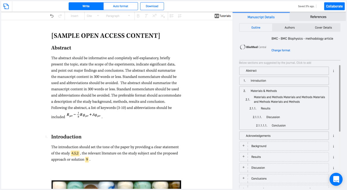
Available only on desktops 🖥

No word template required

Typset automatically formats your research paper to International Journal of Earth Sciences formatting guidelines and citation style.
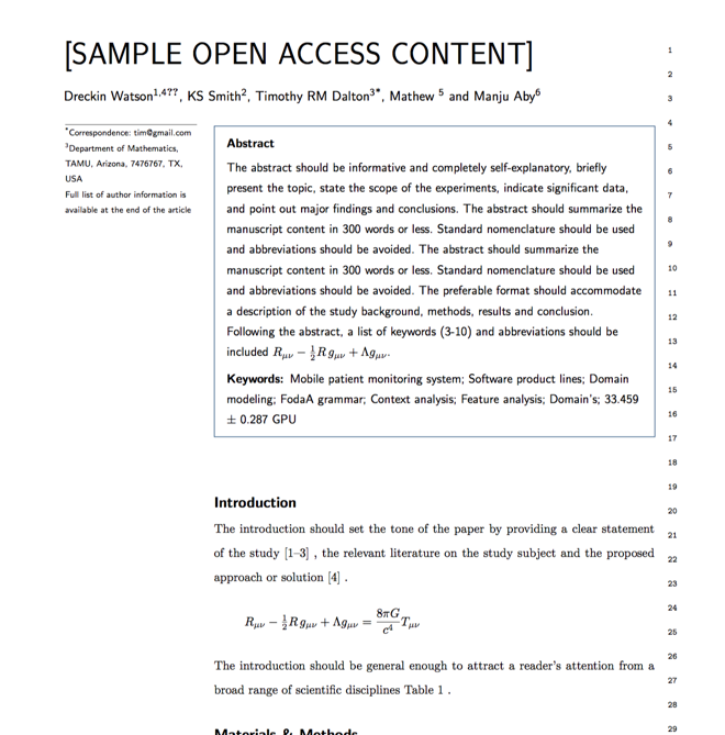
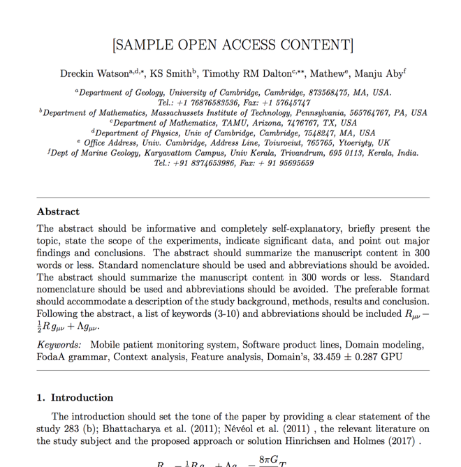
Verifed journal formats

One editor, 100K journal formats.
With the largest collection of verified journal formats, what you need is already there.

Trusted by academicians

I spent hours with MS word for reformatting. It was frustrating - plain and simple. With SciSpace, I can draft my manuscripts and once it is finished I can just submit. In case, I have to submit to another journal it is really just a button click instead of an afternoon of reformatting.

Andreas Frutiger
Researcher & Ex MS Word user
Use this template