Example of International Journal of Health Geographics format
Recent searches

Example of International Journal of Health Geographics format Example of International Journal of Health Geographics format Example of International Journal of Health Geographics format Example of International Journal of Health Geographics format Example of International Journal of Health Geographics format Example of International Journal of Health Geographics format Example of International Journal of Health Geographics format Example of International Journal of Health Geographics format Example of International Journal of Health Geographics format Example of International Journal of Health Geographics format Example of International Journal of Health Geographics format Example of International Journal of Health Geographics format Example of International Journal of Health Geographics format Example of International Journal of Health Geographics format Example of International Journal of Health Geographics format Example of International Journal of Health Geographics format Example of International Journal of Health Geographics format Example of International Journal of Health Geographics format
Sample paper formatted on SciSpace - SciSpace
This content is only for preview purposes. The original open access content can be found here.
Look Inside
Example of International Journal of Health Geographics format Example of International Journal of Health Geographics format Example of International Journal of Health Geographics format Example of International Journal of Health Geographics format Example of International Journal of Health Geographics format Example of International Journal of Health Geographics format Example of International Journal of Health Geographics format Example of International Journal of Health Geographics format Example of International Journal of Health Geographics format Example of International Journal of Health Geographics format Example of International Journal of Health Geographics format Example of International Journal of Health Geographics format Example of International Journal of Health Geographics format Example of International Journal of Health Geographics format Example of International Journal of Health Geographics format Example of International Journal of Health Geographics format Example of International Journal of Health Geographics format Example of International Journal of Health Geographics format
Sample paper formatted on SciSpace - SciSpace
This content is only for preview purposes. The original open access content can be found here.
open access Open Access
recommended Recommended

International Journal of Health Geographics — Template for authors

Publisher: Springer
Categories Rank Trend in last 3 yrs
Business, Management and Accounting (all) #20 of 218 down down by 8 ranks
Public Health, Environmental and Occupational Health #57 of 526 down down by 12 ranks
Computer Science (all) #31 of 226 down down by 13 ranks
journal-quality-icon Journal quality:
High
calendar-icon Last 4 years overview: 176 Published Papers | 1040 Citations
indexed-in-icon Indexed in: Scopus
last-updated-icon Last updated: 25/06/2020
Related journals
Insights
General info
Top papers
Popular templates
Get started guide
Why choose from SciSpace
FAQ

Related Journals

open access Open Access

Inderscience Publishers

Quality:  
Medium
CiteRatio: 0.8
SJR: 0.125
SNIP: 0.17
open access Open Access
recommended Recommended

Taylor and Francis

Quality:  
High
CiteRatio: 8.9
SJR: 1.347
SNIP: 3.098
open access Open Access

Taylor and Francis

Quality:  
High
CiteRatio: 2.9
SJR: 0.575
SNIP: 1.117
open access Open Access

Springer

Quality:  
High
CiteRatio: 3.6
SJR: 0.666
SNIP: 1.867

Journal Performance & Insights

Impact Factor

CiteRatio

Determines the importance of a journal by taking a measure of frequency with which the average article in a journal has been cited in a particular year.

A measure of average citations received per peer-reviewed paper published in the journal.

3.239

13% from 2018

Impact factor for International Journal of Health Geographics from 2016 - 2019
Year Value
2019 3.239
2018 2.862
2017 2.5
2016 3.282
graph view Graph view
table view Table view

5.9

11% from 2019

CiteRatio for International Journal of Health Geographics from 2016 - 2020
Year Value
2020 5.9
2019 5.3
2018 4.5
2017 5.4
2016 5.3
graph view Graph view
table view Table view

insights Insights

  • Impact factor of this journal has increased by 13% in last year.
  • This journal’s impact factor is in the top 10 percentile category.

insights Insights

  • CiteRatio of this journal has increased by 11% in last years.
  • This journal’s CiteRatio is in the top 10 percentile category.

SCImago Journal Rank (SJR)

Source Normalized Impact per Paper (SNIP)

Measures weighted citations received by the journal. Citation weighting depends on the categories and prestige of the citing journal.

Measures actual citations received relative to citations expected for the journal's category.

1.077

12% from 2019

SJR for International Journal of Health Geographics from 2016 - 2020
Year Value
2020 1.077
2019 0.961
2018 0.924
2017 1.385
2016 1.436
graph view Graph view
table view Table view

1.657

23% from 2019

SNIP for International Journal of Health Geographics from 2016 - 2020
Year Value
2020 1.657
2019 1.342
2018 1.345
2017 1.443
2016 1.398
graph view Graph view
table view Table view

insights Insights

  • SJR of this journal has increased by 12% in last years.
  • This journal’s SJR is in the top 10 percentile category.

insights Insights

  • SNIP of this journal has increased by 23% in last years.
  • This journal’s SNIP is in the top 10 percentile category.

International Journal of Health Geographics

Guideline source: View

All company, product and service names used in this website are for identification purposes only. All product names, trademarks and registered trademarks are property of their respective owners.

Use of these names, trademarks and brands does not imply endorsement or affiliation. Disclaimer Notice

Springer

International Journal of Health Geographics

Approved by publishing and review experts on SciSpace, this template is built as per for International Journal of Health Geographics formatting guidelines as mentioned in Springer author instructions. The current version was created on and has been used by 652 authors to write and format their manuscripts to this journal.

i
Last updated on
25 Jun 2020
i
ISSN
1606-8610
i
Open Access
Yes
i
Sherpa RoMEO Archiving Policy
White faq
i
Plagiarism Check
Available via Turnitin
i
Endnote Style
Download Available
i
Citation Type
Numbered
[25]
i
Bibliography Example
Blonder, G.E., Tinkham, M., Klapwijk, T.M.: Transition from metallic to tunneling regimes in superconducting microconstrictions: Excess current, charge imbalance, and supercurrent conversion. Phys. Rev. B 25(7), 4515–4532 (1982)

Top papers written in this journal

open accessOpen access Journal Article DOI: 10.1186/1476-072X-3-3
Spatial accessibility of primary care: concepts, methods and challenges
Mark F. Guagliardo1, Mark F. Guagliardo2

Abstract:

Primary care is recognized as the most important form of healthcare for maintaining population health because it is relatively inexpensive, can be more easily delivered than specialty and inpatient care, and if properly distributed it is most effective in preventing disease progression on a large scale. Recent advances in the... Primary care is recognized as the most important form of healthcare for maintaining population health because it is relatively inexpensive, can be more easily delivered than specialty and inpatient care, and if properly distributed it is most effective in preventing disease progression on a large scale. Recent advances in the field of health geography have greatly improved our understanding of the role played by geographic distribution of health services in population health maintenance. However, most of this knowledge has accrued for hospital and specialty services and services in rural areas. Much less is known about the effect of distance to and supply of primary care on primary care utilization, particularly in the U.S. read more read less

Topics:

Health care (66%)66% related to the paper, Population health (57%)57% related to the paper, Health geography (56%)56% related to the paper, Inpatient care (55%)55% related to the paper, Health informatics (54%)54% related to the paper
View PDF
1,155 Citations
open accessOpen access Journal Article DOI: 10.1186/S12942-020-00202-8
Geographical tracking and mapping of coronavirus disease COVID-19/severe acute respiratory syndrome coronavirus 2 (SARS-CoV-2) epidemic and associated events around the world: how 21st century GIS technologies are supporting the global fight against outbreaks and epidemics.
Maged N. Kamel Boulos1, Estella M. Geraghty2

Abstract:

In December 2019, a new virus (initially called ‘Novel Coronavirus 2019-nCoV’ and later renamed to SARS-CoV-2) causing severe acute respiratory syndrome (coronavirus disease COVID-19) emerged in Wuhan, Hubei Province, China, and rapidly spread to other parts of China and other countries around the world, despite China’s massi... In December 2019, a new virus (initially called ‘Novel Coronavirus 2019-nCoV’ and later renamed to SARS-CoV-2) causing severe acute respiratory syndrome (coronavirus disease COVID-19) emerged in Wuhan, Hubei Province, China, and rapidly spread to other parts of China and other countries around the world, despite China’s massive efforts to contain the disease within Hubei. As with the original SARS-CoV epidemic of 2002/2003 and with seasonal influenza, geographic information systems and methods, including, among other application possibilities, online real-or near-real-time mapping of disease cases and of social media reactions to disease spread, predictive risk mapping using population travel data, and tracing and mapping super-spreader trajectories and contacts across space and time, are proving indispensable for timely and effective epidemic monitoring and response. This paper offers pointers to, and describes, a range of practical online/mobile GIS and mapping dashboards and applications for tracking the 2019/2020 coronavirus epidemic and associated events as they unfold around the world. Some of these dashboards and applications are receiving data updates in near-real-time (at the time of writing), and one of them is meant for individual users (in China) to check if the app user has had any close contact with a person confirmed or suspected to have been infected with SARS-CoV-2 in the recent past. We also discuss additional ways GIS can support the fight against infectious disease outbreaks and epidemics. read more read less

Topics:

Pandemic (52%)52% related to the paper, Population (52%)52% related to the paper, Coronavirus (51%)51% related to the paper
View PDF
530 Citations
open accessOpen access Journal Article DOI: 10.1186/1476-072X-4-11
A flexibly shaped spatial scan statistic for detecting clusters.

Abstract:

The spatial scan statistic proposed by Kulldorff has been applied to a wide variety of epidemiological studies for cluster detection. This scan statistic, however, uses a circular window to define the potential cluster areas and thus has difficulty in correctly detecting actual noncircular clusters. A recent proposal by Duczm... The spatial scan statistic proposed by Kulldorff has been applied to a wide variety of epidemiological studies for cluster detection. This scan statistic, however, uses a circular window to define the potential cluster areas and thus has difficulty in correctly detecting actual noncircular clusters. A recent proposal by Duczmal and Assuncao for detecting noncircular clusters is shown to detect a cluster of very irregular shape that is much larger than the true cluster in our experiences. We propose a flexibly shaped spatial scan statistic that can detect irregular shaped clusters within relatively small neighborhoods of each region. The performance of the proposed spatial scan statistic is compared to that of Kulldorff's circular spatial scan statistic with Monte Carlo simulation by considering several circular and noncircular hot-spot cluster models. For comparison, we also propose a new bivariate power distribution classified by the number of regions detected as the most likely cluster and the number of hot-spot regions included in the most likely cluster. The circular spatial scan statistics shows a high level of accuracy in detecting circular clusters exactly. The proposed spatial scan statistic is shown to have good usual powers plus the ability to detect the noncircular hot-spot clusters more accurately than the circular one. The proposed spatial scan statistic is shown to work well for small to moderate cluster size, up to say 30. For larger cluster sizes, the method is not practically feasible and a more efficient algorithm is needed. read more read less

Topics:

Scan statistic (70%)70% related to the paper
View PDF
529 Citations
open accessOpen access Journal Article DOI: 10.1186/1476-072X-7-7
Comparing alternative approaches to measuring the geographical accessibility of urban health services: Distance types and aggregation-error issues
Philippe Apparicio1, Mohamed Abdelmajid2, Mylène Riva1, Mylène Riva3, Richard Shearmur1

Abstract:

Over the past two decades, geographical accessibility of urban resources for population living in residential areas has received an increased focus in urban health studies. Operationalising and computing geographical accessibility measures depend on a set of four parameters, namely definition of residential areas, a method of... Over the past two decades, geographical accessibility of urban resources for population living in residential areas has received an increased focus in urban health studies. Operationalising and computing geographical accessibility measures depend on a set of four parameters, namely definition of residential areas, a method of aggregation, a measure of accessibility, and a type of distance. Yet, the choice of these parameters may potentially generate different results leading to significant measurement errors. The aim of this paper is to compare discrepancies in results for geographical accessibility of selected health care services for residential areas (i.e. census tracts) computed using different distance types and aggregation methods. First, the comparison of distance types demonstrates that Cartesian distances (Euclidean and Manhattan distances) are strongly correlated with more accurate network distances (shortest network and shortest network time distances) across the metropolitan area (Pearson correlation greater than 0.95). However, important local variations in correlation between Cartesian and network distances were observed notably in suburban areas where Cartesian distances were less precise. Second, the choice of the aggregation method is also important: in comparison to the most accurate aggregation method (population-weighted mean of the accessibility measure for census blocks within census tracts), accessibility measures computed from census tract centroids, though not inaccurate, yield important measurement errors for 5% to 10% of census tracts. Although errors associated to the choice of distance types and aggregation method are only important for about 10% of census tracts located mainly in suburban areas, we should not avoid using the best estimation method possible for evaluating geographical accessibility. This is especially so if these measures are to be included as a dimension of the built environment in studies investigating residential area effects on health. If these measures are not sufficiently precise, this could lead to errors or lack of precision in the estimation of residential area effects on health. read more read less

Topics:

Population (56%)56% related to the paper, Residential area (51%)51% related to the paper
View PDF
458 Citations
open accessOpen access Journal Article DOI: 10.1186/1476-072X-6-4
The case of Montréal's missing food deserts: Evaluation of accessibility to food supermarkets
Philippe Apparicio1, Marie-Soleil Cloutier1, Marie-Soleil Cloutier2, Richard Shearmur1

Abstract:

Access to varied, healthy and inexpensive foods is an important public health concern that has been widely documented. Consequently, there is an increasing interest in identifying food deserts, that is, socially deprived areas within cities that have poor access to food retailers. In this paper we propose a methodology based ... Access to varied, healthy and inexpensive foods is an important public health concern that has been widely documented. Consequently, there is an increasing interest in identifying food deserts, that is, socially deprived areas within cities that have poor access to food retailers. In this paper we propose a methodology based on three measures of accessibility to supermarkets calculated using geographic information systems (GIS), and on exploratory multivariate statistical analysis (hierarchical cluster analysis), which we use to identify food deserts in Montreal. First, the use of three measures of accessibility to supermarkets is very helpful in identifying food deserts according to several dimensions: proximity (distance to the nearest supermarket), diversity (number of supermarkets within a distance of less than 1000 metres) and variety in terms of food and prices (average distance to the three closest different chain-name supermarkets). Next, the cluster analysis applied to the three measures of accessibility to supermarkets and to a social deprivation index demonstrates that there are very few problematic food deserts in Montreal. In fact, census tracts classified as socially deprived and with low accessibility to supermarkets are, on average, 816 metres away from the nearest supermarket and within 1.34 kilometres of three different chain-name supermarkets. We conclude that food deserts do not represent a major problem in Montreal. Since geographic accessibility to healthy food is not a major issue in Montreal, prevention efforts should be directed toward the understanding of other mechanisms leading to an unhealthy diet, rather than attempting to promote an even spatial distribution of supermarkets. read more read less

Topics:

Food desert (59%)59% related to the paper
View PDF
441 Citations
Author Pic

SciSpace is a very innovative solution to the formatting problem and existing providers, such as Mendeley or Word did not really evolve in recent years.

- Andreas Frutiger, Researcher, ETH Zurich, Institute for Biomedical Engineering

Get MS-Word and LaTeX output to any Journal within seconds
1
Choose a template
Select a template from a library of 40,000+ templates
2
Import a MS-Word file or start fresh
It takes only few seconds to import
3
View and edit your final output
SciSpace will automatically format your output to meet journal guidelines
4
Submit directly or Download
Submit to journal directly or Download in PDF, MS Word or LaTeX

(Before submission check for plagiarism via Turnitin)

clock Less than 3 minutes

What to expect from SciSpace?

Speed and accuracy over MS Word

''

With SciSpace, you do not need a word template for International Journal of Health Geographics.

It automatically formats your research paper to Springer formatting guidelines and citation style.

You can download a submission ready research paper in pdf, LaTeX and docx formats.

Time comparison

Time taken to format a paper and Compliance with guidelines

Plagiarism Reports via Turnitin

SciSpace has partnered with Turnitin, the leading provider of Plagiarism Check software.

Using this service, researchers can compare submissions against more than 170 million scholarly articles, a database of 70+ billion current and archived web pages. How Turnitin Integration works?

Turnitin Stats
Publisher Logos

Freedom from formatting guidelines

One editor, 100K journal formats – world's largest collection of journal templates

With such a huge verified library, what you need is already there.

publisher-logos

Easy support from all your favorite tools

Automatically format and order your citations and bibliography in a click.

SciSpace allows imports from all reference managers like Mendeley, Zotero, Endnote, Google Scholar etc.

Frequently asked questions

1. Can I write International Journal of Health Geographics in LaTeX?

Absolutely not! Our tool has been designed to help you focus on writing. You can write your entire paper as per the International Journal of Health Geographics guidelines and auto format it.

2. Do you follow the International Journal of Health Geographics guidelines?

Yes, the template is compliant with the International Journal of Health Geographics guidelines. Our experts at SciSpace ensure that. If there are any changes to the journal's guidelines, we'll change our algorithm accordingly.

3. Can I cite my article in multiple styles in International Journal of Health Geographics?

Of course! We support all the top citation styles, such as APA style, MLA style, Vancouver style, Harvard style, and Chicago style. For example, when you write your paper and hit autoformat, our system will automatically update your article as per the International Journal of Health Geographics citation style.

4. Can I use the International Journal of Health Geographics templates for free?

Sign up for our free trial, and you'll be able to use all our features for seven days. You'll see how helpful they are and how inexpensive they are compared to other options, Especially for International Journal of Health Geographics.

5. Can I use a manuscript in International Journal of Health Geographics that I have written in MS Word?

Yes. You can choose the right template, copy-paste the contents from the word document, and click on auto-format. Once you're done, you'll have a publish-ready paper International Journal of Health Geographics that you can download at the end.

6. How long does it usually take you to format my papers in International Journal of Health Geographics?

It only takes a matter of seconds to edit your manuscript. Besides that, our intuitive editor saves you from writing and formatting it in International Journal of Health Geographics.

7. Where can I find the template for the International Journal of Health Geographics?

It is possible to find the Word template for any journal on Google. However, why use a template when you can write your entire manuscript on SciSpace , auto format it as per International Journal of Health Geographics's guidelines and download the same in Word, PDF and LaTeX formats? Give us a try!.

8. Can I reformat my paper to fit the International Journal of Health Geographics's guidelines?

Of course! You can do this using our intuitive editor. It's very easy. If you need help, our support team is always ready to assist you.

9. International Journal of Health Geographics an online tool or is there a desktop version?

SciSpace's International Journal of Health Geographics is currently available as an online tool. We're developing a desktop version, too. You can request (or upvote) any features that you think would be helpful for you and other researchers in the "feature request" section of your account once you've signed up with us.

10. I cannot find my template in your gallery. Can you create it for me like International Journal of Health Geographics?

Sure. You can request any template and we'll have it setup within a few days. You can find the request box in Journal Gallery on the right side bar under the heading, "Couldn't find the format you were looking for like International Journal of Health Geographics?”

11. What is the output that I would get after using International Journal of Health Geographics?

After writing your paper autoformatting in International Journal of Health Geographics, you can download it in multiple formats, viz., PDF, Docx, and LaTeX.

12. Is International Journal of Health Geographics's impact factor high enough that I should try publishing my article there?

To be honest, the answer is no. The impact factor is one of the many elements that determine the quality of a journal. Few of these factors include review board, rejection rates, frequency of inclusion in indexes, and Eigenfactor. You need to assess all these factors before you make your final call.

13. What is Sherpa RoMEO Archiving Policy for International Journal of Health Geographics?

SHERPA/RoMEO Database

We extracted this data from Sherpa Romeo to help researchers understand the access level of this journal in accordance with the Sherpa Romeo Archiving Policy for International Journal of Health Geographics. The table below indicates the level of access a journal has as per Sherpa Romeo's archiving policy.

RoMEO Colour Archiving policy
Green Can archive pre-print and post-print or publisher's version/PDF
Blue Can archive post-print (ie final draft post-refereeing) or publisher's version/PDF
Yellow Can archive pre-print (ie pre-refereeing)
White Archiving not formally supported
FYI:
  1. Pre-prints as being the version of the paper before peer review and
  2. Post-prints as being the version of the paper after peer-review, with revisions having been made.

14. What are the most common citation types In International Journal of Health Geographics?

The 5 most common citation types in order of usage for International Journal of Health Geographics are:.

S. No. Citation Style Type
1. Author Year
2. Numbered
3. Numbered (Superscripted)
4. Author Year (Cited Pages)
5. Footnote

15. How do I submit my article to the International Journal of Health Geographics?

It is possible to find the Word template for any journal on Google. However, why use a template when you can write your entire manuscript on SciSpace , auto format it as per International Journal of Health Geographics's guidelines and download the same in Word, PDF and LaTeX formats? Give us a try!.

16. Can I download International Journal of Health Geographics in Endnote format?

Yes, SciSpace provides this functionality. After signing up, you would need to import your existing references from Word or Bib file to SciSpace. Then SciSpace would allow you to download your references in International Journal of Health Geographics Endnote style according to Elsevier guidelines.

Fast and reliable,
built for complaince.

Instant formatting to 100% publisher guidelines on - SciSpace.
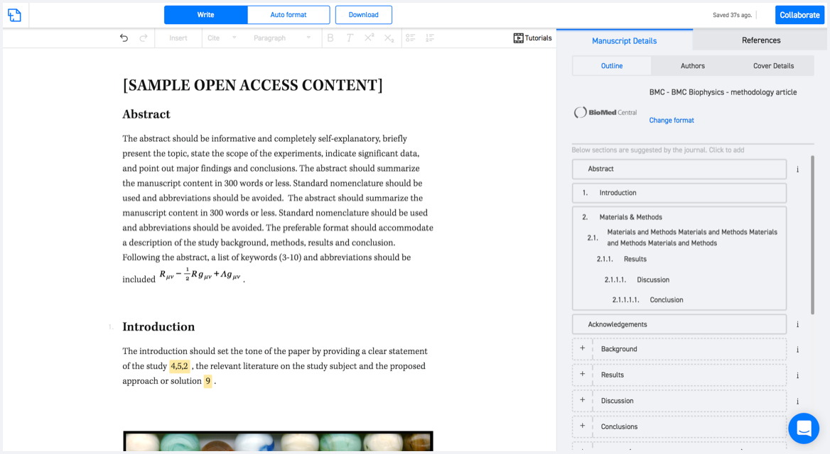
Available only on desktops 🖥

No word template required

Typset automatically formats your research paper to International Journal of Health Geographics formatting guidelines and citation style.
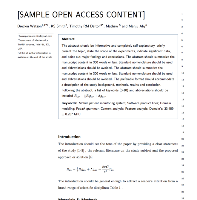
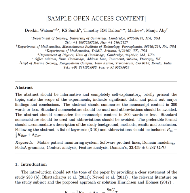
Verifed journal formats

One editor, 100K journal formats.
With the largest collection of verified journal formats, what you need is already there.

Trusted by academicians

I spent hours with MS word for reformatting. It was frustrating - plain and simple. With SciSpace, I can draft my manuscripts and once it is finished I can just submit. In case, I have to submit to another journal it is really just a button click instead of an afternoon of reformatting.

Andreas Frutiger
Researcher & Ex MS Word user
Use this template