Example of Journal of the Indian Society of Remote Sensing format
Recent searches

Example of Journal of the Indian Society of Remote Sensing format Example of Journal of the Indian Society of Remote Sensing format Example of Journal of the Indian Society of Remote Sensing format Example of Journal of the Indian Society of Remote Sensing format Example of Journal of the Indian Society of Remote Sensing format Example of Journal of the Indian Society of Remote Sensing format Example of Journal of the Indian Society of Remote Sensing format Example of Journal of the Indian Society of Remote Sensing format Example of Journal of the Indian Society of Remote Sensing format Example of Journal of the Indian Society of Remote Sensing format Example of Journal of the Indian Society of Remote Sensing format Example of Journal of the Indian Society of Remote Sensing format Example of Journal of the Indian Society of Remote Sensing format Example of Journal of the Indian Society of Remote Sensing format Example of Journal of the Indian Society of Remote Sensing format Example of Journal of the Indian Society of Remote Sensing format Example of Journal of the Indian Society of Remote Sensing format Example of Journal of the Indian Society of Remote Sensing format
Sample paper formatted on SciSpace - SciSpace
This content is only for preview purposes. The original open access content can be found here.
Look Inside
Example of Journal of the Indian Society of Remote Sensing format Example of Journal of the Indian Society of Remote Sensing format Example of Journal of the Indian Society of Remote Sensing format Example of Journal of the Indian Society of Remote Sensing format Example of Journal of the Indian Society of Remote Sensing format Example of Journal of the Indian Society of Remote Sensing format Example of Journal of the Indian Society of Remote Sensing format Example of Journal of the Indian Society of Remote Sensing format Example of Journal of the Indian Society of Remote Sensing format Example of Journal of the Indian Society of Remote Sensing format Example of Journal of the Indian Society of Remote Sensing format Example of Journal of the Indian Society of Remote Sensing format Example of Journal of the Indian Society of Remote Sensing format Example of Journal of the Indian Society of Remote Sensing format Example of Journal of the Indian Society of Remote Sensing format Example of Journal of the Indian Society of Remote Sensing format Example of Journal of the Indian Society of Remote Sensing format Example of Journal of the Indian Society of Remote Sensing format
Sample paper formatted on SciSpace - SciSpace
This content is only for preview purposes. The original open access content can be found here.
open access Open Access

Journal of the Indian Society of Remote Sensing — Template for authors

Publisher: Springer
Categories Rank Trend in last 3 yrs
Geography, Planning and Development #250 of 704 up up by 3 ranks
Earth and Planetary Sciences (miscellaneous) #58 of 106 down down by 2 ranks
journal-quality-icon Journal quality:
Good
calendar-icon Last 4 years overview: 610 Published Papers | 1353 Citations
indexed-in-icon Indexed in: Scopus
last-updated-icon Last updated: 17/04/2023
Related journals
Insights
General info
Top papers
Popular templates
Get started guide
Why choose from SciSpace
FAQ

Related Journals

open access Open Access
recommended Recommended

Taylor and Francis

Quality:  
High
CiteRatio: 4.1
SJR: 0.888
SNIP: 1.46
open access Open Access

Multidisciplinary Digital Publishing Institute

Quality:  
High
CiteRatio: 4.6
SJR: 0.684
SNIP: 1.333
open access Open Access
recommended Recommended

Wiley

Quality:  
High
CiteRatio: 6.4
SJR: 1.294
SNIP: 1.449
open access Open Access

Taylor and Francis

Quality:  
Good
CiteRatio: 3.0
SJR: 0.468
SNIP: 0.945

Journal Performance & Insights

Impact Factor

CiteRatio

Determines the importance of a journal by taking a measure of frequency with which the average article in a journal has been cited in a particular year.

A measure of average citations received per peer-reviewed paper published in the journal.

0.997

15% from 2018

Impact factor for Journal of the Indian Society of Remote Sensing from 2016 - 2019
Year Value
2019 0.997
2018 0.869
2017 0.81
2016 0.725
graph view Graph view
table view Table view

2.2

38% from 2019

CiteRatio for Journal of the Indian Society of Remote Sensing from 2016 - 2020
Year Value
2020 2.2
2019 1.6
2018 1.4
2017 1.6
2016 1.6
graph view Graph view
table view Table view

insights Insights

  • Impact factor of this journal has increased by 15% in last year.
  • This journal’s impact factor is in the top 10 percentile category.

insights Insights

  • CiteRatio of this journal has increased by 38% in last years.
  • This journal’s CiteRatio is in the top 10 percentile category.

SCImago Journal Rank (SJR)

Source Normalized Impact per Paper (SNIP)

Measures weighted citations received by the journal. Citation weighting depends on the categories and prestige of the citing journal.

Measures actual citations received relative to citations expected for the journal's category.

0.371

9% from 2019

SJR for Journal of the Indian Society of Remote Sensing from 2016 - 2020
Year Value
2020 0.371
2019 0.339
2018 0.311
2017 0.337
2016 0.33
graph view Graph view
table view Table view

0.713

9% from 2019

SNIP for Journal of the Indian Society of Remote Sensing from 2016 - 2020
Year Value
2020 0.713
2019 0.652
2018 0.77
2017 0.754
2016 0.718
graph view Graph view
table view Table view

insights Insights

  • SJR of this journal has increased by 9% in last years.
  • This journal’s SJR is in the top 10 percentile category.

insights Insights

  • SNIP of this journal has increased by 9% in last years.
  • This journal’s SNIP is in the top 10 percentile category.

Journal of the Indian Society of Remote Sensing

Guideline source: View

All company, product and service names used in this website are for identification purposes only. All product names, trademarks and registered trademarks are property of their respective owners.

Use of these names, trademarks and brands does not imply endorsement or affiliation. Disclaimer Notice

Springer

Journal of the Indian Society of Remote Sensing

The aims and scope of the Journal of the Indian Society of Remote Sensing areto help towards advancement, dissemination and application of the knowledge of Remote Sensing technology, which is deemed to include photo interpretation, photogrammetry, aerial photography, image pro...... Read More

Geography, Planning and Development

Earth and Planetary Sciences (miscellaneous)

Social Sciences

i
Last updated on
17 Apr 2023
i
ISSN
0255-660X
i
Impact Factor
Medium - 0.574
i
Open Access
No
i
Sherpa RoMEO Archiving Policy
Green faq
i
Plagiarism Check
Available via Turnitin
i
Endnote Style
Download Available
i
Bibliography Name
SPBASIC
i
Citation Type
Author Year
(Blonder et al, 1982)
i
Bibliography Example
Beenakker CWJ (2006) Specular andreev reflection in graphene. Phys Rev Lett 97(6):067,007, URL 10.1103/PhysRevLett.97.067007

Top papers written in this journal

Journal Article DOI: 10.1007/S12524-010-0020-Z
Landslide susceptibility mapping of a catchment area using frequency ratio, fuzzy logic and multivariate logistic regression approaches
Biswajeet Pradhan1

Abstract:

Geospatial database creation for landslide susceptibility mapping is often an almost inhibitive activity. This has been the reason that for quite some time landslide susceptibility analysis was modelled on the basis of spatially related factors. This paper presents the use of frequency ratio, fuzzy logic and multivariate regr... Geospatial database creation for landslide susceptibility mapping is often an almost inhibitive activity. This has been the reason that for quite some time landslide susceptibility analysis was modelled on the basis of spatially related factors. This paper presents the use of frequency ratio, fuzzy logic and multivariate regression models for landslide susceptibility mapping on Cameron catchment area, Malaysia, using a Geographic Information System (GIS) and remote sensing data. Landslide locations were identified in the study area from the interpretation of aerial photographs, high resolution satellite images, inventory reports and field surveys. Topographical, geological data and satellite images were collected, processed, and constructed into a spatial database using GIS and image processing tools. There were nine factors considered for landslide susceptibility mapping and the frequency ratio coefficient for each factor was computed. The factors chosen that influence landslide occurrence were: topographic slope, topographic aspect, topographic curvature and distance from drainage, all from the topographic database; lithology and distance from lineament, taken from the geologic database; land cover from TM satellite image; the vegetation index value from Landsat satellite images; and precipitation distribution from meteorological data. Using these factors the fuzzy membership values were calculated. Then fuzzy operators were applied to the fuzzy membership values for landslide susceptibility mapping. Further, multivariate logistic regression model was applied for the landslide susceptibility. Finally, the results of the analyses were verified using the landslide location data and compared with the frequency ratio, fuzzy logic and multivariate logistic regression models. The validation results showed that the frequency ratio model (accuracy is 89%) is better in prediction than fuzzy logic (accuracy is 84%) and logistic regression (accuracy is 85%) models. Results show that, among the fuzzy operators, in the case with “gamma” operator (λ = 0.9) showed the best accuracy (84%) while the case with “or” operator showed the worst accuracy (69%). read more read less

Topics:

Landslide (58%)58% related to the paper, Fuzzy logic (53%)53% related to the paper, Multivariate statistics (52%)52% related to the paper
304 Citations
Journal Article DOI: 10.1007/BF03007341
Morphometric analysis using remote sensing techniques in the chaka sub-basin, purulia district, West Bengal
S. K. Nag1

Abstract:

Remote sensing techniques using satellite imagery have proved to be an indispensible tool in morphometric analysis and groundwater studies. In the present area, morphometric analysis using temote sensing techniques have been carried out in Chaka river sub-basin of Manbazar Block, Purulia district, West-Bengal, which is one of... Remote sensing techniques using satellite imagery have proved to be an indispensible tool in morphometric analysis and groundwater studies. In the present area, morphometric analysis using temote sensing techniques have been carried out in Chaka river sub-basin of Manbazar Block, Purulia district, West-Bengal, which is one of the most drought affected area in West-Bengal. The parameters worked out include Bifurcation ratio (Rb), Stream length (Lu). Form factor (Rf), Circulatory ratio (Rc), and Drainage density. The morphometric analysis suggests that the area is covered by fractured, resistant, permeable rocks, the drainage network not so affected by tectonic disturbances. read more read less

Topics:

Drainage density (55%)55% related to the paper
299 Citations
Journal Article DOI: 10.1007/BF02989988
Check dam positioning by prioritization of micro-watersheds using SYI model and morphometric analysis — Remote sensing and GIS perspective
K. Nooka Ratnam1, Y. K. Srivastava2, V. Venkateswara Rao1, E. Amminedu1, K. S. R. Murthy1

Abstract:

Sediment Yield Index (SYI) model and results of morphometric analysis have been used to prioritize watersheds and to locate sites for checkdam positioning in Tarafeni watershed in Midnapur district. West Bengal. Various thematic maps such as land use/land cover, slope, drainage, soil etc. were prepared from 1RS ID LISS III di... Sediment Yield Index (SYI) model and results of morphometric analysis have been used to prioritize watersheds and to locate sites for checkdam positioning in Tarafeni watershed in Midnapur district. West Bengal. Various thematic maps such as land use/land cover, slope, drainage, soil etc. were prepared from 1RS ID LISS III digital data, SOI toposheets of 1:50,000 scale and other reference maps. Morphometric parameters such as bifurcation ratio (Rb). drainage density (Dd), texture ratio (T), length of overland flow (Lo), stream frequency (Fu), compactness coefficient (Cc), circularity ratio (Rc), elongation ratio (Er), shape factor (Bs) and form factor (Rf) were computed. Automated demarcation of prioritization of micro-watersheds was done by using GIS overlaying technique by assigning weight factors to all the identified features in each thematic map and ranks were assigned to the morphometric parameters. Five categories of priority viz., very high, high, medium, low and very low, were given to all the watersheds in both the methods. Sixty-two micro-watersheds using SYI method and twenty-three micro-watersheds using morphometric have been prioritized as very high priority. Final priority map was prepared by considering the commonly occurred very high-prioritized micro-watersheds in both SYI model and morphometric analysis. Twenty-four suitable sites were identified for check dam construction in 21 highly prioritized watersheds. It is proved that integrated study of SYI model and morphometric analysis yield good result in prioritization of watersheds. read more read less

Topics:

Drainage density (50%)50% related to the paper
279 Citations
Journal Article DOI: 10.1007/BF02991569
Prioritisation of subwatersheds based on morphometric analysis of drainage basin: a remote sensing and gis approach
Sujata Biswas1, S. Sudhakar1, V. R. Desai1

Abstract:

Remote Sensing and Geographic Information System (GIS) techniques are being effectively used in recent times as tools in determining the quantitative description of basin geometry i.e., morphometric analysis. In the present study, each of the nine subwatersheds of the major part of Nayagram Block in the Midnapore District, We... Remote Sensing and Geographic Information System (GIS) techniques are being effectively used in recent times as tools in determining the quantitative description of basin geometry i.e., morphometric analysis. In the present study, each of the nine subwatersheds of the major part of Nayagram Block in the Midnapore District, West Bengal have been studied in terms of the morphometric parameters - stream length, bifurcation ratio, drainage density stream frequency, texture ratio, form factor, circularity ratio and elongation ratio and prioritised all the subwatersheds under study. The results suggest that the ratio between cumulative stream length and stream order is constant throughout the successive orders of a basin. The morphometric parametersbifurcation ratio and drainage density, confirm that the area is under dense vegetation cover and virtually the drainage has not been affected by structural disturbances. The form factor values indicate that the basin has moderately high and short duration peak flows. It was observed from the prioritisation of subwatersheds, the subwatershed 8 has got the highest priority because of high erosion intensity considering the above mentioned morphometric parameters. The subwatersheds have been analysed through Sediment Yield Index (SYI) model also and the results tally in most of the cases with the present approach. The subwatershed 8 is coming under priority—I by SYI model also, which indicates that the morphometric analysis could be used for prioritisation of subwatersheds even without the availability of reliable soil maps of the area under study. read more read less

Topics:

Drainage density (60%)60% related to the paper, Drainage basin (51%)51% related to the paper
264 Citations
Journal Article DOI: 10.1007/BF03030860
Morphometric analysis of sub-watersheds in the pavagada area of Tumkur district, South India using remote sensing and gis techniques
S. Srinivasa Vittala, S. Govindaiah1, H. Honne Gowda

Abstract:

The study area covers 570 km2 comprising of 9 sub-watersheds (Dalavayihalli, Maddalenahalli, Talamaradahalli, Puluvalli tank, Nagalamadike, Gowdatimmanahalli, Naliganahalli, Devadabetta and Byadanur) range from 49 to 75 km2 forming part of Pennar river basin around Pavagada. The drainage network of 9 sub-watersheds was deline... The study area covers 570 km2 comprising of 9 sub-watersheds (Dalavayihalli, Maddalenahalli, Talamaradahalli, Puluvalli tank, Nagalamadike, Gowdatimmanahalli, Naliganahalli, Devadabetta and Byadanur) range from 49 to 75 km2 forming part of Pennar river basin around Pavagada. The drainage network of 9 sub-watersheds was delineated using remote sensing data - Geocoded FCC of bands - 2 3 4 of IRS 1 C and 1 D (LISS III+PAN merged) on 1:50,000 scale and SOI topomaps were used as reference. The morphometric analysis of 9 sub-watersheds has been carried out using GIS softwares - Arclnfo and Are View. The drainage network shows that the terrain exhibits dendritic to sub-dendritic drainage pattern. Stream orders ranges from fourth to fifth order. Drainage density varies between 1.55 and 2.16 km/ km2 and has very coarse to coarse drainage texture. The relief ratio range from 0.006 to 0.021. The mean bifurcation ratio varies from 3.21 to 4.88 and falls under normal basin category. The elongation ratio shows that Devedabetta sub-watershed possesses circular shape while remaining sub-watersheds mark elongated pattern. Hence from the study it can be concluded that remote sensing techniques proved to be a competent tool in morphometric analysis. read more read less

Topics:

Drainage density (63%)63% related to the paper, Drainage basin (53%)53% related to the paper, Relief ratio (51%)51% related to the paper, Drainage (51%)51% related to the paper
229 Citations
Author Pic

SciSpace is a very innovative solution to the formatting problem and existing providers, such as Mendeley or Word did not really evolve in recent years.

- Andreas Frutiger, Researcher, ETH Zurich, Institute for Biomedical Engineering

Get MS-Word and LaTeX output to any Journal within seconds
1
Choose a template
Select a template from a library of 40,000+ templates
2
Import a MS-Word file or start fresh
It takes only few seconds to import
3
View and edit your final output
SciSpace will automatically format your output to meet journal guidelines
4
Submit directly or Download
Submit to journal directly or Download in PDF, MS Word or LaTeX

(Before submission check for plagiarism via Turnitin)

clock Less than 3 minutes

What to expect from SciSpace?

Speed and accuracy over MS Word

''

With SciSpace, you do not need a word template for Journal of the Indian Society of Remote Sensing.

It automatically formats your research paper to Springer formatting guidelines and citation style.

You can download a submission ready research paper in pdf, LaTeX and docx formats.

Time comparison

Time taken to format a paper and Compliance with guidelines

Plagiarism Reports via Turnitin

SciSpace has partnered with Turnitin, the leading provider of Plagiarism Check software.

Using this service, researchers can compare submissions against more than 170 million scholarly articles, a database of 70+ billion current and archived web pages. How Turnitin Integration works?


Turnitin Stats
Publisher Logos

Freedom from formatting guidelines

One editor, 100K journal formats – world's largest collection of journal templates

With such a huge verified library, what you need is already there.

publisher-logos

Easy support from all your favorite tools

Journal of the Indian Society of Remote Sensing format uses SPBASIC citation style.

Automatically format and order your citations and bibliography in a click.

SciSpace allows imports from all reference managers like Mendeley, Zotero, Endnote, Google Scholar etc.

Frequently asked questions

1. Can I write Journal of the Indian Society of Remote Sensing in LaTeX?

Absolutely not! Our tool has been designed to help you focus on writing. You can write your entire paper as per the Journal of the Indian Society of Remote Sensing guidelines and auto format it.

2. Do you follow the Journal of the Indian Society of Remote Sensing guidelines?

Yes, the template is compliant with the Journal of the Indian Society of Remote Sensing guidelines. Our experts at SciSpace ensure that. If there are any changes to the journal's guidelines, we'll change our algorithm accordingly.

3. Can I cite my article in multiple styles in Journal of the Indian Society of Remote Sensing?

Of course! We support all the top citation styles, such as APA style, MLA style, Vancouver style, Harvard style, and Chicago style. For example, when you write your paper and hit autoformat, our system will automatically update your article as per the Journal of the Indian Society of Remote Sensing citation style.

4. Can I use the Journal of the Indian Society of Remote Sensing templates for free?

Sign up for our free trial, and you'll be able to use all our features for seven days. You'll see how helpful they are and how inexpensive they are compared to other options, Especially for Journal of the Indian Society of Remote Sensing.

5. Can I use a manuscript in Journal of the Indian Society of Remote Sensing that I have written in MS Word?

Yes. You can choose the right template, copy-paste the contents from the word document, and click on auto-format. Once you're done, you'll have a publish-ready paper Journal of the Indian Society of Remote Sensing that you can download at the end.

6. How long does it usually take you to format my papers in Journal of the Indian Society of Remote Sensing?

It only takes a matter of seconds to edit your manuscript. Besides that, our intuitive editor saves you from writing and formatting it in Journal of the Indian Society of Remote Sensing.

7. Where can I find the template for the Journal of the Indian Society of Remote Sensing?

It is possible to find the Word template for any journal on Google. However, why use a template when you can write your entire manuscript on SciSpace , auto format it as per Journal of the Indian Society of Remote Sensing's guidelines and download the same in Word, PDF and LaTeX formats? Give us a try!.

8. Can I reformat my paper to fit the Journal of the Indian Society of Remote Sensing's guidelines?

Of course! You can do this using our intuitive editor. It's very easy. If you need help, our support team is always ready to assist you.

9. Journal of the Indian Society of Remote Sensing an online tool or is there a desktop version?

SciSpace's Journal of the Indian Society of Remote Sensing is currently available as an online tool. We're developing a desktop version, too. You can request (or upvote) any features that you think would be helpful for you and other researchers in the "feature request" section of your account once you've signed up with us.

10. I cannot find my template in your gallery. Can you create it for me like Journal of the Indian Society of Remote Sensing?

Sure. You can request any template and we'll have it setup within a few days. You can find the request box in Journal Gallery on the right side bar under the heading, "Couldn't find the format you were looking for like Journal of the Indian Society of Remote Sensing?”

11. What is the output that I would get after using Journal of the Indian Society of Remote Sensing?

After writing your paper autoformatting in Journal of the Indian Society of Remote Sensing, you can download it in multiple formats, viz., PDF, Docx, and LaTeX.

12. Is Journal of the Indian Society of Remote Sensing's impact factor high enough that I should try publishing my article there?

To be honest, the answer is no. The impact factor is one of the many elements that determine the quality of a journal. Few of these factors include review board, rejection rates, frequency of inclusion in indexes, and Eigenfactor. You need to assess all these factors before you make your final call.

13. What is Sherpa RoMEO Archiving Policy for Journal of the Indian Society of Remote Sensing?

SHERPA/RoMEO Database

We extracted this data from Sherpa Romeo to help researchers understand the access level of this journal in accordance with the Sherpa Romeo Archiving Policy for Journal of the Indian Society of Remote Sensing. The table below indicates the level of access a journal has as per Sherpa Romeo's archiving policy.

RoMEO Colour Archiving policy
Green Can archive pre-print and post-print or publisher's version/PDF
Blue Can archive post-print (ie final draft post-refereeing) or publisher's version/PDF
Yellow Can archive pre-print (ie pre-refereeing)
White Archiving not formally supported
FYI:
  1. Pre-prints as being the version of the paper before peer review and
  2. Post-prints as being the version of the paper after peer-review, with revisions having been made.

14. What are the most common citation types In Journal of the Indian Society of Remote Sensing?

The 5 most common citation types in order of usage for Journal of the Indian Society of Remote Sensing are:.

S. No. Citation Style Type
1. Author Year
2. Numbered
3. Numbered (Superscripted)
4. Author Year (Cited Pages)
5. Footnote

15. How do I submit my article to the Journal of the Indian Society of Remote Sensing?

It is possible to find the Word template for any journal on Google. However, why use a template when you can write your entire manuscript on SciSpace , auto format it as per Journal of the Indian Society of Remote Sensing's guidelines and download the same in Word, PDF and LaTeX formats? Give us a try!.

16. Can I download Journal of the Indian Society of Remote Sensing in Endnote format?

Yes, SciSpace provides this functionality. After signing up, you would need to import your existing references from Word or Bib file to SciSpace. Then SciSpace would allow you to download your references in Journal of the Indian Society of Remote Sensing Endnote style according to Elsevier guidelines.

Fast and reliable,
built for complaince.

Instant formatting to 100% publisher guidelines on - SciSpace.
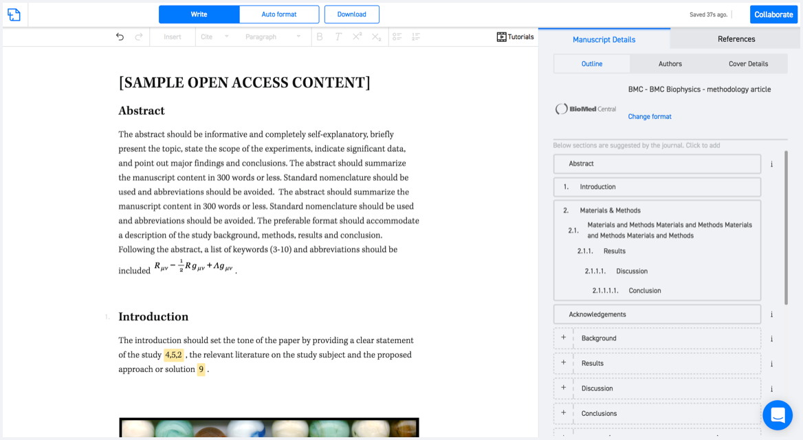
Available only on desktops 🖥

No word template required

Typset automatically formats your research paper to Journal of the Indian Society of Remote Sensing formatting guidelines and citation style.
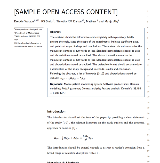

Verifed journal formats

One editor, 100K journal formats.
With the largest collection of verified journal formats, what you need is already there.

Trusted by academicians

I spent hours with MS word for reformatting. It was frustrating - plain and simple. With SciSpace, I can draft my manuscripts and once it is finished I can just submit. In case, I have to submit to another journal it is really just a button click instead of an afternoon of reformatting.

Andreas Frutiger
Researcher & Ex MS Word user
Use this template