Example of Geomatics, Natural Hazards and Risk format
Recent searches

Example of Geomatics, Natural Hazards and Risk format Example of Geomatics, Natural Hazards and Risk format Example of Geomatics, Natural Hazards and Risk format Example of Geomatics, Natural Hazards and Risk format Example of Geomatics, Natural Hazards and Risk format Example of Geomatics, Natural Hazards and Risk format Example of Geomatics, Natural Hazards and Risk format Example of Geomatics, Natural Hazards and Risk format Example of Geomatics, Natural Hazards and Risk format Example of Geomatics, Natural Hazards and Risk format Example of Geomatics, Natural Hazards and Risk format Example of Geomatics, Natural Hazards and Risk format Example of Geomatics, Natural Hazards and Risk format Example of Geomatics, Natural Hazards and Risk format Example of Geomatics, Natural Hazards and Risk format Example of Geomatics, Natural Hazards and Risk format Example of Geomatics, Natural Hazards and Risk format Example of Geomatics, Natural Hazards and Risk format Example of Geomatics, Natural Hazards and Risk format Example of Geomatics, Natural Hazards and Risk format Example of Geomatics, Natural Hazards and Risk format Example of Geomatics, Natural Hazards and Risk format
Sample paper formatted on SciSpace - SciSpace
This content is only for preview purposes. The original open access content can be found here.
Look Inside
Example of Geomatics, Natural Hazards and Risk format Example of Geomatics, Natural Hazards and Risk format Example of Geomatics, Natural Hazards and Risk format Example of Geomatics, Natural Hazards and Risk format Example of Geomatics, Natural Hazards and Risk format Example of Geomatics, Natural Hazards and Risk format Example of Geomatics, Natural Hazards and Risk format Example of Geomatics, Natural Hazards and Risk format Example of Geomatics, Natural Hazards and Risk format Example of Geomatics, Natural Hazards and Risk format Example of Geomatics, Natural Hazards and Risk format Example of Geomatics, Natural Hazards and Risk format Example of Geomatics, Natural Hazards and Risk format Example of Geomatics, Natural Hazards and Risk format Example of Geomatics, Natural Hazards and Risk format Example of Geomatics, Natural Hazards and Risk format Example of Geomatics, Natural Hazards and Risk format Example of Geomatics, Natural Hazards and Risk format Example of Geomatics, Natural Hazards and Risk format Example of Geomatics, Natural Hazards and Risk format Example of Geomatics, Natural Hazards and Risk format Example of Geomatics, Natural Hazards and Risk format
Sample paper formatted on SciSpace - SciSpace
This content is only for preview purposes. The original open access content can be found here.
open access Open Access

Geomatics, Natural Hazards and Risk — Template for authors

Publisher: Taylor and Francis
Categories Rank Trend in last 3 yrs
Earth and Planetary Sciences (all) #20 of 186 up up by 38 ranks
Environmental Science (all) #33 of 220 up up by 43 ranks
journal-quality-icon Journal quality:
High
calendar-icon Last 4 years overview: 432 Published Papers | 2674 Citations
indexed-in-icon Indexed in: Scopus
last-updated-icon Last updated: 01/06/2020
Related journals
Insights
General info
Top papers
Popular templates
Get started guide
Why choose from SciSpace
FAQ

Related Journals

open access Open Access

Cambridge University Press

Quality:  
High
CiteRatio: 3.9
SJR: 0.574
SNIP: 0.957
open access Open Access

Springer

Quality:  
High
CiteRatio: 2.8
SJR: 0.371
SNIP: 0.625
open access Open Access

Springer

Quality:  
Good
CiteRatio: 2.1
SJR: 0.415
SNIP: 0.842
open access Open Access

Springer

Quality:  
Good
CiteRatio: 3.2
SJR: 0.468
SNIP: 1.089

Journal Performance & Insights

Impact Factor

CiteRatio

Determines the importance of a journal by taking a measure of frequency with which the average article in a journal has been cited in a particular year.

A measure of average citations received per peer-reviewed paper published in the journal.

3.333

43% from 2018

Impact factor for Geomatics, Natural Hazards and Risk from 2016 - 2019
Year Value
2019 3.333
2018 2.332
2017 1.713
2016 1.71
graph view Graph view
table view Table view

6.2

19% from 2019

CiteRatio for Geomatics, Natural Hazards and Risk from 2016 - 2020
Year Value
2020 6.2
2019 5.2
2018 3.8
2017 2.3
2016 2.1
graph view Graph view
table view Table view

insights Insights

  • Impact factor of this journal has increased by 43% in last year.
  • This journal’s impact factor is in the top 10 percentile category.

insights Insights

  • CiteRatio of this journal has increased by 19% in last years.
  • This journal’s CiteRatio is in the top 10 percentile category.

SCImago Journal Rank (SJR)

Source Normalized Impact per Paper (SNIP)

Measures weighted citations received by the journal. Citation weighting depends on the categories and prestige of the citing journal.

Measures actual citations received relative to citations expected for the journal's category.

0.899

10% from 2019

SJR for Geomatics, Natural Hazards and Risk from 2016 - 2020
Year Value
2020 0.899
2019 0.814
2018 0.651
2017 0.426
2016 0.399
graph view Graph view
table view Table view

1.595

5% from 2019

SNIP for Geomatics, Natural Hazards and Risk from 2016 - 2020
Year Value
2020 1.595
2019 1.518
2018 1.255
2017 0.919
2016 1.403
graph view Graph view
table view Table view

insights Insights

  • SJR of this journal has increased by 10% in last years.
  • This journal’s SJR is in the top 10 percentile category.

insights Insights

  • SNIP of this journal has increased by 5% in last years.
  • This journal’s SNIP is in the top 10 percentile category.
Geomatics, Natural Hazards and Risk

Guideline source: View

All company, product and service names used in this website are for identification purposes only. All product names, trademarks and registered trademarks are property of their respective owners.

Use of these names, trademarks and brands does not imply endorsement or affiliation. Disclaimer Notice

Taylor and Francis

Geomatics, Natural Hazards and Risk

Geomatics, Natural Hazards and Risk publishes papers that deal with new concepts, approaches and case studies using geospatial (GIS and GPS) and remote sensing techniques to study monitoring, mapping, risk management and mitigation, risk vulnerability and early warning of nat...... Read More

Earth and Planetary Sciences

i
Last updated on
01 Jun 2020
i
ISSN
1947-5705
i
Acceptance Rate
Not provided
i
Frequency
Not provided
i
Open Access
No
i
Sherpa RoMEO Archiving Policy
Green faq
i
Plagiarism Check
Available via Turnitin
i
Endnote Style
Download Available
i
Bibliography Name
Taylor and Francis Custom Citation
i
Citation Type
Author Year
(Blonder et al., 1982)
i
Bibliography Example
Blonder, G. E., Tinkham, M., and Klapwijk, T. M. 1982. Transition from metallic to tunneling regimes in superconducting microconstrictions: Excess current, charge imbalance, and supercurrent conversion. Phys Rev B., 25(7):4515–4532.

Top papers written in this journal

open accessOpen access Journal Article DOI: 10.1080/19475705.2017.1407368
Assessment of the effects of training data selection on the landslide susceptibility mapping: a comparison between support vector machine (SVM), logistic regression (LR) and artificial neural networks (ANN)
Bahareh Kalantar1, Biswajeet Pradhan2, Seyed Amir Naghibi3, Alireza Motevalli3, Shattri Mansor1

Abstract:

Landslide is a natural hazard that results in many economic damages and human losses every year. Numerous researchers have studied landslide susceptibility mapping (LSM), each attempting to improve the accuracy of the final outputs. However, few studies have been published on the training data selection effects on the LSM. Th... Landslide is a natural hazard that results in many economic damages and human losses every year. Numerous researchers have studied landslide susceptibility mapping (LSM), each attempting to improve the accuracy of the final outputs. However, few studies have been published on the training data selection effects on the LSM. Thus, this study assesses the training landslides random selection effects on support vector machine (SVM) accuracy, logistic regression (LR) and artificial neural networks (ANN) models for LSM in a catchment at the Dodangeh watershed, Mazandaran province, Iran. A 160 landslide locations inventory was collected by Geological Survey of Iran for this investigation. Different methods were implemented to define the landslide locations, such as inventory reports, satellite images and field survey. Moreover, 14 landslide conditioning factors were considered in the analysis of landslide susceptibility. These factors include curvature, plan curvature, profile curvature, altitude, slope ... read more read less

Topics:

Landslide (57%)57% related to the paper
View PDF
334 Citations
open accessOpen access Journal Article DOI: 10.1080/19475705.2015.1045043
Flood hazard zoning in Yasooj region, Iran, using GIS and multi-criteria decision analysis
Omid Rahmati1, Hossein Zeinivand1, Mosa Besharat1

Abstract:

Flood is considered to be the most common natural disaster worldwide during the last decades. Flood hazard potential mapping is required for management and mitigation of flood. The present research was aimed to assess the efficiency of analytical hierarchical process (AHP) to identify potential flood hazard zones by comparing... Flood is considered to be the most common natural disaster worldwide during the last decades. Flood hazard potential mapping is required for management and mitigation of flood. The present research was aimed to assess the efficiency of analytical hierarchical process (AHP) to identify potential flood hazard zones by comparing with the results of a hydraulic model. Initially, four parameters via distance to river, land use, elevation and land slope were used in some part of the Yasooj River, Iran. In order to determine the weight of each effective factor, questionnaires of comparison ratings on the Saaty's scale were prepared and distributed to eight experts. The normalized weights of criteria/parameters were determined based on Saaty's nine-point scale and its importance in specifying flood hazard potential zones using the AHP and eigenvector methods. The set of criteria were integrated by weighted linear combination method using ArcGIS 10.2 software to generate flood hazard prediction map. The inundation... read more read less

Topics:

Flood myth (57%)57% related to the paper
259 Citations
open accessOpen access Journal Article DOI: 10.1080/19475705.2016.1238852
Multipurpose UAV for search and rescue operations in mountain avalanche events
Mario Silvagni1, Andrea Tonoli1, Enrico Cesare Zenerino1, Marcello Chiaberge1

Abstract:

This paper presents a multipurpose UAV (unmanned aerial vehicle) for mountain rescue operations. The multi-rotors based flying platform and its embedded avionics are designed to meet environmental requirements for mountainous terrain such as low temperatures, high altitude and strong winds, assuring the capability of carrying... This paper presents a multipurpose UAV (unmanned aerial vehicle) for mountain rescue operations. The multi-rotors based flying platform and its embedded avionics are designed to meet environmental requirements for mountainous terrain such as low temperatures, high altitude and strong winds, assuring the capability of carrying different payloads (separately or together) such as: avalanche beacon (ARTVA) with automatic signal recognition and path following algorithms for the rapid location of snow-covered body; camera (visible and thermal) for search and rescue of missing persons on snow and in woods during the day or night; payload deployment to drop emergency kits or specific explosive cartridge for controlled avalanche detachment. The resulting small (less than 5 kg) UAV is capable of full autonomous flight (including take-off and landing) of a pre-programmed, or easily configurable, custom mission. Furthermore, the autopilot manages the sensors measurements (i.e. beacons or cameras) to update th... read more read less

Topics:

Search and rescue (57%)57% related to the paper, Mountain rescue (52%)52% related to the paper, Beacon (52%)52% related to the paper, Payload (51%)51% related to the paper
View PDF
251 Citations
open accessOpen access Journal Article DOI: 10.1080/19475705.2017.1294113
Ensemble machine-learning-based geospatial approach for flood risk assessment using multi-sensor remote-sensing data and GIS
Hossein Mojaddadi1, Biswajeet Pradhan1, Haleh Nampak1, Noordin Ahmad1, Abdul Halim Ghazali1

Abstract:

In this paper, an ensemble method, which demonstrated efficiency in GIS based flood modeling, was used to create flood probability indices for the Damansara River catchment in Malaysia. To estimate... In this paper, an ensemble method, which demonstrated efficiency in GIS based flood modeling, was used to create flood probability indices for the Damansara River catchment in Malaysia. To estimate... read more read less

Topics:

100-year flood (62%)62% related to the paper, Flood risk assessment (61%)61% related to the paper, Ensemble learning (56%)56% related to the paper, Flood myth (55%)55% related to the paper, Geospatial analysis (54%)54% related to the paper
View PDF
249 Citations
open accessOpen access Journal Article DOI: 10.1080/19475705.2017.1308971
Spatial prediction of flood susceptibility using random-forest and boosted-tree models in Seoul metropolitan city, Korea
Sunmin Lee1, Jeong-Cheol Kim1, Hyung-Sup Jung1, Moung Jin Lee, Saro Lee2

Abstract:

Since flood frequency increases with the impact of climate change, the damage that is emphasized on flood-risk maps is based on actual flooded area data; therefore, flood-susceptibility maps for the Seoul metropolitan area, for which random-forest and boosted-tree models are used in a geographic information system (GIS) envir... Since flood frequency increases with the impact of climate change, the damage that is emphasized on flood-risk maps is based on actual flooded area data; therefore, flood-susceptibility maps for the Seoul metropolitan area, for which random-forest and boosted-tree models are used in a geographic information system (GIS) environment, are created for this study. For the flood-susceptibility mapping, flooded-area, topography, geology, soil and land-use datasets were collected and entered into spatial datasets. From the spatial datasets, 12 factors were calculated and extracted as the input data for the models. The flooded area of 2010 was used to train the model, and the flooded area of 2011 was used for the validation. The importance of the factors of the flood-susceptibility maps was calculated and lastly, the maps were validated. As a result, the distance from the river, geology and digital elevation model showed a high importance among the factors. The random-forest model showed validation accura... read more read less

Topics:

Geographic information system (54%)54% related to the paper
View PDF
212 Citations
Author Pic

SciSpace is a very innovative solution to the formatting problem and existing providers, such as Mendeley or Word did not really evolve in recent years.

- Andreas Frutiger, Researcher, ETH Zurich, Institute for Biomedical Engineering

Get MS-Word and LaTeX output to any Journal within seconds
1
Choose a template
Select a template from a library of 40,000+ templates
2
Import a MS-Word file or start fresh
It takes only few seconds to import
3
View and edit your final output
SciSpace will automatically format your output to meet journal guidelines
4
Submit directly or Download
Submit to journal directly or Download in PDF, MS Word or LaTeX

(Before submission check for plagiarism via Turnitin)

clock Less than 3 minutes

What to expect from SciSpace?

Speed and accuracy over MS Word

''

With SciSpace, you do not need a word template for Geomatics, Natural Hazards and Risk.

It automatically formats your research paper to Taylor and Francis formatting guidelines and citation style.

You can download a submission ready research paper in pdf, LaTeX and docx formats.

Time comparison

Time taken to format a paper and Compliance with guidelines

Plagiarism Reports via Turnitin

SciSpace has partnered with Turnitin, the leading provider of Plagiarism Check software.

Using this service, researchers can compare submissions against more than 170 million scholarly articles, a database of 70+ billion current and archived web pages. How Turnitin Integration works?

Turnitin Stats
Publisher Logos

Freedom from formatting guidelines

One editor, 100K journal formats – world's largest collection of journal templates

With such a huge verified library, what you need is already there.

publisher-logos

Easy support from all your favorite tools

Geomatics, Natural Hazards and Risk format uses Taylor and Francis Custom Citation citation style.

Automatically format and order your citations and bibliography in a click.

SciSpace allows imports from all reference managers like Mendeley, Zotero, Endnote, Google Scholar etc.

Frequently asked questions

1. Can I write Geomatics, Natural Hazards and Risk in LaTeX?

Absolutely not! Our tool has been designed to help you focus on writing. You can write your entire paper as per the Geomatics, Natural Hazards and Risk guidelines and auto format it.

2. Do you follow the Geomatics, Natural Hazards and Risk guidelines?

Yes, the template is compliant with the Geomatics, Natural Hazards and Risk guidelines. Our experts at SciSpace ensure that. If there are any changes to the journal's guidelines, we'll change our algorithm accordingly.

3. Can I cite my article in multiple styles in Geomatics, Natural Hazards and Risk?

Of course! We support all the top citation styles, such as APA style, MLA style, Vancouver style, Harvard style, and Chicago style. For example, when you write your paper and hit autoformat, our system will automatically update your article as per the Geomatics, Natural Hazards and Risk citation style.

4. Can I use the Geomatics, Natural Hazards and Risk templates for free?

Sign up for our free trial, and you'll be able to use all our features for seven days. You'll see how helpful they are and how inexpensive they are compared to other options, Especially for Geomatics, Natural Hazards and Risk.

5. Can I use a manuscript in Geomatics, Natural Hazards and Risk that I have written in MS Word?

Yes. You can choose the right template, copy-paste the contents from the word document, and click on auto-format. Once you're done, you'll have a publish-ready paper Geomatics, Natural Hazards and Risk that you can download at the end.

6. How long does it usually take you to format my papers in Geomatics, Natural Hazards and Risk?

It only takes a matter of seconds to edit your manuscript. Besides that, our intuitive editor saves you from writing and formatting it in Geomatics, Natural Hazards and Risk.

7. Where can I find the template for the Geomatics, Natural Hazards and Risk?

It is possible to find the Word template for any journal on Google. However, why use a template when you can write your entire manuscript on SciSpace , auto format it as per Geomatics, Natural Hazards and Risk's guidelines and download the same in Word, PDF and LaTeX formats? Give us a try!.

8. Can I reformat my paper to fit the Geomatics, Natural Hazards and Risk's guidelines?

Of course! You can do this using our intuitive editor. It's very easy. If you need help, our support team is always ready to assist you.

9. Geomatics, Natural Hazards and Risk an online tool or is there a desktop version?

SciSpace's Geomatics, Natural Hazards and Risk is currently available as an online tool. We're developing a desktop version, too. You can request (or upvote) any features that you think would be helpful for you and other researchers in the "feature request" section of your account once you've signed up with us.

10. I cannot find my template in your gallery. Can you create it for me like Geomatics, Natural Hazards and Risk?

Sure. You can request any template and we'll have it setup within a few days. You can find the request box in Journal Gallery on the right side bar under the heading, "Couldn't find the format you were looking for like Geomatics, Natural Hazards and Risk?”

11. What is the output that I would get after using Geomatics, Natural Hazards and Risk?

After writing your paper autoformatting in Geomatics, Natural Hazards and Risk, you can download it in multiple formats, viz., PDF, Docx, and LaTeX.

12. Is Geomatics, Natural Hazards and Risk's impact factor high enough that I should try publishing my article there?

To be honest, the answer is no. The impact factor is one of the many elements that determine the quality of a journal. Few of these factors include review board, rejection rates, frequency of inclusion in indexes, and Eigenfactor. You need to assess all these factors before you make your final call.

13. What is Sherpa RoMEO Archiving Policy for Geomatics, Natural Hazards and Risk?

SHERPA/RoMEO Database

We extracted this data from Sherpa Romeo to help researchers understand the access level of this journal in accordance with the Sherpa Romeo Archiving Policy for Geomatics, Natural Hazards and Risk. The table below indicates the level of access a journal has as per Sherpa Romeo's archiving policy.

RoMEO Colour Archiving policy
Green Can archive pre-print and post-print or publisher's version/PDF
Blue Can archive post-print (ie final draft post-refereeing) or publisher's version/PDF
Yellow Can archive pre-print (ie pre-refereeing)
White Archiving not formally supported
FYI:
  1. Pre-prints as being the version of the paper before peer review and
  2. Post-prints as being the version of the paper after peer-review, with revisions having been made.

14. What are the most common citation types In Geomatics, Natural Hazards and Risk?

The 5 most common citation types in order of usage for Geomatics, Natural Hazards and Risk are:.

S. No. Citation Style Type
1. Author Year
2. Numbered
3. Numbered (Superscripted)
4. Author Year (Cited Pages)
5. Footnote

15. How do I submit my article to the Geomatics, Natural Hazards and Risk?

It is possible to find the Word template for any journal on Google. However, why use a template when you can write your entire manuscript on SciSpace , auto format it as per Geomatics, Natural Hazards and Risk's guidelines and download the same in Word, PDF and LaTeX formats? Give us a try!.

16. Can I download Geomatics, Natural Hazards and Risk in Endnote format?

Yes, SciSpace provides this functionality. After signing up, you would need to import your existing references from Word or Bib file to SciSpace. Then SciSpace would allow you to download your references in Geomatics, Natural Hazards and Risk Endnote style according to Elsevier guidelines.

Fast and reliable,
built for complaince.

Instant formatting to 100% publisher guidelines on - SciSpace.
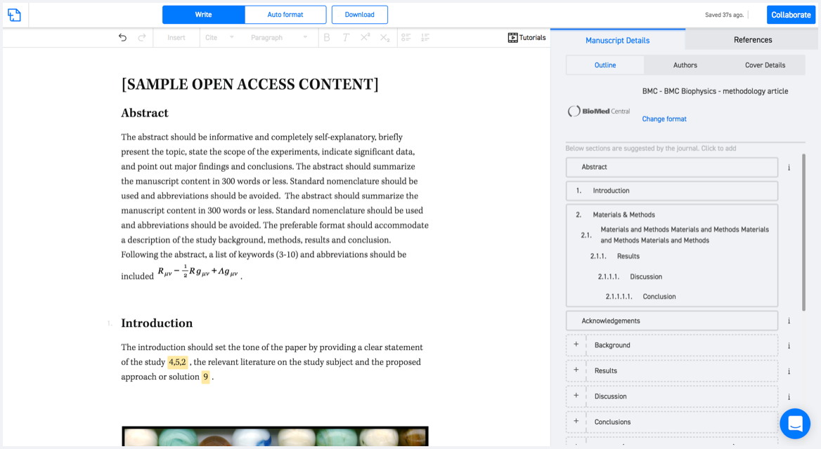
Available only on desktops 🖥

No word template required

Typset automatically formats your research paper to Geomatics, Natural Hazards and Risk formatting guidelines and citation style.
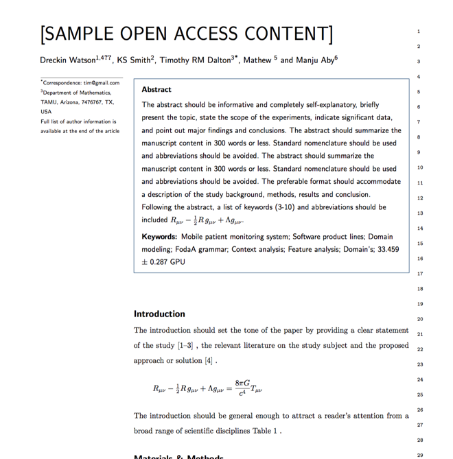

Verifed journal formats

One editor, 100K journal formats.
With the largest collection of verified journal formats, what you need is already there.

Trusted by academicians

I spent hours with MS word for reformatting. It was frustrating - plain and simple. With SciSpace, I can draft my manuscripts and once it is finished I can just submit. In case, I have to submit to another journal it is really just a button click instead of an afternoon of reformatting.

Andreas Frutiger
Researcher & Ex MS Word user
Use this template