Example of Earth Surface Processes and Landforms format
Recent searches

Example of Earth Surface Processes and Landforms format Example of Earth Surface Processes and Landforms format Example of Earth Surface Processes and Landforms format Example of Earth Surface Processes and Landforms format Example of Earth Surface Processes and Landforms format Example of Earth Surface Processes and Landforms format Example of Earth Surface Processes and Landforms format Example of Earth Surface Processes and Landforms format Example of Earth Surface Processes and Landforms format Example of Earth Surface Processes and Landforms format Example of Earth Surface Processes and Landforms format Example of Earth Surface Processes and Landforms format Example of Earth Surface Processes and Landforms format
Sample paper formatted on SciSpace - SciSpace
This content is only for preview purposes. The original open access content can be found here.
Look Inside
Example of Earth Surface Processes and Landforms format Example of Earth Surface Processes and Landforms format Example of Earth Surface Processes and Landforms format Example of Earth Surface Processes and Landforms format Example of Earth Surface Processes and Landforms format Example of Earth Surface Processes and Landforms format Example of Earth Surface Processes and Landforms format Example of Earth Surface Processes and Landforms format Example of Earth Surface Processes and Landforms format Example of Earth Surface Processes and Landforms format Example of Earth Surface Processes and Landforms format Example of Earth Surface Processes and Landforms format Example of Earth Surface Processes and Landforms format
Sample paper formatted on SciSpace - SciSpace
This content is only for preview purposes. The original open access content can be found here.
open access Open Access
recommended Recommended

Earth Surface Processes and Landforms — Template for authors

Publisher: Wiley
Categories Rank Trend in last 3 yrs
Geography, Planning and Development #39 of 704 down down by 22 ranks
Earth-Surface Processes #12 of 145 down down by 7 ranks
Earth and Planetary Sciences (miscellaneous) #11 of 106 down down by 7 ranks
journal-quality-icon Journal quality:
High
calendar-icon Last 4 years overview: 876 Published Papers | 5636 Citations
indexed-in-icon Indexed in: Scopus
last-updated-icon Last updated: 12/07/2020
Related journals
Insights
General info
Top papers
Popular templates
Get started guide
Why choose from SciSpace
FAQ

Related Journals

open access Open Access
recommended Recommended

Taylor and Francis

Quality:  
High
CiteRatio: 4.1
SJR: 0.888
SNIP: 1.46
open access Open Access

Springer

Quality:  
High
CiteRatio: 3.1
SJR: 0.551
SNIP: 0.866
open access Open Access

Multidisciplinary Digital Publishing Institute

Quality:  
High
CiteRatio: 4.6
SJR: 0.684
SNIP: 1.333
open access Open Access
recommended Recommended

Wiley

Quality:  
High
CiteRatio: 5.9
SJR: 2.177
SNIP: 2.511

Journal Performance & Insights

CiteRatio

SCImago Journal Rank (SJR)

Source Normalized Impact per Paper (SNIP)

A measure of average citations received per peer-reviewed paper published in the journal.

Measures weighted citations received by the journal. Citation weighting depends on the categories and prestige of the citing journal.

Measures actual citations received relative to citations expected for the journal's category.

6.4

7% from 2019

CiteRatio for Earth Surface Processes and Landforms from 2016 - 2020
Year Value
2020 6.4
2019 6.0
2018 6.3
2017 6.6
2016 6.2
graph view Graph view
table view Table view

1.294

0% from 2019

SJR for Earth Surface Processes and Landforms from 2016 - 2020
Year Value
2020 1.294
2019 1.3
2018 1.358
2017 1.493
2016 1.529
graph view Graph view
table view Table view

1.449

4% from 2019

SNIP for Earth Surface Processes and Landforms from 2016 - 2020
Year Value
2020 1.449
2019 1.39
2018 1.602
2017 1.383
2016 1.494
graph view Graph view
table view Table view

insights Insights

  • CiteRatio of this journal has increased by 7% in last years.
  • This journal’s CiteRatio is in the top 10 percentile category.

insights Insights

  • SJR of this journal has decreased by 0% in last years.
  • This journal’s SJR is in the top 10 percentile category.

insights Insights

  • SNIP of this journal has increased by 4% in last years.
  • This journal’s SNIP is in the top 10 percentile category.
Earth Surface Processes and Landforms

Guideline source: View

All company, product and service names used in this website are for identification purposes only. All product names, trademarks and registered trademarks are property of their respective owners.

Use of these names, trademarks and brands does not imply endorsement or affiliation. Disclaimer Notice

Wiley

Earth Surface Processes and Landforms

The Journal of the British Society for Geomorphology (BSG) , formerly the British Geomorphological Research Group (BGRG), is a professional organisation that promotes the field of geomorphology, encouraging interests in: earth surface process, and the erosion, deposition and f...... Read More

Geography, Planning and Development

Earth and Planetary Sciences (miscellaneous)

Earth-Surface Processes

Social Sciences

i
Last updated on
12 Jul 2020
i
ISSN
0197-9337
i
Impact Factor
High - 1.329
i
Open Access
Yes
i
Sherpa RoMEO Archiving Policy
Yellow faq
i
Plagiarism Check
Available via Turnitin
i
Endnote Style
Download Available
i
Bibliography Name
apa
i
Citation Type
Numbered
[25]
i
Bibliography Example
Beenakker, C.W.J. (2006) Specular andreev reflection in graphene.Phys. Rev. Lett., 97 (6), 067 007. URL 10.1103/PhysRevLett.97.067007.

Top papers written in this journal

open accessOpen access Journal Article DOI: 10.1002/ESP.261
GRADISTAT: a grain size distribution and statistics package for the analysis of unconsolidated sediments
Simon J. Blott1, Kenneth Pye1

Abstract:

Grain size analysis is an essential tool for classifying sedimentary environments. The calculation of statistics for many samples can, however, be a laborious process. A computer program called GRADISTAT has been written for the rapid analysis of grain size statistics from any of the standard measuring techniques, such as sie... Grain size analysis is an essential tool for classifying sedimentary environments. The calculation of statistics for many samples can, however, be a laborious process. A computer program called GRADISTAT has been written for the rapid analysis of grain size statistics from any of the standard measuring techniques, such as sieving and laser granulometry. Mean, mode, sorting, skewness and other statistics are calculated arithmetically and geometrically (in metric units) and logarithmically (in phi units) using moment and Folk and Ward graphical methods. Method comparison has allowed Folk and Ward descriptive terms to be assigned to moments statistics. Results indicate that Folk and Ward measures, expressed in metric units, appear to provide the most robust basis for routine comparisons of compositionally variable sediments. The program runs within the Microsoft Excel spreadsheet package and is extremely versatile, accepting standard and non-standard size data, and producing a range of graphical outputs including frequency and ternary plots. Copyright © 2001 John Wiley & Sons, Ltd. read more read less

Topics:

Skewness (52%)52% related to the paper, Range (statistics) (50%)50% related to the paper
View PDF
3,419 Citations
Journal Article DOI: 10.1002/ESP.3290120107
Quantitative analysis of land surface topography
Lyle W. Zevenbergen1, Colin R. Thorne2

Abstract:

Land surface topography significantly affects the processes of runoff and erosion. A system which determines slope, aspect, and curvature in both the down-slope and across-slope directions is developed for an altitude matrix. Also, the upslope drainage area and maximum drainage distance are determined for every point within t... Land surface topography significantly affects the processes of runoff and erosion. A system which determines slope, aspect, and curvature in both the down-slope and across-slope directions is developed for an altitude matrix. Also, the upslope drainage area and maximum drainage distance are determined for every point within the altitude matrix. A FORTRAN 66 program performs the analysis. read more read less

Topics:

Altitude (55%)55% related to the paper, Geomorphometry (52%)52% related to the paper, Surface runoff (51%)51% related to the paper, Drainage (51%)51% related to the paper, Drainage basin (50%)50% related to the paper
1,316 Citations
open accessOpen access Journal Article DOI: 10.1002/(SICI)1096-9837(199806)23:6<527::AID-ESP868>3.0.CO;2-5
The European Soil Erosion Model (EUROSEM): A dynamic approach for predicting sediment transport from fields and small catchments.

Abstract:

The European Soil Erosion Model (EUROSEM) is a dynamic distributed model, able to simulate sediment transport, erosion and deposition over the land surface by rill and interill processes in single storms for both individual fields and small catchments. Model output includes total runoff, total soil loss, the storm hydrograph ... The European Soil Erosion Model (EUROSEM) is a dynamic distributed model, able to simulate sediment transport, erosion and deposition over the land surface by rill and interill processes in single storms for both individual fields and small catchments. Model output includes total runoff, total soil loss, the storm hydrograph and storm sediment graph. Compared with other erosion models, EUROSEM has explicit simulation of interill and rill flow; plant cover effects on interception and rainfall energy; rock fragment (stoniness) effects on infiltration, flow velocity and splash erosion; and changes in the shape and size of rill channels as a result of erosion and deposition. The transport capacity of runoff is modelled using relationships based on over 500 experimental observations of shallow surface flows. EUROSEM can be applied to smooth slope planes without rills, rilled surfaces and surfaces with furrows. Examples are given of model output and of the unique capabilities of dynamic erosion modelling in general. © 1998 John Wiley & Sons, Ltd. read more read less

Topics:

WEPP (62%)62% related to the paper, Surface runoff (61%)61% related to the paper, Erosion (59%)59% related to the paper, Rill (58%)58% related to the paper, Infiltration (hydrology) (52%)52% related to the paper
View PDF
1,164 Citations
Journal Article DOI: 10.1002/ESP.1064
Landslide inventories and their statistical properties
Bruce D. Malamud1, Donald L. Turcotte2, Fausto Guzzetti, Paola Reichenbach

Abstract:

Landslides are generally associated with a trigger, such as an earthquake, a rapid snowmelt or a large storm. The landslide event can include a single landslide or many thousands. The frequency–area (or volume) distribution of a landslide event quantifies the number of landslides that occur at different sizes. We examine thre... Landslides are generally associated with a trigger, such as an earthquake, a rapid snowmelt or a large storm. The landslide event can include a single landslide or many thousands. The frequency–area (or volume) distribution of a landslide event quantifies the number of landslides that occur at different sizes. We examine three well-documented landslide events, from Italy, Guatemala and the USA, each with a different triggering mechanism, and find that the landslide areas for all three are well approximated by the same three-parameter inverse-gamma distribution. For small landslide areas this distribution has an exponential ‘roll-over’ and for medium and large landslide areas decays as a power-law with exponent −2·40. One implication of this landslide distribution is that the mean area of landslides in the distribution is independent of the size of the event. We also introduce a landslide-event magnitude scale mL = log(NLT), with NLT the total number of landslides associated with a trigger. If a landslide-event inventory is incomplete (i.e. smaller landslides are not included), the partial inventory can be compared with our landslide probability distribution, and the corresponding landslide-event magnitude inferred. This technique can be applied to inventories of historical landslides, inferring the total number of landslides that occurred over geologic time, and how many of these have been erased by erosion, vegetation, and human activity. We have also considered three rockfall-dominated inventories, and find that the frequency–size distributions differ substantially from those associated with other landslide types. We suggest that our proposed frequency–size distribution for landslides (excluding rockfalls) will be useful in quantifying the severity of landslide events and the contribution of landslides to erosion. Copyright © 2004 John Wiley & Sons, Ltd. read more read less

Topics:

Landslide classification (76%)76% related to the paper, Landslide mitigation (70%)70% related to the paper, Landslide (70%)70% related to the paper
1,070 Citations
open accessOpen access Journal Article DOI: 10.1002/ESP.3366
Topographic structure from motion: a new development in photogrammetric measurement

Abstract:

The production of topographic datasets is of increasing interest and application throughout the geomorphic sciences, and river science is no exception. Consequently, a wide range of topographic measurement methods have evolved. Despite the range of available methods, the production of high resolution, high quality digital ele... The production of topographic datasets is of increasing interest and application throughout the geomorphic sciences, and river science is no exception. Consequently, a wide range of topographic measurement methods have evolved. Despite the range of available methods, the production of high resolution, high quality digital elevation models (DEMs) requires a significant investment in personnel time, hardware and/or software. However, image-based methods such as digital photogrammetry have been decreasing in costs. Developed for the purpose of rapid, inexpensive and easy three-dimensional surveys of buildings or small objects, the ‘structure from motion’ photogrammetric approach (SfM) is an image-based method which could deliver a methodological leap if transferred to geomorphic applications, requires little training and is extremely inexpensive. Using an online SfM program, we created high-resolution digital elevation models of a river environment from ordinary photographs produced from a workflow that takes advantage of free and open source software. This process reconstructs real world scenes from SfM algorithms based on the derived positions of the photographs in three-dimensional space. The basic product of the SfM process is a point cloud of identifiable features present in the input photographs. This point cloud can be georeferenced from a small number of ground control points collected in the field or from measurements of camera positions at the time of image acquisition. The georeferenced point cloud can then be used to create a variety of digital elevation products. We examine the applicability of SfM in the Pedernales River in Texas (USA), where several hundred images taken from a hand-held helikite are used to produce DEMs of the fluvial topographic environment. This test shows that SfM and low-altitude platforms can produce point clouds with point densities comparable with airborne LiDAR, with horizontal and vertical precision in the centimeter range, and with very low capital and labor costs and low expertise levels. Copyright © 2012 John Wiley & Sons, Ltd. read more read less

Topics:

Photogrammetry (56%)56% related to the paper, Point cloud (54%)54% related to the paper, Structure from motion (53%)53% related to the paper, Digital elevation model (51%)51% related to the paper
View PDF
980 Citations
Author Pic

SciSpace is a very innovative solution to the formatting problem and existing providers, such as Mendeley or Word did not really evolve in recent years.

- Andreas Frutiger, Researcher, ETH Zurich, Institute for Biomedical Engineering

Get MS-Word and LaTeX output to any Journal within seconds
1
Choose a template
Select a template from a library of 40,000+ templates
2
Import a MS-Word file or start fresh
It takes only few seconds to import
3
View and edit your final output
SciSpace will automatically format your output to meet journal guidelines
4
Submit directly or Download
Submit to journal directly or Download in PDF, MS Word or LaTeX

(Before submission check for plagiarism via Turnitin)

clock Less than 3 minutes

What to expect from SciSpace?

Speed and accuracy over MS Word

''

With SciSpace, you do not need a word template for Earth Surface Processes and Landforms.

It automatically formats your research paper to Wiley formatting guidelines and citation style.

You can download a submission ready research paper in pdf, LaTeX and docx formats.

Time comparison

Time taken to format a paper and Compliance with guidelines

Plagiarism Reports via Turnitin

SciSpace has partnered with Turnitin, the leading provider of Plagiarism Check software.

Using this service, researchers can compare submissions against more than 170 million scholarly articles, a database of 70+ billion current and archived web pages. How Turnitin Integration works?


Turnitin Stats
Publisher Logos

Freedom from formatting guidelines

One editor, 100K journal formats – world's largest collection of journal templates

With such a huge verified library, what you need is already there.

publisher-logos

Easy support from all your favorite tools

Earth Surface Processes and Landforms format uses apa citation style.

Automatically format and order your citations and bibliography in a click.

SciSpace allows imports from all reference managers like Mendeley, Zotero, Endnote, Google Scholar etc.

Frequently asked questions

1. Can I write Earth Surface Processes and Landforms in LaTeX?

Absolutely not! Our tool has been designed to help you focus on writing. You can write your entire paper as per the Earth Surface Processes and Landforms guidelines and auto format it.

2. Do you follow the Earth Surface Processes and Landforms guidelines?

Yes, the template is compliant with the Earth Surface Processes and Landforms guidelines. Our experts at SciSpace ensure that. If there are any changes to the journal's guidelines, we'll change our algorithm accordingly.

3. Can I cite my article in multiple styles in Earth Surface Processes and Landforms?

Of course! We support all the top citation styles, such as APA style, MLA style, Vancouver style, Harvard style, and Chicago style. For example, when you write your paper and hit autoformat, our system will automatically update your article as per the Earth Surface Processes and Landforms citation style.

4. Can I use the Earth Surface Processes and Landforms templates for free?

Sign up for our free trial, and you'll be able to use all our features for seven days. You'll see how helpful they are and how inexpensive they are compared to other options, Especially for Earth Surface Processes and Landforms.

5. Can I use a manuscript in Earth Surface Processes and Landforms that I have written in MS Word?

Yes. You can choose the right template, copy-paste the contents from the word document, and click on auto-format. Once you're done, you'll have a publish-ready paper Earth Surface Processes and Landforms that you can download at the end.

6. How long does it usually take you to format my papers in Earth Surface Processes and Landforms?

It only takes a matter of seconds to edit your manuscript. Besides that, our intuitive editor saves you from writing and formatting it in Earth Surface Processes and Landforms.

7. Where can I find the template for the Earth Surface Processes and Landforms?

It is possible to find the Word template for any journal on Google. However, why use a template when you can write your entire manuscript on SciSpace , auto format it as per Earth Surface Processes and Landforms's guidelines and download the same in Word, PDF and LaTeX formats? Give us a try!.

8. Can I reformat my paper to fit the Earth Surface Processes and Landforms's guidelines?

Of course! You can do this using our intuitive editor. It's very easy. If you need help, our support team is always ready to assist you.

9. Earth Surface Processes and Landforms an online tool or is there a desktop version?

SciSpace's Earth Surface Processes and Landforms is currently available as an online tool. We're developing a desktop version, too. You can request (or upvote) any features that you think would be helpful for you and other researchers in the "feature request" section of your account once you've signed up with us.

10. I cannot find my template in your gallery. Can you create it for me like Earth Surface Processes and Landforms?

Sure. You can request any template and we'll have it setup within a few days. You can find the request box in Journal Gallery on the right side bar under the heading, "Couldn't find the format you were looking for like Earth Surface Processes and Landforms?”

11. What is the output that I would get after using Earth Surface Processes and Landforms?

After writing your paper autoformatting in Earth Surface Processes and Landforms, you can download it in multiple formats, viz., PDF, Docx, and LaTeX.

12. Is Earth Surface Processes and Landforms's impact factor high enough that I should try publishing my article there?

To be honest, the answer is no. The impact factor is one of the many elements that determine the quality of a journal. Few of these factors include review board, rejection rates, frequency of inclusion in indexes, and Eigenfactor. You need to assess all these factors before you make your final call.

13. What is Sherpa RoMEO Archiving Policy for Earth Surface Processes and Landforms?

SHERPA/RoMEO Database

We extracted this data from Sherpa Romeo to help researchers understand the access level of this journal in accordance with the Sherpa Romeo Archiving Policy for Earth Surface Processes and Landforms. The table below indicates the level of access a journal has as per Sherpa Romeo's archiving policy.

RoMEO Colour Archiving policy
Green Can archive pre-print and post-print or publisher's version/PDF
Blue Can archive post-print (ie final draft post-refereeing) or publisher's version/PDF
Yellow Can archive pre-print (ie pre-refereeing)
White Archiving not formally supported
FYI:
  1. Pre-prints as being the version of the paper before peer review and
  2. Post-prints as being the version of the paper after peer-review, with revisions having been made.

14. What are the most common citation types In Earth Surface Processes and Landforms?

The 5 most common citation types in order of usage for Earth Surface Processes and Landforms are:.

S. No. Citation Style Type
1. Author Year
2. Numbered
3. Numbered (Superscripted)
4. Author Year (Cited Pages)
5. Footnote

15. How do I submit my article to the Earth Surface Processes and Landforms?

It is possible to find the Word template for any journal on Google. However, why use a template when you can write your entire manuscript on SciSpace , auto format it as per Earth Surface Processes and Landforms's guidelines and download the same in Word, PDF and LaTeX formats? Give us a try!.

16. Can I download Earth Surface Processes and Landforms in Endnote format?

Yes, SciSpace provides this functionality. After signing up, you would need to import your existing references from Word or Bib file to SciSpace. Then SciSpace would allow you to download your references in Earth Surface Processes and Landforms Endnote style according to Elsevier guidelines.

Fast and reliable,
built for complaince.

Instant formatting to 100% publisher guidelines on - SciSpace.
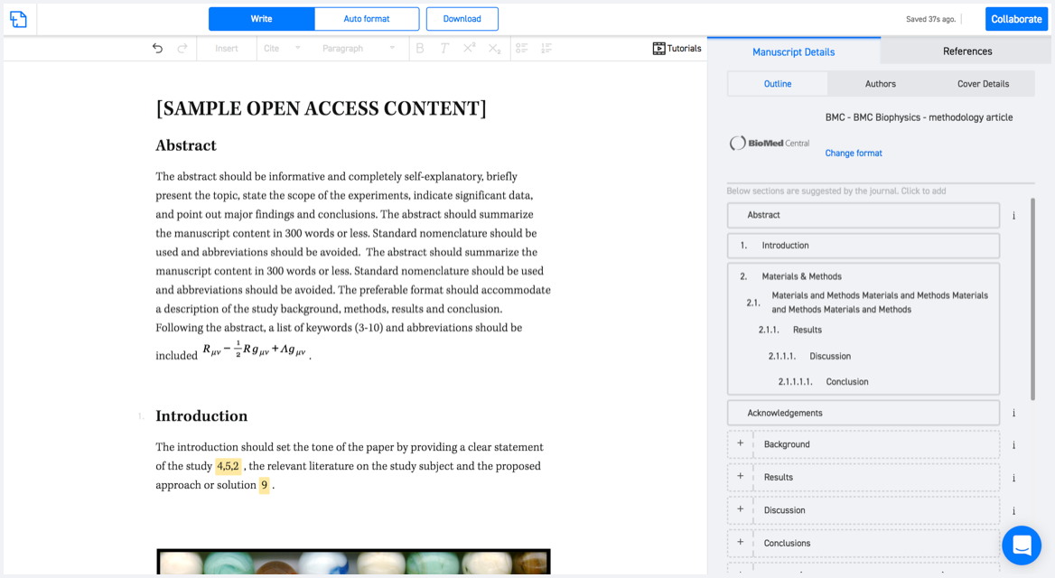
Available only on desktops 🖥

No word template required

Typset automatically formats your research paper to Earth Surface Processes and Landforms formatting guidelines and citation style.
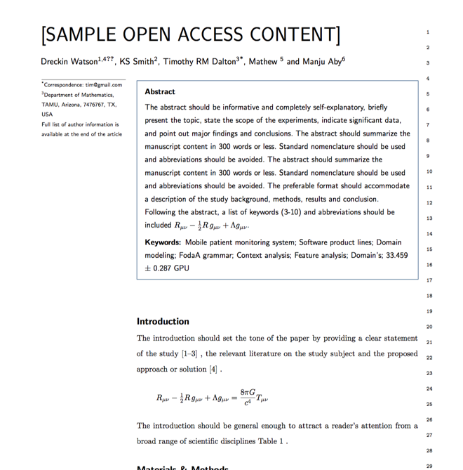

Verifed journal formats

One editor, 100K journal formats.
With the largest collection of verified journal formats, what you need is already there.

Trusted by academicians

I spent hours with MS word for reformatting. It was frustrating - plain and simple. With SciSpace, I can draft my manuscripts and once it is finished I can just submit. In case, I have to submit to another journal it is really just a button click instead of an afternoon of reformatting.

Andreas Frutiger
Researcher & Ex MS Word user
Use this template