Example of Journal of Mountain Science format
Recent searches

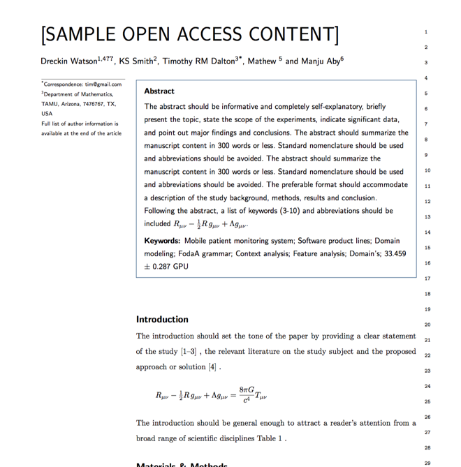
Example of Journal of Mountain Science format Example of Journal of Mountain Science format Example of Journal of Mountain Science format Example of Journal of Mountain Science format Example of Journal of Mountain Science format Example of Journal of Mountain Science format Example of Journal of Mountain Science format Example of Journal of Mountain Science format Example of Journal of Mountain Science format Example of Journal of Mountain Science format Example of Journal of Mountain Science format Example of Journal of Mountain Science format Example of Journal of Mountain Science format Example of Journal of Mountain Science format Example of Journal of Mountain Science format Example of Journal of Mountain Science format Example of Journal of Mountain Science format Example of Journal of Mountain Science format
Sample paper formatted on SciSpace - SciSpace
This content is only for preview purposes. The original open access content can be found here.
Look Inside
Example of Journal of Mountain Science format Example of Journal of Mountain Science format Example of Journal of Mountain Science format Example of Journal of Mountain Science format Example of Journal of Mountain Science format Example of Journal of Mountain Science format Example of Journal of Mountain Science format Example of Journal of Mountain Science format Example of Journal of Mountain Science format Example of Journal of Mountain Science format Example of Journal of Mountain Science format Example of Journal of Mountain Science format Example of Journal of Mountain Science format Example of Journal of Mountain Science format Example of Journal of Mountain Science format Example of Journal of Mountain Science format Example of Journal of Mountain Science format Example of Journal of Mountain Science format
Sample paper formatted on SciSpace - SciSpace
This content is only for preview purposes. The original open access content can be found here.
open access Open Access

Journal of Mountain Science — Template for authors

Publisher: Springer
Categories Rank Trend in last 3 yrs
Geography, Planning and Development #174 of 704 up up by 42 ranks
Nature and Landscape Conservation #56 of 177 up up by 12 ranks
Geology #80 of 251 up up by 23 ranks
Earth-Surface Processes #51 of 145 up up by 5 ranks
Global and Planetary Change #48 of 93 down down by 8 ranks
journal-quality-icon Journal quality:
High
calendar-icon Last 4 years overview: 823 Published Papers | 2570 Citations
indexed-in-icon Indexed in: Scopus
last-updated-icon Last updated: 14/06/2020
Related journals
Insights
General info
Top papers
Popular templates
Get started guide
Why choose from SciSpace
FAQ

Related Journals

open access Open Access

Springer

Quality:  
High
CiteRatio: 4.5
SJR: 0.641
SNIP: 1.11
open access Open Access
recommended Recommended

Elsevier

Quality:  
High
CiteRatio: 11.2
SJR: 2.053
SNIP: 1.984
open access Open Access
recommended Recommended

Elsevier

Quality:  
High
CiteRatio: 12.5
SJR: 1.623
SNIP: 1.998
open access Open Access

Elsevier

Quality:  
High
CiteRatio: 5.9
SJR: 1.203
SNIP: 1.352

Journal Performance & Insights

Impact Factor

CiteRatio

Determines the importance of a journal by taking a measure of frequency with which the average article in a journal has been cited in a particular year.

A measure of average citations received per peer-reviewed paper published in the journal.

1.55

9% from 2018

Impact factor for Journal of Mountain Science from 2016 - 2019
Year Value
2019 1.55
2018 1.423
2017 1.135
2016 1.016
graph view Graph view
table view Table view

3.1

24% from 2019

CiteRatio for Journal of Mountain Science from 2016 - 2020
Year Value
2020 3.1
2019 2.5
2018 2.1
2017 1.9
2016 1.8
graph view Graph view
table view Table view

insights Insights

  • Impact factor of this journal has increased by 9% in last year.
  • This journal’s impact factor is in the top 10 percentile category.

insights Insights

  • CiteRatio of this journal has increased by 24% in last years.
  • This journal’s CiteRatio is in the top 10 percentile category.

SCImago Journal Rank (SJR)

Source Normalized Impact per Paper (SNIP)

Measures weighted citations received by the journal. Citation weighting depends on the categories and prestige of the citing journal.

Measures actual citations received relative to citations expected for the journal's category.

0.551

19% from 2019

SJR for Journal of Mountain Science from 2016 - 2020
Year Value
2020 0.551
2019 0.462
2018 0.462
2017 0.442
2016 0.437
graph view Graph view
table view Table view

0.866

7% from 2019

SNIP for Journal of Mountain Science from 2016 - 2020
Year Value
2020 0.866
2019 0.81
2018 0.713
2017 0.709
2016 0.707
graph view Graph view
table view Table view

insights Insights

  • SJR of this journal has increased by 19% in last years.
  • This journal’s SJR is in the top 10 percentile category.

insights Insights

  • SNIP of this journal has increased by 7% in last years.
  • This journal’s SNIP is in the top 10 percentile category.
Journal of Mountain Science

Guideline source: View

All company, product and service names used in this website are for identification purposes only. All product names, trademarks and registered trademarks are property of their respective owners.

Use of these names, trademarks and brands does not imply endorsement or affiliation. Disclaimer Notice

Springer

Journal of Mountain Science

Approved by publishing and review experts on SciSpace, this template is built as per for Journal of Mountain Science formatting guidelines as mentioned in Springer author instructions. The current version was created on and has been used by 951 authors to write and format their manuscripts to this journal.

i
Last updated on
14 Jun 2020
i
ISSN
1993-0321
i
Open Access
Hybrid
i
Sherpa RoMEO Archiving Policy
Green faq
i
Plagiarism Check
Available via Turnitin
i
Endnote Style
Download Available
i
Citation Type
Author Year
(Blonder et al, 1982)
i
Bibliography Example
Blonder GE, Tinkham M, Klapwijk TM (1982) Transition from metallic to tunneling regimes in superconducting microconstrictions: Excess current, charge imbalance, and supercurrent conversion. Phys Rev B 25(7):4515_x0015_ 4532, URL 10.1103/PhysRevB.25.4515

Top papers written in this journal

Journal Article DOI: 10.1007/S11629-008-0079-Y
Plant species diversity along an altitudinal gradient of Bhabha Valley in western Himalaya
Amit Chawla1, S. Rajkumar1, K. N. Singh1, Brij Lal1, R. D. Singh1, Ashwani Kumar Thukral2

Abstract:

The present study highlights the rich species diversity of higher plants in the Bhabha Valley of western Himalaya in India. The analysis of species diversity revealed that a total of 313 species of higher plants inhabit the valley with a characteristic of moist alpine shrub vegetation. The herbaceous life forms dominate and i... The present study highlights the rich species diversity of higher plants in the Bhabha Valley of western Himalaya in India. The analysis of species diversity revealed that a total of 313 species of higher plants inhabit the valley with a characteristic of moist alpine shrub vegetation. The herbaceous life forms dominate and increase with increasing altitude. The major representations are from the families Asteraceae, Rosaceae, Lamiaceae and Poaceae, suggesting thereby the alpine meadow nature of the study area. The effect of altitude on species diversity displays a hump-shaped curve which may be attributed to increase in habitat diversity at the median ranges and relatively less habitat diversity at higher altitudes. The anthropogenic pressure at lower altitudes results in low plant diversity towards the bottom of the valley with most of the species being exotic in nature. Though the plant diversity is less at higher altitudinal ranges, the uniqueness is relatively high with high species replacement rates. More than 90 % of variability in the species diversity could be explained using appropriate quantitative and statistical analysis along the altitudinal gradient. The valley harbours 18 threatened and 41 endemic species, most of which occur at higher altitudinal gradients due to habitat specificity. read more read less

Topics:

Species diversity (64%)64% related to the paper, Species richness (62%)62% related to the paper, Threatened species (52%)52% related to the paper, Altitude (52%)52% related to the paper, Endemism (51%)51% related to the paper
View PDF
119 Citations
Journal Article DOI: 10.1007/S11629-016-4126-9
Landslide susceptibility mapping using an integrated model of information value method and logistic regression in the Bailongjiang watershed, Gansu Province, China
Guo-liang Du, Yong-shuang Zhang, Javed Iqbal1, Zhi-hua Yang, Xin Yao

Abstract:

Bailongjiang watershed in southern Gansu province, China, is one of the most landslide-prone regions in China, characterized by very high frequency of landslide occurrence. In order to predict the landslide occurrence, a comprehensive map of landslide susceptibility is required which may be significantly helpful in reducing l... Bailongjiang watershed in southern Gansu province, China, is one of the most landslide-prone regions in China, characterized by very high frequency of landslide occurrence. In order to predict the landslide occurrence, a comprehensive map of landslide susceptibility is required which may be significantly helpful in reducing loss of property and human life. In this study, an integrated model of information value method and logistic regression is proposed by using their merits at maximum and overcoming their weaknesses, which may enhance precision and accuracy of landslide susceptibility assessment. A detailed and reliable landslide inventory with 1587 landslides was prepared and randomly divided into two groups, (i) training dataset and (ii) testing dataset. Eight distinct landslide conditioning factors including lithology, slope gradient, aspect, elevation, distance to drainages, distance to faults, distance to roads and vegetation coverage were selected for landslide susceptibility mapping. The produced landslide susceptibility maps were validated by the success rate and prediction rate curves. The validation results show that the success rate and the prediction rate of the integrated model are 81.7 % and 84.6 %, respectively, which indicate that the proposed integrated method is reliable to produce an accurate landslide susceptibility map and the results may be used for landslides management and mitigation. read more read less

Topics:

Landslide (65%)65% related to the paper
116 Citations
Journal Article DOI: 10.1007/S11629-011-2007-9
Glacier Fluctuations between 1975 and 2008 in the Greater Himalaya Range of Zanskar, Southern Ladakh
Ulrich Kamp1, Martin Byrne1, Tobias Bolch2

Abstract:

Glaciers in the Himalaya are often heavily covered with supraglacial debris, making them difficult to study with remotely-sensed imagery alone. Various methods such as band ratios can be used effectively to map clean-ice glaciers; however, a thicker layer of debris often makes it impossible to distinguish between supraglacial... Glaciers in the Himalaya are often heavily covered with supraglacial debris, making them difficult to study with remotely-sensed imagery alone. Various methods such as band ratios can be used effectively to map clean-ice glaciers; however, a thicker layer of debris often makes it impossible to distinguish between supraglacial debris and the surrounding terrain. Previously, a morphometric mapping approach employing an ASTER-derived digital elevation model has been used to map glaciers in the Khumbu Himal and the Tien Shan. This study on glaciers in the Greater Himalaya Range in Zanskar, southern Ladakh, aims (i) to use the morphometric approach to map large debris-covered glaciers; and (ii) to use Landsat and ASTER data and GPS and field measurements to document glacier change over the past four decades. Field work was carried out in the summers of 2008. For clean ice, band ratios from the ASTER dataset were used to distinguish glacial features. For debris-covered glaciers, topographic features such as slope were combined with thermal imagery and supervised classifiers to map glacial margins. The method is promising for large glaciers, although problems occurred in the distal and lateral parts and in the fore field of the glaciers. A multitemporal analysis of glaciers in Zanskar showed that in general they have receded since at least the mid- to late-1970s. However, some few glaciers that advanced or oscillated — probably because of specific local environmental conditions — do exist. read more read less

Topics:

Rock glacier (73%)73% related to the paper, Glacier morphology (63%)63% related to the paper, Glacier (57%)57% related to the paper, Glacial period (52%)52% related to the paper
115 Citations
Journal Article DOI: 10.1007/S11629-018-5168-Y
GIS-based landslide susceptibility mapping using numerical risk factor bivariate model and its ensemble with linear multivariate regression and boosted regression tree algorithms

Abstract:

In this study, a novel approach of the landslide numerical risk factor (LNRF) bivariate model was used in ensemble with linear multivariate regression (LMR) and boosted regression tree (BRT) models, coupled with radar remote sensing data and geographic information system (GIS), for landslide susceptibility mapping (LSM) in th... In this study, a novel approach of the landslide numerical risk factor (LNRF) bivariate model was used in ensemble with linear multivariate regression (LMR) and boosted regression tree (BRT) models, coupled with radar remote sensing data and geographic information system (GIS), for landslide susceptibility mapping (LSM) in the Gorganroud watershed, Iran. Fifteen topographic, hydrological, geological and environmental conditioning factors and a landslide inventory (70%, or 298 landslides) were used in mapping. Phased array-type L-band synthetic aperture radar data were used to extract topographic parameters. Coefficients of tolerance and variance inflation factor were used to determine the coherence among conditioning factors. Data for the landslide inventory map were obtained from various resources, such as Iranian Landslide Working Party (ILWP), Forestry, Rangeland and Watershed Organisation (FRWO), extensive field surveys, interpretation of aerial photos and satellite images, and radar data. Of the total data, 30% were used to validate LSMs, using area under the curve (AUC), frequency ratio (FR) and seed cell area index (SCAI). Normalised difference vegetation index, land use/ land cover and slope degree in BRT model elevation, rainfall and distance from stream were found to be important factors and were given the highest weightage in modelling. Validation results using AUC showed that the ensemble LNRF-BRT and LNRFLMR models (AUC = 0.912 (91.2%) and 0.907 (90.7%), respectively) had high predictive accuracy than the LNRF model alone (AUC = 0.855 (85.5%)). The FR and SCAI analyses showed that all models divided the parameter classes with high precision. Overall, our novel approach of combining multivariate and machine learning methods with bivariate models, radar remote sensing data and GIS proved to be a powerful tool for landslide susceptibility mapping. read more read less

Topics:

Landslide (55%)55% related to the paper, Multivariate statistics (51%)51% related to the paper
104 Citations
Journal Article DOI: 10.1007/S11629-007-0275-1
Reforestation programs in southwest China: Reported success, observed failure, and the reasons why
Christine Jane Trac1, Stevan Harrell1, Thomas M. Hinckley1, Amanda Henck1

Abstract:

Ever since the disastrous floods of 1998, the Chinese government has used the Natural Forest Protection and Sloping Land Conversion Programs to promote afforestation and reforestation as means to reduce runoff, control erosion, and stabilize local livelihoods. These two ambitious programs have been reported as large-scale suc... Ever since the disastrous floods of 1998, the Chinese government has used the Natural Forest Protection and Sloping Land Conversion Programs to promote afforestation and reforestation as means to reduce runoff, control erosion, and stabilize local livelihoods. These two ambitious programs have been reported as large-scale successes, contributing to an overall increase in China's forest cover and to the stated goals of environmental stabilization. A small-scale field study at the project level of the implementation of these two programs in Baiwu Township, Yanyuan County, Sichuan, casts doubt upon the accuracy and reliability of these claims of success; ground observations revealed utter failure in some sites and only marginal success in others. Reasons for this discrepancy are posited as involving ecological, economic, and bureaucratic factors. Further research is suggested to determine whether these discrepancies are merely local aberrations or represent larger-scale failures in reforestation programs. read more read less

Topics:

Reforestation (53%)53% related to the paper
102 Citations
Author Pic

SciSpace is a very innovative solution to the formatting problem and existing providers, such as Mendeley or Word did not really evolve in recent years.

- Andreas Frutiger, Researcher, ETH Zurich, Institute for Biomedical Engineering

Get MS-Word and LaTeX output to any Journal within seconds
1
Choose a template
Select a template from a library of 40,000+ templates
2
Import a MS-Word file or start fresh
It takes only few seconds to import
3
View and edit your final output
SciSpace will automatically format your output to meet journal guidelines
4
Submit directly or Download
Submit to journal directly or Download in PDF, MS Word or LaTeX

(Before submission check for plagiarism via Turnitin)

clock Less than 3 minutes

What to expect from SciSpace?

Speed and accuracy over MS Word

''

With SciSpace, you do not need a word template for Journal of Mountain Science.

It automatically formats your research paper to Springer formatting guidelines and citation style.

You can download a submission ready research paper in pdf, LaTeX and docx formats.

Time comparison

Time taken to format a paper and Compliance with guidelines

Plagiarism Reports via Turnitin

SciSpace has partnered with Turnitin, the leading provider of Plagiarism Check software.

Using this service, researchers can compare submissions against more than 170 million scholarly articles, a database of 70+ billion current and archived web pages. How Turnitin Integration works?

Turnitin Stats
Publisher Logos

Freedom from formatting guidelines

One editor, 100K journal formats – world's largest collection of journal templates

With such a huge verified library, what you need is already there.

publisher-logos

Easy support from all your favorite tools

Automatically format and order your citations and bibliography in a click.

SciSpace allows imports from all reference managers like Mendeley, Zotero, Endnote, Google Scholar etc.

Frequently asked questions

1. Can I write Journal of Mountain Science in LaTeX?

Absolutely not! Our tool has been designed to help you focus on writing. You can write your entire paper as per the Journal of Mountain Science guidelines and auto format it.

2. Do you follow the Journal of Mountain Science guidelines?

Yes, the template is compliant with the Journal of Mountain Science guidelines. Our experts at SciSpace ensure that. If there are any changes to the journal's guidelines, we'll change our algorithm accordingly.

3. Can I cite my article in multiple styles in Journal of Mountain Science?

Of course! We support all the top citation styles, such as APA style, MLA style, Vancouver style, Harvard style, and Chicago style. For example, when you write your paper and hit autoformat, our system will automatically update your article as per the Journal of Mountain Science citation style.

4. Can I use the Journal of Mountain Science templates for free?

Sign up for our free trial, and you'll be able to use all our features for seven days. You'll see how helpful they are and how inexpensive they are compared to other options, Especially for Journal of Mountain Science.

5. Can I use a manuscript in Journal of Mountain Science that I have written in MS Word?

Yes. You can choose the right template, copy-paste the contents from the word document, and click on auto-format. Once you're done, you'll have a publish-ready paper Journal of Mountain Science that you can download at the end.

6. How long does it usually take you to format my papers in Journal of Mountain Science?

It only takes a matter of seconds to edit your manuscript. Besides that, our intuitive editor saves you from writing and formatting it in Journal of Mountain Science.

7. Where can I find the template for the Journal of Mountain Science?

It is possible to find the Word template for any journal on Google. However, why use a template when you can write your entire manuscript on SciSpace , auto format it as per Journal of Mountain Science's guidelines and download the same in Word, PDF and LaTeX formats? Give us a try!.

8. Can I reformat my paper to fit the Journal of Mountain Science's guidelines?

Of course! You can do this using our intuitive editor. It's very easy. If you need help, our support team is always ready to assist you.

9. Journal of Mountain Science an online tool or is there a desktop version?

SciSpace's Journal of Mountain Science is currently available as an online tool. We're developing a desktop version, too. You can request (or upvote) any features that you think would be helpful for you and other researchers in the "feature request" section of your account once you've signed up with us.

10. I cannot find my template in your gallery. Can you create it for me like Journal of Mountain Science?

Sure. You can request any template and we'll have it setup within a few days. You can find the request box in Journal Gallery on the right side bar under the heading, "Couldn't find the format you were looking for like Journal of Mountain Science?”

11. What is the output that I would get after using Journal of Mountain Science?

After writing your paper autoformatting in Journal of Mountain Science, you can download it in multiple formats, viz., PDF, Docx, and LaTeX.

12. Is Journal of Mountain Science's impact factor high enough that I should try publishing my article there?

To be honest, the answer is no. The impact factor is one of the many elements that determine the quality of a journal. Few of these factors include review board, rejection rates, frequency of inclusion in indexes, and Eigenfactor. You need to assess all these factors before you make your final call.

13. What is Sherpa RoMEO Archiving Policy for Journal of Mountain Science?

SHERPA/RoMEO Database

We extracted this data from Sherpa Romeo to help researchers understand the access level of this journal in accordance with the Sherpa Romeo Archiving Policy for Journal of Mountain Science. The table below indicates the level of access a journal has as per Sherpa Romeo's archiving policy.

RoMEO Colour Archiving policy
Green Can archive pre-print and post-print or publisher's version/PDF
Blue Can archive post-print (ie final draft post-refereeing) or publisher's version/PDF
Yellow Can archive pre-print (ie pre-refereeing)
White Archiving not formally supported
FYI:
  1. Pre-prints as being the version of the paper before peer review and
  2. Post-prints as being the version of the paper after peer-review, with revisions having been made.

14. What are the most common citation types In Journal of Mountain Science?

The 5 most common citation types in order of usage for Journal of Mountain Science are:.

S. No. Citation Style Type
1. Author Year
2. Numbered
3. Numbered (Superscripted)
4. Author Year (Cited Pages)
5. Footnote

15. How do I submit my article to the Journal of Mountain Science?

It is possible to find the Word template for any journal on Google. However, why use a template when you can write your entire manuscript on SciSpace , auto format it as per Journal of Mountain Science's guidelines and download the same in Word, PDF and LaTeX formats? Give us a try!.

16. Can I download Journal of Mountain Science in Endnote format?

Yes, SciSpace provides this functionality. After signing up, you would need to import your existing references from Word or Bib file to SciSpace. Then SciSpace would allow you to download your references in Journal of Mountain Science Endnote style according to Elsevier guidelines.

Fast and reliable,
built for complaince.

Instant formatting to 100% publisher guidelines on - SciSpace.

Available only on desktops 🖥

No word template required

Typset automatically formats your research paper to Journal of Mountain Science formatting guidelines and citation style.

Verifed journal formats

One editor, 100K journal formats.
With the largest collection of verified journal formats, what you need is already there.

Trusted by academicians

I spent hours with MS word for reformatting. It was frustrating - plain and simple. With SciSpace, I can draft my manuscripts and once it is finished I can just submit. In case, I have to submit to another journal it is really just a button click instead of an afternoon of reformatting.

Andreas Frutiger
Researcher & Ex MS Word user
Use this template