Example of Networks and Spatial Economics format
Recent searches

Example of Networks and Spatial Economics format Example of Networks and Spatial Economics format Example of Networks and Spatial Economics format Example of Networks and Spatial Economics format Example of Networks and Spatial Economics format Example of Networks and Spatial Economics format Example of Networks and Spatial Economics format Example of Networks and Spatial Economics format Example of Networks and Spatial Economics format Example of Networks and Spatial Economics format Example of Networks and Spatial Economics format Example of Networks and Spatial Economics format Example of Networks and Spatial Economics format Example of Networks and Spatial Economics format Example of Networks and Spatial Economics format Example of Networks and Spatial Economics format Example of Networks and Spatial Economics format Example of Networks and Spatial Economics format
Sample paper formatted on SciSpace - SciSpace
This content is only for preview purposes. The original open access content can be found here.
Look Inside
Example of Networks and Spatial Economics format Example of Networks and Spatial Economics format Example of Networks and Spatial Economics format Example of Networks and Spatial Economics format Example of Networks and Spatial Economics format Example of Networks and Spatial Economics format Example of Networks and Spatial Economics format Example of Networks and Spatial Economics format Example of Networks and Spatial Economics format Example of Networks and Spatial Economics format Example of Networks and Spatial Economics format Example of Networks and Spatial Economics format Example of Networks and Spatial Economics format Example of Networks and Spatial Economics format Example of Networks and Spatial Economics format Example of Networks and Spatial Economics format Example of Networks and Spatial Economics format Example of Networks and Spatial Economics format
Sample paper formatted on SciSpace - SciSpace
This content is only for preview purposes. The original open access content can be found here.
open access Open Access

Networks and Spatial Economics — Template for authors

Publisher: Springer
Categories Rank Trend in last 3 yrs
Computer Networks and Communications #91 of 334 down down by 41 ranks
Software #143 of 389 down down by 54 ranks
Artificial Intelligence #84 of 227 down down by 37 ranks
journal-quality-icon Journal quality:
Good
calendar-icon Last 4 years overview: 171 Published Papers | 789 Citations
indexed-in-icon Indexed in: Scopus
last-updated-icon Last updated: 28/06/2020
Related journals
Insights
General info
Top papers
Popular templates
Get started guide
Why choose from SciSpace
FAQ

Related Journals

open access Open Access
recommended Recommended

IEEE

Quality:  
High
CiteRatio: 19.8
SJR: 2.882
SNIP: 3.86
open access Open Access

Frontiers Media

Quality:  
High
CiteRatio: 6.2
SJR: 0.427
SNIP: 1.319
open access Open Access

Elsevier

Quality:  
High
CiteRatio: 6.9
SJR: 0.638
SNIP: 1.44
open access Open Access

Springer

Quality:  
Good
CiteRatio: 4.2
SJR: 0.463
SNIP: 0.887

Journal Performance & Insights

Impact Factor

CiteRatio

Determines the importance of a journal by taking a measure of frequency with which the average article in a journal has been cited in a particular year.

A measure of average citations received per peer-reviewed paper published in the journal.

2.379

14% from 2018

Impact factor for Networks and Spatial Economics from 2016 - 2019
Year Value
2019 2.379
2018 2.084
2017 2.695
2016 2.662
graph view Graph view
table view Table view

4.6

8% from 2019

CiteRatio for Networks and Spatial Economics from 2016 - 2020
Year Value
2020 4.6
2019 5.0
2018 5.8
2017 4.8
2016 4.6
graph view Graph view
table view Table view

insights Insights

  • Impact factor of this journal has increased by 14% in last year.
  • This journal’s impact factor is in the top 10 percentile category.

insights Insights

  • CiteRatio of this journal has decreased by 8% in last years.
  • This journal’s CiteRatio is in the top 10 percentile category.

SCImago Journal Rank (SJR)

Source Normalized Impact per Paper (SNIP)

Measures weighted citations received by the journal. Citation weighting depends on the categories and prestige of the citing journal.

Measures actual citations received relative to citations expected for the journal's category.

0.983

20% from 2019

SJR for Networks and Spatial Economics from 2016 - 2020
Year Value
2020 0.983
2019 1.227
2018 1.626
2017 1.562
2016 1.677
graph view Graph view
table view Table view

1.376

13% from 2019

SNIP for Networks and Spatial Economics from 2016 - 2020
Year Value
2020 1.376
2019 1.573
2018 1.507
2017 1.57
2016 2.064
graph view Graph view
table view Table view

insights Insights

  • SJR of this journal has decreased by 20% in last years.
  • This journal’s SJR is in the top 10 percentile category.

insights Insights

  • SNIP of this journal has decreased by 13% in last years.
  • This journal’s SNIP is in the top 10 percentile category.

Networks and Spatial Economics

Guideline source: View

All company, product and service names used in this website are for identification purposes only. All product names, trademarks and registered trademarks are property of their respective owners.

Use of these names, trademarks and brands does not imply endorsement or affiliation. Disclaimer Notice

Springer

Networks and Spatial Economics

Networks and Spatial Economics (NETS) is devoted to the mathematical and numerical study of economic activities facilitated by human infrastructure, broadly defined to include technologies pertinent to information, telecommunications, the Internet, transportation, energy stora...... Read More

Computer Networks and Communications

Software

Artificial Intelligence

Computer Science

i
Last updated on
28 Jun 2020
i
ISSN
1566-113X
i
Impact Factor
High - 1.508
i
Open Access
No
i
Sherpa RoMEO Archiving Policy
Green faq
i
Plagiarism Check
Available via Turnitin
i
Endnote Style
Download Available
i
Bibliography Name
SPBASIC
i
Citation Type
Author Year
(Blonder et al, 1982)
i
Bibliography Example
Beenakker CWJ (2006) Specular andreev reflection in graphene. Phys Rev Lett 97(6):067,007, URL 10.1103/PhysRevLett.97.067007

Top papers written in this journal

Journal Article DOI: 10.1023/A:1012827724856
Foundations of dynamic traffic assignment : the past, the present and the future

Abstract:

Dynamic Traffic Assignment (DTA) has evolved substantially since the pioneering work of Merchant and Nemhauser. Numerous formulations and solutions approaches have been introduced ranging from mathematical programming, to variational inequality, optimal control, and simulation-based. The aim of this special issue is to docume... Dynamic Traffic Assignment (DTA) has evolved substantially since the pioneering work of Merchant and Nemhauser. Numerous formulations and solutions approaches have been introduced ranging from mathematical programming, to variational inequality, optimal control, and simulation-based. The aim of this special issue is to document the main existing DTA approaches for future reference. This opening paper will summarize the current understanding of DTA, review the existing literature, make the connection to the approaches presented in this special issue, and attempt to hypothesize about the future. read more read less
843 Citations
Journal Article DOI: 10.1023/A:1022049000877
Microsimulation of Urban Development and Location Choices: Design and Implementation of UrbanSim
Paul Waddell1, Alan Borning1, Michael E. Noth1, Nathan G. Freier1, M. Becke1, Gudmundur F. Ulfarsson1

Abstract:

UrbanSim is a new urban simulation model, developed over the past several years, which is now operational in three urban areas in the United States. The model system is designed to address emerging needs to better coordinate transportation and land use planning as a result of recognition of the strong interactions between lan... UrbanSim is a new urban simulation model, developed over the past several years, which is now operational in three urban areas in the United States. The model system is designed to address emerging needs to better coordinate transportation and land use planning as a result of recognition of the strong interactions between land use and transportation, increasing pressure from federal transportation and environmental legislation, and growing adoption of state growth management programs. The model system is implemented as a set of interacting model components that represent the major actors and choices in the urban system, including household moving and residential location, business choices of employment location, and developer choices of locations and types of real estate development, all subject to the influence of governmental transportation and land use policy scenarios. The model design is unusual in the degree of disaggregation of space, time, and agents, and in the adoption of a dynamic disequilibrium approach. The objective of this paper is to describe the entire system at a sufficient level of detail to convey the key specification and design choices made in implementing the system. read more read less

Topics:

UrbanSim (69%)69% related to the paper, Urban planning (61%)61% related to the paper, Land-use planning (58%)58% related to the paper, Real estate development (56%)56% related to the paper, Microsimulation (52%)52% related to the paper
View PDF
421 Citations
Journal Article DOI: 10.1023/A:1012831808926
Dynamic network traffic assignment and simulation methodology for advanced system management applications
Hani S. Mahmassani1

Abstract:

Evaluation and operation of intelligent transportation system technologies in transportation networks give rise to methodological capabilities that require description of the dynamics of network traffic flows over time and space. Both descriptive and normative dynamic traffic assignment capabilities are required in this envir... Evaluation and operation of intelligent transportation system technologies in transportation networks give rise to methodological capabilities that require description of the dynamics of network traffic flows over time and space. Both descriptive and normative dynamic traffic assignment capabilities are required in this environment. Several dynamic network flow modeling problem formulations that arise in this context are discussed, and simulation-assignment procedures are described for these problems. A dynamic traffic assignment (DTA) system for advanced traffic network management is described. It is built around a traffic simulation-assignment modeling framework, which describes the evolution of traffic patterns in the network for given traffic loading under particular control measures and route guidance information supply strategies to individual motorists. The simulator is also embedded in an interactive search algorithm to determine optimal route guidance instructions to motorists. Numerical experiments with the model illustrate the relative effectiveness of different information supply strategies under different user behavior response rules. read more read less

Topics:

Traffic generation model (68%)68% related to the paper, Advanced Traffic Management System (67%)67% related to the paper, Network traffic control (65%)65% related to the paper, Network traffic simulation (64%)64% related to the paper, Traffic flow (63%)63% related to the paper
410 Citations
Journal Article DOI: 10.1007/S11067-005-2630-5
ILUTE: An Operational Prototype of a Comprehensive Microsimulation Model of Urban Systems
Paul A. Salvini1, Eric J. Miller1

Abstract:

This paper describes the development of an operational proto type for a comprehensive microsimulation model of urban systems. It examines several important design advances that emerged during the transition from a conceptual framework to operational code. ILUTE (Integrated Land Use, Transportation, Environment) simulates the ... This paper describes the development of an operational proto type for a comprehensive microsimulation model of urban systems. It examines several important design advances that emerged during the transition from a conceptual framework to operational code. ILUTE (Integrated Land Use, Transportation, Environment) simulates the evolution of an integrated urban system over an extended period of time . This model is intended to replace conventional models for the analysis of a broad range of transportation, housing and other urban policies. An overview of the ILUTE framework was presented at the 9 th IATBR conference (Miller and Salvini, 2001). Since then, considerable progress has been made on the overall model and its component submodels. At present, an operational prototype is being tested using data from the Greater Toronto Area. Disaggregate information for the model is synthesized from census data, travel survey data, activity data, and randomly generate d proxy data. ILUTE is based on the "ideal model" described in the fina l report of the Transit Cooperative Research Program's (TCRP) Project H-12, “Integrated Urban Models for Simulation of Transit and Land-Use Policies” (Miller, Kriger, and Hunt, 1998). read more read less

Topics:

Microsimulation (51%)51% related to the paper
360 Citations
Journal Article DOI: 10.1007/S11067-006-9284-9
Application of Accessibility Based Methods for Vulnerability Analysis of Strategic Road Networks
Michael A. P. Taylor1, Somenahalli V. C. Sekhar1, Glen M. D'Este1

Abstract:

This paper describes the development of a method for strategic assessment of vulnerability in road networks. Our vulnerability analysis considers the socio-economic impacts of network degradation, on the basis of changes in the levels of accessibility provided by the degraded network. A number of standard indices of accessibi... This paper describes the development of a method for strategic assessment of vulnerability in road networks. Our vulnerability analysis considers the socio-economic impacts of network degradation, on the basis of changes in the levels of accessibility provided by the degraded network. A number of standard indices of accessibility are considered, including generalised travel cost, the Hansen integral accessibility index, and the ARIA index used in Australia to assess levels of remoteness in rural areas. Simple case studies of a national strategic road network and a regional road network are used to illustrate both the general approach and specific implementations. read more read less

Topics:

Vulnerability assessment (57%)57% related to the paper, Vulnerability (53%)53% related to the paper
342 Citations
Author Pic

SciSpace is a very innovative solution to the formatting problem and existing providers, such as Mendeley or Word did not really evolve in recent years.

- Andreas Frutiger, Researcher, ETH Zurich, Institute for Biomedical Engineering

Get MS-Word and LaTeX output to any Journal within seconds
1
Choose a template
Select a template from a library of 40,000+ templates
2
Import a MS-Word file or start fresh
It takes only few seconds to import
3
View and edit your final output
SciSpace will automatically format your output to meet journal guidelines
4
Submit directly or Download
Submit to journal directly or Download in PDF, MS Word or LaTeX

(Before submission check for plagiarism via Turnitin)

clock Less than 3 minutes

What to expect from SciSpace?

Speed and accuracy over MS Word

''

With SciSpace, you do not need a word template for Networks and Spatial Economics.

It automatically formats your research paper to Springer formatting guidelines and citation style.

You can download a submission ready research paper in pdf, LaTeX and docx formats.

Time comparison

Time taken to format a paper and Compliance with guidelines

Plagiarism Reports via Turnitin

SciSpace has partnered with Turnitin, the leading provider of Plagiarism Check software.

Using this service, researchers can compare submissions against more than 170 million scholarly articles, a database of 70+ billion current and archived web pages. How Turnitin Integration works?

Turnitin Stats
Publisher Logos

Freedom from formatting guidelines

One editor, 100K journal formats – world's largest collection of journal templates

With such a huge verified library, what you need is already there.

publisher-logos

Easy support from all your favorite tools

Networks and Spatial Economics format uses SPBASIC citation style.

Automatically format and order your citations and bibliography in a click.

SciSpace allows imports from all reference managers like Mendeley, Zotero, Endnote, Google Scholar etc.

Frequently asked questions

1. Can I write Networks and Spatial Economics in LaTeX?

Absolutely not! Our tool has been designed to help you focus on writing. You can write your entire paper as per the Networks and Spatial Economics guidelines and auto format it.

2. Do you follow the Networks and Spatial Economics guidelines?

Yes, the template is compliant with the Networks and Spatial Economics guidelines. Our experts at SciSpace ensure that. If there are any changes to the journal's guidelines, we'll change our algorithm accordingly.

3. Can I cite my article in multiple styles in Networks and Spatial Economics?

Of course! We support all the top citation styles, such as APA style, MLA style, Vancouver style, Harvard style, and Chicago style. For example, when you write your paper and hit autoformat, our system will automatically update your article as per the Networks and Spatial Economics citation style.

4. Can I use the Networks and Spatial Economics templates for free?

Sign up for our free trial, and you'll be able to use all our features for seven days. You'll see how helpful they are and how inexpensive they are compared to other options, Especially for Networks and Spatial Economics.

5. Can I use a manuscript in Networks and Spatial Economics that I have written in MS Word?

Yes. You can choose the right template, copy-paste the contents from the word document, and click on auto-format. Once you're done, you'll have a publish-ready paper Networks and Spatial Economics that you can download at the end.

6. How long does it usually take you to format my papers in Networks and Spatial Economics?

It only takes a matter of seconds to edit your manuscript. Besides that, our intuitive editor saves you from writing and formatting it in Networks and Spatial Economics.

7. Where can I find the template for the Networks and Spatial Economics?

It is possible to find the Word template for any journal on Google. However, why use a template when you can write your entire manuscript on SciSpace , auto format it as per Networks and Spatial Economics's guidelines and download the same in Word, PDF and LaTeX formats? Give us a try!.

8. Can I reformat my paper to fit the Networks and Spatial Economics's guidelines?

Of course! You can do this using our intuitive editor. It's very easy. If you need help, our support team is always ready to assist you.

9. Networks and Spatial Economics an online tool or is there a desktop version?

SciSpace's Networks and Spatial Economics is currently available as an online tool. We're developing a desktop version, too. You can request (or upvote) any features that you think would be helpful for you and other researchers in the "feature request" section of your account once you've signed up with us.

10. I cannot find my template in your gallery. Can you create it for me like Networks and Spatial Economics?

Sure. You can request any template and we'll have it setup within a few days. You can find the request box in Journal Gallery on the right side bar under the heading, "Couldn't find the format you were looking for like Networks and Spatial Economics?”

11. What is the output that I would get after using Networks and Spatial Economics?

After writing your paper autoformatting in Networks and Spatial Economics, you can download it in multiple formats, viz., PDF, Docx, and LaTeX.

12. Is Networks and Spatial Economics's impact factor high enough that I should try publishing my article there?

To be honest, the answer is no. The impact factor is one of the many elements that determine the quality of a journal. Few of these factors include review board, rejection rates, frequency of inclusion in indexes, and Eigenfactor. You need to assess all these factors before you make your final call.

13. What is Sherpa RoMEO Archiving Policy for Networks and Spatial Economics?

SHERPA/RoMEO Database

We extracted this data from Sherpa Romeo to help researchers understand the access level of this journal in accordance with the Sherpa Romeo Archiving Policy for Networks and Spatial Economics. The table below indicates the level of access a journal has as per Sherpa Romeo's archiving policy.

RoMEO Colour Archiving policy
Green Can archive pre-print and post-print or publisher's version/PDF
Blue Can archive post-print (ie final draft post-refereeing) or publisher's version/PDF
Yellow Can archive pre-print (ie pre-refereeing)
White Archiving not formally supported
FYI:
  1. Pre-prints as being the version of the paper before peer review and
  2. Post-prints as being the version of the paper after peer-review, with revisions having been made.

14. What are the most common citation types In Networks and Spatial Economics?

The 5 most common citation types in order of usage for Networks and Spatial Economics are:.

S. No. Citation Style Type
1. Author Year
2. Numbered
3. Numbered (Superscripted)
4. Author Year (Cited Pages)
5. Footnote

15. How do I submit my article to the Networks and Spatial Economics?

It is possible to find the Word template for any journal on Google. However, why use a template when you can write your entire manuscript on SciSpace , auto format it as per Networks and Spatial Economics's guidelines and download the same in Word, PDF and LaTeX formats? Give us a try!.

16. Can I download Networks and Spatial Economics in Endnote format?

Yes, SciSpace provides this functionality. After signing up, you would need to import your existing references from Word or Bib file to SciSpace. Then SciSpace would allow you to download your references in Networks and Spatial Economics Endnote style according to Elsevier guidelines.

Fast and reliable,
built for complaince.

Instant formatting to 100% publisher guidelines on - SciSpace.
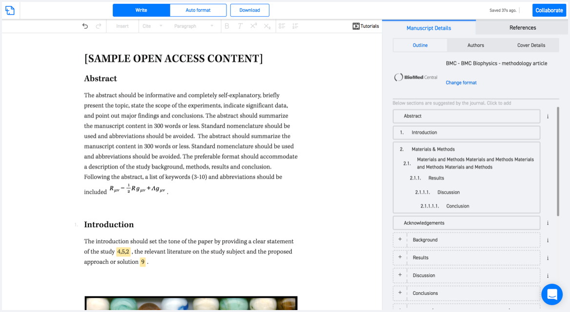
Available only on desktops 🖥

No word template required

Typset automatically formats your research paper to Networks and Spatial Economics formatting guidelines and citation style.
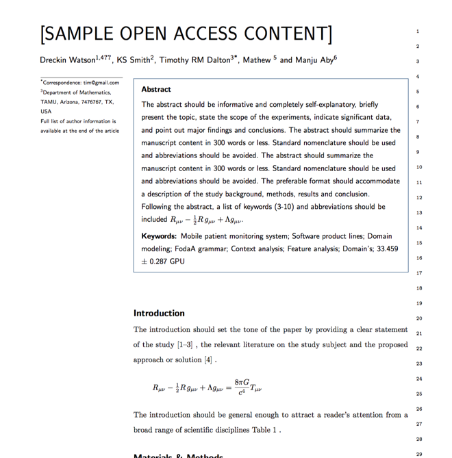

Verifed journal formats

One editor, 100K journal formats.
With the largest collection of verified journal formats, what you need is already there.

Trusted by academicians

I spent hours with MS word for reformatting. It was frustrating - plain and simple. With SciSpace, I can draft my manuscripts and once it is finished I can just submit. In case, I have to submit to another journal it is really just a button click instead of an afternoon of reformatting.

Andreas Frutiger
Researcher & Ex MS Word user
Use this template