Example of Surveys in Geophysics format
Recent searches

Example of Surveys in Geophysics format Example of Surveys in Geophysics format Example of Surveys in Geophysics format Example of Surveys in Geophysics format Example of Surveys in Geophysics format Example of Surveys in Geophysics format Example of Surveys in Geophysics format Example of Surveys in Geophysics format Example of Surveys in Geophysics format Example of Surveys in Geophysics format Example of Surveys in Geophysics format Example of Surveys in Geophysics format Example of Surveys in Geophysics format Example of Surveys in Geophysics format Example of Surveys in Geophysics format Example of Surveys in Geophysics format Example of Surveys in Geophysics format Example of Surveys in Geophysics format
Sample paper formatted on SciSpace - SciSpace
This content is only for preview purposes. The original open access content can be found here.
Look Inside
Example of Surveys in Geophysics format Example of Surveys in Geophysics format Example of Surveys in Geophysics format Example of Surveys in Geophysics format Example of Surveys in Geophysics format Example of Surveys in Geophysics format Example of Surveys in Geophysics format Example of Surveys in Geophysics format Example of Surveys in Geophysics format Example of Surveys in Geophysics format Example of Surveys in Geophysics format Example of Surveys in Geophysics format Example of Surveys in Geophysics format Example of Surveys in Geophysics format Example of Surveys in Geophysics format Example of Surveys in Geophysics format Example of Surveys in Geophysics format Example of Surveys in Geophysics format
Sample paper formatted on SciSpace - SciSpace
This content is only for preview purposes. The original open access content can be found here.
open access Open Access
recommended Recommended

Surveys in Geophysics — Template for authors

Publisher: Springer
Categories Rank Trend in last 3 yrs
Geophysics #2 of 131 -
Geochemistry and Petrology #2 of 128 up up by 1 rank
journal-quality-icon Journal quality:
High
calendar-icon Last 4 years overview: 209 Published Papers | 2400 Citations
indexed-in-icon Indexed in: Scopus
last-updated-icon Last updated: 16/07/2020
Related journals
Insights
General info
Top papers
Popular templates
Get started guide
Why choose from SciSpace
FAQ

Related Journals

open access Open Access

Springer

Quality:  
High
CiteRatio: 5.9
SJR: 2.078
SNIP: 1.439
open access Open Access
recommended Recommended

Springer

Quality:  
High
CiteRatio: 7.5
SJR: 1.78
SNIP: 2.18
open access Open Access
recommended Recommended

Springer

Quality:  
High
CiteRatio: 7.8
SJR: 1.51
SNIP: 1.687
open access Open Access

Elsevier

Quality:  
High
CiteRatio: 5.0
SJR: 1.089
SNIP: 1.081

Journal Performance & Insights

Impact Factor

CiteRatio

Determines the importance of a journal by taking a measure of frequency with which the average article in a journal has been cited in a particular year.

A measure of average citations received per peer-reviewed paper published in the journal.

5.544

6% from 2018

Impact factor for Surveys in Geophysics from 2016 - 2019
Year Value
2019 5.544
2018 5.226
2017 3.761
2016 4.413
graph view Graph view
table view Table view

11.5

17% from 2019

CiteRatio for Surveys in Geophysics from 2016 - 2020
Year Value
2020 11.5
2019 9.8
2018 7.6
2017 8.9
2016 7.3
graph view Graph view
table view Table view

insights Insights

  • Impact factor of this journal has increased by 6% in last year.
  • This journal’s impact factor is in the top 10 percentile category.

insights Insights

  • CiteRatio of this journal has increased by 17% in last years.
  • This journal’s CiteRatio is in the top 10 percentile category.

SCImago Journal Rank (SJR)

Source Normalized Impact per Paper (SNIP)

Measures weighted citations received by the journal. Citation weighting depends on the categories and prestige of the citing journal.

Measures actual citations received relative to citations expected for the journal's category.

1.991

11% from 2019

SJR for Surveys in Geophysics from 2016 - 2020
Year Value
2020 1.991
2019 2.236
2018 2.294
2017 1.813
2016 2.076
graph view Graph view
table view Table view

2.319

3% from 2019

SNIP for Surveys in Geophysics from 2016 - 2020
Year Value
2020 2.319
2019 2.252
2018 2.256
2017 2.007
2016 1.99
graph view Graph view
table view Table view

insights Insights

  • SJR of this journal has decreased by 11% in last years.
  • This journal’s SJR is in the top 10 percentile category.

insights Insights

  • SNIP of this journal has increased by 3% in last years.
  • This journal’s SNIP is in the top 10 percentile category.

Surveys in Geophysics

Guideline source: View

All company, product and service names used in this website are for identification purposes only. All product names, trademarks and registered trademarks are property of their respective owners.

Use of these names, trademarks and brands does not imply endorsement or affiliation. Disclaimer Notice

Springer

Surveys in Geophysics

Surveys in Geophysics publishes refereed overview articles on the physical, chemical and biological processes occurring within the Earth, on its surface, in its atmosphere and in the near-Earth space environment, including relations with other bodies in the solar system. Obser...... Read More

Geophysics

Geochemistry and Petrology

Earth and Planetary Sciences

i
Last updated on
15 Jul 2020
i
ISSN
0169-3298
i
Impact Factor
High - 2.044
i
Open Access
No
i
Sherpa RoMEO Archiving Policy
Green faq
i
Plagiarism Check
Available via Turnitin
i
Endnote Style
Download Available
i
Bibliography Name
SPBASIC
i
Citation Type
Author Year
(Blonder et al, 1982)
i
Bibliography Example
Blonder GE, Tinkham M, Klapwijk TM (1982) Transition from metallic to tunneling regimes in superconducting microconstrictions: Excess current, charge imbalance, and supercurrent conversion. Phys Rev B 25(7):4515–4532, URL 10.1103/PhysRevB.25.4515

Top papers written in this journal

open accessOpen access Journal Article DOI: 10.1007/S10712-011-9119-1
Sea-Level Rise from the Late 19th to the Early 21st Century
John A. Church1, Neil J. White1
30 Mar 2011 - Surveys in Geophysics

Abstract:

We estimate the rise in global average sea level from satellite altimeter data for 1993–2009 and from coastal and island sea-level measurements from 1880 to 2009. For 1993–2009 and after correcting for glacial isostatic adjustment, the estimated rate of rise is 3.2 ± 0.4 mm year−1 from the satellite data and 2.8 ± 0.8 mm year... We estimate the rise in global average sea level from satellite altimeter data for 1993–2009 and from coastal and island sea-level measurements from 1880 to 2009. For 1993–2009 and after correcting for glacial isostatic adjustment, the estimated rate of rise is 3.2 ± 0.4 mm year−1 from the satellite data and 2.8 ± 0.8 mm year−1 from the in situ data. The global average sea-level rise from 1880 to 2009 is about 210 mm. The linear trend from 1900 to 2009 is 1.7 ± 0.2 mm year−1 and since 1961 is 1.9 ± 0.4 mm year−1. There is considerable variability in the rate of rise during the twentieth century but there has been a statistically significant acceleration since 1880 and 1900 of 0.009 ± 0.003 mm year−2 and 0.009 ± 0.004 mm year−2, respectively. Since the start of the altimeter record in 1993, global average sea level rose at a rate near the upper end of the sea level projections of the Intergovernmental Panel on Climate Change’s Third and Fourth Assessment Reports. However, the reconstruction indicates there was little net change in sea level from 1990 to 1993, most likely as a result of the volcanic eruption of Mount Pinatubo in 1991. read more read less

Topics:

Sea level (54%)54% related to the paper, Post-glacial rebound (51%)51% related to the paper, Altimeter (50%)50% related to the paper
View PDF
1,355 Citations
Journal Article DOI: 10.1007/S10712-008-9037-Z
Estimating Land Surface Evaporation: A Review of Methods Using Remotely Sensed Surface Temperature Data
Jetse D. Kalma1, Tim R. McVicar2, Matthew F. McCabe3
12 Aug 2008 - Surveys in Geophysics

Abstract:

This paper reviews methods for estimating evaporation from landscapes, regions and larger geographic extents, with remotely sensed surface temperatures, and highlights uncertainties and limitations associated with those estimation methods. Particular attention is given to the validation of such approaches against ground based... This paper reviews methods for estimating evaporation from landscapes, regions and larger geographic extents, with remotely sensed surface temperatures, and highlights uncertainties and limitations associated with those estimation methods. Particular attention is given to the validation of such approaches against ground based flux measurements. An assessment of some 30 published validations shows an average root mean squared error value of about 50 W m−2 and relative errors of 15–30%. The comparison also shows that more complex physical and analytical methods are not necessarily more accurate than empirical and statistical approaches. While some of the methods were developed for specific land covers (e.g. irrigation areas only) we also review methods developed for other disciplines, such as hydrology and meteorology, where continuous estimates in space and in time are needed, thereby focusing on physical and analytical methods as empirical methods are usually limited by in situ training data. This review also provides a discussion of temporal and spatial scaling issues associated with the use of thermal remote sensing for estimating evaporation. Improved temporal scaling procedures are required to extrapolate instantaneous estimates to daily and longer time periods and gap-filling procedures are needed when temporal scaling is affected by intermittent satellite coverage. It is also noted that analysis of multi-resolution data from different satellite/sensor systems (i.e. data fusion) will assist in the development of spatial scaling and aggregation approaches, and that several biological processes need to be better characterized in many current land surface models. read more read less

Topics:

Land cover (53%)53% related to the paper
1,019 Citations
open accessOpen access Journal Article DOI: 10.1007/S10712-007-9017-8
A decade of the Super Dual Auroral Radar Network (SuperDARN): scientific achievements, new techniques and future directions
30 May 2007 - Surveys in Geophysics

Abstract:

The Super Dual Auroral Radar Network (SuperDARN) has been operating as an international co-operative organization for over 10 years. The network has now grown so that the fields of view of its 18 radars cover the majority of the northern and southern hemisphere polar ionospheres. SuperDARN has been successful in addressing a ... The Super Dual Auroral Radar Network (SuperDARN) has been operating as an international co-operative organization for over 10 years. The network has now grown so that the fields of view of its 18 radars cover the majority of the northern and southern hemisphere polar ionospheres. SuperDARN has been successful in addressing a wide range of scientific questions concerning processes in the magnetosphere, ionosphere, thermosphere, and mesosphere, as well as general plasma physics questions. We commence this paper with a historical introduction to SuperDARN. Following this, we review the science performed by SuperDARN over the last 10 years covering the areas of ionospheric convection, field-aligned currents, magnetic reconnection, substorms, MHD waves, the neutral atmosphere, and E-region ionospheric irregularities. In addition, we provide an up-to-date description of the current network, as well as the analysis techniques available for use with the data from the radars. We conclude the paper with a discussion of the future of SuperDARN, its expansion, and new science opportunities. read more read less

Topics:

Super Dual Auroral Radar Network (65%)65% related to the paper
View PDF
690 Citations
open accessOpen access Journal Article DOI: 10.1007/S10712-014-9284-0
Effects of Arctic Sea Ice Decline on Weather and Climate: A Review
Timo Vihma1
09 Mar 2014 - Surveys in Geophysics

Abstract:

The areal extent, concentration and thickness of sea ice in the Arctic Ocean and adjacent seas have strongly decreased during the recent decades, but cold, snow-rich winters have been common over mid-latitude land areas since 2005. A review is presented on studies addressing the local and remote effects of the sea ice decline... The areal extent, concentration and thickness of sea ice in the Arctic Ocean and adjacent seas have strongly decreased during the recent decades, but cold, snow-rich winters have been common over mid-latitude land areas since 2005. A review is presented on studies addressing the local and remote effects of the sea ice decline on weather and climate. It is evident that the reduction in sea ice cover has increased the heat flux from the ocean to atmosphere in autumn and early winter. This has locally increased air tempera- ture, moisture, and cloud cover and reduced the static stability in the lower troposphere. Several studies based on observations, atmospheric reanalyses, and model experiments suggest that the sea ice decline, together with increased snow cover in Eurasia, favours circulation patterns resembling the negative phase of the North Atlantic Oscillation and Arctic Oscillation. The suggested large-scale pressure patterns include a high over Eurasia, which favours cold winters in Europe and northeastern Eurasia. A high over the western and a low over the eastern North America have also been suggested, favouring advection of Arctic air masses to North America. Mid-latitude winter weather is, however, affected by several other factors, which generate a large inter-annual variability and often mask the effects of sea ice decline. In addition, the small sample of years with a large sea ice loss makes it difficult to distinguish the effects directly attributable to sea ice conditions. Several studies suggest that, with advancing global warming, cold winters in mid-latitude continents will no longer be common during the second half of the twenty-first century. Recent studies have also suggested causal links between the sea ice decline and summer precipitation in Europe, the Mediterranean, and East Asia. read more read less

Topics:

Arctic sea ice decline (77%)77% related to the paper, Arctic ice pack (77%)77% related to the paper, Antarctic sea ice (72%)72% related to the paper, Sea ice (72%)72% related to the paper, Cryosphere (70%)70% related to the paper
View PDF
645 Citations
Journal Article DOI: 10.1023/A:1014217317898
North atlantic oscillation - concepts and studies
01 Jul 2001 - Surveys in Geophysics

Abstract:

This paper aims to provide a comprehensive review of previous studies and concepts concerning the North Atlantic Oscillation. The North Atlantic Oscillation (NAO) and its recent homologue, the Arctic Oscillation/Northern Hemisphere annular mode (AO/NAM), are the most prominent modes of variability in the Northern Hemisphere w... This paper aims to provide a comprehensive review of previous studies and concepts concerning the North Atlantic Oscillation. The North Atlantic Oscillation (NAO) and its recent homologue, the Arctic Oscillation/Northern Hemisphere annular mode (AO/NAM), are the most prominent modes of variability in the Northern Hemisphere winter climate. The NAO teleconnection is characterised by a meridional displacement of atmospheric mass over the North Atlantic area. Its state is usually expressed by the standardised air pressure difference between the Azores High and the Iceland Low. This NAO index is a measure of the strength of the westerly flow (positive with strong westerlies, and vice versa). Together with the El Nino/Southern Oscillation (ENSO) phenomenon, the NAO is a major source of seasonal to interdecadal variability in the global atmosphere. On interannual and shorter time scales, the NAO dynamics can be explained as a purely internal mode of variability of the atmospheric circulation. Interdecadal variability may be influenced, however, by ocean and sea-ice processes. read more read less

Topics:

North Atlantic oscillation (70%)70% related to the paper, Antarctic oscillation (65%)65% related to the paper, Icelandic Low (64%)64% related to the paper, Atlantic multidecadal oscillation (64%)64% related to the paper, Atlantic Equatorial mode (63%)63% related to the paper
View PDF
615 Citations
Author Pic

SciSpace is a very innovative solution to the formatting problem and existing providers, such as Mendeley or Word did not really evolve in recent years.

- Andreas Frutiger, Researcher, ETH Zurich, Institute for Biomedical Engineering

Get MS-Word and LaTeX output to any Journal within seconds
1
Choose a template
Select a template from a library of 40,000+ templates
2
Import a MS-Word file or start fresh
It takes only few seconds to import
3
View and edit your final output
SciSpace will automatically format your output to meet journal guidelines
4
Submit directly or Download
Submit to journal directly or Download in PDF, MS Word or LaTeX

(Before submission check for plagiarism via Turnitin)

clock Less than 3 minutes

What to expect from SciSpace?

Speed and accuracy over MS Word

''

With SciSpace, you do not need a word template for Surveys in Geophysics.

It automatically formats your research paper to Springer formatting guidelines and citation style.

You can download a submission ready research paper in pdf, LaTeX and docx formats.

Time comparison

Time taken to format a paper and Compliance with guidelines

Plagiarism Reports via Turnitin

SciSpace has partnered with Turnitin, the leading provider of Plagiarism Check software.

Using this service, researchers can compare submissions against more than 170 million scholarly articles, a database of 70+ billion current and archived web pages. How Turnitin Integration works?


Turnitin Stats
Publisher Logos

Freedom from formatting guidelines

One editor, 100K journal formats – world's largest collection of journal templates

With such a huge verified library, what you need is already there.

publisher-logos

Easy support from all your favorite tools

Surveys in Geophysics format uses SPBASIC citation style.

Automatically format and order your citations and bibliography in a click.

SciSpace allows imports from all reference managers like Mendeley, Zotero, Endnote, Google Scholar etc.

Frequently asked questions

1. Can I write Surveys in Geophysics in LaTeX?

Absolutely not! Our tool has been designed to help you focus on writing. You can write your entire paper as per the Surveys in Geophysics guidelines and auto format it.

2. Do you follow the Surveys in Geophysics guidelines?

Yes, the template is compliant with the Surveys in Geophysics guidelines. Our experts at SciSpace ensure that. If there are any changes to the journal's guidelines, we'll change our algorithm accordingly.

3. Can I cite my article in multiple styles in Surveys in Geophysics?

Of course! We support all the top citation styles, such as APA style, MLA style, Vancouver style, Harvard style, and Chicago style. For example, when you write your paper and hit autoformat, our system will automatically update your article as per the Surveys in Geophysics citation style.

4. Can I use the Surveys in Geophysics templates for free?

Sign up for our free trial, and you'll be able to use all our features for seven days. You'll see how helpful they are and how inexpensive they are compared to other options, Especially for Surveys in Geophysics.

5. Can I use a manuscript in Surveys in Geophysics that I have written in MS Word?

Yes. You can choose the right template, copy-paste the contents from the word document, and click on auto-format. Once you're done, you'll have a publish-ready paper Surveys in Geophysics that you can download at the end.

6. How long does it usually take you to format my papers in Surveys in Geophysics?

It only takes a matter of seconds to edit your manuscript. Besides that, our intuitive editor saves you from writing and formatting it in Surveys in Geophysics.

7. Where can I find the template for the Surveys in Geophysics?

It is possible to find the Word template for any journal on Google. However, why use a template when you can write your entire manuscript on SciSpace , auto format it as per Surveys in Geophysics's guidelines and download the same in Word, PDF and LaTeX formats? Give us a try!.

8. Can I reformat my paper to fit the Surveys in Geophysics's guidelines?

Of course! You can do this using our intuitive editor. It's very easy. If you need help, our support team is always ready to assist you.

9. Surveys in Geophysics an online tool or is there a desktop version?

SciSpace's Surveys in Geophysics is currently available as an online tool. We're developing a desktop version, too. You can request (or upvote) any features that you think would be helpful for you and other researchers in the "feature request" section of your account once you've signed up with us.

10. I cannot find my template in your gallery. Can you create it for me like Surveys in Geophysics?

Sure. You can request any template and we'll have it setup within a few days. You can find the request box in Journal Gallery on the right side bar under the heading, "Couldn't find the format you were looking for like Surveys in Geophysics?”

11. What is the output that I would get after using Surveys in Geophysics?

After writing your paper autoformatting in Surveys in Geophysics, you can download it in multiple formats, viz., PDF, Docx, and LaTeX.

12. Is Surveys in Geophysics's impact factor high enough that I should try publishing my article there?

To be honest, the answer is no. The impact factor is one of the many elements that determine the quality of a journal. Few of these factors include review board, rejection rates, frequency of inclusion in indexes, and Eigenfactor. You need to assess all these factors before you make your final call.

13. What is Sherpa RoMEO Archiving Policy for Surveys in Geophysics?

SHERPA/RoMEO Database

We extracted this data from Sherpa Romeo to help researchers understand the access level of this journal in accordance with the Sherpa Romeo Archiving Policy for Surveys in Geophysics. The table below indicates the level of access a journal has as per Sherpa Romeo's archiving policy.

RoMEO Colour Archiving policy
Green Can archive pre-print and post-print or publisher's version/PDF
Blue Can archive post-print (ie final draft post-refereeing) or publisher's version/PDF
Yellow Can archive pre-print (ie pre-refereeing)
White Archiving not formally supported
FYI:
  1. Pre-prints as being the version of the paper before peer review and
  2. Post-prints as being the version of the paper after peer-review, with revisions having been made.

14. What are the most common citation types In Surveys in Geophysics?

The 5 most common citation types in order of usage for Surveys in Geophysics are:.

S. No. Citation Style Type
1. Author Year
2. Numbered
3. Numbered (Superscripted)
4. Author Year (Cited Pages)
5. Footnote

15. How do I submit my article to the Surveys in Geophysics?

It is possible to find the Word template for any journal on Google. However, why use a template when you can write your entire manuscript on SciSpace , auto format it as per Surveys in Geophysics's guidelines and download the same in Word, PDF and LaTeX formats? Give us a try!.

16. Can I download Surveys in Geophysics in Endnote format?

Yes, SciSpace provides this functionality. After signing up, you would need to import your existing references from Word or Bib file to SciSpace. Then SciSpace would allow you to download your references in Surveys in Geophysics Endnote style according to Elsevier guidelines.

Fast and reliable,
built for complaince.

Instant formatting to 100% publisher guidelines on - SciSpace.
Available only on desktops 🖥

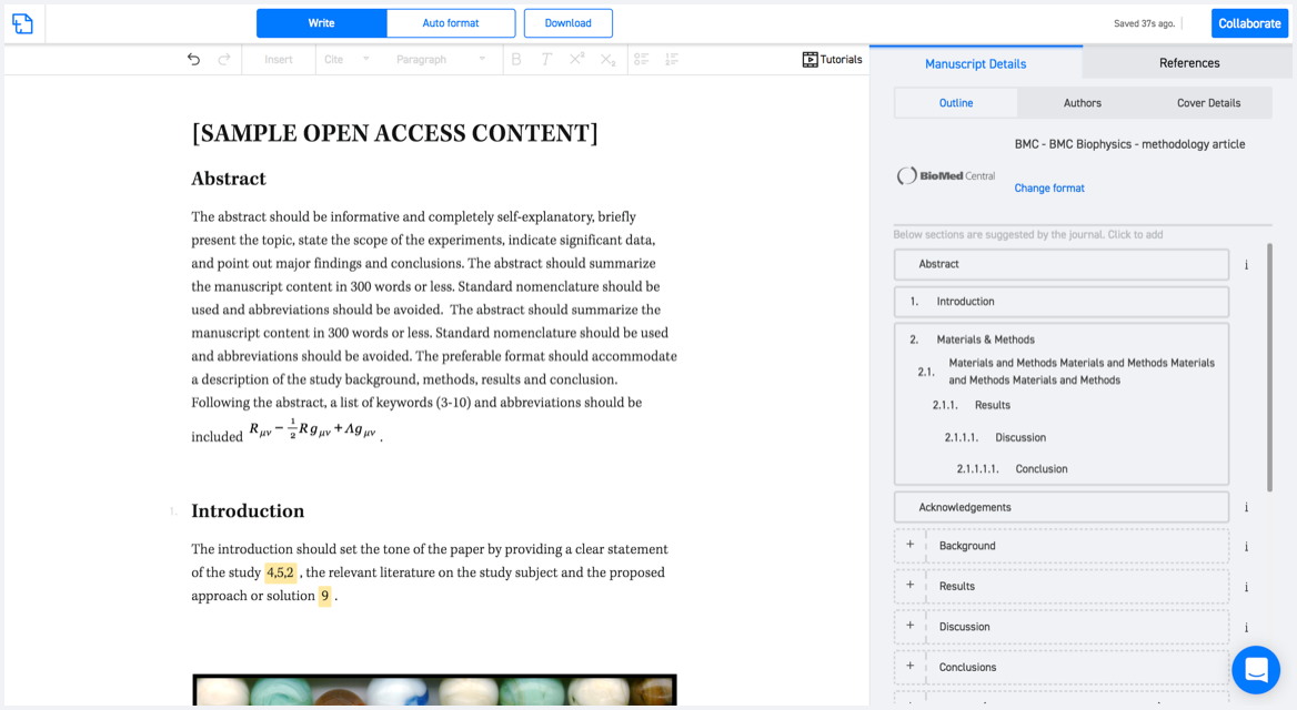
No word template required

Typset automatically formats your research paper to Surveys in Geophysics formatting guidelines and citation style.
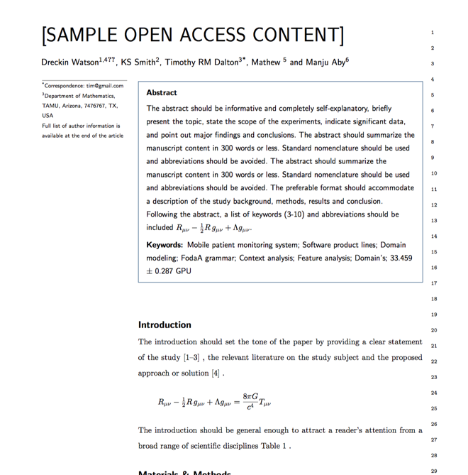
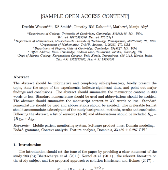
Verifed journal formats

One editor, 100K journal formats.
With the largest collection of verified journal formats, what you need is already there.

Trusted by academicians

I spent hours with MS word for reformatting. It was frustrating - plain and simple. With SciSpace, I can draft my manuscripts and once it is finished I can just submit. In case, I have to submit to another journal it is really just a button click instead of an afternoon of reformatting.

Andreas Frutiger
Researcher & Ex MS Word user
Use this template