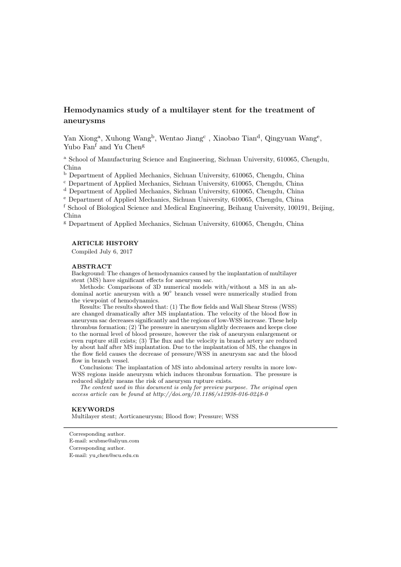
Example of Canadian Journal of Remote Sensing format
Recent searches

Example of Canadian Journal of Remote Sensing format Example of Canadian Journal of Remote Sensing format Example of Canadian Journal of Remote Sensing format Example of Canadian Journal of Remote Sensing format Example of Canadian Journal of Remote Sensing format Example of Canadian Journal of Remote Sensing format Example of Canadian Journal of Remote Sensing format Example of Canadian Journal of Remote Sensing format Example of Canadian Journal of Remote Sensing format Example of Canadian Journal of Remote Sensing format Example of Canadian Journal of Remote Sensing format
Sample paper formatted on SciSpace - SciSpace
This content is only for preview purposes. The original open access content can be found here.
Look Inside
Example of Canadian Journal of Remote Sensing format Example of Canadian Journal of Remote Sensing format Example of Canadian Journal of Remote Sensing format Example of Canadian Journal of Remote Sensing format Example of Canadian Journal of Remote Sensing format Example of Canadian Journal of Remote Sensing format Example of Canadian Journal of Remote Sensing format Example of Canadian Journal of Remote Sensing format Example of Canadian Journal of Remote Sensing format Example of Canadian Journal of Remote Sensing format Example of Canadian Journal of Remote Sensing format
Sample paper formatted on SciSpace - SciSpace
This content is only for preview purposes. The original open access content can be found here.
open access Open Access

Canadian Journal of Remote Sensing — Template for authors

Publisher: Taylor and Francis
Categories Rank Trend in last 3 yrs
Earth and Planetary Sciences (all) #36 of 186 down down by 3 ranks
journal-quality-icon Journal quality:
High
calendar-icon Last 4 years overview: 169 Published Papers | 687 Citations
indexed-in-icon Indexed in: Scopus
last-updated-icon Last updated: 13/06/2020
Related journals
Insights
General info
Top papers
Popular templates
Get started guide
Why choose from SciSpace
FAQ

Related Journals

open access Open Access
recommended Recommended

Taylor and Francis

Quality:  
High
CiteRatio: 6.6
SJR: 0.813
SNIP: 1.434
open access Open Access
recommended Recommended

Springer

Quality:  
High
CiteRatio: 7.2
SJR: 1.148
SNIP: 1.68
open access Open Access
recommended Recommended

IEEE

Quality:  
High
CiteRatio: 15.5
SJR: 3.038
SNIP: 7.166
open access Open Access

Cambridge University Press

Quality:  
High
CiteRatio: 3.9
SJR: 0.574
SNIP: 0.957

Journal Performance & Insights

Impact Factor

CiteRatio

Determines the importance of a journal by taking a measure of frequency with which the average article in a journal has been cited in a particular year.

A measure of average citations received per peer-reviewed paper published in the journal.

2.126

17% from 2018

Impact factor for Canadian Journal of Remote Sensing from 2016 - 2019
Year Value
2019 2.126
2018 2.553
2017 2.0
2016 1.838
graph view Graph view
table view Table view

4.1

16% from 2019

CiteRatio for Canadian Journal of Remote Sensing from 2016 - 2020
Year Value
2020 4.1
2019 4.9
2018 3.8
2017 3.5
2016 3.1
graph view Graph view
table view Table view

insights Insights

  • Impact factor of this journal has decreased by 17% in last year.
  • This journal’s impact factor is in the top 10 percentile category.

insights Insights

  • CiteRatio of this journal has decreased by 16% in last years.
  • This journal’s CiteRatio is in the top 10 percentile category.

SCImago Journal Rank (SJR)

Source Normalized Impact per Paper (SNIP)

Measures weighted citations received by the journal. Citation weighting depends on the categories and prestige of the citing journal.

Measures actual citations received relative to citations expected for the journal's category.

0.694

23% from 2019

SJR for Canadian Journal of Remote Sensing from 2016 - 2020
Year Value
2020 0.694
2019 0.905
2018 1.028
2017 0.929
2016 0.829
graph view Graph view
table view Table view

0.72

64% from 2019

SNIP for Canadian Journal of Remote Sensing from 2016 - 2020
Year Value
2020 0.72
2019 2.015
2018 1.276
2017 0.982
2016 0.874
graph view Graph view
table view Table view

insights Insights

  • SJR of this journal has decreased by 23% in last years.
  • This journal’s SJR is in the top 10 percentile category.

insights Insights

  • SNIP of this journal has decreased by 64% in last years.
  • This journal’s SNIP is in the top 10 percentile category.

Canadian Journal of Remote Sensing

Guideline source: View

All company, product and service names used in this website are for identification purposes only. All product names, trademarks and registered trademarks are property of their respective owners.

Use of these names, trademarks and brands does not imply endorsement or affiliation. Disclaimer Notice

Taylor and Francis

Canadian Journal of Remote Sensing

he Canadian Journal of Remote Sensing provides a forum for the publication of scientific research and review articles. The journal publishes topics including sensor and algorithm development, image processing techniques and advances focused on a wide range of remote sensing ap...... Read More

Earth and Planetary Sciences

i
Last updated on
13 Jun 2020
i
ISSN
0703-8992
i
Impact Factor
High - 1.075
i
Open Access
No
i
Sherpa RoMEO Archiving Policy
White faq
i
Plagiarism Check
Available via Turnitin
i
Endnote Style
Download Available
i
Bibliography Name
Taylor and Francis Custom Citation
i
Citation Type
Numbered
[25]
i
Bibliography Example
Blonder GE, Tinkham M, Klapwijk TM. Transition from metallic to tunneling regimes in superconducting microconstrictions: Excess current, charge imbalance, and supercurrent conversion. Phys Rev B. 1982; 25(7):4515–4532. Available from: 10.1103/PhysRevB.25.4515.

Top papers written in this journal

Journal Article DOI: 10.5589/M02-004
An analysis of co-occurrence texture statistics as a function of grey level quantization

Abstract:

In this paper, the effect of grey level quantization on the ability of co-occurrence probability statistics to classify natural textures is studied. Generally, as a function of increasing grey levels, many of the statistics demonstrate a decrease in classification ability while a few maintain constant classification accuracy.... In this paper, the effect of grey level quantization on the ability of co-occurrence probability statistics to classify natural textures is studied. Generally, as a function of increasing grey levels, many of the statistics demonstrate a decrease in classification ability while a few maintain constant classification accuracy. None of the individual statistics show increasing classification accuracy throughout all grey levels. Correlation analysis is used to rationalize a preferred subset of statistics. The preferred statistics set (contrast, correlation, and entropy) is demonstrated to be an improvement over using single statistics or using the entire set of statistics. If the feature space dimension only allows for a single statistic, one of contrast, dissimilarity, inverse difference normalized, or inverse difference moment normalized, is recommended. Testing that compares (using all orientations separately), the average of all orientations and look direction averaging, when determining the co-occurrenc... read more read less

Topics:

Nonparametric statistics (62%)62% related to the paper, L-estimator (61%)61% related to the paper, Pseudomedian (61%)61% related to the paper, Probability and statistics (58%)58% related to the paper
View PDF
935 Citations
open accessOpen access Journal Article DOI: 10.1080/07038992.1982.10855028
On the Slope-Aspect Correction of Multispectral Scanner Data
P. M. Teillet1, Bert Guindon1, David G. Goodenough1

Abstract:

SUMMARYThe effects of topography on the radiometric properties of multispectral scanner (MSS) data are examined in the context of the remote sensing of forests in mountainous regions. The two test areas considered for this study are located in the coastal mountains of British Columbia, one at the Anderson River near Boston Ba... SUMMARYThe effects of topography on the radiometric properties of multispectral scanner (MSS) data are examined in the context of the remote sensing of forests in mountainous regions. The two test areas considered for this study are located in the coastal mountains of British Columbia, one at the Anderson River near Boston Bar and the other at Gun Lake near Bralorne. The predominant forest type at the former site is Douglas fir, whereas forest types at the latter site are primarily lodgepole pine and ponderosa pine. Both regions have rugged topography, with elevations ranging from 330 to 1100 metres above sea level at Anderson River and from 750 to 1300 metres above sea level at Gun Lake.Lambertian and non-Lambertian illumination corrections are formulated, taking into account atmospheric effects as well as topographic variations. Terrain slope and aspect values are determined from a digital elevation model and atmospheric parameters are obtained from a model atmosphere computation for the solar angles an... read more read less

Topics:

Metres above sea level (57%)57% related to the paper, Multispectral Scanner (56%)56% related to the paper, Digital elevation model (52%)52% related to the paper
View PDF
794 Citations
Journal Article DOI: 10.1080/07038992.1996.10855178
Evaluation of Vegetation Indices and a Modified Simple Ratio for Boreal Applications

Abstract:

RESUMEUn ratio simple modifie (MSR) est propose pour extraire les parametres biophysiques des forets boreales a l'aide de donnees de teledetection. Cet indice de vegetation est formule en fonction de l'evaluation de plusieurs indices de vegetation derives de la combinaison de deux bandes spectrales, dont les suivants : indice... RESUMEUn ratio simple modifie (MSR) est propose pour extraire les parametres biophysiques des forets boreales a l'aide de donnees de teledetection. Cet indice de vegetation est formule en fonction de l'evaluation de plusieurs indices de vegetation derives de la combinaison de deux bandes spectrales, dont les suivants : indice de vegetation par difference normalisee ou indice d'activite vegetale (NDVI), ratio simple (SR), indice de vegetation ajuste en fonction des sols (SAVI, SAVI1, SAVI2), indice de vegetation par difference ponderee (WDVI), indice de vegetation zonale (GEMI), indice de vegetation non lineaire (NLI) et indice de vegetation par difference renormalisee (RDVI). Le ratio simple modifie est une version amelioree des indices de vegetation par difference renormalisee et sert a delimiter les relations de ces derniers avec les parametres biophysiques. Tous les indices ont ete obtenus a partir d'images acquises par le capteur thematique de Landsat-5 dans les bandes 3 (visible) et 4 (proche infraro... read more read less
756 Citations
Journal Article DOI: 10.5589/M03-027
Measuring individual tree crown diameter with lidar and assessing its influence on estimating forest volume and biomass

Abstract:

The main objective of this study was to develop reliable processing and analysis techniques to facilitate the use of small-footprint lidar data for estimating tree crown diameter by measuring individual trees identifiable on the three-dimensional lidar surface. In addition, the study explored the importance of the lidar-deriv... The main objective of this study was to develop reliable processing and analysis techniques to facilitate the use of small-footprint lidar data for estimating tree crown diameter by measuring individual trees identifiable on the three-dimensional lidar surface. In addition, the study explored the importance of the lidar-derived crown diameter for estimating tree volume and biomass. The lidar dataset was acquired over deciduous, coniferous, and mixed stands of varying age classes and settings typical of the southeastern United States. For identifying individual trees, lidar processing techniques used data fusion with multispectral optical data and local filtering with both square and circular windows of variable size. The crown diameter was calculated as the average of two values measured along two perpendicular directions from the location of each tree top by fitting a fourth-degree polynomial on both profiles. The lidar-derived tree measurements were used with regression models and cross-validation to es... read more read less

Topics:

Tree measurement (66%)66% related to the paper, Lidar (54%)54% related to the paper
View PDF
693 Citations
Journal Article DOI: 10.5589/M03-026
Using airborne and ground-based ranging lidar to measure canopy structure in Australian forests

Abstract:

Airborne and ground-based lidars are useful tools to probe the structure of forest canopies. Such information is not readily available from other remote sensing methods but is essential for modern forest inventory in which growth models and ecological assessment are becoming increasingly important. This study was undertaken t... Airborne and ground-based lidars are useful tools to probe the structure of forest canopies. Such information is not readily available from other remote sensing methods but is essential for modern forest inventory in which growth models and ecological assessment are becoming increasingly important. This study was undertaken to investigate the capacity of current airborne and ground-based ranging systems to provide data from which useful forest inventory parameters can be derived. Additional data collected included standard forest inventory, hemispherical photography, and optical point-quadrat sampling. Four contrasting study sites were established within an existing study area in the Bago and Maragle State Forests, New South Wales, Australia. A simple and standard set of models was fitted to the data to establish consistency between methods and current practice. Methods to reduce the bias induced by interaction of the size of the airborne laser scanner (ALS) footprint and thresholding used in ranging syst... read more read less

Topics:

Forest inventory (62%)62% related to the paper, Lidar (51%)51% related to the paper, Hemispherical photography (51%)51% related to the paper
482 Citations
Author Pic

SciSpace is a very innovative solution to the formatting problem and existing providers, such as Mendeley or Word did not really evolve in recent years.

- Andreas Frutiger, Researcher, ETH Zurich, Institute for Biomedical Engineering

Get MS-Word and LaTeX output to any Journal within seconds
1
Choose a template
Select a template from a library of 40,000+ templates
2
Import a MS-Word file or start fresh
It takes only few seconds to import
3
View and edit your final output
SciSpace will automatically format your output to meet journal guidelines
4
Submit directly or Download
Submit to journal directly or Download in PDF, MS Word or LaTeX

(Before submission check for plagiarism via Turnitin)

clock Less than 3 minutes

What to expect from SciSpace?

Speed and accuracy over MS Word

''

With SciSpace, you do not need a word template for Canadian Journal of Remote Sensing.

It automatically formats your research paper to Taylor and Francis formatting guidelines and citation style.

You can download a submission ready research paper in pdf, LaTeX and docx formats.

Time comparison

Time taken to format a paper and Compliance with guidelines

Plagiarism Reports via Turnitin

SciSpace has partnered with Turnitin, the leading provider of Plagiarism Check software.

Using this service, researchers can compare submissions against more than 170 million scholarly articles, a database of 70+ billion current and archived web pages. How Turnitin Integration works?


Turnitin Stats
Publisher Logos

Freedom from formatting guidelines

One editor, 100K journal formats – world's largest collection of journal templates

With such a huge verified library, what you need is already there.

publisher-logos

Easy support from all your favorite tools

Canadian Journal of Remote Sensing format uses Taylor and Francis Custom Citation citation style.

Automatically format and order your citations and bibliography in a click.

SciSpace allows imports from all reference managers like Mendeley, Zotero, Endnote, Google Scholar etc.

Frequently asked questions

1. Can I write Canadian Journal of Remote Sensing in LaTeX?

Absolutely not! Our tool has been designed to help you focus on writing. You can write your entire paper as per the Canadian Journal of Remote Sensing guidelines and auto format it.

2. Do you follow the Canadian Journal of Remote Sensing guidelines?

Yes, the template is compliant with the Canadian Journal of Remote Sensing guidelines. Our experts at SciSpace ensure that. If there are any changes to the journal's guidelines, we'll change our algorithm accordingly.

3. Can I cite my article in multiple styles in Canadian Journal of Remote Sensing?

Of course! We support all the top citation styles, such as APA style, MLA style, Vancouver style, Harvard style, and Chicago style. For example, when you write your paper and hit autoformat, our system will automatically update your article as per the Canadian Journal of Remote Sensing citation style.

4. Can I use the Canadian Journal of Remote Sensing templates for free?

Sign up for our free trial, and you'll be able to use all our features for seven days. You'll see how helpful they are and how inexpensive they are compared to other options, Especially for Canadian Journal of Remote Sensing.

5. Can I use a manuscript in Canadian Journal of Remote Sensing that I have written in MS Word?

Yes. You can choose the right template, copy-paste the contents from the word document, and click on auto-format. Once you're done, you'll have a publish-ready paper Canadian Journal of Remote Sensing that you can download at the end.

6. How long does it usually take you to format my papers in Canadian Journal of Remote Sensing?

It only takes a matter of seconds to edit your manuscript. Besides that, our intuitive editor saves you from writing and formatting it in Canadian Journal of Remote Sensing.

7. Where can I find the template for the Canadian Journal of Remote Sensing?

It is possible to find the Word template for any journal on Google. However, why use a template when you can write your entire manuscript on SciSpace , auto format it as per Canadian Journal of Remote Sensing's guidelines and download the same in Word, PDF and LaTeX formats? Give us a try!.

8. Can I reformat my paper to fit the Canadian Journal of Remote Sensing's guidelines?

Of course! You can do this using our intuitive editor. It's very easy. If you need help, our support team is always ready to assist you.

9. Canadian Journal of Remote Sensing an online tool or is there a desktop version?

SciSpace's Canadian Journal of Remote Sensing is currently available as an online tool. We're developing a desktop version, too. You can request (or upvote) any features that you think would be helpful for you and other researchers in the "feature request" section of your account once you've signed up with us.

10. I cannot find my template in your gallery. Can you create it for me like Canadian Journal of Remote Sensing?

Sure. You can request any template and we'll have it setup within a few days. You can find the request box in Journal Gallery on the right side bar under the heading, "Couldn't find the format you were looking for like Canadian Journal of Remote Sensing?”

11. What is the output that I would get after using Canadian Journal of Remote Sensing?

After writing your paper autoformatting in Canadian Journal of Remote Sensing, you can download it in multiple formats, viz., PDF, Docx, and LaTeX.

12. Is Canadian Journal of Remote Sensing's impact factor high enough that I should try publishing my article there?

To be honest, the answer is no. The impact factor is one of the many elements that determine the quality of a journal. Few of these factors include review board, rejection rates, frequency of inclusion in indexes, and Eigenfactor. You need to assess all these factors before you make your final call.

13. What is Sherpa RoMEO Archiving Policy for Canadian Journal of Remote Sensing?

SHERPA/RoMEO Database

We extracted this data from Sherpa Romeo to help researchers understand the access level of this journal in accordance with the Sherpa Romeo Archiving Policy for Canadian Journal of Remote Sensing. The table below indicates the level of access a journal has as per Sherpa Romeo's archiving policy.

RoMEO Colour Archiving policy
Green Can archive pre-print and post-print or publisher's version/PDF
Blue Can archive post-print (ie final draft post-refereeing) or publisher's version/PDF
Yellow Can archive pre-print (ie pre-refereeing)
White Archiving not formally supported
FYI:
  1. Pre-prints as being the version of the paper before peer review and
  2. Post-prints as being the version of the paper after peer-review, with revisions having been made.

14. What are the most common citation types In Canadian Journal of Remote Sensing?

The 5 most common citation types in order of usage for Canadian Journal of Remote Sensing are:.

S. No. Citation Style Type
1. Author Year
2. Numbered
3. Numbered (Superscripted)
4. Author Year (Cited Pages)
5. Footnote

15. How do I submit my article to the Canadian Journal of Remote Sensing?

It is possible to find the Word template for any journal on Google. However, why use a template when you can write your entire manuscript on SciSpace , auto format it as per Canadian Journal of Remote Sensing's guidelines and download the same in Word, PDF and LaTeX formats? Give us a try!.

16. Can I download Canadian Journal of Remote Sensing in Endnote format?

Yes, SciSpace provides this functionality. After signing up, you would need to import your existing references from Word or Bib file to SciSpace. Then SciSpace would allow you to download your references in Canadian Journal of Remote Sensing Endnote style according to Elsevier guidelines.

Fast and reliable,
built for complaince.

Instant formatting to 100% publisher guidelines on - SciSpace.
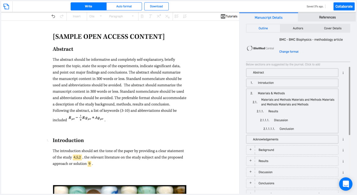
Available only on desktops 🖥

No word template required

Typset automatically formats your research paper to Canadian Journal of Remote Sensing formatting guidelines and citation style.
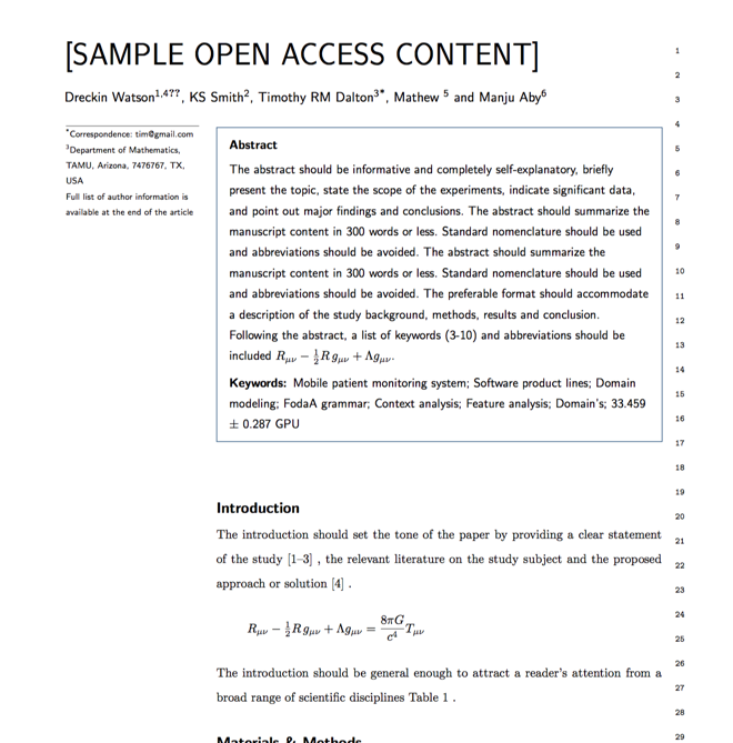

Verifed journal formats

One editor, 100K journal formats.
With the largest collection of verified journal formats, what you need is already there.

Trusted by academicians

I spent hours with MS word for reformatting. It was frustrating - plain and simple. With SciSpace, I can draft my manuscripts and once it is finished I can just submit. In case, I have to submit to another journal it is really just a button click instead of an afternoon of reformatting.

Andreas Frutiger
Researcher & Ex MS Word user
Use this template